|
 Administrative Centre Administrative Centre
30 Frances St
Randwick 2031
Tel: 02 9399 0999
Fax 02 9319 1510
DX 4121 Maroubra Junction
general.manager@randwick.nsw.gov.au
|
INCORPORATED
AS A MUNICIPALITY
22 FEBRUARY 1859
PROCLAIMED AS
A CITY JULY 1990
|
4th September, 2007
HEALTH, BUILDING AND PLANNING
COMMITTEE MEETING
NOTICE IS
HEREBY GIVEN THAT A HEALTH BUILDING AND PLANNING COMMITTEE MEETING OF THE
COUNCIL OF THE CITY OF RANDWICK WILL BE HELD IN THE COUNCIL CHAMBER, TOWN HALL, 90 AVOCA
STREET, RANDWICK, ON TUESDAY, 11TH SEPTEMBER,
2007
AT 6.30
P.M.
Committee Members: The
Mayor, Cr P. Tracey, Crs Andrews, Bastic, Belleli, Daley, Hughes, Kenny, Matson
(Deputy Chairperson), Nash (Chairperson), Notley-Smith, Procopiadis, Seng,
Sullivan, White & Woodsmith.
Quorum: Eight
(8) members.
|
NOTE: AT THE EXTRAORDINARY MEETING HELD ON 28TH SEPTEMBER, 2004, THE COUNCIL RESOLVED THAT THE
HEALTH, BUILDING AND PLANNING COMMITTEE BE CONSTITUTED AS A COMMITTEE WHOSE
MEMBERSHIP CONSISTS OF ALL MEMBERS OF THE COUNCIL AND WITH FULL DELEGATION TO
DETERMINE MATTERS ON THE AGENDA.
|
1 Apologies/Granting
of leave of absences
2 Confirmation of the Minutes
CONFIRMATION OF THE MINUTES OF THE HEALTH, BUILDING &
PLANNING COMMITTEE MEETING HELD ON TUESDAY, 14TH AUGUST,
2007.
3 Declaration of Pecuniary & Non-Pecuniary
Interests
4 Addressing of Committee by Members of the
Public
5 Urgent Business
6 Development Applications
|
6.1
|
DEVELOPMENT APPLICATION REPORT –
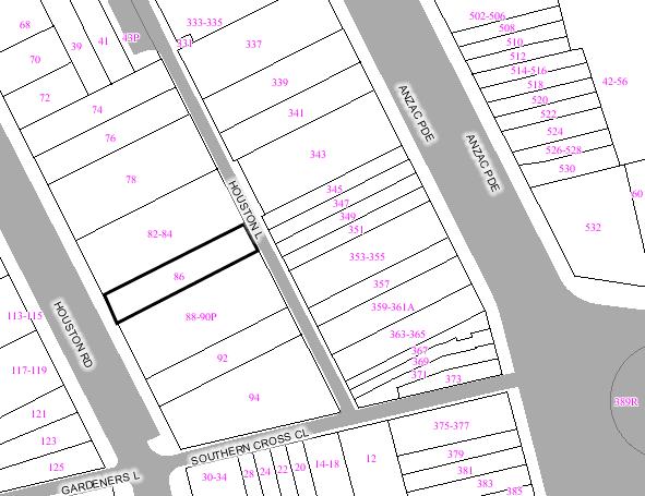
86 HOUSTON ROAD, KINGSFORD.
|
2
|
|
6.2
|
DEVELOPMENT APPLICATION REPORT –
42 CLIFFBROOK PARADE, CLOVELLY.
|
37
|
|
6.3
|
DEVELOPMENT APPLICATION REPORT –
14-16 DAINTREY CRESCENT, RANDWICK.
|
74
|
|
6.4
|
DEVELOPMENT APPLICATION REPORT –
3A GORDON AVENUE, COOGEE.
|
100
|
|
6.5
|
DEVELOPMENT APPLICATION REPORT –
143 - 147 COOGEE BAY ROAD, COOGEE.
|
151
|
|
6.6
|
DEVELOPMENT APPLICATION REPORT –
26 MAWSON PARADE, CHIFLEY.
|
168
|
|
6.7
|
DEVELOPMENT APPLICATION REPORT –
44 HOOPER STREET RANDWICK.
|
173
|
|
6.8
|
DEVELOPMENT APPLICATION REPORT –
45 EARL STREET, RANDWICK.
|
203
|
|
6.9
|
DEVELOPMENT APPLICATION REPORT –
8 SHAW AVENUE, KINGSFORD.
|
230
|
|
6.10
|
DIRECTOR, CITY PLANNING REPORT 65/2007 –
7 TOWER STREET, COOGEE. (DEFERRED)
|
252
|
|
6.11
|
1408 ANZAC PARADE, LITTLE BAY. (Report to be separately
circularised prior to Meeting.)
|
|
7 Miscellaneous
|
7.1
|
DIRECTOR, CITY PLANNING REPORT
66/2007 - USE OF STORMWATER DETENTION TANKS FOR WATER STORAGE AND ON-SITE
REUSE.
|
297
|
|
7.2
|
DIRECTOR, CITY PLANNING REPORT 67/2007
- DRAFT DEVELOPMENT CONTROL PLAN - TELECOMMUNICATION AND RADIOCOMMUNICATION
FACILITIES - REPORT ON RECENT PUBLIC EXHIBITION
|
303
|
|
7.3
|
DIRECTOR, CITY PLANNING REPORT 68/2007
- DRAFT PLANNING AGREEMENT POLICY.
|
346
|
|
7.4
|
DIRECTOR, CITY PLANNING REPORT 69/2007
- AFFORDABLE HOUSING UNITS - PRINCE HENRY AT LITTLE BAY DEVELOPMENT SITE.
|
362
|
8 Confidential Items (Closed Session)
9 Notice of Rescission Motions
…………………………………..
GENERAL MANAGER

Development Application Report
|
REPORT
BY: DIRECTOR,
CITY PLANNING
|
|
|
|
|
Subject
Site
|
|
|
|
|
|
|
|
|
|
Submissions
received
|
|
Ù
North
|
|
LOCALITY
PLAN
|
1. EXECUTIVE SUMMARY
The
application is referred to Council as it is valued at $2.5 million.
The application lodged on 19 October 2006 proposes demolition of existing structures at the site
and construction of a residential flat building comprising of 6 x 2 bedroom
dwellings, landscaping and basement car parking accessible from Houston Road. The application also
necessitates the removal and replacement of existing landscaping on the Council
owned car park adjoining the subject site to the south.
The application has been reviewed by the Urban Design
Review Panel with few reservations raised. The panel suggests Council officers
determine the likely use of the adjoining car park site.
The application was notified and advertised for 14 days in
accordance with Council’s DCP Public Notification during which no submissions
were received.
The application proposes significant variations to the
landscaping, wall height and floor space ratio clauses within the Randwick
Local Environmental Plan 1998. Similarly, the application also proposes to vary
numerical guidelines with Development Control Plan – Multi Unit Housing.
The built form of the proposal raises some concern,
particularly the placement of an 11.5m high and 26.5m long wall on the common
boundary, which provides a poor vista and unsatisfactory interface with the
public domain.
Accordingly, it is recommended Development Application
899/2006 be refused.
2. THE PROPOSAL
The application proposes the following development:
- Demolition of existing dwelling, detached garage and
outbuilding.
- Construction of a residential flat building
comprising of 6 x 2 bedroom dwellings, landscaping and basement car
parking accessible from Houston Road.
- Partial removal and replacement of landscaping within
the Council owned car park adjoining the subject site to the south in order
to accommodate the development.
3. THE SUBJECT SITE AND
SURROUNDING AREA:
The site is rectangular in shape being 9.6m in width,
51.5m in length and 494.4m2 in area with a fall of approximately 4m
from Houston Lane to Houston Road (east to west).
Vehicular access is currently provided from both Houston Road and Houston Lane at the rear of the site. A single
storey dwelling, detached outhouse and garage currently occupy the site while
no vegetation of significant species exists.
The immediately surrounding locality is residential in
nature and consists predominantly of established residential flat buildings up
to four (4) storeys in height. Several larger residential flat buildings up to
fifteen (15) storeys in height front Anzac Parade while the Kingsford Shopping
area is also within walking distance of the subject site.
A reasonably sized Council owned car park for public use
adjoins the subject site directly to the south. The car park is accessible from
both Houston Road and Houston Lane and has established landscaping
particularly along its northern boundary which interfaces with the subject
site.
4. HISTORY
4.1 APPLICATION HISTORY
The development application was lodged at Council on 19 October 2006. The development was referred to
the Design Review Panel for consideration at its November 2006 and April 2007
meetings. The amended plans submitted at the April 2007 meeting generated the
following comments:
- The deletion of the fourth storey generates a
satisfactory scale.
- The built form is acceptable and generates suitable
internal amenity by locating the building on the southern boundary,
maximising exposure to northerly orientation.
- There exists potential to raise the building and
decrease the amount of excavation required.
- The floor space ratio appears satisfactory and
consistent with the surrounding context.
- Window operation can be amended to optimize cross
ventilation, ventilating clerestory roof lights should be provided in the
top floor, ceiling fans should be provided in top floor bedrooms.
- There exists potential to increase deep soil planting
by amending the north eastern corner of the basement car park.
- Intensive landscaping should be provided along the
northern boundary to create visual interest and privacy between the
subject site and the adjoining flat building.
- The units are generally efficiently planned providing
for high amenity.
- It would be preferable to gain more light and air to
the adjoining car park by utilising indentation and slots on the upper
floors.
- A light weight roof construction should be considered
as it is easier to effectively insulate.
- The minor additional height provided would not be
inappropriate.
- The location, close to shops and transport, is
suitable for development of this kind.
- Generally, the proposed design is well considered.
- The reduction in the length of the wall to the car
park is an improvement.
The applicant has also approached Council to purchase the
adjoining carpark with a view to consolidating both sites. Council has advised
the applicant that the carpark is classified as community land and Council is
not in a position to sell the land.
5. HISTORY OF SITE USAGE
The site
has principally been used for residential purposes and more recently, as a
health consulting room.
6. COMMUNITY CONSULTATION
The proposal had been notified and advertised in
accordance with the DCP for Public Notification of Development Proposals and
Council Plans from 14
November 2006 to 29 November 2006. No submissions were received by
Council during this period.
7. TECHNICAL OFFICERS
COMMENTS
The application has been referred
to the relevant technical officers, including where necessary external bodies
and the following comments have been provided:-
7.1 Building Comments
Key Issues
Noise:
There is potential for the generation of noise from the
proposed development due to the installation of plant and equipment, such as
any mechanical exhaust system serving the basement car park. Conditions should
be imposed on the consent to address potential noise emissions from the development.
Site Management:
Standard conditions are proposed to be included in the
consent to address construction site management issues, such as the location of
stock piled material or the storage and disposal of excavated materials,
sediment and erosion control, public safety and perimeter safety fencing.
Building Code of Australia (BCA):
Full details of compliance with BCA and fire safety
provisions are not included in the DA documentation and therefore further
detailed information is required to be incorporated in the documentation for a
construction certificate.
Conclusion:
No objections are raised in relation to the proposed
development, subject to the following conditions being included in any
development consent.
RECOMMENDATION:
Should the approval be granted to the application, the
appropriate conditions as indicated should be included in the development
consent.
7.2 Landscape Comments
The assessing officer is advised that Council’s landscape
development officer does not support this application in its current form as
excavations associated with the basement level and the three storey privacy
wall, both proposed along almost the entire length of the southern boundary,
would affect several established trees within the adjoining council owned car park
(identified as 88-90P Houston Road), to the point where they could not be
reasonably or safely retained and would therefore need to be removed should
construction proceed as shown.
While replacement landscape treatment to the this carpark
has been indicated as part of the proposal, it is still deemed an unacceptable
situation to allow the development of private property to impact the public
domain to such an extent, which will also result in a reduction of one car
space available to the community from a total of 19 spaces to 18.
The excessive nature of this proposal is further evidenced
by its failure to adhere to council’s numerical control for the minimum amount
of deep soil to be provided from multi unit housing, zone 2C, in that no more
than 50% of the landscaped area is to be provided over podium.
However, due to the extent of the basement level occupying
the majority of the site, 70% of the landscaped area will be situated over the
podium, resulting in a non compliance of 45% (or 50.5sqm), and when viewed
together with its inability to comply with Council’s controls for wall height,
F.S.R and side setbacks, is seen to constitute an over development of the site.
Ordinarily in this situation, conditions would not be
provided as large scale amendments would be required in order to get this
proposal to the desired/required standard, to the point where it may no longer
be economically feasible to pursue the level of development that is being
sought.
However, it is understood that this application will be
referred to a future council meeting for consideration, and in the case that
approval is forthcoming as a result of this process, relevant landscape
conditions have been included, with the main issue being that as part of
developing the subject property, the applicant will also be responsible for
covering all costs associated with the tree removals, replacement landscaping
and any reinstatement works in the adjoining council car park, to council’s
satisfaction.
7.3 Drainage Comments
On site stormwater detention is required for this
development.
The Planning Officer is advised that
the submitted drainage plans should not be approved in conjunction with the DA,
rather, the Development Engineer has included a number of conditions in this
memo that relate to drainage design requirements. The applicant is required to
submit detailed drainage plans to the certifying authority for approval prior
to the issuing of a construction certificate.
7.4 Flooding Comments
The Planning Officer is advised that as part of the
assessment process the Development Engineer considered whether the site may be
subject to stormwater inundation during major storm events; however noting the
relatively small flows expected in Houston Lane and the existing ground levels
fronting Houston Lane, it is considered that no flood study is required for
this development application.
7.5 Traffic Comments
Vehicular Access - All new walls adjacent to vehicular
crossings must be lowered to a height of 600mm above the internal driveway
level for a distance of 1.50m within the site or splayed 1.5 metre by 1.5 metre
to provide satisfactory sight lines. Details are to be submitted to the
Certifying Authority prior to the release of the construction certificate
showing compliance with this condition.
The driveway opening at the Houston Road street frontage must be 3.50
metres wide and is generally required to be located at least 1.5 metres clear
of the side property. The applicant shall amend the plans to show compliance
with this requirement, or alternatively, submit documentation detailing how
satisfactory sight distance can be achieved for vehicles exiting the site from
the vehicular access location currently proposed.
Parking Provisions – For a development of this size,
Council’s DCP – Parking specifies a parking requirement of 9 car spaces (6
spaces for the 5 x 2brm, 1.5 spaces for the 1 x 3 brm & 1.5 spaces for
visitor parking). The submitted plans show 9 spaces within the basement carpark
demonstrating compliance with this requirement.
7.6 Service Authority Comments
At the Health, Building and Planning Committee meeting on 8 November 2005, it was resolved on the motion of
Councillors Nash and Belelli that:
(a) the
applicants of development applications be required to meet all costs associated
with replacing overhead wires with underground cables in the vicinity of the
development site when the cost of works on the site exceeds $2 million;
(b) the
applicants of development applications be required to meet all costs associated
with replacing overhead wires with Aerial Bundled Cables in the vicinity of the
development site, when the cost of works on the site exceeds $1 million up to
$2 million; and
(c) the
Director, City Planning investigate the feasibility of funding the
undergrounding of existing overhead cables for new development under the new
options provided for in the Environmental Planning & Assessment Act
(Developer Contributions) Act 2005.
Given that the proposed works will be in excess of $2
million the applicant will be required to meet all costs associated with
replacing the overhead wires with underground cables in the vicinity of the
development site.
An inspection of the site revealed that with the exception
of the feeder lines into the subject site there are no overhead cables along
the Houston
Road site
frontage. Consequently, the applicant will only need to underground the cables
servicing the subject development site together with the overhead cable located
along the Harbourne
Lane site
frontage.
7.7 Geotechnical Comments
The applicant shall carry out sufficient
Geotechnical investigation to determine if the proposed development will have
any affect on, or be affected by groundwater. The bore holes for the
Geotechnical report are to be drilled to a depth of 2.00 metres below the
proposed basement carpark level.
Pending the results of the geotechnical report, the
above site may be present within a fluctuating water table and/or affected by
the movement of seepage water, hence any basement carpark may need to be
suitably tanked and waterproofed.
Furthermore, should groundwater be encountered
within the depth of the proposed basement excavation, the application may
require referral to the Department of Natural Resources as integrated
development.
7.8 Design
Review Panel
As noted
previously, the application has been considered by the Design Review Panel on
two occasions. The following comments were received from the panel at its last
meeting dated 2 April
2007 in relation to
amended plans submitted by the applicant:
1. Relationship
to the Context of the Proposal
As noted by the Applicant the
context is one of mixed residential and commercial, in close proximity to
shops, services and public transport, and is well placed to contribute to urban
consolidation.
2. The Scale of the
Proposal
Following its previous meeting
with the applicant, the Panel’s view was that the scale of the proposal would
be improved by the removal of the fourth accommodation level. This floor has
been eliminated. The Panel considers that the scale is now satisfactory.
3. The Built Form of
the Proposal
As previously noted, by locating
the building on the southern boundary the amenity of the apartments is
maximized, exposure to northern winter sun increased and the distance to the
neighbors to the north increases privacy. The resultant slim-line built form
of the building is considered to be satisfactory.
The Panel nonetheless considered
that raising the building by a small amount and reducing the extent of
excavation and retaining wall construction at the rear would be a positive.
Simplification of the area between
the building and the street and modification to the entry stair is discussed
below.
4. The
Proposed Density
The Panel has not been advised of the FSR of the
proposed building, however in its context it is not considered to be excessive.
5. Resource and
Energy Use and Water Efficiency
Window operation should be
designed to optimize cross ventilation, and must be indicated on the DA
drawings. Adequate sun shading is proposed.
Internal bathrooms on the top
level should be provided with ventilating clerestory roof lights and ceiling
fans should be provided to the bedrooms.
6. The
Proposed Landscape
It is suggested that the car space
in the northeast corner of the basement should be eliminated to allow for an
increased area of deep soil planting. The placement of the rainwater tanks
under the building footprint or driveway should be correspondingly adjusted and
the landscape plan modified to suit the reduced excavation.
More intensive landscaping to the
long north side with for example some deciduous trees and lush under storey
planting would assist in creating visual interest and privacy between the
proposed building and the bland unit block next door.
It is noted that rainwater storage
is to be provided for garden irrigation.
It is suggested that the area
between the building and Houston Road should be redesigned to make it much
simpler: there is no need for the driveway and the car park exit to be
separated by a wall or for the landscaping to be in a built up planter (this
would be a good location for a tree). The main entry stairs from the street
should commence at the building line: they would be more user-friendly if
broken by a landing. The entrance to unit 1 could, with benefit to its
interior layout, be relocated to the east between the kitchen and bedroom 2 to
make room for this.
It is suggested that the rear
garden could be terraced and sloped to eliminate or substantially reduce the
retaining wall shown on Section AA: this provides an excellent location for
trees. A rear entry should be provided to Houston Lane, planned to provide
the opportunity for wheelchair access. This would provide a convenient shortcut
for the building’s residents to the shops.
7. The Amenity
of the Proposal for its Users
The units are generally
efficiently planned. Generally the proposal provides a framework for high
amenity for the occupants. The provision of some solid up stand below the
proposed glass balustrades to balcony fronts would increase privacy.
It would be preferable to gain
more light and air from the articulation of the carpark side, using the
strategies already being tried (indents, slot windows, etc) on the upper
floors. This is particularly the case at lower levels.
It is suggested that a lightweight
roof construction be considered, as this would be very much easier to
effectively insulate. The minor additional height involved would not be
inappropriate and, as noted above, roof lighting and ventilation should be
provided to internal rooms on the top floor.
8. The
Safety and Security Characteristics of the Proposal
Satisfactory.
9. Social
issues
The location, close to shops and
transport is suitable for development of this kind.
10. The Aesthetics
of the Proposal
Generally the proposed design is well considered, however
the elevations will require modification to address the suggested changes
levels. The reduction of the length of the wall to the car park has been an
improvement.
The height of the ground floor balcony screen should be
reduced.
It is suggested that the louvres on the north façade
should be operable. A horizontal division at second floor level would improve
their scale.
The metal panels nominated on the drawings are not
included in the sample board and should be clarified.
SUMMARY AND RECOMMENDATIONS
The proposal displays sensible
planning and potential for good levels of livability. The Panel looks forward
to reviewing the scheme again when changes, in line with this report, are done
and further supporting information provided.
Council should give some
consideration as to what the future of the adjacent council car park might be.
The Panel views the car park as a potential development site albeit one that is
likely to maintain public parking access at ground level.
Comment:
The panel has considered the proposal’s architectural and
amenity merits. That is, the proposal’s integration with the Council owned car
park on the adjoining site to the south is to be investigated and considered
principally by the appropriate Council staff and branches.
Construction of a residential flat building along the
common boundary of the car park is inappropriate as the wall is 11.5m in height
and 26.5m in length, and will result in a poor interface with a public
facility. Additionally, such a wall will have an overbearing impact and
represents a poor transition between private property and public land and
importantly, will affect the ability to provide an appropriate level of amenity
for any potential medium density residential development on the carpark site.
8. MASTER PLANNING
REQUIREMENTS
As the site is less than 4,000m2 in area,
clause 40A of RLEP 98 does not apply.
9. RELEVANT ENVIRONMENTAL
PLANNING INSTRUMENTS
The Development Application has been assessed in accordance
with the provisions of the following relevant planning documents:
- Randwick Local Environmental Plan
1998 (RLEP 98)
- State
Environmental Planning Policy 1 – Development Standards (SEPP 1)
- State
Environmental Planning Policy 55 – Remediation of Land (SEPP 55)
- State
Environmental Planning Policy 65 – Design Quality of Residential Flat
Buildings (SEPP65)
- State
Environmental Planning Policy (Building Sustainability Index: BASIX) 2004
(SEPP: BASIX)
- Development
Control Plan – Multi – unit Housing
- DCP –
Parking
- Section
94 Contributions Policy
(a) Randwick Local Environmental Plan 1998
(RLEP 98)
The RLEP 98 defines multi-unit housing as
“two or more dwellings, whether or not attached.”
The proposal is consistent with the abovementioned
definition as it contains 6 attached dwellings.
Multi – unit housing is permitted in the 2C – Residential
zone the site is subject to, pursuant to the RLEP 98.
The
objectives of Zone No 2C are:
(a) to allow a variety of housing types within residential
areas, and
(b) to allow a range of community facilities to be provided
to serve the needs of residents, workers and visitors, and
(c) to enable residential development in a variety of
medium density housing forms where such development does not compromise the
amenity of surrounding residential areas, and
(d) to allow people to carry out a range of activities from
their homes, where such activities are not likely to adversely affect the
environment of the locality, and
(e) to enable a mix of housing types to encourage housing
affordability.
The proposal represents a medium density form of
residential development hence, satisfies objective A.
The proposal provides opportunities for housing for
members of the community hence, satisfies objective B.
The proposal would affect the amenity of any residential
dwellings developed on the adjoining, residentially zoned car park site in
terms of over shadowing and visual outlook. The proposal’s nil setbacks from
the southern boundary is inconsistent with existing development in the locality
and would interrupt the streetscape rhythm. The proposal would therefore, not
satisfy objective C of the zone. The compliance table below indicates that the
proposal is significantly below the minimum landscaped area or landscaped area
over podium requirements within RLEP 98 as well as significantly in excess of
its floor space ratio requirements. The extent of such non-compliances,
together with the minimal width of the site, indicate the site is significantly
constrained and that conventional residential flat development will
detrimentally affect the streetscape and amenity of the locality.
The proposed dwellings provide ample internal space to
permit occupants to carry out a variety of activities at reasonable levels.
Objective D is therefore satisfied.
The proposal represents a higher density form of
development at a limited scale. The proposal therefore satisfies objective E.
The following Clauses of the RLEP 98 apply to the
proposal:-
|
Clause
|
Requirement
|
Provided
|
Compliance
|
|
Clause
31(2) Landscaped Area
|
Min 50%
of site area to be landscaped (ie: 247.2m2)
|
76m2
|
No – SEPP1 submitted and
discussed below.
|
|
Clause
31(3) Landscaped Area Over Podiums
|
|
|
No – SEPP 1 submitted and
discussed below.
|
|
22 –
Services
|
Adequate provision for water, sewerage and drainage.
|
Adequate facilities exist in locality and applicant is
required to consult with relevant service authorities.
|
Yes
|
|
32(1)
– FSR
|
0.65:1
|
1.27:1
|
No – SEPP
1 submitted and discussed below.
|
|
33(2)
Building Height
|
|
11.7m
|
Yes
|
|
33(3)
External Wall Height
|
|
11.5m
|
No – SEPP 1 submitted and
discussed below
|
|
40 –
Excavation and Filling of Land
|
Effects of excavation must be considered.
|
Suitable provisions can be
implemented to accommodate change in subsurface drainage.
|
Yes
|
|
|
|
|
|
(b) State Environmental
Planning Policy No. 1 – Development Standards (SEPP1)
SEPP 1 aims to provide flexibility in the
application of planning controls operating by virtue of development standards
in circumstances where strict compliance with those standards would, in any
particular case, be unreasonable or unnecessary or tend to hinder the
attainment of the objects specified in section 5 (a) (i) and (ii) of the
Environmental Planning & Assessment Act, 1979 (as amended).
The aims of the act can be summarised as being to promote
the orderly and economic use and development of land while having consideration
for the environmental, social and economic impacts of carrying out the
development.
The applicant has submitted an objection pursuant to SEPP
1 to the site landscaping, floor space ratio and maximum external wall height
provisions within RELP 98.
(b)(i)
SEPP 1 objection to Clause 31(2) – Landscaping of RLEP 98.
Clause 31(2) of the RLEP requires that 50% of the site
area shall be landscaped which in this case, equates to 247.6m2 of
area. A SEPP 1 objection has been submitted as the application provides for 76m2
of landscaping.
What is the object or purpose of the standard?
The purpose of the standard as stated in RLEP 98 is to establish minimum requirements for
the provision of landscaping to soften the visual impact of development assist
in the reduction of urban runoff and provide adequate areas of open space for
recreational purposes.
Is compliance with the standard unreasonable and
unnecessary in the circumstances of the case?
A principle purpose of the landscaping requirement as
stated in the RLEP 98, is to soften the visual impact of development.
The application proposes the positioning of the southern
elevation of the development along the common boundary of the subject site and
the adjoining property to the south. This property is a car park owned by
Council and which is zoned for residential purposes.
The southern elevation is 11.5m in height and 26.5m in
length. The elevation does include some articulation, however, it will remain
overbearing due to its length, height and positioning on the boundary and
primarily relies on landscaping along the boundary on the car park site to
soften the impact of the proposed development. It is considered that the
reliance on the adjoining properties landscaping would set an unreasonable
precedent, and any future development on the adjoining property may require the
removal of such landscaping.
As on neighbouring land, it is not considered unreasonable
or unnecessary to expect the provision of landscaping along the southern
boundary to soften the impact of the development.
Would compliance with the standard tend to hinder
the attainment of the objective of the Environmental Planning & Assessment
Act 1979 (the Act)?
A principle objective of the act is to promote the orderly
and economic use and development of land while having consideration for the
environmental, social and economic impacts of carrying out the development.
The interface between the southern elevation of the
proposal and the adjoining car park site is inadequate due to its height and
length. Such an outcome provides an unsatisfactory outlook from the adjoining
car park site not only in its current form, but particularly if the car park is
re-developed for residential purposes which its current zoning permits. Such an
elevation would also adversely affect the general amenity of potential future
residential dwellings on the car park site. Alternatively, any potential
building footprint on the car park site may have to be limited to compensate
for such circumstances. Such an outcome is inequitable and does not represent
the orderly or economic development of land.
Further, the car park were to maintain its current use,
the proposed elevation represents an unsatisfactory view from a public domain
for the reasons mentioned above.
(b)(ii)
SEPP 1 objection to Clause 32(1) – Floor Space Ratio of RLEP98.
Clause 32(1) of RLEP98 states that the maximum floor
space ratio in the applicable 2C zone is 0.65:1. A SEPP 1 objection has
been submitted as the proposed floor space ratio is 1.27:1.
What is the object or purpose of the standard?
The purpose
of Clause 32(1) as stated in RLEP 98 is to establish reasonable upper limits
for development in residential, business, industrial and special uses zones
through a limit on the amount of floor space that can be provided. This will
help to reduce the potential for adverse impact on nearby and adjoining
development while still providing for reasonable levels of development and
redevelopment.
Is compliance with the standard unreasonable and
unnecessary in the circumstances of the case?
Considering the visual and amenity impacts of the proposal
from the perspective of both the car park outlook and the streetscape, as
discussed above, it is considered compliance with the standard would not be
unreasonable or unnecessary.
The overall scale of the development appears to be a
factor necessitating the location of the southern elevation of the proposal
entirely on the common boundary between the subject site and the car park site
to the south. The adverse impacts of which have been detailed above.
Compliance with the standard in question will
significantly reduce the gross floor area of the development and hence, its
overall scale. A reduction in scale will reduce the adverse amenity impacts of
any development on the adjoining residentially zoned car park site, provide a
less over bearing outlook from the car park, as well as effectively mediate the
difference in scales between the subject site and the car park from a
streetscape perspective. Such an outcome is achieved by the existing flat
building adjoining the southern boundary of the car park site.
Would compliance with the standard tend to hinder
the attainment of the objective of the Environmental Planning & Assessment
Act 1979 (the Act)?
Compliance with the standard would improve the visual
outlook from the car park site, particularly if the car park is re-developed in
accordance with its residential zoning. Similarly, appropriate amenity of any
residential re-development would be facilitated.
In this regard, compliance with the standard would assist
in achieving orderly development which is sensitive towards the environmental
aspects of adjoining properties and hence, achieve the objectives of the Act.
(b)(iii) SEPP 1 objection to Clause 33(3) – External Wall
Height of RLEP 98.
Clause 33(3) of the RLEP98 states that the maximum
external wall height shall be 10m from natural ground level. The application
includes a SEPP 1 objection as the proposed external wall height is 11.5.
What is the object or purpose of the standard?
The purpose of the standard as stated in RLEP 98 is to
set upper limits for the height of buildings in residential and business zones
that are consistent with the redevelopment potential of land in those zones
given other development restrictions, such as floor space and landscaping, and
have regard for the amenity of surrounding areas.
Is compliance with the standard unreasonable and
unnecessary in the circumstances of the case?
The variation proposed is minor and the SEPP 1 objection
justifiably states that the proposed building height remains consistent with
various other flat buildings in the locality as well as that existing directly
to the north of the subject site.
However, the southern elevation of the proposed
development is overbearing and represents an unsatisfactory outlook from the
car park principally due to its height, length and limited articulation. The
outlook is particularly unsatisfactory as an interface to potential future
residential development, which the adjoining site is zoned to accommodate.
In conjunction with the shadow impacts the proposal would
generate on any residential development to the southern property, principally
due to wall height, length and the overall scale of the development, the
objection raised is considered unjustifiable.
Similarly, such an outlook is an unsatisfactory interface
with the public domain.
Would compliance with the standard tend to hinder
the attainment of the objective of the Environmental Planning & Assessment
Act 1979 (the Act)?
Compliance with this standard and the various others
discussed above, would improve visual outlook from the carpark as well as
streetscape. Importantly, compliance would also ensure any residential
development on the adjoining residentially zoned property to the south, could
generate suitable amenity for likely occupants.
Accordingly, it is considered compliance with the standard
would satisfy the objectives of the Act.
(c) State
Environmental Planning Policy No. 55
Clause 7(1)(a) of the SEPP requires Council to consider
whether the land is contaminated for rezoning and development applications.
As the
site has been used principally for residential purposes, the likelihood of
contamination is minimal.
(d) State Environmental
Planning Policy No. 65 – Design Quality of Residential Flat Development (SEPP
65)
The proposal is subject to the provisions of State
Environmental Planning Policy No. 65 (SEPP 65) – Design Quality of Residential
Flat Buildings. Principally, SEPP 65 aims to improve the design quality of
residential flat development by providing 10 design principles which new
residential flat development is required to be consistent with. The principles
and the manner in which the subject proposal complies with such principles is
indicated below:
Principle 1: Context
Good design responds and
contributes to its context. Context can be defined as the key natural and built
features of an area.
Responding to context
involves identifying the desirable elements of a location’s current character
or, in the case of precincts undergoing a transition, the desired future
character as stated in planning and design policies. New buildings will thereby
contribute to the quality and identity of the area.
If the proposal is to be considered in the context of the
existing surrounding flat developments only, it does in fact satisfactorily
responds to such development as its height and composition is similar to that
which exists.
However,
the site directly adjoins a public car park owned by council to the south. The
car park has no other improvements other than road surfacing and landscaping.
The application proposes construction of a wall 11.5m high wall for a length of
26.5m along the common boundary between the subject sites at the adjoining car
park. A wall of such a height and length, with no setback is an abrupt and
unsatisfactory transition to the public domain and to any future residential
redevelopment of the carpark.
Principle 2: Scale
Good design provides an
appropriate scale in terms of the bulk and height that suits the scale of the
street and the surrounding buildings.
Establishing an
appropriate scale requires a considered response to the scale of existing
development. In precincts undergoing a transition, proposed bulk and height
needs to achieve the scale identified for the desired future character of the
area.
The proposed scale is in keeping with existing flat
development in the immediate locality as its height and width are numerically
similar to existing flat developments in the street. Additionally, the
arrangement of the front elevation in terms of balcony and glazing reflects
surrounding developments. This assists in generating a scale that is similar to
that of existing flat buildings.
However, as indicated previously, the site to the south is
a car park with no development in terms of scale. Such circumstances require an
approach which is sympathetic to the obvious change in scale between the two
sites. Additionally, the potential for substantial residential development on
the car park site should also be considered. Construction of an 11.5m high wall
on the common boundary represents poor transition between the varying scales of
development. Additionally, such a wall generates overshadowing and a visual
outlook that would be inappropriate for any adjoining residential development.
Principle
3: Built form
Good
design achieves an appropriate built form for a site and the building’s
purpose, in terms of building alignments, proportions, building type and the
manipulation of building elements.
Appropriate
built form defines the public domain, contributes to the character of
streetscapes and parks, including their views and vistas, and provides internal
amenity and outlook.
The
proposed built form is consistent with existing surrounding flat developments
due to its 3 storey height, narrow footprint and composition of elements on the
front elevations.
However,
the adjoining property to the south does not contain a flat development and
includes no built form. As such, it is considered the location of the proposed
development on the common boundary between the car park and the subject site
represents a poor transition between the two sites. Additionally, the proposed
built form may restrict built form entitlements on the car park site.
Principle
4: Density
Good
design has a density appropriate for a site and its context, in terms of floor
space yields (or number of units or residents).
Appropriate
densities are sustainable and consistent with the existing density in an area
or, in precincts undergoing a transition, are consistent with the stated
desired future density. Sustainable densities respond to the regional context,
availability of infrastructure, public transport, community facilities and
environmental quality.
The
proposed density is considered to be proportional to the limited site area and
that contained within existing surrounding flat developments.
Principle 5: Resource, energy and water efficiency
Good
design makes efficient use of natural resources, energy and water throughout
its full life cycle, including construction.
Sustainability
is integral to the design process. Aspects include demolition of existing
structures, recycling of materials, selection of appropriate and sustainable
materials, adaptability and reuse of buildings, layouts and built form, passive
solar design principles, efficient appliances and mechanical services, soil
zones for vegetation and reuse of water.
The
proposal employs passive solar design with northerly orientated residential
floor plans, conventional corner unit ventilation, window shading devices and
stormwater harvesting tanks.
Principle 6: Landscape
Good
design recognises that together landscape and buildings operate as an
integrated and sustainable system, resulting in greater aesthetic quality and
amenity for both occupants and the adjoining public domain.
Landscape
design builds on the existing site’s natural and cultural features in
responsible and creative ways. It enhances the development’s natural
environmental performance by co-coordinating water and soil management, solar access,
micro-climate, tree canopy and habitat values. It contributes to the positive
image and contextual fit of development through respect for streetscape and
neighbourhood character, or desired future character.
All
existing flat developments in the street are setback from all boundaries
creating a notable rhythm in built form. Although most side setbacks provide
for vehicular maneuvering, the proposal can maintain this rhythm by having
landscaping along the boundary as it has included along the northern boundary.
Principle
7: Amenity
Good
design provides amenity through the physical, spatial and environmental quality
of a development.
Optimising
amenity requires appropriate room dimensions and shapes, access to sunlight,
natural ventilation, visual and acoustic privacy, storage, indoor and outdoor
space, efficient layouts and service areas, outlook and ease of access for all
age groups and degrees of mobility.
The
proposed units will provide satisfactory internal amenity with appropriately
dimensioned, ventilated and orientated rooms.
However,
the amenity of any residential development on the adjoining car park may be
compromised due to the placement of the entire southern elevation of the
proposal on the common boundary of the two properties. Such a wall may generate
unsatisfactory over shadowing and vistas for any future residential development
on the car park. Alternatively, any development may not realize its maximum
potential in order to compensate for such characteristics.
Principle 8: Safety and security
Good
design optimises safety and security, both internal to the development and for
the public domain.
This
is achieved by maximising overlooking of public and communal spaces while
maintaining internal privacy, avoiding dark and non-visible areas, maximising
activity on streets, providing clear, safe access points, providing quality
public spaces that cater for desired recreational uses, providing lighting
appropriate to the location and desired activities, and clear definition
between public and private spaces.
The
proposal includes balconies and windows which satisfactorily overlook the
public streets and private domain in north, south and west directions. The
adjoining public car park represents an opportunity to provide essential casual
surveillance over a public facility. This has not been capitalized as no
windows or balconies are provided on the southern elevation of the proposed
development.
Principle 9: Social dimensions
Good
design responds to the social context and needs of the local community in terms
of lifestyles, affordability, and access to social facilities.
New
developments should optimise the provision of housing to suit the social mix
and needs in the neighbourhood or, in the case of precincts undergoing
transition, provide for the desired future community.
The limited density and scale of the development would
consolidate the existing social dimensions of the locality.
Principle
10: Aesthetics
Quality
aesthetics require the appropriate composition of building elements, textures,
materials and colours and reflect the use, internal design and structure of the
development. Aesthetics should respond to the environment and context,
particularly to desirable elements of the existing streetscape or, in precincts
undergoing transition, contribute to the desired future character of the area.
Other than the southern elevation of the development, the
proposed aesthetic treatment is considered acceptable. For example, window and
balcony composition particularly on the front (west) elevation as well as the
narrow building footprint, replicate that of existing surrounding development,
consolidating the character of development in the locality.
The southern elevation proposed on the common boundary
between the subject site and the adjoining car park represents poor aesthetic
treatment as it includes limited articulation in comparison to its extensive
height and length.
Additionally, the elevation is reliant upon landscaping on
the adjoining car park site. Such a practice is considered unsustainable as the
permanency of the landscaping or any feature on any site, is difficult to
determine.
Summary:
The proposal does satisfactorily address various aspects
and principles of SEPP 65. However, as the site directly adjoins a public car
park which currently includes no built form and is zoned for residential
purposes, it is considered that the circumstances are irregular and that any
proposed development should develop site specific solutions.
It is considered the proposal does not do so, failing to
mediate between the varying scales of the two sites and providing no casual
surveillance throughout a public facility. Most importantly, the positioning of
an 11.5m high and 26.5m long wall wholly along the common boundary of the two
sites, is likely to have an adverse impact on any residential development on
the adjoining car park site in terms of amenity and visual outlook, nor does
it represent a satisfactory outlook from a public facility.
(e) State Environmental
Planning Policy (Building Sustainability Index: BASIX) 2004 (SEPP: BASIX)
Basix
compliant certificates have been submitted with the application.
10. Policy Controls
a
Development Control Plan – Multi Unit Housing
The
manner in which the proposal complies with Development Control Plan – Multi
Unit Housing is indicated in the table below:
|
CONTROLS
|
PERFORMANCE REQUIREMENTS
|
PREFERRED SOLUTIONS
|
COMPLIANCE
|
|
site
planning
|
P1 All development applications
must be accompanied by a Site Analysis Plan which identifies development opportunities
and constraints for the site. The plan is to demonstrate that these factors
have been instrumental in shaping the design of the proposed development.
P2 Development sites have appropriate areas and
dimensions to allow for the satisfactory siting of buildings and ensure
adequate separation between buildings.
Building design is related to
the size, shape and dimensions of the site.
|
|
|
|
building
height
|
P1 Heights of
walls, their location and orientation do not cause substantial adverse
impacts on the streetscape or adjoining properties, particularly in relation
to privacy, solar access and building bulk.
P2 Variations in massing and height create visual
interest, distribute the bulk of the building and minimise amenity impacts on
adjoining properties and the streetscape.
|
|
Proposal includes
an 11.5m high and 26.5m long wall along the common boundary which will affect
the development potential or amenity of the adjoining car park zoned for
residential purposes as well as creating a poor vista from both a public and
private domain – NON-COMPLIANT.
North, east and
west elevations employ variation in massing and create visual interest and
appropriate bulk. South elevation utilises minimal variation in mass and
creates an unsatisfactory vista – NON-COMPLIANT.
|
|
BUILDING
SETBACKS
|
Front Boundary Setbacks
P1 The
front setback is determined by the existing and desired character of the
streetscape.
The setback is to be consistent with the setback of
adjoining development or the dominant setback along the street.
|
|
The proposed front setback is in keeping with adjoining
flat developments – COMPLIANT.
|
|
|
Side Boundary Setbacks
- reasonable levels of privacy between neighbouring
dwellings and their open spaces are provided.
- opportunities for landscaping and private open
space are provided.
- streetscape amenity is maintained.
|
S2 Zone 2B
Buildings (including
balconies) maintain a
minimum average
setback of 4
metres from any side
boundary. No part of the building is closer than 2.5 metres from any side
boundary. The maximum length of any one section of wall (without any
articulation) is 10 metres. The minimum length of any step is 3 metres.
Zone 2C
Buildings (including
balconies) maintain a
minimum average
setback of 5
metres from any side
boundary. No part of the building is closer than 3.5 metres to any side
boundary.
|
N/A
Proposed average setback along northern boundary = 3.4m.
17m long portion of northern elevation within 3m of northern boundary.
Southern elevation proposed entirely on southern
boundary – UNSATISFACTORY.
Proposal is not excessively affected by shadows
generated from existing flat development to north. Proposal would adversely
affect any residential development on adjoining property to the north which
is currently a car park but zoned for residential purposes.
Reasonable separation/privacy generated between proposal
and flat development to the adjoining northern property.
No landscaping proposed along southern boundary as
building proposed on boundary.
|
|
|
Rear Boundary Setbacks
P3
Buildings are set back from the rear boundary to ensure that:
·
There is adequate separation between buildings to maintain reasonable
levels of solar access and minimise overshadowing.
- reasonable levels of privacy between
neighbouring dwellings and their open spaces are provided.
- opportunities
for landscaping, communal recreation facilities and outdoor clothes
drying spaces are provided.
- Buildings
are built across a site rather than down its length.
|
S3 Zone 2B
Buildings (including balconies)
maintain a minimum average setback of 6 metres from the rear boundary.
No part of the building is
closer than 4.5 metres from the rear boundary.
The maximum length of any one
section of wall (without any articulation) is 10 metres. The minimum length
of any step is 3 metres.
Zone 2C
Buildings (including balconies)
maintain a minimum average of 8 metres from the rear boundary.
No part of the building is
closer than 6 metres from the rear boundary.
The maximum length of any one
section of wall (without any articulation) is 10 metres. The minimum length
of any step is 3 metres from any side boundary.
|
N/A
Proposed
rear setback = 4m from balcony.
Minimal
rear setback will contribute to excessive shadow generation on adjoining southern
property, particularly when combined with southern elevation proposed to be
built along common boundary (ie : no setback) – UNSATISFACTORY.
Reasonable
level of communal landscaped open space provided at rear – SATISFACTORY.
|
|
|
P4 The provision of eaves, window hoods and other
sun-shading or weather protection devices demonstrates that no significant
adverse impact on adjoining properties would occur.
|
S4 Eaves, window hoods and other sun-shading or weather
protection devices may encroach no more than 25% of the Preferred Solution
for the building setback at that point.
|
Eaves and sun shading devices contained within building
footprint – SATISFACTORY.
|
|
 DENSITY DENSITY
|
P1 Building bulk is compatible with
surrounding built forms and minimises impact of building bulk on nearby
buildings, open spaces and the streetscape.
|
|
|
|
FENCES
|
P1 Front
fences integrate with the local streetscape, complement the architectural
design of the building and fence design features of the locality.
Entrances to
the site and buildings are highlighted.
Planting is used to soften
impacts of front fences and provide additional privacy.
|
S1 Solid front fences
facing the street are no higher than 1.2 metres. This may be increased to 1.8
metres where the fence has openings that make it at least 50 % transparent.
|
No front fences
proposed. 600mm raised planter box proposed along front boundary however. No
need for raised planter box and can be reduced to ground level to reduce
masonry element and improve public visual access to landscaping and assist in
softening masonry component of proposal – UNSATISFACTORY.
Front entry
not highlighted – UNSATISFACTORY.
|
|
LANDSCAPE AND private OPEN
SPACE
|
P1 Landscaped areas are of
sufficient size to enable the space to be used for recreational activities,
or be capable of growing substantial vegetation.
P2 Landscaped areas around flat buildings are treated
as communal open space for use by all residents of development. Common open
space is not divided up and allocated to individual dwellings within a
development to the exclusion of other users on upper levels.
|
|
|
|
|
Private Open Space
P3 Private open space:-
- provides
privacy;
- is
readily accessible from the main living areas of the dwelling so that it
can become an extension of the dwelling,
- provides
opportunities for outdoor recreation and living.
P4
Private open space may only be provided between the front of the building and
the street where building setback and front fence design achieve a
sympathetic relationship with the street.
|
|
|
|
|
Flats and apartments:
P6 Each dwellings has access to an area of private open
space in the form of a courtyard, balcony, deck or roof garden, accessible
from within the dwelling.
|
S6 Private open space for flats and
apartments has a minimum area of 8 m2 and a minimum dimension of 2 metres.
|
Each unit has access to a POS area
ranging from 15m2 to 7.2m2 – SATISFACTORY.
Minimum dimensions range from 0.8m to
7m - UNSATISFACTORY
|
|
PRIVACY
|
Visual Privacy:
P1 Windows and balconies of main living areas are
located to avoid overlooking of similar windows in adjoining dwellings and
areas of private open space (whether part of the development or on adjoining
properties).
P2
Private open space design and location ensure privacy.
Acoustic
Privacy:
P3
Building layout and design minimises transmission of noise. Development is
designed to separate “quiet areas” such as bedrooms from common recreation
areas, parking areas, vehicle access ways and other noise generating
activities.
|
S1 Where there is a
horizontal separation of less than
10 metres between
windows, they should offset,
angled or screened to
reduce potential privacy
impacts.
A sill level of 1.6
metres above floor level provides
satisfactory protection for
overlooking.
S4 Walls and floors
between dwellings are constructed
in accordance with
the requirements of the Building
Code of Australia regarding sound
transmission and
insulation.
|
|
|
VIEW SHARING
|
P1 The design and location of
buildings takes existing topography, vegetation and surrounding development
into account as a basis for assessing effect on view.
P2 Development minimises effects on views and
demonstrates steps that have been taken to mitigate view loss, in particular
view loss of significant features such as the ocean, coastline, nearby open
space areas and significant landmarks or buildings.
|
|
Any development on adjoining public
car park will be affected by the proposed developments wall location on the
common boundary – UNSATISFACTORY.
|
|
SOLAR ACCESS AND ENERGY EFFICIENCY
|
Solar Access to Neighbouring
Properties:
P1 The design, orientation and
siting of new buildings and landscaping minimises loss of solar access to
neighbouring properties.
P1.1 Solar access to existing solar collectors on
adjacent buildings is maintained between 9am and 3pm each day, throughout the year.
P1.2 Living areas of neighbouring dwellings do not have
access to sunlight reduced to less than 3 hours per day.
P1.3 At least 50% of the principal landscaped areas of
neighbouring dwellings does not have access to sunlight reduced to less than
3 hours per day.
|
|
|
|
|
Building Layout, Design and Construction:
P4 Buildings and outdoor spaces are designed to be
protected from prevailing strong winds and adverse weather conditions.
·
Living areas are orientated to the north with access to winter sun
and summer shade.
·
Larger windows are located on the north side where they are exposed
to the lower winter sun, but can be shaded by roof eaves, verandahs or
balconies from high summer sun. Windows are protected with effective shading
devices such as verandahs, hoods and external screens.
P7
Adequate space is provided for outdoor clothes drying.
|
|
Living areas of proposal
oriented north and contain appropriately sized windows. Balcony windows
include fixed sun shading devices – COMPLIANT.
Proposal likely to impact solar
access to any likely development on adjoining southern property – NON –
COMPLIANT.
Proposed roof can accommodate solar collectors –
COMPLIANT.
Units 4 and 6 have balconies 7.2m2 in area
(ie: < than recommended 8m2 minimum) which is insufficient for
clothes drying and general use. All other units have satisfactory balcony
space – UNSATISFACTORY.
|
|
SAFETY AND SECURITY
|
P1 Building and landscaping
design allows casual surveillance of footpaths and driveways.
P2 Approaches to the site and the entries of each
dwelling are visible from within that dwelling.
P3 High walls and parking structures which obstruct
views into the development are avoided.
P4 Resident car parking are equipped with security
grilles or doors.
P5 Visitor parking spaces are clearly identifiable and
located to facilitate surveillance by some units.
P6 Visitor entry to all units and internal common areas
is controlled by intercom and remote locking systems.
P7 Adequate lighting for
personal safety and security is provided in common and access areas of the
development.
P8 External lighting is neither
intrusive nor creates a nuisance for nearby residents.
|
|
|
PARKING
|
P1 Garages and parking
structures are sited and designed to not dominate the street frontage by:
·
minimising
frontage width;
·
ensuring
that the form, materials and detailing complement the associated building;
·
being
excavated or setback further from the street than the associated building.
P3
Accessible, safe and secure storage for bicycles are provided.
|
|
Basement entry garage is relative in size to width of
proposed building and recessed beneath balcony to not visually dominant front
elevation – COMPLIANT.
No storage areas indicated on plan – NON-COMPLIANT.
|
|
DRIVE-WAYS AND turning AREAS
|
P1 Site planning and building
layout minimise the amount of driveways and manoeuvring areas.
P2 Vehicles are able to enter and leave the site in a
forward direction at all times.
P3 The alignment of driveways and access roads is
varied to create visual interest and avoid a ‘gun barrel’ effect.
P4 Clearance between boundaries and
driveways, access ways and parking spaces is of sufficient width to enable
landscaping and screen planting.
P5 Surface materials and external finishes are
consistent and compatible with those used throughout the development.
P6 Driveway gradients are designed for vehicle and
pedestrian safety. Potential for vehicles to scrape at gradient changes is
avoided.
|
|
Number of driveways and
manoeuvring areas minimised – COMPLIANT.
Vehicles can enter and exit in a forward direction –
COMPLIANT.
Driveways are short in distance – COMPLIANT.
Basement can be reduced in size to permit further ground
level landscaping – UNSATISFACTORY.
Material usage consistent throughout – COMPLIANT.
1:8 gradient provided for ramp –
COMPLIANT.
|
STORAGE
|
P1 Development provides for
readily accessible and separately contained storage areas for each dwelling.
|
|
|
UTILITIES/ SITE FACILITIES
|
|
|
|
WASTE
|
P1 Waste collection and
separation facilities are provided for each dwelling.
P2 Waste storage facilities are provided either as a
centralised garbage /recycling room accessible to garbage compactors or in a
facility where bins can be easily wheeled to the street for collection. The
facilities are of a sufficient size to meet the needs of the dwellings and
the garbage /recycling collection service.
|
|
|
The compliance table above indicates the proposal is not
consistent with various aspects of the DCP. The inconsistencies of the greatest
impact are considered to be the height and side setbacks. The proposed height
of the southern elevation of the development, combined with the lack of
landscaping along the southern boundary, generate an unsatisfactory vista from
a public domain or particularly, if the site if developed for residential
purposes which its zoning permits.
b. DCP
– Parking
Parking rates and layout requirements for
residential development are contained within the DCP - Parking.
|
Item
|
DCP Parking
Requirement
|
Allocation
|
Complies
|
|
Residential
6 X 2 Bedroom
units
|
1.2 spaces per 2
bedroom unit = 7.2 (8) spaces
|
8
|
Yes
|
|
Visitor
|
1 space per 4
dwellings = 1.5 (2) spaces
|
1
|
No
|
|
Subtotal Residential
|
8.7 (9)
|
9
|
Yes
|
11. RELEVANT PLANNING
PRINCIPLES
On 27
April 2004, Senior
Commissioner Roseth provided judgement on an appeal to the Land and Environment Court regarding development of a narrow
allotment in the Randwick Local Government Area.
In this particular case, the application proposed a three
(3) storey residential flat building on an allotment 13m wide.
In providing his judgement SC Roseth determined that when
assessing development applications involving small or narrow sites, the
following questions should be asked:
“Would approval of the application result in the isolation
of neighbouring sites?
Would it render the reasonable development of neighbouring
sites difficult?
Can orderly, economic and appropriate development of the
subject site as well as neighbouring sites be achieved?”
SC Roseth also provides that the main criteria for
assessing such applications with respect to the site itself, is whether the
proposal “meets other planning controls, eg:
Does the proposal meet density, setback and landscaping
controls? The most critical control for small and narrow sites is that for
setbacks.
Is its impact on adjoining properties and the streetscape
worse because the development is on a small or narrow site?”
In noting this SC Roseth indicates that if a proposal
satisfies the other relevant planning controls and does not adversely affect
adjoining properties, the inability to achieve a preferred lot width does not
warrant refusal.
With respect to the first question above, the proposal
would not result in isolation of neighbouring sites as the adjoining car park
benefits from ample area to accommodate residential flat development.
The provision of an 11.5m high wall with minimal
articulation, for a length of 26.5m on the common boundary is likely to provide
difficulties for any possible residential development on the adjoining car park
site. This is particularly with regard to providing acceptable vistas from the
possible dwellings as well as ensuring an overbearing dominance is not created.
It should be noted that the application proposes a rear
setback of 4.5m which is not compliant with the 8m rear setback preferred by
the applicable Development Control Plan – Multi Unit Housing (MUH DCP), despite
surrounding development complying with such a requirement. The likely result
being that any residential development on the adjoining car park site complying
with the 8m setback, will have a greater portion of the southern elevation of
the proposed development to view, exaggerating the poor vista as well as the
overbearing visual impact.
The MUH DCP also provides that preferably, a minimum
average side setback of 5m should be maintained, with no buildings being within
3.5m of side boundaries. It is unlikely any residential development on the car
park site could achieve the minimum requirement (hence, achieve its maximum
developable potential) as the proximity of such a large, minimally articulated
wall on the common boundary does not provide appropriate amenity for possible
residential dwellings in terms of vista, ventilation or access to sunlight.
Therefore, the proposal would render the development of
the car park site for residential purposes, difficult. With reference to the
third question raised by SC Roseth, the matters raised above would not permit
the orderly or economic development of the adjoining car park.
Additionally, the proposal relies heavily on the provision
of landscaping on the car park site to soften the impact of its southern
elevation. This is considered to be an unsustainable precedent as the
permanency of such landscaping is unknown or cannot be enforced. Alternatively,
it may force the owner of the car park site to retain such landscaping their
wishes, in order to mediate the poor vista and over bearing nature of the
proposed elevation. This may have detrimental impacts on the developable
potential of the car park site. Such an outcome is also considered to be
unorderly and uneconomic.
With regards to whether the proposal meets other planning
controls as specified by SC Roseth, the RLEP 98 and MUH DCP compliance tables
in section 8 above indicates that the proposal does not comply with clauses
31(2) landscaped area, 31(3) landscaped area above podiums, 32(1) floor space
ratio and 33(3) external wall height while the side and rear setback controls
within MUH DCP are also not complied with.
12. ENVIRONMENTAL ASSESSMENT
Section
79C Environmental Planning & Assessment Act 1979 (as amended) contains
various considerations which a consent authority is required to take into
account the following matters of relevance, when considering a development
application:
(a) the
provisions of:
(i) any
environmental planning instrument, and
The environmental planning instruments applicable to the
site are the Randwick Local Environmental Plan 1998, State Environmental
Planning Policy 55 – Remediation of Land (SEPP 55) and State Environmental
Planning Policy 65 – Design Quality of Residential Flat Buildings (SEPP 65).
Such instruments have been previously addressed in section
8 of this report. In summary, the proposal does not comply with various objectives
or numerical requirements of the RLEP98 as well as various principles of SEPP
65 without meritorious justification.
(ii) any
draft environmental planning instrument that is or has been placed on public
exhibition and details of which have been notified to the consent authority
(unless the Director-General has notified the consent authority that the making
of the draft instrument has been deferred indefinitely or has not been
approved), and
No draft
environmental planning instruments apply to the site or the proposal.
(iii) any
development control plan,
The applicable development control plans are Development
Control Plan – Multi Unit Housing as well as Development Control Plan –
Parking. Such plans were addressed in section 8 of this report and it was found
that the proposal does not comply with several components of Development
Control Plan – Multi Unit Housing.
(iiia) any
planning agreement that has been entered into under section 93F, or any draft
planning agreement that a developer has offered to enter into under section
93F,
No
planning agreements apply to the site or the development.
(iv) the
regulations (to the extent that they prescribe matters for the purposes of this
paragraph), that apply to the land to which the development application
relates,
No
components of the regulations apply to the development.
(b) the likely impacts
of that development, including environmental impacts on both the natural and
built environments, and social and economic impacts in the locality,
The inclusion of a wall
11.5m high and 26.5m long along the common boundary between the subject site
and the adjoining car park will generate adverse impacts upon the built and
social environments.
The positioning of the
building footprint and the southern elevation on the common boundary is abrupt
and fails to mediate between the two varying scales of development while it
also represents an unsatisfactory outlook from a public domain.
Additionally, the
residential zoning of the adjoining car park must be respected. The positioning
of such a wall on the common boundary will either unduly limit the residential
development potential of the car park or affect the amenity of any dwelling in
proximity to the boundary. Specifically, the southern elevation of the proposal
will generate unsatisfactory shadow impacts upon any dwelling in proximity to
the boundary as well as provide an unsatisfactory outlook.
While the wall does
include articulation, its significant height and length will create a
monolithic and hence, unsatisfactory view. Considering the adjoining property
is a public facility, albeit a car park, development should create a pleasing
and visually interesting elevation of a suitable scale.
(c) the suitability of
the site for the development,
The requirement for the
provision of an 11.5m high wall for a length of the 26.5m along a common
boundary, and the subsequent impacts in terms of streetscape appearance, shadow
generation on the adjoining southern property, amenity impacts if the adjoining
residentially zoned property were re-developed for residential purposes as well
as the potential for the proposed development to limit the potential of
development on the adjoining property, indicates that the subject site is not
suitable for the scale of the proposal.
(d) any submissions made in accordance with this Act or
the regulations,
No
submissions were made in relation to the application.
(e) the public interest,.
The
proposal is not in the public interest for the following reasons:
- The provision of an 11.5m high wall for a length of
the 26.5m along a common boundary generates an unsatisfactory streetscape
outcome. That is, the wall fails to mediate between the varying scale of
the proposed development and the limited scale on the adjoining car park
site (ie: landscaping on the subject site or graduation in building
heights would remove the abrupt change in scale).
- Locating the southern elevation on the boundary is
unlike other development in the immediate locality which include
reasonable side setbacks and hence, the proposal would interrupt the
streetscape rhythm.
- The southern elevation, due to its length and height,
represents an unsatisfactory vista from the public domain.
- The proposal would unreasonably limit the residential
development potential of the adjoining car park site. That is, the shadow
cast by the development and the southern elevation would affect the
amenity of any residential dwellings on the car park site and provide an
unsatisfactory visual outlook. Alternatively, any development on the car
park site may not be able to utilise fully its entitled floor area in
order to compensate for such matters.
- The proposal is reliant upon landscaping on an
adjoining property to soften its visual impact, such an approach would
represent an undesirable precedent.
- The proposal does not satisfy all applicable
objectives of the 2C Residential zone or the numerical provisions of the
Randwick Local Environmental Plan 1998, in relation to floor space ratios,
landscaping and height.
- The proposal is inconsistent with the principles set
by State Environmental Planning Policy 65 – Design Quality of Residential
Flat Buildings.
13. FINANCIAL IMPACT STATEMENT
There is
no direct financial impact for this matter.
14. RELATIONSHIP TO CITY PLAN
The relationship with the City Plan is as follows:
Outcome: Excellence in urban
design.
Direction: Improved design and sustainability across
all development.
15. CONCLUSION
Assessment of the application
indicates the proposal does not comply with various aspects of State
Environmental Planning Policy 65 – Design Quality of Residential Flat
Buildings; objectives and numerical requirements of the Randwick Local
Environmental Plan 1998 as well as various provisions with Development Control
Plan – Multi Unit Housing. The proposal does not satisfactorily respond to the
questions and principles raised by SC Roseth in his judgement of CSA Architects
v Randwick Council.
Most importantly, the proposal
unsatisfactorily integrates with the adjoining car park and the general
streetscape in terms of built form and scale. Additionally, the proposal fails
to respect the residential development potential of the adjoining car park site
or provide a suitable interface with the public domain.
RECOMMENDATION:
A. THAT Council as the
responsible authority refuse development consent under Section 80 of the
Environmental Planning and Assessment Act 1979 (as amended) to Development
Application No. DA/899/2006 for Demolition of existing buildings at the site
and construction of a residential flat building comprising of 6 x 2 bedroom
dwellings, landscaping and basement car parking at 86 Houston Road, Kingsford
for the following reasons:-
1. The
proposal is not in the public interest pursuant to Section 79C(iii)(e) of the
Environmental Planning & Assessment Act 1979.
2. The
provision of an 11.5m high wall for a length of the 26.5m along a common
boundary generates an unsatisfactory streetscape outcome. That is, the wall
fails to mediate between the varying scale of the proposed development and the
limited scale on the adjoining car park site (ie: landscaping on the subject
site or graduation in building heights would remove the abrupt change in
scale).
3. Locating
the southern elevation on the boundary is unlike other development in the
immediate locality which include reasonable side setbacks and hence, the
proposal would interrupt the streetscape rhythm.
4. The
southern elevation, due to its length and height, represents an unsatisfactory
vista from the public domain.
5. The
proposal would unreasonably limit the residential development potential of the
adjoining car park site. That is, the shadow cast by the development and the
southern elevation would affect the amenity of any residential dwellings on the
car park site and provide an unsatisfactory visual outlook. Alternatively, any
development on the car park site may not be able to utilise fully its entitled
floor area in order to compensate for such matters.
6. The
proposal is reliant upon landscaping on an adjoining property to soften its visual
impact, such an approach would represent an undesirable precedent.
7. The
proposal is inconsistent with the principles of State Environmental Planning
Policy No. 65 – Design Quality of Residential Flat Development in terms of
safety and security, amenity, landscape, built form, scale and context.
8. The
proposal is inconsistent with objective C of the 2C Residential zone pursuant
to the Randwick Local Environmental Plan 1998 in that it will adversely affect
the amenity of surrounding development due to its excessive bulk and scale.
9. The
proposal is inconsistent with the purposes of clauses 31(2) Landscaped Area;
31(3) Landscaped area over podiums; 32(1) Floor Space Ratio and 33(3) External
wall height of the Randwick Local Environmental Plan 1998.
10. The proposal is inconsistent
with the objectives, performance requirements and preferred solutions of
Development Control Plan – Multi unit housing in relation to density, height,
landscaping, setbacks and solar access.
11. The subject site is not suitable
for the scale of the proposed development.
ATTACHMENT/S:
Nil
Development Application Report
|
REPORT
BY: DIRECTOR,
CITY PLANNING
|
|
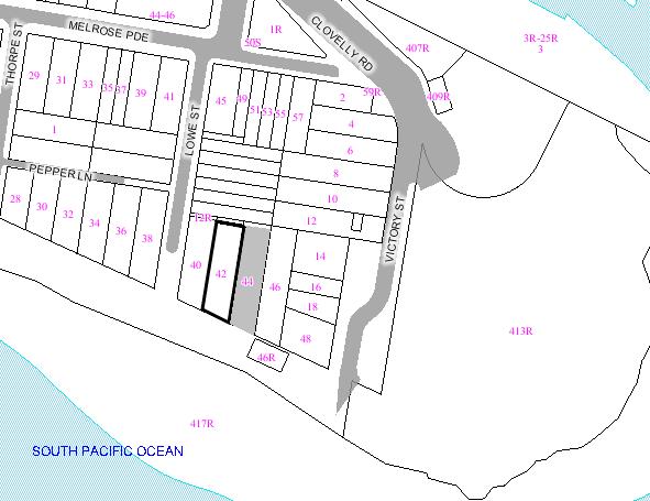
|
|
|
Subject
Site
|
|
|
|
|
|
|
|
|
|
Submissions
received
|
|
Ù
North
|
|
LOCALITY
PLAN
|
1. EXECUTIVE SUMMARY
The application has been referred to the Health, Building
and Planning Committee for determination at the request of Councillors Hughes,
Matson and Woodsmith.
The development application is seeking development consent
to make alterations and additions to the existing multi-unit housing building
involving the construction of a roof top addition comprising of new bedrooms,
kitchen and living room accessed from the units from the level below (level
four), demolition of internal walls at each level to improve internal amenity,
enlarge living space, enlarge south facing balconies to levels three and four,
new windows to level four and roof level and general refurbishment works to the
units located on levels one, two and three and landscaping to the rear yard
area. It is noted that the subject site is located within the 2A residential
zone and as such, development for the purposes of multi-unit housing is
prohibited. The application relies upon existing use rights as defined in the
Environmental Planing and Assessment Act and Regulation for development
consent.
The development application was notified to the
surrounding properties for two weeks and four objections were received during
this notification period, all from no.44 Cliffbrook Parade, the adjacent
property to the east. The objections raised concerns regarding visual privacy,
potential for increased noise from larger balconies, loss of amenity and
sunlight from roof level addition, the intensification of the use of the site
and the lack of any provision for on-site car parking.
The development application was referred to the SEPP 65
Design Review Panel meeting, held on 4 June 2007. The panel was generally
supportive the application, however did raise some concerns in respect to the
bulk and scale of the development and internal arrangement of units. In
response to these concerns the applicant submitted an amended design for the
room level structure, which reduces the total height by 350mm whilst
maintaining the same form and design and made changes to the internal
configuration of the residential dwellings.
The proposed development is considered to greatly improve
the internal amenity of the building and will significantly increase internal
useability of the units. The proposal will also involve the rendering and
painting of the building and other external works, such as integrated
landscaping to the rear of the site that will significantly improve the
presentation of the building to the surrounding area and its contribution to
the foreshore. Some of the objections relating to visual and acoustic privacy,
landscaping and bulk and scale have been addressed by the applicant, however
some other issues relating to parking, solar access and intensification of use
are not supported by the assessing officer and did not require the proposal to
be amended. Generally the proposal is acceptable in respect existing use
rights.
The recommendation is for approval subject to conditions.
2. THE PROPOSAL
The proposal involves internal and external alterations
and additions to the existing three storey multi-unit housing building and will
reconfigure the arrangement of units from 8 x 1 bedroom units to 4 x 1 bedroom
and 4 x 2 bedroom units. The works involve in detail:
Ground Floor (level 1)
- Relocation of
laundries from roof level to rear of ground floor.
- New external
path and steps along western side of site.
First floor (level 2)
- Garbage bin storage
area to the front boundary of the site.
- Internal
demolition works and rear extension of dining room.
- New timber
terraces to the rear of the building, accessed via the new dining rooms.
- New internal
stairs to level above.
Second Floor (level 3)
- New rear
terraces to rear of building with planter box to eastern side of terrace.
- Internal
demolition and refurbishment of rear units.
- New entry deck
to main pedestrian access on western side of building.
- New external
privacy screens to windows along the elevation.
- New court area
incorporating planter boxes and garbage storage area.
- New feature
wall along the western boundary.
Third Floor (level 4)
- New rear
terraces to rear units with planter box to eastern side of terrace.
- New stairs to
level above.
- Demolition of
internal walls and general refurbishment.
Fourth Floor (level 5 – existing roof terrace)
- Demolition of
existing laundry structure.
- New structure
comprising of WC, kitchen, dining and living rooms to unit 7 (eastern unit) and
two bedrooms and bathroom to unit 8 (western unit).
- New deck to
rear of building with privacy screens and planter boxes to western and eastern
sides.
3. THE SUBJECT SITE AND
SURROUNDING AREA:
The subject site is located on the northern side of Cliffbrook
Parade and is accessed via a right of way that extends from Lowe Street to the west of the subject site.
The site has a rear frontage to Lowe Lane (right of way) of 13.105m and a site length of 42.73m and
46.6m with the eastern side boundary being the greater. The southern boundary
adjoins Cliffbrook Pde in a section that comprises the coastal walkway and has
a width of 13.63m. The site is currently occupied by a three storey multi-unit
development comprising of a roof top terrace with current laundry access and
balcony areas to the southern elevation. The site has an area of 584.35sqm.
To the east of the site is a terraced multi-unit
development containing a maximum of three storeys. To the western elevation is
a two to three storey dwelling house. Semi-detached dwellings run perpendicular
to the subject site along the northern boundary. Figure 1 is an
aerial view of the subject site and surrounding area. Figure 2 is
the subject site from the rear.
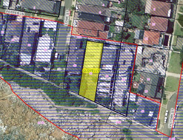
Figure 1: The subject site and
surrounding area.
4. SITE HISTORY
4.1 HISTORY OF SITE USEAGE
Previous applications submitted for development on the site includes:
|
Development No.
|
Description
|
Determination
|
|
DA/318/1989
|
Erect four balconies at the rear
of the existing residential flat building.
|
Approved
on 12 December 1989
|
|
DA/426/2004
|
Incorporate subfloor area to Unit 3 of the existing
residential flat building and modify strata plan to incorporate the new area.
Amended plans received - bedrooms on existing level and living areas at lower
level.
|
Approved
on 3 September 2004
|
|
DA/942/2004
|
Demolish existing balconies and make alterations and
additions including new balconies, extend dwellings 3 and 4, replace existing
openings, new laundry and upgrading of common areas.
|
Approved
on 28 April 2005
|
|
DA/455/2006
|
Alterations and additions to
existing residential flat building including additional level to units 7 and
8 and new upper level decks on southern elevation.
|
Withdrawn
on 27 November 2006
|
Development application 455/2006 was withdrawn at the
request of Council as it was considered that approval of the development
application with two active consents may result in cumulative impacts of each
development adversely impacting the amenity of the adjoining properties. As
such, the applicant withdrew the application and lodged this development
application including elements of the previously approved developments to
provide a cohesive and comprehensive application.
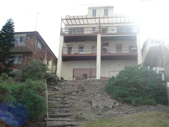
Figure 2: The subject site from
the rear, on the coastal walkway that passes the site. The dwelling on the left
(west) of the photo is no.40 Cliffbrook Pde.
5. COMMUNITY CONSULTATION:
The proposal has been notified in accordance with the
Development Control Plan – Public Notification of Development Proposals and
Council Plans. The following submissions were received:
5.1 Objections
Merryn Burrowes – Unit 3, 44 Cliffbrook Parade, Clovelly.
|
Issue
|
Comment
|
|
The roof top level addition will increase the height of
the building and adversely impact the appearance of the building.
|
It is considered the height of the roof level addition
is acceptable and is integrated with the design of the building. An
assessment of the height of the building is contained in the report below.
|
|
The proposal is not consistent with the NSW Land and Environment Court planning principle of Fodor
Investments v Hornsby Shire Council [2005] specifically in respect to
existing use rights and redevelopment of the site.
|
The proposal is consistent with the planning principle. See
section 11 of this report for an assessment of the application in regards to
the planning principle.
|
|
The proposal will “result in significant loss of privacy
particularly to Units 4 and 5” therefore privacy screens should extend the
full width of the rear terraces.
|
The proposal will not adversely impact upon visual
privacy as a condition has been included requiring details of the external
louvres to be provided for approval by Council prior to a construction
certificate being issued. A condition has also been included requiring the
terraces to level 4 and 5 to be reduced to the width of the existing
balconies and planter boxes to be structurally fixed to the building.
|
Martin and Nadia Bloom – Unit 5, 44 Cliffbrook Parade,
Clovelly.
|
Issue
|
Comment
|
|
The proposal will adversely affect privacy to the indoor
and outdoor living areas. The roof level addition will provide a perceived
sense of overlooking and overbearing.
|
The louvres to the east facing windows of the roof level
addition can be designed in a manner than prevents downwards overlooking. As
noted above, a condition has been included requiring details of the external
louvres to be provided for approval by Council prior to a construction
certificate being issued.
|
|
Louvres or screens to the east facing windows and
balconies may not be suitable as future occupants may be able to look through
the gaps of the louvres or screens.
|
See comments above. Louvres are appropriate as they can
designed to significantly minimise overlooking in a downwards direction.
|
|
The roof level addition will overshadow no.44 Cliffbrook
Pde and adversely impact views.
|
Given the orientation of the sun, the roof level
addition will not adversely impact solar access from sunrise to mid
afternoon.
|
|
The subject site does not provide on-site parking or
delivery areas and the addition of bedrooms will further increase parking
demand.
|
The site currently does not provide on-site parking and
the proposal will increase the parking demand. This issue is discussed in
section 9.5 of this report.
|
|
The bin storage doors swing over the right of way
adversely affecting other users of the easement.
|
A condition has been included requiring the doors of the
bin storage area to be sliding.
|
Carolyn Mathews – Unit 4, 44 Cliffbrook Parade, Clovelly.
|
Issue
|
Comment
|
|
The proposal does little to improve the external appearance
of the site to the surrounding properties and coastal pedestrian walk.
|
The proposal enhances the appearance of the building and
the associated landscape plan will significantly improve the appearance of
the site to the foreshore area.
|
|
The site provides no on-site parking and the proposal
will further increase parking demand.
|
This issue is discussed in section 9.5 of this report.
|
|
The roof level addition results in excessive height for
the building affecting solar access.
|
The increase in height is considered acceptable in the
context of development in the surrounding area and the solar impact of the
roof level addition will be negligible.
|
|
The proposed terraces and balconies will significantly
impact upon the visual privacy of the residents of no.44.
|
A condition has been included requiring the balconies to
be reduced to match the depth of the existing balconies on the subject site.
Blade walls and privacy screens feature along the eastern side of each
balcony to minimise potential overlooking.
|
|
The garbage bin storage area to the front of the site
includes doors that may impinge access to the right of way.
|
A condition has been included requiring the doors of the
bin storage area to be sliding.
|
|
The planter boxes to the terraces should be structurally
integrated with the building to ensure they are permanent fixtures and cannot
be removed by future occupants.
|
A condition has been included in the consent requiring
the planter boxes to be fixed to the balcony structure and not to be removed.
|
Gordon Edgar of Credence Planning – on behalf of owners of
44 Cliffbrook Parade.
|
Issue
|
Comment
|
|
The proposal will increase the height of building so
that it will be 3.45m higher than the multi-unit housing building at no.44
Cliffbrook Pde and 5.42m higher than the detached single dwelling at no.40
Cliffbrook Pde. The proposal is out of context and is not compatible with the
surrounding development and will “further increase this disparity in height.”
|
The roof level addition is located to the southern most
area of the roof and will not be immediately noticeable from the nearest
streets (Lowe Street, Victory Street or Melrose Parade). The roof level
addition will be most visible from the top level rear terrace of no.44,
however it will located above eye level and will not obstruct the sweeping
ocean and coastal views obtained by each unit of no.44 Cliffbrook Parade.
|
|
The proposal does not have a stepped built form akin to
no.44 Cliffbrook Pde and the roof level addition further exacerbates this
incompatible built form.
|
The proposal will improve the articulation and aesthetic
presentation of the building to the foreshore area. Requiring a stepped built
form akin to no.44 is unnecessary considering the proposal involves
relatively minor change to the building envelope. The roof addition will not
visually dominate the vista of the area and does not represent an
incompatible built form.
|
|
The floor area is “twice the density of any future
development and existing compliant development.”
|
Floor space ratio controls do not apply. A merit based
assessment on the physical character of the development is contained in
section 10.1 of this report.
|
|
The proposal is not consistent with the NSW Land and
Environment Court planning principle of Fodor Investments v Hornsby Shire
Council [2005] specifically in respect to existing use rights and
redevelopment of the site.
|
The proposal is consistent with the planning principle. See
section 11 of this report for an assessment of the application in regards to
the planning principle.
|
|
The proposal will have the potential to adversely impact
the privacy of the occupants of no.44 Cliffbrook Parade.
|
As noted above, conditions will be included requiring
the depth of the proposed balconies to be reduced and details of louvres to
the roof level addition to be provided prior to construction.
|
|
The proposal will generate additional car parking where
no additional on-site parking spaces have been provided.
|
This issue is discussed in section 9.5 of this report.
|
|
The swinging garbage bin storage doors illegally encroach
upon the right of way.
|
A condition has been included requiring the doors of the
bin storage area to be sliding.
|
|
There is opportunity for more substantial plantings to
the rear yard to provide additional privacy.
|
A condition has been included in the consent requiring
the details of the landscaping along the eastern side of the site to be
agreed upon by the owner’s corporation of no.44.
|
6. TECHNICAL OFFICERS COMMENTS
The application has been referred
to the relevant technical officers, including where necessary external bodies
and the following comments have been provided:-
6.1 Building
and Development Control Services
The application has been referred to the Building and
Development Control Officer for comment, conditions have been provided for inclusion
with any consent granted. The following comments were received:
Alterations and additions to the
existing three storey residential flat building to create another storey at
rooftop level on the existing trafficable roof/laundry area.
BCA Building Classification
Class 2 – Residential units
Description of the Building
In summary, the building
incorporates:
·
A ‘rise in
storeys’ of 4
·
Masonry
walls, trafficable roof and timber floors
·
One exit
stairway, of concrete construction
Building Code of Australia (BCA):
Full details of compliance with
BCA are not included in the DA documentation and therefore further detailed
information is required to be incorporated in the documentation for a
construction certificate.
Site Management:
Standard conditions are proposed
to be included in the consent to address construction site management issues,
such as the location of stock piled material or the storage and disposal of
excavated materials, sediment and erosion control, public safety and perimeter
safety fencing.
Recommendation
Should the approval be granted to
the application, the conditions included with the officer’s memorandum should
be included in the development consent
7. MASTER PLANNING REQUIREMENTS
The site has a total area of approximately 584.35sqm and
is therefore exempt from the master plan requirements of Clause 40A of the
Randwick LEP 1998.
8. ENVIRONMENTAL ASSESSMENT
The site has been inspected and the application has been
assessed having regard to Section 79C of the Environmental Planning and
Assessment Act, 1979, as amended.
9. RELEVANT ENVIRONMENTAL
PLANNING INSTRUMENTS
The proposal has been assessed in relation to compliance
with the following controls: -
- Environmental
Planning and Assessment Act 1979 as amended.
- State
Environmental Planning Policy No.10 – Retention of Low-Cost Rental
Accommodation.
- State
Environmental Planning Policy No.65 – Design Quality of Residential Flat
Development.
- State
Environmental Planning Policy No.71 – Coastal Protection.
- Randwick Local
Environmental Plan 1998.
- Development
Control Plan – Parking
- Development
Control Plan – Public Notification of Development Proposals and Council
Plans
- Randwick City
Council Section 94 Contributions Plan – (including amendment for Kensington
Town Centre).
- Building Code
of Australia (BCA).
9.1 Randwick
Local Environmental Plan 1998
The site is zoned 2A (Residential
A Zone) under the Randwick Local Environmental Plan 1998 and as such the
proposal for multi-unit housing is a prohibited use in the zone. However,
under Section 41 of the Environmental Planning and Assessment Regulation 2000,
the non conforming use may be enlarged, expanded, intensified, altered,
extended or rebuilt. Hence, notwithstanding that the proposal is prohibited
within Zone 2A, it may be approved by development consent under the existing
use rights provisions of the Environmental Planning and Assessment Act, 1979
and the Environmental Planning and Assessment Regulation 2000.
As the proposal is a prohibited
use in the 2A Zone, other provisions such as aims and objectives and
development standards regarding floor space ratios, building heights and
landscaped areas are not applicable and do not require objections pursuant to
State Environmental Planning Policy No. 1 – Development Standards. Similarly,
the Development Control Plan – Multi-unit housing is also not applicable to the
proposed development. Nevertheless, aims and objectives, development standards
and development controls can be considered as a guide in the context of a merit
assessment of the proposal as contained in section 10 of this report.
The following clauses of the Randwick Local Environmental
Plan 1998 are applicable for development other than dwelling houses in the
zone:
|
Clause
No.
|
Requirement
|
Provided
|
Compliance
|
|
29 – Foreshore scenic protection area
|
The subject site is located within the Foreshore scenic
protection area.
|
The development increases the height of the building
however its overall appearance is considered to result in an improved
presentation to the foreshore area.
|
The development significantly improves the aesthetic
attributes of the existing building. Complies.
|
|
31 - Landscaped area
|
50% of the total site area as landscaped area.
Landscaped areas over podiums or excavated basement areas must not exceed 50%
of the landscaped area requirements.
|
49% of the site is landscaped; 38% is soft landscaped.
|
Development for multi-unit housing is prohibited in the
zone. The application relies upon existing use rights and therefore Clauses
31, 32 and 33 of the LEP are not applicable to the development application. A
merit based assessment has been undertaken in respect to landscaped area,
floor area and building heights.
|
|
32
– Floor space ratios
|
0.5:1
|
1:1.
|
|
33
- Building heights.
|
7m
external wall height and 9.5m maximum building height.
|
Maximum
building height of 10.9m, maximum external wall height of 10.6m.
|
9.2 State Environmental
Planning Policy No.10 – Retention of Low-Cost Rental Accommodation.
The multi-unit housing building located on the subject
site has been strata subdivided pursuant to the Strata Schemes (Freehold
Development) Act 1973 and as such, pursuant to section 6(2)(c) of the SEPP, is
exempt from consideration of the Policy.
9.3 State Environmental
Planning Policy No.65 - Design Quality of Residential Flat Development
This Policy applies to development being:
a. The erection of a new
residential flat building, and
b. The substantial redevelopment
or the substantial refurbishment of an existing residential flat building, and
c. The conversion of an existing
building to a residential flat building.
d. If particular development
comprises development to which subclause (1) applies and other development,
this Policy applies to the part of the development that is development to which
subclause (1) applies and does not apply to the other part.
The guide stipulates that the SEPP
is to be applied in accordance with the following box:
|
Definition of residential flat building and application
of SEPP No 65
The SEPP will apply to residential flat buildings of three
or more storeys (not including levels that protrude less than 1.2m above
ground level that are devoted to car parking and storage) and four or more
self contained dwelling units. It will not apply to buildings classified
as Class 1a or 1b under the Building Code of Australia.
|
The proposed works fall under SEPP 65 and as such the
application was referred to the 4 June 2007 Design Review Panel. The comments are included below.
9.3.1 SEPP 65 Design Review
Panel Comments
This is the first time that the
Panel has viewed this application, although the Panel understands that a
previous application has been approved by Council for works to the lower
floors.
1. Relationship to the
Context of the Proposal
The proposal is located in a
prominent stretch of waterfront at Gordon’s Bay. The context is diverse, in
terms of scale, types and materials.
The proposal transforms the
southern half on an existing apartment building. This building, which currently
contains 8 small flat floor units, is in a somewhat dilapidated state, due to
its extremely exposed position and age. The proposal refurbishes and enlarges
the 4 south facing units, making them all 2 storeys.
In the Panel’s opinion, the
proposal significantly improves the building’s scale and presentation to the
public waterfront. The retention of the generous landscaped sloping garden to
the waterfront is strongly supported, as it is contiguous with neighbouring
gardens and remnant rock shelves to the west and south.
2. The Scale of the Proposal
The new rooftop elements increase
the scale of the building. However, as there are a number of existing
structures on the rooftop, the new form does not significantly add to the
height or bulk and is considered acceptable in this dramatic setting.
The balconies terrace down the
slope, mitigating the vertical scale of the rear façade.
3. The Built Form of the
Proposal
Acceptable, as the design is a
clear improvement over the existing conditions.
The detail of the retractable
awnings should be indicated on the elevations.
4. The Proposed Density
Acceptable. A modest increase in
density allied to physical and environmental improvements.
5. Resource and Energy Use
and Water Efficiency
All apartments are
cross-ventilated, and the 4 modified apartments also benefit from stack effect
ventilation.
The top floor apartments benefit
from some northern sun through the hi-light windows.
The provision of rainwater tanks
in the base is supported.
Windows should be provided to the
level 1 laundry for environmental reasons as well as amenity.
6. The Proposed Landscape
The retention of the large deep
soil garden on the south side of the building is strongly supported. A
landscape plan has been submitted by a landscape architect.
7. The Amenity of the
Proposal for its Users
The Panel suggested a number of
potential improvements could be made to the internal planning to improve
amenity;
- Unit 7, with
the living room at the upper level, has a much better plan than Unit 8. This
Unit should be approached to suggest this change as the rooftop position with
improved light and views will be a much better place for a kitchen, living and
dining area.
- Some of the
bathrooms, laundries and kitchens are a little awkward, and would benefit from
further planning refinements. For example the toilet off the kitchen in Unit 8
is highly undesirable. The laundry off the lounge is not ideal in Unit 8.
- In the lower
units, the internal stairs are not always as well integrated with the planning
as could be achieved. It may also be better to keep some of the wall to say
1200 high between the lounge and the kitchen. This will help with the placement
of furniture in the lounge area.
- The amount
of natural light should be improved to the entry corridors and stairs of units
3 and 4
- The planters
/ privacy screens on the sides of the balconies need further refinement
- The scale of
the openings to the waterside would be improved if they were floor to floor,
with top light windows to allow the occupants more options for natural
ventilation in this windy and exposed site.
- The generous
new balconies to the water side are supported.
8. The Safety and Security
Characteristics of the Proposal
Acceptable – improved overlooking
of Cliffbrook Parade.
A BCA report should be supplied
that considers the windows and egress within 3 meters of the property boundary,
and any other fire safety issues.
9. Social issues
The Panel supports the improved
mix of apartments provided, and the retention of the common roof terrace. The
new communal laundry adjoining the common garden is also supported.
10. The Aesthetics of the
Proposal
The Panel suggested that the steel
frame on the rear façade could have a stronger reading to the waterside, to
better match the scale of the elevation. The balconies would be improved with a
matching steel handrail to cap the glass balustrade.
Further work on the steel
structure may give greater legibility and improve the aesthetics of the
proposal The steel post that comes out half way to unit three and four’s
terrace and continues up to Units seven and eight may be better pushed out to
the edge of the terrace. Consideration could also be given to the dimension of
the steel. The posts appear a little thin in the montage.
The laundry / masonry base would
benefit from some well-scaled openings, that retain the monolithic scale of the
base.
Narrow deep windows with recessed
glass would be suitable on the south stone elevation. This would ensure that
the monolithic nature of this wall remains. Alternatively larger openings,
which are permanently ventilated, could be considered on the east and west.
Permanent ventilating larger windows on these two sides will assist in this
area remaining dry and natural light will also reduce the need for lights to be
turned on during the day.
The re-worked openings in the side
elevations at upper levels are well handled.
The Panel considers that the roof
design could be further refined, particularly if issues of bulk or
overshadowing are a concern. The important consideration for the roof design is
providing north light and memorable volumes for the top floor apartments.
The durability of materials is a
major consideration, given the exposure of the site.
9.3.2 Applicant’s
response to SEPP 65 DRP Comments
As stated above, the panel held concerns regarding the
roof level addition, stating that the “roof design could be further refined,
particularly if issues of bulk or overshadowing.” As such, the applicant
amended the height of the proposed roof level addition by reducing the total
height of the structure by 350mm. The other issues raised by the panel involved
internal reconfiguration to the residential apartments to improve the internal
amenity for future occupants of the building. The issues have been addressed by
the applicant and incorporated as amended internal configurations to the
dwellings and do not affect the appearance of the building to the street.
Amended plans were received by Council on 23 August 2007 and made the following
modifications to the proposed development:
- Windows added to northern, eastern
and southern elevations of the proposed laundry area.
- The
floor plan to Unit No. 8 has been amended to match that of Unit No. 7.
- Plan
layouts to Unit no. 3 & 4 have been amended to improve pantry & fridge
layouts to the kitchens.
- Windows
have been added to the stairwells of Units 3 & 4 to improve natural light /
ventilation.
- The
windows to the south elevation have been amended, to incorporate highlight
panels to assist in cross ventilation, as discussed in the meeting.
- The
steel frame has been amended to incorporate more substantial steel framing the
south elevation.
- New
window openings have been incorporated into the bathroom and bedroom of Level 4
to the south elevation.
The issues raised by the panel in respect to the planter
boxes and privacy screens is noted, and a condition has been included in the
consent requiring the privacy screens to the northern sides of the rear
terraces to be extended to cover the full depth of the terraces. A condition
has been included in the development consent requiring the extended window to
the northern elevation of level 3 to be provided with external fixed louvres to
minimise potential privacy impacts and the new bathroom windows to the southern
elevation to fitted with obscured glazing to maintain the amenity of the
adjoining property to the south.
The amendments were considered relatively minor and as
they will not impact upon the amenity or privacy of the adjoining properties
renotification to the surrounding properties was not undertaken.
9.4 State
Environmental Planning Policy No.71 – Coastal Protection
The subject site is located within the area specified
under the SEPP. The main aim of the policy is to protect and manage the
natural, cultural, recreational and economic attributes of the New South Wales coast, and to protect and improve
existing public access to and along coastal foreshores to the extent that this
is compatible with the natural attributes of the coastal foreshore.
Pursuant to clause 8 of SEPP 71 the relevant matters of
consideration include:
(d) The suitability of development
given its type, location and design and its relationship with the surrounding
area.
The proposed development involves the internal
reconfiguration and refurbishment of an existing three storey multi-unit housing
building and the construction of a roof level addition comprising of two
bedroom, a kitchen, WC, living room and new balconies. The type of development
is not permissible in the zone however is consistent with surrounding
development is not considered to be incompatible with development in the area.
The design of the proposal is considered contemporary and compatible with the
style of other dwellings in the area and generally the development will
significantly improve the presentation of the site to the foreshore area,
notably the coastal walkway that passes the rear of the site. It is considered
the proposal will have a positive relationship with the development in the
surrounding area and will not become a prominent or distracting visual element
when viewed from the foreshore area. As such it is considered the proposal is
consistent with the relevant clauses of this SEPP.
9.5 Development Control Plans
9.5.1 Development Control Plan –
Parking
The DCP – Parking
does not apply to the site however the table below is included as a guide to
indicate the level of parking generated by the development.
|
Use
|
Parking
rate
|
Requirement
|
Proposed
|
|
Multi Unit Housing
|
1 space per two studio dwellings
1 space per 1 bedroom dwelling or bedsitter unit over 40
sqm
1.2 spaces per 2 bedroom dwelling
1.5 spaces per 3 or more bedroom dwelling
|
4 x 1 bedroom apartments = 4 spaces
4 x 2 bedroom apartments = 4.8 spaces
Total residential = 8.8 spaces required.
|
Nil. The site currently does not provide on-site parking
and the proposal will not include provision for any on-site parking.
|
|
|
Visitor Parking: 1 space per 4 dwellings or part thereof, but shall not
be required for a development containing less than 4 dwellings.
|
2 spaces required.
|
|
|
|
Service and Delivery Parking: See Section 3.4 of the DCP.
|
Not required.
|
|
|
|
Bicycle Parking: 1 space per 3 units, plus 1 visitor space per 10 units.
|
3 spaces required.
|
|
|
|
Car Wash Bays: 1 car wash bay required per 12 dwellings. Note:
Visitor spaces may be used as car wash bays.
|
Not required.
|
|
The current building if subject to the DCP requirements
would generate a total of 10 car parking spaces. The proposal will involve a
reconfiguration of the number of bedrooms provided in the building, however
will not increase the total number of units. Generally a development of this
nature in a 2B or 2C zone would generate a total of 10.8 car parking spaces, an
increase of 0.8 spaces. The issue of increased car parking generation and the
lack of on-site car parking has been raised frequently by the objections
received during the notification period. The issue of parking has been
addressed in the Statement of Environmental Effects (SEE) and main
justification provided in the SEE revolves around the relatively close access
to public transport for future occupants to access and the relatively minor
increase that the proposed development will result.
The issue of parking is also addressed in the section 11
of this report as part of the assessment undertaken in respect to the existing
use rights and the Land and Environment Court planning principle applicable to the development application.
10. Likely Impacts
10.1 Height,
Bulk, Scale and Streetscape
The proposal will increase the floor space ratio (FSR) of
the site from approximately 0.83:1 to 1:1, an increase of 99sqm that
predominantly results from the new floor area to the roof level of the building
with 13sqm to the new level 1 laundry. The general appearance of the building
will be altered and overall height increased however it is considered that the
scale of the residential building will be maintained and that the numerical
increase in the gross floor area (GFA) of the site is a poor measure of the
increase in respects to the perceptible impacts to the adjoining properties and
to the foreshore area. As such it is considered more appropriate to make an
assessment of the increased GFA in respect to the performance requirements of
the Multi-unit housing DCP, objectives of the 2A zone, the purpose of clause
no.32 of the LEP and the context of the development in relation to surrounding
development of a similar nature.
It is noted that the main performance requirement of the
Multi-unit housing DCP in relation to FSR/density is to ensure building bulk is
“compatible with the surrounding built forms and minimises impact of building
bulk on nearby buildings, open spaces and the streetscape”. The roof level
addition will contribute to an increased building bulk, however the increase is
considered acceptable as the addition only covers a portion of the entire roof
level, is located to the rear away from the street, is lower in height at the
southern edge than the existing laundry building, features a low pitch skillion
roof which slopes to the north and away from the rear terraces of no.44
Cliffbrook Parade which generally gives the addition a modest bulk and scale
and will be consistent with the bulk and scale of other buildings in the area
as seen in Figure 4 below which is a photograph taken from the
roof level of the subject site showing two, three and four storey residential
flat buildings within the vicinity of the subject site.
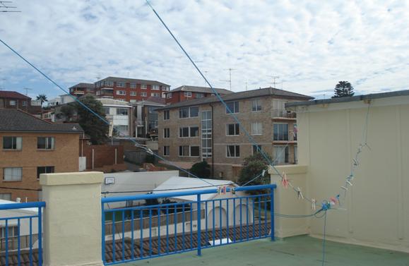
Figure 4: Photograph from the roof
level of the subject site looking north-west to existing two, three and four
storey multi-unit housing buildings.
The addition will have an appropriate degree of
articulation, use a mix of materials (rendered and painted walls, glazing,
metal louvres, metal privacy screens) and will be integrated with the building
as the proposal also includes works to the rear of the entire building and
landscaping that will substantially improve the presentation of the entire site
to the foreshore area. The adverse impact of building bulk to the adjoining
properties will be minimised through keeping the height of the roof level
addition lowest at its southern end and where it will be most visible from the
rear terraces of the occupants of no.44 Cliffbrook Parade. The purpose of
clause no.32 of the LEP seeks to “reduce the potential for adverse impact on
nearby and adjoining development while still providing for reasonable levels of
development and redevelopment.” The proposed development is considered to be
consistent with the purpose of the clause in respect to providing a appropriate
and relatively modest increase in floor area to improve the internal amenity of
the building while being sensitive to the amenity of the adjoining properties
and the foreshore area.
It should be noted that the applicant amended the total
height of the roof level addition, resulting in a decrease of 350mm of the
structure, which results in the new structure being 200mm to 300mm above the
existing laundry structure at the southern end of the roof having an height of
RL 24.095 at the southern end and an RL of 25.025 at the northern end, which
represents a height range of 2.895m to 3.825m above the floor level of the roof
and above the height of the existing laundry structure of approximately 2.745m.
The proposed roof level addition results in a maximum building height of 10.9m
(an increase of 1.7m) and an external wall height increase from 6.9m to 10.6m.
A condition has been included in the development consent requiring the
reduction of the height of the roof level structure by 350mm to be implemented
as part of the construction certificate plans.
The broad objectives of the 2A zone require development to
maintain the amenity of the area through sensitive development that is
compatible with the dominant character of the area. The subject site is
surrounded by a variety of residential development with a predominance for
larger residential buildings comprising of two, three and four storeys and
residential dwellings of one, but mainly two storeys. Figure 4 above
clearly indicates that development within the relative vicinity of the subject
site comprises of multi-unit housing buildings with built forms that are
similar to the building that exists upon the subject site. It is therefore
considered that the proposed development maintains the character of the area
and will enhance the presentation of the building improve the internal amenity
for future occupants.
Considering this amendment and the general issues of
potential impacts of bulk, scale, and visual amenity to the adjoining
properties, it is deemed that the proposal is reasonable and will not adversely
impact upon the area. Therefore the proposed GFA of the building is considered
acceptable.
10.2 Visual
and Acoustic Privacy
The proposal involves the creation of new openings to the
existing building, with new windows to the eastern and western sides to level 4
and new sliding doors to the south facing rooms to the roof level of the
building. The proposed rear terraces will maintain the dimensions of the
existing balconies and a condition has been included in the development consent
that requires the privacy screens to extend the full length of the northern
side of the terraces to minimise direct overlooking into the rear terraces of
no.44 Cliffbrook Parade.
The objections received from the adjoining property to the
east, no.44 Cliffbrook Parade, raised a number of concerns that the proposal
may result in a significant reduction in the privacy of the rear terraces of
each of the objectors units. A visit to the objectors’ units ascertained that
there would be a potential for increase overlooking as a result of the
increased size of the terraces and therefore it was considered pertinent to
include a condition that would reduce the proposed terraces to be the same
depth as the existing terraces and for the privacy screens to extend the full
length of the northern side of the terraces. As such the overlooking potential
from the rear terraces would not be increased beyond the existing site
conditions.
The proposed roof level addition will include windows to
the eastern and western elevations (both with sill heights of 1m) and will
provide the potential to overlook into the adjoining properties adjoining the
site, particularly the rear open terrace of unit 5 (topmost unit) of no.44
Cliffbrook Parade. It is noted however that the existing roof terrace to the
building located upon the subject site provides ample and expansive overlooking
opportunity into the aforementioned rear terrace and is accessible by all
owners of the building as the laundry facilities of the building are located at
the roof level. As such, considering this existing potential for overlooking the
inclusion of the windows, particularly to the eastern elevation, is deemed
acceptable and especially noting the inclusion of external horizontal louvres
that will significantly mitigate any potential overlooking from the unit 7
kitchen and dining rooms. To further ensure the privacy of the rear terrace to
the topmost level of no.44 is preserved or improved, a condition has been
included with the development consent requiring additional detail specifying
the gaps, length and angle of the louvres demonstrating that overlooking in a
downwards angle is not possible.
The works to the roof level will effectively reduce the
accessible floor area by approximately half and thus reduce significantly the
potential for use of the roof for entertainment or noisy activities such as
parties or the like. The new habitable space to the roof level will include
terraces facing south, however their size and orientation is entirely
commensurate with the other terraces on the site and consistent with the
terraces in the area that share outlooks to the water of Gordons Bay and to Wedding Cake Island in the distance. It is
considered likely that the terraces will not be conducive to large
congregations of people for entertainment purposes as their size is
considerably smaller than the terraces to each unit at no.44 Cliffbrook Parade.
As such any noise emanating from the terraces will be characteristic to the
noise level the other terraces in the area have to potential of producing.
As such the proposal, with the inclusion of conditions in
the consent as discussed above, is considered to have a satisfactory degree of
measures that will reduce and mitigate any adverse privacy impacts upon the
adjoining properties.
10.3 Landscaping
and Private Open Space
The proposal includes a landscape plan that will
significantly improve the amenity of the rear private open space and contribute
to the overall aesthetic appearance of the building to the foreshore area and
the surrounding properties. The current site features an uninspiring rear yard
area that is relatively open and does not promote use by the occupants. The
proposal will provide greater visual screening from persons using the coastal
walkway at the rear of the site, provide an attractive green space for future
occupants and also the views from the adjoining properties.
The landscape plan will generally provide a substantial
improvement over the current landscaped areas on the site and will benefit the
amenity of the occupants of the subject site and those adjoining the site. A
condition has been included in the development consent requiring the applicant
to liaise with the body corporate of no.44 Cliffbrook Parade to agree to
greater landscaping along the eastern boundary to provide greater degree of
visual screening and reduce potentially hazardous coastal winds.
The proposal is considered to have an appropriate degree
of landscaped area and will significantly improve the amenity of the area,
benefiting the amenity of the adjoining properties and the appearance of the
site from the foreshore area.
10.4 Solar Access and Energy
Efficiency
The proposed development mainly involves works related to
residential development confined to the rear of the subject site whilst some
works, relating to garbage bin storage area, to the front of the site. The
subject site and those adjoining the site, have a north to south orientation
which is favourable when considering potential impacts to solar access as the
eastern and northern elevations and northern and western elevations of the
eastern and western adjoining properties respectively will not be affected..
The works being at the rear of the site will have a reasonable impact upon
solar access and will not significantly impinge upon solar access for the
adjoining properties to the east and west. The objections received from no.44
Cliffbrook Parade raised concerns regarding significant and adverse losses of
sunlight, however it is deemed that the proposed development does not involve
excessive increase in the height, bulk or scale of the building and as such,
any solar access impacts are reasonable and acceptable with consideration to
the character of development in the area, which is predominantly multi-unit
housing buildings.
The overshadowing diagrams submitted with the development
application indicate that the additional shadow cast by the roof level addition
will add shadow to the extremities of the existing shadows and as such, will
affect solar access generally at the southern end of the adjoining properties.
It should be noted that the proposal does not affect sunlight to solar
collectors of the adjoining properties, overshadow landscaped areas and due to
the relatively favourable orientation of the subject site and adjoining sites,
the overall impact to solar access will be minimal or negligible.
10.5 Utilities/Site Facilities
The relocation of the garbage bins to the northern section
(front) of the site is considered an acceptable location as it provides level
access to Lowe Street for waste collection. A condition
will be included requiring the swinging doors to be made into sliding doors to
avoid conflicts with the right of way.
11. PLANNING
PRINCIPLE – FODOR INVESTMENTS V HORNSBY SHIRE COUNCIL [2005]
As noted above in this report, the subject site is zoned
as 2A (Residential A Zone) and development for the purposes of a multi-unit
housing building is prohibited. As such, the development relies upon existing
use rights to be considered as part of the assessment of the application. An
existing use as defined in section 106 of the Environmental Planning and
Assessment Act 1979 (‘the Act’) is a use that is lawfully commenced but
subsequently become prohibited use under a new local environmental plan or
other environmental planning instrument. Development relating to existing use
rights is pursuant to the following sections of the Act and the Environmental
Planning and Assessment Regulations 2000 (‘the Regulation’):
Section 108(3) of the Act states:
An environmental planning
instrument may, in accordance with this Act, contain provisions extending,
expanding or supplementing the incorporated provisions, but any provisions
(other than incorporated provisions) in such an instrument that, but for this
subsection, would derogate or have the effect of derogating from the
incorporated provisions have no force or effect while the incorporated
provisions remain in force.
And;
Section 41(1) of the Regulation
states that:
(1) An existing use may, subject
to this Division:
(a) be enlarged, expanded or
intensified, or
(b) be altered or extended, or
(c) be rebuilt, or
(d) be changed to another use, but
only if that other use is a use that may be carried out with or without
development consent under the Act, or
(e) if it is a commercial use-be
changed to another commercial use (including a commercial use that would
otherwise be prohibited under the Act), or
(f) if it is a light industrial
use-be changed to another light industrial use or a commercial use (including a
light industrial use or commercial use that would otherwise be prohibited under
the Act).
(2) However, an existing use must
not be changed under subclause (1) (e) or (f) unless that change:
(a) involves only alterations or
additions that are minor in nature, and
(b) does not involve an increase
of more than 10% in the floor space of the premises associated with the
existing use, and
(c) does not involve the
rebuilding of the premises associated with the existing use, and
(d) does not involve a significant
intensification of that existing use, and
(e) relates only to premises that have
a floor space of less than 1,000 square metres.
It should be noted that amendments were made to the
existing use provisions in the Regulation on 29 March 2006 so that it was no
longer possible to change from one prohibited use to another prohibited use
without a rezoning of the site being made first. On 9 February 2007 the NSW Government further amended the Regulation
to include transitional provisions to development involving subdivision and
fit-out of shops that relied upon existing use rights.
The Land and Environment Court provides two court
decisions as planning principles to aid in the assessment of development
relying upon existing use rights, they are the Stromness Pty Limited v
Woollahra Municipal Council decision of 2006 and the Fodor Investments v
Hornsby Shire Council decision of 2005. The Stromness decision reinforced each
of the four principles of the Fodor decision with particular note that
presiding commissioner Pain of the Stromness case affirmed that “care must be
exercised in the application of the principles to ensure that there is not a de
facto application of standards in environmental planning instruments as that is
prohibited by s 108(3) of the Environmental Planning and Assessment Act.”
Commissioner Pain also stated that the planning principles were intended to be
applied “as guidelines to assist resolution of issues that commonly arise in
merits review cases”. Notwithstanding this cautionary note, it is considered
the planning principle of Fodor Investments v Hornsby Shire Council is
pertinent to the this proposed development.
Whilst the Fodor Investments v Hornsby Shire Council Land and Environment Court decision (and subsequent adoption as a planning principle) predates
the significant amendment of 29 March 2006
to the Regulation, it is considered a pertinent apparatus to aid in the
assessment of this development application. Senior Commissioner Roseth presents four questions
that should be asked of any development seeking consent relating to existing
use rights:
[Question 1] How do the bulk and scale (as
expressed by height, floor space ratio and setbacks) of the proposal relate to
what is permissible on surrounding sites?
While planning controls, such as
height, floor space ratio and setbacks do not apply to sites with existing use
rights; they have relevance to the assessment of applications on such sites.
This is because the controls apply to surrounding sites and indicate the kind
of development that can be expected if and when surrounding sites are
redeveloped. The relationship of new development to its existing and likely
future context is a matter to be considered in all planning assessment.
The existing building has a built form that is
commensurate with the surrounding development in the area and is an older
structure than what exists on the adjoining properties to the west and east.
The development further from the site, but still in the vicinity of the area,
contains a variety of multi-unit housing buildings or similar scale, bulk and
height especially along the northern parts of Lowe Street and the southern side of Melrose Parade, approximately
40m to 50m to the north of the subject site. The adjoining development to the
subject site consists of a dwelling house to the west, and a multi-unit housing
building to the east. The dwelling is a two storey structure that has a lower
height than the building on the subject site and is generally considered to
have a lesser scale. The multi-unit housing to the east of the subject site
(no.44 Cliffbrook Pde) has a stepped built for that extends from the north to
the southern part of the site, giving the appearance of being a larger
structure when viewed from the foreshore area to the south. The total height of
the structure of no.44 may be lower than the building on the subject site,
however it is deemed that the building of no.44 extends closer to the foreshore
and the rear setback of no.44 is significantly less (approximately 10 to 15m)
than the building on the subject site. As such, when considering the issue of
bulk and scale it is pertinent to consider that the buildings adjoining the
subject site are not necessarily relevant indicators of what may or may not be
acceptable development on the subject site, particularly when the adjoining
property to the east contains a similar prohibited use. Figure 3
below is a photograph of the adjoining property to the east and its visual
impact created by a built form that stretches significantly greater than the
building on the subject site, and it is considered, has a more immediate and dominant
presence when viewed from the foreshore area, and particularly the coastal
walkway.
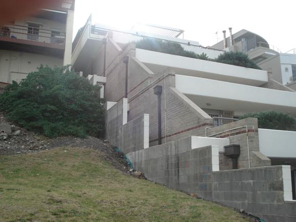
Figure 4: The western wall of
no.44 Cliffbrook Pde as viewed from the rear boundary (near the coastal
walkway) of the subject site. Encouraging a similar stepped form to the subject
site is not deemed appropriate.
The FSR of the proposal reaches approximately 1:1 and
would exceed the LEP requirement for development other than the purposes of a
dwelling house to have an FSR of no greater than 0.5:1. The degree of non-compliance
with the LEP FSR requirements aside, it is considered that the overall
character of the building will be maintained and that the roof level addition
will be most noticeable from the adjoining dwellings and the dwellings located
to the north west that essentially look down onto
the subject site. The streetscapes of the nearest street of Lowe Street, Melrose Parade and Victory Street are unlikely to be adversely impacted by the proposed
development.
The degree of work proposed on the subject site is
considered relatively minor in the context of the development that exists
currently and it is deemed that similar refurbishment works resulting in
additional floor area to improve the amenity of future occupants of the site
would not be uncharacteristic in the area and would maintain the amenity and
prevailing built form of the area which predominantly consists of multi-unit
housing buildings. Therefore, the proposal is considered to be consistent with
the character of the area and that relationship of the new development to its
existing and likely future context is deemed acceptable.
[Question 2] This question relates to change of
use and is not applicable to this assessment.
[Question 3] What are the impacts on adjoining
land?
The impact on adjoining land
should be assessed as it is assessed for all development. It is true that
where, for example, a development control plan requires three hours of sunlight
to be maintained in adjoining rear yards, the numerical control does not apply.
However, the overshadowing impact on adjoining rear yards should be reasonable.
After consideration of the objections received it is
deemed that the most significant impacts of the proposal involves visual
privacy impacts such as direct overlooking, excessive bulk and scale of the
roof level addition resulting in visual amenity impact and overshadowing and
increased generation for on-site parking spaces where the current site provides
no on-site parking resulting in increased demand for on-street parking spaces and
adversely affecting availability for parking for existing residents in the
area.
The issue of visual privacy loss as a result of potential
increased overlooking from new windows to the roof level addition and the
balconies to the rear of the site has been addressed by the applicant through
the implementation of privacy screens and angled external louvres to minimise
or completed reduce overlooking. Following a site visit to the units of no.44
Cliffbrook Parade it was determined that the balconies to the rear of the
subject site would be required to be reduced in depth to match the existing
balconies and that privacy screens should extend the full length of the
balconies. Appropriate conditions to this effect have been included in the
development consent. The issue of overlooking from the eastern windows of the
roof level addition has also been addressed by the applicant through the use of
fixed angled external louvres to the southernmost side window (to the living
room of unit 7). Objections received regarding resizing the window or deleting
the window are not supported as it is considered a appropriate design of the
louvres can effectively limit all downward overlooking into the rear terrace of
the topmost unit of no.44 whilst also preserving the internal amenity of the
proposed living spaces to the roof level addition. As such, a condition has
been included in the development consent requiring details of the louvres to be
provided and approved by Council prior to a construction certificate being
issued.
The issue regarding visual amenity and overshadowing
impacts as a direct result of the roof level addition has been raised also by
the SEPP 65 DRP members and as such resulted in an amended design for the roof
level addition being reduced in height by 350mm. The height reduction aids in
reducing the perceived bulkiness of the structure when viewed from no.44
Cliffbrook Parade whilst possibly reducing the potential for the roof level
addition to impact upon the solar access to the terrace areas of the adjoining
eastern property. It is important to note that as no DCP applies to the site
for this development, no prescriptive controls regarding solar access are
applicable to the proposed development. Regardless, the Multi-unit housing DCP
requires consideration of solar access to adjoining properties and specifically
seeks to maintain solar access to solar collectors of adjacent buildings, to
the living areas of neighbouring properties and to at least 50 per cent of the
principal landscaped areas of neighbouring dwellings. In respect to these
controls, the proposal will not impinge upon solar access from sunrise to until
the mid-afternoon for the adjoining property to the east. It is possible that
the proposal will affect afternoon solar access to the top most terrace of
no.44 Cliffbrook Parade; however the orientation of the subject site is such
that any impact is solely after 12pm and does not impinge upon access to sunlight prior to that time. This
question of the planning principle acknowledges that development may adversely
impact upon the solar access of another property, as such it allows for impacts
provided that the impact is reasonable. In this instance the proposal is
considered reasonable.
The issue regarding on-site parking provision has been
addressed in the Statement of Environmental Effects (SEE) and stated that the
development application is acceptable in respect to car parking for the
following reasons:
- “The
proposed increase of 0.6 of a space is negligible given the location of the
subject site to local services;
- The site
is within level walking distance to local beaches;
- The site
is within 200 metres level walk to a frequent bus service (buses every 3-5
minutes during peak hours) to the Sydney CBD and Central Railway;
- The site
is in close proximity to the public car park at Clovelly Beach which contains approximately 300
spaces;
- There is
street parking available in the area along streets with not residential
frontage.”
It is considered the abovestated reasons provided by the
applicant in respect to parking availability are well founded in respect to the
availability of public transport within walking distance of the subject site
and car parking spaces available on-street and at the Clovelly Beach car
parking area to the east of the site. The applicant states in the SEE that the
DCP – Parking does not apply to the development and any impact of the
development to car parking availability is a reasonable impact for the
abovestated reasons. Provision of on-site parking is not deemed reasonable for
two main reasons, the first being the potential difficulties in providing
adequate space for cars to park on the site without significantly altering the
configuration of the building on the subject site, and the second reason being
that the subject site does not currently provide any parking on the site and
that the proposal does not increase the number of units, thus, resulting in a
minor increase in the generation of parking spaces.
It is noted that the issue of car parking and on-site
parking has been addressed in the report above and generally the proposal is
considered acceptable when considering the current provisions of the site to
provide for on-site parking and the significant logistical issues that would be
present if it was required for all on-site parking to be provided on-site.
It is evident that the impacts of the proposal will be
generally minor especially considering when appropriate conditions are included
in the development consent. The issues of visual privacy impacts, potential
loss of solar access and on-site car parking availability are valid concerns
that have been addressed via the applicant in the supplied SEE and submitted
plans. The inclusion of the conditions relating to reduction balcony depth and
increasing privacy screens to the width of the balconies, increasing plantings
along the eastern boundary to improve the amenity of the adjoining property,
greater detail in respect to external louvres
[Question 4] What is the internal amenity?
Internal amenity must be assessed
as it is assessed for all development. Again, numerical requirements for
sunlight access or private open space do not apply, but these and other aspects
must be judged acceptable as a matter of good planning and design. None of the
legal principles discussed above suggests that development on sites with
existing use rights may have lower amenity than development generally.
The design of the roof level addition will include windows
to the south, east and west to and highlight windows to the northern elevation.
The internal amenity of the units to the roof level will be acceptable and will
promote useable spaces for future occupants. The alterations to the site will
involve the southern units, with the rear units of level two, three and four
receiving refurbished balconies and the rear units on level four receiving new
windows to the eastern and western external walls. The internal configuration
of the units is considered to result in an markedly improved amenity for future
occupants of the rear units and as such will be consistent with the aims of
this planning principle.
Generally the proposal remains
consistent with the objectives of the planning principal and the impact to the
surrounding properties, specifically no.44 Cliffbrook Parade, is acceptable
with the inclusion of conditions in the development consent. Amendments to the
proposal to address the other issues raised in the objections is considered
particularly onerous and unnecessary as the proposal is commensurate with the
scale of other residential buildings in the immediate area and in some
instances has a lesser visual impact than that of no.44 Cliffbrook Parade.
Therefore the development
application is recommended for approval.
12. RELATIONSHIP TO CITY PLAN
The relationship with the City Plan is as follows:
Outcome 4: Excellence in urban design and development
The proposal maintains the built form and character of the
approved development and has an appropriate level of articulation that
addresses the significance of the location in the surrounding area and its
proximity to the foreshore area. The proposed modifications are sympathetic to
the surrounding properties and minimises the adverse impacts of bulk by
implementing a skillion roof and modest built form. The proposal will
significantly improve the appearance and internal amenity of the building.
Direction 4a & associated key action: Improved design
and sustainability across all development
The proposed modifications will not adversely impact upon
the design and presentation of the development to the street, foreshore and
adjoining properties and will improve the sustainability of the residential
units by increasing openings and promoting greater natural ventilation. The
modifications will promote a more amenable internal amenity for future occupants
of the site.
13. FINANCIAL IMPACT STATEMENT
There is
no direct financial impact for this matter.
14. CONCLUSION
The proposed alterations and additions to the existing
residential building will significantly improve the internal spaces of the residential
units, promote a more amenable internal amenity for future occupants of the
site and maintain the character of the existing building. Whilst the proposed
development will further increase the floor space ratio of the building, the
addition to the roof level is considered appropriate in form and scale and will
not dominate the appearance of the building to the neighbouring properties,
surrounding dwellings or the foreshore area. The proposed alterations and
additions will have a consistent height and bulk with surrounding development,
will preserve or improve the privacy of the adjoining properties and will not
be out of scale or context with adjacent development or the streetscape. The
proposal results in minor additional overshadowing in the afternoon during the
winter solstice to the adjacent eastern buildings however the impact is minor
and reasonable when considering the degree of overshadowing other buildings in
the area contribute. The overall impact to the amenity of adjacent residents
will be minor and the proposed development is therefore supported subject to
conditions.
RECOMMENDATION:
A. THAT Council as the
responsible authority grant its development consent under Section 80 and 80A of
the Environmental Planning and Assessment Act 1979 (as amended) to Development
Application No.347/2007 for Alterations and additions to existing residential
flat building including part storey on southern side of building, new windows
on east and west sides, new deck on south side and replacement of existing
decks, new balustrade to roof terrace, reconfiguration of units 7 & 8 and
alterations to units 3 & 4. at 42 Cliffbrook Parade, Clovelly subject to
the following conditions:
The following conditions are applied to satisfy the
provisions of section 79C of the Environmental Planning and Assessment Act 1979
and to maintain reasonable levels of environmental amenity:
1. The
development must be implemented substantially in accordance with the plan
numbered DA/01, dated 23 November 2006, received by Council on 10 May 2007, the
plans numbered DA/02, DA/03, DA/04, DA/05, DA/06, DA/07 and DA/08, DA/09, and
DA/10, drawn by Form Architecture, dated 23 November 2006 and received by
Council on 23 August 2007, the application form and on any supporting
information received with the application, except as may be amended by the
following conditions and as may be shown in red on the attached plans.
2. The
colours, materials and finishes of the external surfaces to the building are to
be compatible with the adjacent development to maintain the integrity and
amenity of the building and the streetscape.
Details of the proposed colours,
materials and textures (i.e. a schedule and brochure/s or sample board) are to
be submitted to and approved by Council’s Director of City Planning, in
accordance with section 80A (2) of the Environmental Planning and Assessment
Act 1979 prior to a construction certificate being issued for the
relevant building works.
3. Metal roof
sheeting is to be painted or colour bonded to minimise reflection and to be
sympathetic and compatible with the building and surrounding environment.
4. There must
be no encroachment of the structure/s onto any adjoining premises or onto
Council’s road reserve, footway or public place, unless permission has been obtained
from the owner/s of the adjoining land accordingly.
5. No cooking
facilities or sanitary fittings other than those indicated on the approved
plans are to be installed in the premises without the prior written consent of
the Council.
6. The level
5 roof level addition shall be reduced in height by 350mm in accordance with
the sketch diagram received by Council on 2 August 2007. Details of compliance are to be
noted in the construction certificate plans or specifications.
7. The south
rear boundary setback of the southern terraces to levels three (3) and four (4)
shall be increased by 1m and result in the terraces to these levels not
projecting more than 2m from the southern face of the existing building.
Details of compliance are to be noted in the construction certificate
plans or specifications.
8. Privacy
screens and planter boxes shall extend the full length of the northern
elevation of each terrace to the rear of the building. Details of the privacy
screens is to be submitted to and approved by Council’s Director of City
Planning, in accordance with section 80A (2) of the Environmental Planning
and Assessment Act 1979 prior to a construction certificate being
issued for the relevant building works
9. Detail of
the louvres to the eastern and western elevations of the roof level addition to
level 5 is to be submitted to and approved by Council’s Director of City
Planning, in accordance with section 80A (2) of the Environmental Planning
and Assessment Act 1979 prior to a construction certificate being
issued for the relevant building works
10. The
landscaping plan detail to eastern side of site to be shall be amended along
the eastern boundary to include larger native plant species that will provide
visual screening and will have the potential reduce harsh southerly winds. The
amended landscape plan is to be submitted to and approved by Council’s Director
of City Planning, in accordance with section 80A (2) of the Environmental
Planning and Assessment Act 1979 prior to a construction certificate
being issued for the relevant building works
11. The doors
to the garbage bin storage area to the front of the site shall be sliding doors
that do not impinge upon the right of way to the northern boundary of the site.
Details of this amendment is to be submitted to and approved by Council’s
Director of City Planning, in accordance with section 80A (2) of the Environmental
Planning and Assessment Act 1979 prior to a construction certificate
being issued for the relevant building works.
12. The windows
to the bathrooms on level 4 to unit 7 and 8 are to be provided with
translucent, obscured, frosted or sandblasted glazing. Details of compliance
are to be noted in the construction certificate plans or specifications.
13. The window
to bedroom 1 and the northern staircase of level 3 shall be fitted with an
external privacy screen to limit views to the adjoining northern property.
Details of compliance are to be noted in the construction certificate
plans or specifications.
The following condition is imposed to satisfy relevant
requirements of the Sydney Water Corporation.
14. All
building, plumbing and drainage work must be carried out in accordance with the
requirements of the Sydney Water Corporation.
The approved Construction Certificate plans must be submitted
to a Sydney Water Quick Check agent or Customer Centre prior to commencing any
building or excavation works, to determine whether the development will affect
Sydney Water’s sewer and water mains, stormwater drains and/or easements, and
if any further requirements need to be met.
If suitable, the plans will be appropriately stamped. For
Quick Check agent details please refer to Sydney Water’s web site at
www.sydneywater.com.au and go to the Building, Developing and Plumbing, then
Quick Check or Building and Renovating or telephone 13 20 92.
The principal certifying authority is required to ensure
that a Quick Check Agent/Sydney Water has appropriately stamped the plans
before commencing works.
The following conditions are imposed to promote ecologically
sustainable development and energy efficiency.
15. The
consumption of water within the building shall be minimised by the use of
triple A rated water efficient plumbing fixtures (taps and shower roses) and
water efficient dual flush toilets. Details of compliance are to be noted in
the construction certificate plans or specifications.
16. External
timber or metal framed and brick veneer walls and roofs are to be provided with
insulation (i.e. bulk insulation and a reflective building membrane/reflective
sarking/foil insulation), having a minimum total thermal resistance R–value of
3.0 in roofs and 1.5 in external walls. The insulation and reflective building
membrane is to be installed in accordance with the relevant requirements of the
Building Code of Australia and the manufacturers details.
Details of compliance with the
requirements for insulation are to be included in the construction
certificate application.
17. Hot water
service pipes are to be provided with insulation and must also satisfy any
relevant requirements of Building Code of Australia and AS 3500.
The following conditions are applied to ensure that the
development satisfies the provisions of the Environmental Planning and
Assessment Act 1979 and Regulations and to provide for reasonable levels of
safety and amenity:
Regulatory
18. The
requirements and provisions of the Environmental Planning & Assessment Act
1979 and Environmental Planning & Assessment Regulation 2000, must be fully
complied with at all times.
Failure to comply with these
legislative requirements is an offence and may result in the commencement of
legal proceedings, issuing of `on-the-spot` penalty infringements or service of
a notice and order by Council.
19. All new
building work must be carried out in accordance with the provisions of the Building
Code of Australia (BCA), in accordance with Clause 98 of the Environmental
Planning and Assessment Regulation 2000.
20. Prior to
the commencement of any building or fire safety works, a construction
certificate must be obtained from the Council or an accredited certifier,
in accordance with the provisions of the Environmental Planning &
Assessment Act 1979 and Environmental Planning & Assessment Regulation
2000.
A copy of the construction
certificate, the approved plans and development consent conditions must be kept
on the site at all times and be made available to the Council officers and all
building contractors for assessment
21. Prior to
the commencement of any building or fire safety works, the person having
the benefit of the development consent must:-
i) appoint a
Principal Certifying Authority for the building work, and
ii) appoint a
principal contractor for the building work, or in relation to
residential building work, obtain an owner-builder permit in accordance
with the requirements of the Home Building Act 1989, and notify the Principal
Certifying Authority and Council accordingly in writing, and
iii) unless
the person having the benefit of the consent is the principal contractor
(i.e. owner-builder), notify the principal contractor of the
required critical stage inspections and other inspections to be carried
out, as specified by the Principal Certifying Authority, and
iv) give at
least two days notice to the Council, in writing, of the persons intention to
commence building works.
In relation to
residential building work, the principal contractor must be the holder of a
contractor licence, in accordance with the provisions of the Home Building Act
1989.
22. The
building works must be inspected by the Principal Certifying Authority
(or another certifying authority if the Principal Certifying
Authority agrees), in accordance with sections 109 E (3) of the
Environmental Planning & Assessment Act 1979 and clause 162A of the
Environmental Planning & Assessment Regulation 2000, to monitor compliance
with the relevant standards of construction, Council’s development consent and
the construction certificate.
The Principal Certifying
Authority must specify the relevant stages of construction to be inspected
in accordance with section 81A (2) (b1) (ii) of the Environmental Planning
& Assessment Regulation 2000 and a satisfactory inspection must be carried
out, to the satisfaction of the Principal Certifying Authority, prior to
proceeding to the subsequent stages of construction or finalisation of the
works (as applicable).
Documentary evidence of the
building inspections carried out and details of compliance with Council’s
consent is to be maintained by the Principal Certifying Authority.
Details of critical stage inspections carried out and copies of
certification relied upon must also be forwarded to Council with the occupation
certificate.
The principal contractor or
owner-builder (as applicable) must ensure that the required critical
stage and other inspections, as specified in the Principal Certifying
Authority’s “Notice of Critical Stage Inspections”, are carried out to the
satisfaction of the Principal Certifying Authority and at least 48 hours
notice (excluding weekends and public holidays) is to be given to the Principal
Certifying Authority, to carry out the required inspection, before carrying
out any further works.
23. A sign must
be erected and maintained in a prominent position on the site for the duration
of the works, which contains the following details:
· name, address, contractor licence number and
telephone number of the principal contractor, including a telephone
number at which the person may be contacted outside working hours, or owner-builder
permit details (as applicable)
· name, address and telephone number of the Principal
Certifying Authority,
· a statement stating that “unauthorised entry to
the work site is prohibited”.
24. An Occupation
Certificate must be obtained from the Principal Certifying Authority prior
to any occupation of the building work encompassed in this development consent
(including alterations and additions to existing buildings), in accordance with
the relevant provisions of the Environmental Planning & Assessment Act
1979.
An Occupation Certificate must not
be issued for the development if the development is inconsistent with the
development consent. The requirements of the Environmental Planning &
Assessment Act 1979 and conditions of development consent must be satisfied
prior to the issuing of an occupation certificate.
25. Prior to
the issuing of an interim or final occupation certificate, a statement is
required to be obtained from the Principal Certifying Authority, which confirms
that the development is not inconsistent with the development consent and the
relevant conditions of development consent have been satisfied.
Details of critical stage
inspections carried out by the principal certifying authority together with any
other certification relied upon and must also be provided to Council with the occupation
certificate.
26. The
required Long Service Levy payment, under the Building and Construction
Industry Long Service Payments Act 1986, is to be forwarded to the Long Service
Levy Corporation or the Council, prior to the issuing of a Construction Certificate,
in accordance with Section 109F of the Environmental Planning & Assessment
Act 1979.
At
the time of this development consent, Long Service Levy payment is applicable
on building work having a value of $25,000 or more, at the rate of 0.35% of the cost of the works.
Structural
adequacy
27. A Certificate of Adequacy supplied by a professional
engineer shall be submitted to the certifying authority (and the
Council, if the Council is not the certifying authority) prior to a
construction certificate being issued for the development, certifying the
structural adequacy of the existing structure to support the additional storey.
28. A
Certificate prepared by a professional engineer shall be submitted to
the certifying authority (and the Council, if the Council is not the
certifying authority) prior to issuing an occupation certificate,
which certifies the structural adequacy of the building.
Construction site management
29. Demolition
work and the removal, storage, handling and disposal of building materials must
be carried out in accordance with the relevant requirements of WorkCover NSW,
the NSW Department of Environment & Conservation (formerly the Environment
Protection Authority) and Randwick City Council policies and conditions,
including:
· Occupational Health and Safety Act 2000
· Occupational Health and Safety (Hazardous
Substances) Regulation 2001
· Occupational Health and Safety (Asbestos
Removal Work) Regulation 2001
· WorkCover NSW Code of Practice for the Safe
Removal of Asbestos
·
Australian
Standard 2601 (2001) – Demolition of Structures
·
The Protection
of the Environment Operations Act 1997 and Protection of the Environment
Operations (Waste) Regulation 1996.
·
Relevant Department of Environment &
Conservation (DEC) / Environment Protection Authority (EPA) and WorkCover NSW
Guidelines.
·
Randwick City
Council Asbestos Policy (adopted 13 September 2005)
A copy of Council’s Asbestos Policy is available on Council’s web
site at www.randwick.nsw.gov.au in the Building & Development section or a
copy can be obtained from Council’s Customer Service Centre.
30. In
accordance with Council’s Asbestos Policy, the following requirements are to be
satisfied if any materials containing asbestos are present in the building:
·
A Demolition
Work Plan must be developed and implemented in accordance with Australian
Standard AS2601-2001, Demolition of Structures.
·
A WorkCover
licensed demolition or asbestos removal contractor must undertake removal of
more than 200 m2 of bonded asbestos (or as otherwise specified by
WorkCover or relevant legislation). Removal of friable asbestos material must
only be undertaken by contractor that holds a current friable asbestos removal
licence. It is the responsibility of the persons undertaking demolition work
to obtain the relevant WorkCover licences and permits.
·
Asbestos waste
must be stored, transported and disposed of in compliance with the Protection
of the Environment Operations Act 1997 and the Protection of the Environment
Operations (Waste) Regulation 1996.
·
Asbestos waste
must be disposed of at an approved waste disposal depot (refer to the DEC or
Waste Service NSW for details of sites). Copies of all receipts detailing
method and location of disposal must be maintained on site and be provided to
Council officers upon request, as evidence of correct disposal.
·
On demolition
sites involving the removal of asbestos, a professionally manufactured sign
must be clearly displayed in a prominent visible position at the front of the
site, containing the words ‘DANGER ASBESTOS REMOVAL IN PROGRESS” and include
details of the licensed contractor. The sign shall measure not less than 400mm
x 300mm and the sign is to be installed prior to demolition work commencing and
is to remain in place until such time as all asbestos has been safely removed
from the site.
·
A certificate
or Statement, prepared by a suitably qualified person (ie an occupational
hygienist, licensed asbestos removal contractor, building consultant, architect
or experienced licensed building contractor), must be provided to Council upon
completion of the works (prior to an Occupation Certificate being issued),
which confirms that the relevant requirements contained in the Asbestos Survey
and conditions of consent, in relation to the safe removal and disposal of asbestos,
have been satisfied.
31. All
excavations and backfilling associated with the erection or demolition of a
building must be executed safely in accordance with appropriate professional
standards and excavations are to be properly guarded and supported to prevent
them from being dangerous to life, property or buildings.
Retaining
walls, shoring or piling must be provided to support land which is excavated in
association with the erection or demolition of a building, to prevent the
movement of soil and to support the adjacent land and buildings, if the soil
conditions require it. Adequate provisions are also to be made for drainage.
Retaining
walls, shoring, or piling must be designed and installed in accordance with
appropriate professional standards and the relevant requirements of the
Building Code of Australia and Australian Standards. Details of proposed
retaining walls, shoring or piling are to be submitted to and approved by the
Principal Certifying Authority for the development prior to commencing such
excavations or works.
32. If an
excavation associated with the erection or demolition of a building extends
below the level of the base of the footings of a building on an adjoining
allotment of land, the person causing the excavation must:
· preserve and protect the
building /s on the adjoining land from damage; and
· if necessary, underpin and
support the building and excavation in an approved manner; and
· at least seven (7) days
before excavating below the level of the base of the footings of a building on
an adjoining allotment of land (including a public road or public place), give
notice of the intention to do so to the owner of the adjoining land.
Particulars of the excavation are to be provided to the owner of the adjoining
land and also the owner of the land where the building is being erected or
demolished.
33. Except with
the written approval of Council’s Manager of Health, Building & Regulatory
Services, all building, demolition and associated site works (including site
deliveries) must only be carried out between the hours of 7.00am to 5.00pm on
Monday to Friday inclusive and (except as detailed below) between 8.00am to
5.00pm on Saturdays.
All building, demolition and
associated site works are strictly prohibited on Sundays, Public Holidays and
also on Saturdays adjacent to a Public Holiday.
In addition, the use of any rock
excavation machinery or any mechanical pile drivers or the like is restricted
to the hours of 8.00am
to 5.00pm (maximum)
on Monday to Friday only, to minimise the noise levels during construction and
loss of amenity to nearby residents.
34. Noise and
vibration emissions during the construction of the building and associated site
works must not result in damage to nearby premises or result in an unreasonable
loss of amenity to nearby residents and the relevant provisions of the Protection
of the Environment Operations Act 1997 must be satisfied at all times.
35. Public
safety and convenience must be maintained at all times during demolition,
excavation and construction works.
a) The roadway, footpath and
nature strip must be maintained in a good, safe condition and free from any
obstructions, materials, soils or debris at all times. Any damage caused to
the road, footway or nature strip must be repaired immediately, to the
satisfaction of Council.
b) A Road Opening Permit
must be obtained from the Council and other relevant Authorities prior to
excavating or opening-up the road or footway for services or the like.
c) Building materials, sand,
soil, waste materials or construction equipment must not be placed upon the
footpath, roadway or nature strip at any time and the footpath, nature strip
and road must be maintained in a clean condition and free from any
obstructions, soil and debris at all times.
d) Bulk bins/waste
containers must not be located upon the footpath, roadway or nature strip at
any time without the prior written approval of the Council. Applications to
place a waste container in a public place can be made to Council’s Building
Services section.
e) During construction
stages, sediment laden stormwater run-off shall be controlled using the
sediment control measures outlined in the manual for Managing Urban Stormwater
– Soils and Construction, published by the NSW Department of Housing. Sediment
and erosion control measures must be implemented prior to the commencement of
any site works and be maintained throughout construction.
f) Public access to
demolition/building works, materials and equipment on the site is to be
restricted and a temporary safety fence is to be provided to protect the
public, located to the perimeter of the site (unless the site is separated from
the adjoining land by an existing structurally adequate fence, having a minimum
height of 1.5 metres). Temporary fences are to have a minimum height of 1.8
metres and be constructed of cyclone wire fencing, with geotextile fabric
attached to the inside of the fence to provide dust control, or other material
approved by Council.
g) Temporary fences or
hoardings or the like are to be structurally adequate, safe and be constructed
in a professional manner and the use of poor quality materials or steel
reinforcement mesh as fencing is not permissible.
h) The public safety
provisions and temporary fences or hoardings must be in place prior to the
commencement of any demolition, excavation or building works and be maintained
throughout construction.
i) If it is proposed to
locate any hoardings, site fencing or amenities upon any part of the footpath,
nature strip or any public place, the written consent from Council’s Building
Services section must be obtained beforehand and detailed plans are to
be submitted to Council for consideration, together with payment of the weekly
charge in accordance with Council’s adopted fees and charges.
j) Stockpiles of soil,
sand, aggregate or other materials must not be located on any footpath,
roadway, nature strip, drainage line or any public place and the stockpiles
must be protected with adequate sediment control measures.
k) Building operations such
as brick cutting, washing tools or equipment and mixing mortar are not
permitted on public footpaths, roadways, nature strips, in any public place or
any location which may lead to the discharge of materials into the stormwater
drainage system.
36. A local
approval application must be submitted to and be approved by Council's Building
Services section prior to commencing any of the following activities upon any
part of the footpath, road, nature strip or in any public place:-
· Install or erect any site fencing,
hoardings or site structures
· Operate a crane or hoist
goods or materials over a footpath or road
· Placement of a waste skip,
container or other article.
Fire safety
37. The
existing levels of fire and safety within the building are to be upgraded in
accordance with the following requirements and the fire safety certificate
provisions of Part 9 of the Environmental Planning and Assessment Regulation
2000 must be complied with, prior to issuing an occupation certificate
[or strata subdivision certificate]:
The following fire and safety works are to be undertaken
in accordance with the specified provisions of the Building Code of Australia
(BCA) :
(1) Provide a -/60/30 fire
door set, with a self-closing device, to the front entry of each sole-occupancy
unit in accordance with clause C3.11 of the Building Code of Australia (BCA),
(2) Install a smoke detection
and alarm system throughout the building in accordance with specification E2.2a
of the BCA,
(3) Provide emergency
lighting system to the common stairway and corridor/s, in accordance with
clause E4.2 & E4.4 of the BCA,
(4) Provide a non-combustible
enclosure (ie a metal cabinet) with seals to prevent the passage of smoke to
any electricity meters or switchboards located in corridors, exits and within
stairways etc,
(5) Balustrades and handrails
to stairway/s, balconies, decks or the like are to be designed and constructed
to satisfy clause D2.16 & D2.17 of the BCA,
(6) The main entry/exit door
is to be self closing, have an FRL of -/30/60 and be provided with a
‘hold-open’ device, or swing in the direction of egress, to facilitate people
seeking egress from the building in the event of an emergency,
Details
of the required fire safety upgrading works are to be included in the plans and
specifications for the construction certificate and written
confirmation of completion of the works is to be provided to Council
accordingly.
The
upgrading works are to be included in the construction certificate and
be implemented prior to issuing an occupation certificate for the new building
or part and written confirmation is to be provided to Council accordingly.
38. All new
building works (including the proposed alterations/additions) must satisfy the
relevant performance or deemed-to-satisfy provisions of the Building Code of
Australia.
39. All of the
fire safety upgrading works and new building work must be detailed in the
Construction Certificate for the development.
The fire safety upgrading works
must be carried out prior to issuing of an Occupation Certificate for
the development and written confirmation must be provided to Council which
confirms that all of the upgrading works have been carried out in accordance
with the conditions of consent.
40. Upon
completion of the fire safety upgrading works and prior to the issuing of an
occupation certificate, a single, complete, fire safety certificate
is to be submitted to Council. A copy of the fire safety certificate and fire
safety schedule are to be displayed in a prominent position within the building
(i.e. entrance area) and a copy must be provided to the NSW Fire Brigades, in
accordance with the provisions of the Environmental Planning and Assessment Act
1979.
The following group of conditions have been applied to
ensure that adequate drainage is provided from the premises and to maintain
adequate levels of health and amenity in the locality:
41. Surface
water/stormwater must be drained and discharged to the street gutter or
suitably designed absorption pit, to the satisfaction of the Certifying Authority
and details are to be included in the construction certificate application for
the development.
Absorption pits must be located
not less than 3m from any adjoining premises and the stormwater must not be
directed or flow onto any adjoining premises or cause a nuisance.
Details of
any works proposed to be carried out in or on a public road/footway are to be
submitted to and approved by Council prior to commencement of works.
42. External
paths and ground surfaces are to be constructed at appropriate levels and be
graded and drained away from the building and adjoining premises, so as not to
result in the entry of water into the building, or cause a nuisance or damage
to the adjoining premises.
The following conditions have been applied to ensure that
noise emissions from the development satisfy legislative requirements and
maintain reasonable levels of amenity to the area:
43. The
operation of all plant and equipment shall not give rise to an ‘offensive
noise’ as defined in the Protection of the Environment Operations Act 1997
and Regulations.
In this regard, the operation of
the plant and equipment shall not give rise to an LAeq, 15 min
sound pressure level at any affected premises that exceeds the background LA90,
15 min noise level, measured in the absence of the noise source/s
under consideration by more than 5dB(A) in accordance with relevant NSW
Department of Environment & Conservation Noise Control Guidelines.
44. Any air
conditioning plant and equipment shall not be operated during the following
hours if the noise emitted can be heard within a habitable room in any other
residential premises, or, as otherwise specified in relevant Noise Control
Regulations:
· before 8.00am or after 10.00pm on any Saturday, Sunday or public holiday; or
· before 7.00am or after 10.00pm on any other day.
45. The
installation of rainwater tanks shall comply with the following noise control
requirements:-
a) The
operation of all plant and equipment shall not give rise to an ‘offensive
noise’ as defined in the Protection of the Environment Operations Act 1997
and Regulations.
In this
regard, the operation of the plant and equipment shall not give rise to an LAeq,
15 min sound pressure level at any affected premises that exceeds
the background LA90, 15 min noise level, measured in the
absence of the noise source/s under consideration by more than 5dB(A) in
accordance with relevant NSW Department of Environment & Conservation Noise
Control Guidelines.
b) Plant and equipment
associated with rainwater tank(s) are to be enclosed in a sound absorbing
enclosure or installed within a building, to minimise noise emissions and
possible nuisance to nearby residents.
c) The operation of plant and
equipment associated with the rainwater tank(s) are to be restricted to the
following hours if the noise emitted can be heard within a habitable room in
any other residential premises:
● before 8.00am or after 8.00pm on weekends or public holiday; or
● before 7.00am or after 8.00pm on weekdays.
The following conditions are applied to satisfy the
relevant pollution control criteria and to maintain reasonable levels of
health, safety and amenity to the locality:
46. The use and
operation of the premises shall not give rise to an environmental health or
public nuisance.
47. There are
to be no emissions or discharges from the premises which give rise to a public
nuisance or result in an offence under the Protection of the Environment
Operations Act 1997 and Regulations.
The following conditions have been applied to ensure that
adequate security provisions are made for vehicular access, parking and public
infrastructure:
48. The applicant must meet
the full cost for Council or a Council approved contractor to install vehicular
crossings and to repair/replace any damaged sections of Council's footpath,
kerb & gutter, nature strip etc which are due to building works being
carried out at the above site. This includes the removal of cement slurry from
Council's footpath and roadway.
49. A Road Opening Permit must
be obtained from Council's City Services Department prior to opening-up or
carrying out any proposed works within the road, footpath, nature strip or
other public place and all works including repairs are to be carried out to
Council's satisfaction.
ADVISORY MATTERS:
A1 Building or excavations
works must not be commenced until a construction certificate has been obtained
from Council's Building Certification Services or an Accredited Certifier and
either Council's Building Certification Services or an Accredited Certifier has
been appointed as the Principal Certifying Authority (PCA) for this
development.
Failure to obtain a Construction Certificate and appoint a
PCA before commencing works is an offence, which renders the responsible person
liable to a maximum penalty of $1.1 million under the Environmental Planning
& Assessment Act 1979.
A2 The applicant is advised
that the Construction Certificate plans and specification must comply with the
provisions of the Building Code of Australia (BCA) and the construction certificate
must not be inconsistent with the development consent.
In this regard, the development consent plans do not
detail compliance with the deemed-to-satisfy provisions of the BCA.
Details of compliance with the relevant provisions of the
Building Code of Australia and conditions of development consent are to be
provided in the plans and specifications for the construction certificate.
You are therefore advised to ensure that the development
is not inconsistent with Council's consent and to consult with Council’s
Building Certification Services or an accredited certifier prior to submitting
your construction certificate application to enable these matters to be
addressed accordingly.
ATTACHMENT/S:
Nil
Development Application Report
|
REPORT
BY: DIRECTOR,
CITY PLANNING
|
|
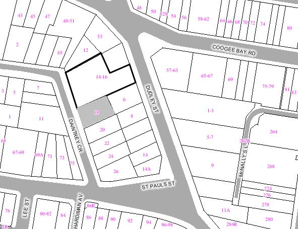
|
|
|
Subject
Site
|
|
|
|
|
|
|
|
|
|
Submissions
received
|
|
Ù
North
|
|
LOCALITY
PLAN
|
1. EXECUTIVE SUMMARY
The application has been referred to the Health, Building
and Planning Committee for determination as the original application was
determined by Council and at the request of Councillors Paul Tracey, John
Procopiadis and Alan White.
The Section 96 application is seeking development consent
to modify the Land and Environment
Court approved
multi-unit housing development comprising of two detached buildings with a
total of eighteen units with basement car parking for 32 vehicles accessed from
Dudley Street. The modifications involve the
increase of the gross floor area of the development by 118.5sqm and resulting
in a floor space ratio (FSR) of 1.20:1, further increasing the non-compliant
FSR of 1.12:1. The proposed increase in floor area will be distributed across
the site at separate levels and will not be concentrated within certain areas
of the site. The surrounding properties were notified of the proposal for a two
week period and several objections were received during this period. The main
issues raised included general concerns regarding loss of visual privacy,
increased overshadowing as a result of additional floor area and an
intensification of the use of the site and its potential adverse and
significant impact to on-street parking and accessibility for neighbouring
residents to their sites. The application was referred to the State
Environmental Planning Policy no.65 - Design Quality of Residential Flat
Development (SEPP 65) Design Review Panel held on 4 June 2007. The panel’s comments were generally supportive of the
proposal however did raise some concerns that the development may adversely
impact upon visual privacy of dwellings within the site, increase the bulkiness
of the buildings when viewed from adjoining site, reduce solar access to the
surrounding properties and did not appropriately explore increasing the permeable
landscaped area of the site.
Amended plans were received on 3 August 2007 and made several modifications to the originally
submitted plans, mostly addressing the comments provided by the SEPP 65 Design
Review Panel (DRP) and generally reducing the potential for the modifications
to increase overshadowing, improve visual privacy of units and reducing
potential overlooking into adjoining properties. The modifications are
considered to satisfy the main issues raised by the DRP members however the
amended plans did not increase the amount of permeable landscaped area provided
by the development. As the modifications in the amended plans generally reduced
the potential impact of the development and were relatively minor in scale, it
was not deemed necessary to renotify the amended plans to the surrounding
properties.
It is acknowledged that the proposed modifications will
increase the gross floor area of the site; however it is deemed that the
modifications will improve the internal amenity of the dwellings on the site
whilst not significantly increasing the bulk and scale of the approved
development and will not increase the overall height or increasing the
generation of on-site car parking spaces. The objections received regarding
intensification of the use of the site are not supported as the additional
floor area is distributed throughout the site and is not concentrated in one
particular area and the proposal does not result in increased number of
dwellings, as such, there will be no increase in parking demand on Dudley Street or Daintrey Crescent.
The recommendation is for approval subject to conditions.
2. THE PROPOSAL
The proposal is seeking development consent to modify the
Land and Environment
Court approved
multi-unit housing development comprising of two detached multi-unit housing
buildings with a total of eighteen units with and basement car parking for 32
vehicles accessed from Dudley
Street by
increasing the gross floor area of the site from 2119.6sqm to 2238.1sqm or
118.5sqm. The proposal involves in detail the following works:
Level 1 (vehicular entry from Dudley Street and lower level basement car
parking)
- No
modifications to this level.
Level 2 and 3
Apartments 3.1 and 3.2.
- Increase floor
area to living room and kitchen of apartment 3.1 (southern apartment) and 3.2 (northern apartment) by extending
external walls to the south and north respectively.
- Increase size
of ensuite and bedroom 1 of apartments
3.1 and 3.2 by
extending external walls to the west.
- Translucent
glass fitted to the ensuite window of apartment 3.1.
Level 4 and 5
Apartments 4.1 and 4.2.
- Increase floor
area to living room and kitchen of apartment 4.1 (southern apartment) and 4.2 (northern apartment) by extending
external walls to the south and north respectively.
- Increase size
of ensuite and bedroom 1 of apartments
3.1 and 3.2 by
extending external walls to the west.
- Translucent
glass fitted to the west facing ensuite windows and south and north facing
windows of bathrooms of apartments 4.1 and 4.2 respectively.
- New timber and
steel privacy screen fitted to ensuite window of apartment 4.1 to restrict views from southern properties.
Apartments 5.1 and 5.3.
- Increase size
of bedroom 1 of apartment 5.1 by extending external wall
southwards.
- Reconfigure the
entry to unit 5.3 to provide additional floor area and additional storage and
bench space for kitchen.
Level 6 and 7
Apartment 6.1.
- Extend external
northern and southern walls of living room apartment to increase floor area of
kitchen and study rooms.
Apartments 7.1, 7.2 and 7.3.
- Extend western
external wall to bedrooms 1, 2 and 3 to increase floor area of those rooms.
- Extend southern
external wall to increase bench space for kitchen.
- Increase area
of eastern external balcony to be more comparable in area with balconies to the
northern apartments of 7.2 and 7.3.
- Extend eastern
external wall of bedroom 1 of apartment
7.2 to increase
floor area and fit external operable sun shading louvres.
- Extend eastern
external wall of bedroom 1 of apartment
7.3 to increase
floor area and fit external operable sun shading louvres.
- Extend portion
of northern external wall to apartment
7.3 to increase
kitchen bench space.
Level 8
Apartments 8.1 and 9.1.
- Bathroom and
ensuite windows to apartment 8.1 facing Daintrey Crescent fitted with translucent glazing.
- Extend western
wall to increase floor area of bedroom 1 of apartment 8.1 and bedrooms 1 and 2 of apartment 9.1.
Level 9 and 10
Apartments 9.1, 9.4 and 11.1
- Extend portion
of northern external wall to apartment
9.4 to increase
kitchen bench space.
- Extend western
wall of apartment 11.1 to increase floor area of bedroom
1 and ensuite.
- New window to
southern stair case of apartment 11.1 with steel and timber louvred
screen.
- Extend external
southern wall to increase kitchen bench space of apartment 9.1.
- Increase area
of eastern external balcony to be more comparable in area with balconies to the
northern apartments of 9.2, 9.3 and 9.4.
Level 11 and 12
Apartments 11.2 and 11.1
- New steel and
timber privacy screen to the northern section of the terrace area.
- Extend eastern
external wall of apartment 11.2 to increase floor area of living
room and bedroom floor areas.
- Extend external
western wall of apartment 11.1 to increase floor area of
bedrooms 2 and 3.
- Extend external
southern wall to increase kitchen bench space of apartment 11.1 with new window to eastern side of kitchen.
- Increase area
of eastern external balcony of apartment
11.1.
Roof Level
- Parapet
relocated to the north to reduce area of roof terrace of apartment 11.1.
- Increase of
roof area above terrace on level below.
- Extend western
external wall to continue modifications on floors below.
The table below indicates the proposed distribution of the
proposed increased floor area
|
|
GFA of approved development
(sqm).
|
Proposed GFA of s.96 application
(sqm).
|
Change in floor area.
|
|
Level 1
|
76.6
|
76.6
|
Nil.
|
|
Level 2 and 3
|
202
|
221
|
+ 19
|
|
Level 4 and 5
|
500
|
515
|
+ 15
|
|
Level 6 and 7
|
504
|
538.5
|
+ 34.5
|
|
Level 8
|
200
|
206
|
+ 6
|
|
Level 9 and 10
|
337
|
353
|
+ 16
|
|
Level 11 and 12
|
300
|
328
|
+ 28
|
|
Total
|
2119.6
|
2238.1
|
118.5
|
|
FSR
|
1.12:1
|
1.20:1
|
FSR Increase of 7 per cent.
|
3. THE SUBJECT SITE AND
SURROUNDING AREA:
The subject site is located on the western side of Dudley Street and the eastern side of Daintrey Crescent, Randwick and has frontages to both streets. The site is comprised
of three allotments and is L shaped with a 35.5m frontage to Daintrey Crescent, an 18.5m frontage to Dudley Street, a 61.6m length on the southern
boundary and a 39m length on the northern boundary with a total area of 1867
sqm. There is a considerable fall on the site from the Daintrey Crescent boundary to the Dudley Street
Boundary of approximately 9m. The site contains three substantial buildings
comprising a former three storey nursing home on the northern side of the site
and two residential dwellings on the southern side of the property with one
fronting Dudley
Street and the
other fronting Daintrey
Crescent.
The surrounding area is a mix of single dwellings and
multi unit housing varying in size from single storey to 5 storeys. Along Daintrey Crescent, the adjacent building to the
south is a four storey multi unit development and the adjacent building to the
north is a two storey residential dwelling. Along Dudley Street, the adjacent building to the
south contains a three storey dwelling including a garage at street level and
the adjacent building to the north contains a four storey multi unit housing
development including garages at street level. The subject site is located
approximately 90m north east of The Spot heritage conservation area and
approximately 90m east of the heritage item site Brigidine Convent and chapel
site known as “Aeolia”.
Figure 1 is an aerial view of the subject site and surrounding area.
Figure 2 is the subject site from Daintrey Crescent. Figure 3 is a photograph of the
subject site from Dudley
Street.
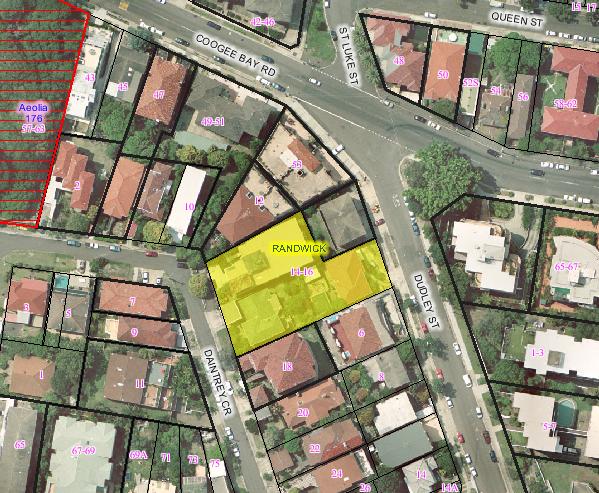
Figure 1: The subject site and
surrounding area.
4. SITE HISTORY
4.1 Application History
The original development application was lodged on 12 March 2003 and sought development consent to
construct a multi-unit housing development comprising of two detached buildings
with a total of eighteen units with basement car parking for 32 vehicles
accessed from Dudley
Street. The application
received a number of objections from the surrounding residents which raised
concerns regarding the bulk and scale of the development, solar access impacts,
view loss and other impacts such as increased traffic movement in Dudley Street, impact upon the amenity of the
area and a disruption of the character of the Dudley Street and Daintrey Crescent streetscapes.
The application contained several non-compliances with
Council’s LEP in respect to floor space ratio (FSR), landscaped area and
building height and other inconsistencies with the preferred solutions of the
Multi-unit housing Development Control Plan. State Environmental Planning
Policy No.1 (SEPP 1) objections were submitted with the application and the
variations to the LEP clauses were supported by the assessing officer.
Generally the proposal was considered to be a development that was suited to
the site and would not result in significant or adverse impacts to the
neighbouring properties or to the character of the locality.
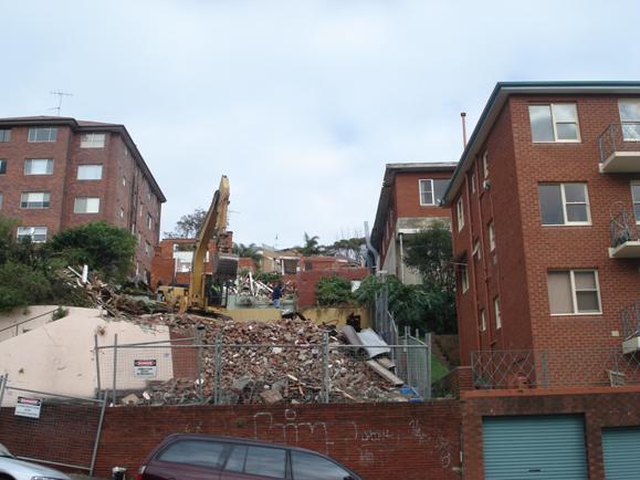
Figure 2: The subject site from
the opposite side of Daintrey Crescent.
As such, the application was recommended for approval;
however the Councillors at the Health, Building and Planing Committee meeting
of 18 November 2003 resolved to defer the application
for mediation between the applicant and the surrounding neighbours of whom
objected to the development application. The outcome of the mediation resolved
three options, with the third option being preferred by the applicants, whilst
Option 1 was favoured by Council and the opposing parties. The development
application was referred to the Extraordinary Council Meeting of 16 December 2003 where the assessing officer
presented Option 1 as the option that produced the most balanced outcome for
preserving the amenity of the neighbouring properties and provided an
appropriate financially viable development for the applicant. Council endorsed
Option 1 and resolved to approve the application, issuing a deferred
commencement consent with a sole condition that stipulated that:
“The height of
the proposed building fronting Daintrey Crescent (Daintrey Block proposed at RL 70.75 and RL 70)
shall be lowered such that the maximum RL shall be 68.75m. This may be achieved
by one or more of the following options:- excavating the development further
into the ground, Amended plans detailing compliance with this condition shall
be submitted for approval by the Director Planning and Community Development
changing the roof pitch and/or having a flat roof.”
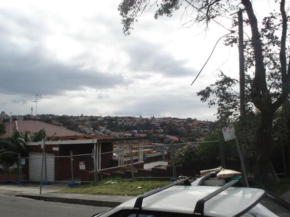
Figure 2: The subject site from
the opposite side of Dudley Street.
The applicant appealed Council’s deferred commencement
condition and on 24
August 2004, the New South Wales Land and Environment Court upheld the appeal and approved the development. The Court deleted the
deferred commencement condition from the development consent and approved the
development in accordance with the plans submitted by the applicant.
4.2 History of Site Usage
Previous applications submitted for development on the site includes:
|
Development No.
|
Description
|
Determination
|
|
BA/868/1964
|
Additions
|
Approved
in 1964
|
|
BA/604/1965
|
Additions
to private hospital
|
Approved
in 1965
|
|
BA/619/1977
|
Alterations
|
Approved
in 1977
|
|
BA/1043/1979
|
Alterations
to nursing home
|
Approved
in 1979
|
|
BA/30/1982
|
Alterations
|
Approved
in 1982
|
|
BA/811/1985
|
Alterations
and additions
|
Approved
in 1985
|
|
DA/81/1989
|
Alterations
and additions to the existing nursing home
|
Approved
on 12 December 1989
|
|
BA/1102/1990
|
Alterations
and additions to nursing home
|
Refused
on 19 November 1990
|
|
BA/1102/1990/A
|
Alterations
and additions to nursing home
|
Approved
on 13 February 1991
|
|
DA/197/2003
|
Demolition
of existing buildings on site and erection of a multi unit residential
development containing 18 units and 34 car parking spaces
|
Recommended
for approval, Council at its 18 November 2004 Health, Building and Planning Committee meeting.
|
5. COMMUNITY CONSULTATION:
The proposal has been notified and advertised in
accordance with the Development Control Plan - Public Notification of
Development Proposals and Council Plans. The following submissions were
received:
5.1 Objections
Andrew Tosti – Chairman of The
Spot Precinct Committee
|
Issue
|
Comment
|
|
The proposal to add an additional 127sqm of gross floor
area “cannot be considered a minor change” and will be “significantly over
the allowable FSR” for the site.
|
In the context of the entire development, the proposed
increase in floor area is considered relatively minor and will not
significantly increase the perceptible bulk and scale of the development. The
modifications will increase the building envelope, however generally, the
increases are mitigated through a design that successfully integrates with
the approved development.
|
|
The proposal will “severely” impact the residential
amenity and “can only exacerbate negative issues such as traffic congestion,
noise, rubbish and parking difficulties.”
|
The proposal will not increase the number of residential
units or increase the generation for on-site car parking spaces. The proposal
is not considered to result in additional impact upon the amenity of the
surrounding residential area.
|
Proprietors of Strata Plan No. 6417 – 18 Daintrey Crescent, Randwick, including:
Mr.
Dudley Williams – Unit 1/18 Daintrey Crescent, Randwick
Mrs.
R. Lissing – Unit 2/18 Daintrey Crescent, Randwick
Mrs.
Carole Guiry – Unit 3/18 Daintrey Crescent, Randwick
Ms.
Lynette Pierse – Unit 4/18 Daintrey Crescent, Randwick
Mrs.
R. Lissing for Ms. Denise Pritchard – Unit 5/18 Daintrey Crescent, Randwick
Mr.
Holger Ohnesorge – Unit 6/18 Daintrey Crescent, Randwick
Lyn
Pierse for Mr. and Mrs Brad and Charity Downing – Unit 7/18 Daintrey Crescent, Randwick
Mrs.
T. Marchandeau – Unit 8/18 Daintrey Crescent, Randwick
Body
Corporate SP 6417
|
Issue
|
Comment
|
|
The approved development is overdeveloped and the proposal
will cause a “loss of sun light, overshadowing and loss of privacy” and there
will be additional adverse overshadowing impact to units 1, 3 and 5.
|
The proposal will not significantly alter the approved
solar access diagrams submitted with the original application. The design of
the new floor area has considered overlooking and arranged windows to the
sides of the site, rather than across boundaries. As such, this objection is
not supported.
|
|
The proposal “increases the floor space from 2247.1 sqm
to 2284.5 sqm”, “altering the distance between the Daintrey building on the
southern wall and creeps closer to our building on our northern wall.”
|
The proposal will decrease the setback of portions of
the development to the southern boundary by 1m to 1.2m. The modifications to
the setback are generally considered minor and will not reduce the visual
amenity or privacy of the adjoining southern property.
|
|
The proposal to increase windows and convert obscured
glass windows to clear glass will impact upon visual privacy.
|
The plans indicate that all south facing bathroom
windows to level 2 and 4 are to be made obscure. The windows to level 8 and
10 will have fixed external screening to prevent direct overlooking, as such,
conditions requiring obscured glass will not be required.
|
|
As a result of the proposed modifications of Amendment 6
and 7, Units 1, 3, 5 on the northern side, the eastern aspect of units 1, 3,
4, 5 and 6 will all be significantly impacted by overshadowing.
|
The modifications to the southern side of the approved
development do not involve increasing the height of the residential buildings
but do reduce the setback of the building in some areas by 1m to 1.2m. As
such there will be not significant impact to solar access of the surrounding
properties.
|
|
The proposal will adversely impact upon the Daintrey Crescent streetscape.
|
The proposed modifications visible from Daintrey Crescent include the increase of the
southern portion of the Daintrey Crescrent building by 0.8m closer to the
street boundary. The changes will maintain the appearance of the building and
are not considered to adversely impact upon the bulk, mass or proportion of
the development. It is deemed that the impact of the proposed modification
on the Daintrey
Crescent
streetscape will be negligible.
|
Planet
Urban Planning and Development Consultants – On behalf of the Body Corporate of
Strata Plan 6417 – 18 Daintrey Crescent, Randwick
|
Issue
|
Comment
|
|
The proposal reduces the landscaped area from 433sqm to
401sqm (21.5%) and increases the built upon area from 1434sqm to 1463sqm
(78.4%) which is excessive.
|
The proposal reduces landscaped area from 50.6% to
48.9%, (approx 31sqm) resulting in a further non-compliance. The general
approved landscaped plan will not be significant affected by the proposal and
as such, the minor reduction in landscaped area is not likely to impact upon
the amenity of the future occupants of the site, the neighbouring properties
or the character of the streetscapes of Daintrey Crescent and Dudley Street.
|
|
The proposal will increase the approved FSR from 1.12:1
to 1.20:1, with the increase in floor area occurring above ground resulting
in “greater mass and bulk with reduced setbacks from the site’s boundaries.”
|
The proposal will not contribute significantly to the
overall bulk and scale or mass of the approved development. The proposed
increase in floor area is distributed across a number of floors and
throughout the Daintrey
Crescent and Dudley Street buildings, and is not
concentrated in a sole location on the site. As such, the increased area will
not result in a bulk and scale that is disproportionate with the approved
development or will result in a significant or adverse impact to the
adjoining properties.
|
|
The approved average setback is 4.5m and the proposal
will result in “a further non-compliance with the preferred setback
solutions” of the Multi-unit housing DCP.
|
The reduction in the southern boundary setbacks ranges
from 1m to 1.2m. The non-compliance is not considered to adversely impact
upon the amenity of the neighbouring residential properties or be
inconsistent with the performance requirements of the DCP. This issue is
discussed further below in this report.
|
|
The proposed modifications will result “in additional
impacts of visual mass and bulk, and of loss of light and reduced solar
access” and should not be supported.
|
The proposed modifications are relatively minor
additions that are distributed across the site and throughout the two
buildings. The modifications are compatible with the approved built form and
will not adversely impact upon the amenity, privacy or solar access of the
adjoining properties. The potential impact of the development is discussed in
this report below.
|
6. TECHNICAL
OFFICERS COMMENTS
This Section 96 application did not require any referrals.
7. MASTER
PLANNING REQUIREMENTS
The site has a total area of approximately 1850 sqm and is
therefore exempt from the master plan requirements of Clause 40A of the
Randwick LEP 1998.
8. ENVIRONMENTAL
ASSESSMENT
The site has been inspected and
the application has been assessed having regard to Section 79C of the
Environmental Planning and Assessment Act, 1979, as amended.
9. RELEVANT
ENVIRONMENTAL PLANNING INSTRUMENTS
The Development application has
been assessed in accordance with the provisions of the following relevant
planning documents:
- Environmental
Planning and Assessment Act 1979 as amended.
- State
Environment Planning Policy (Building Sustainability Index: BASIX) 2004.
- State
Environmental Planning Policy 65 - Design Quality of Residential Flat
Development
- Randwick Local Environmental Plan 1998.
- Development
Control Plan – Multi-unit housing
- Development
Control Plan – Parking
- Development
Control Plan – Public Notification of Development Proposals and Council Plans
- Randwick City Council Section 94 Contributions Plan – (including
amendment for Kensington Town Centre).
- Building Code
of Australia (BCA).
9.1 SECTION 96 AMENDMENT
9.1.1 Substantially the same
The proposed development will involve additional floor
area to levels 1 to 12 of both approved buildings on the site. The proposal
will not alter the number of residential units on the site, the allocation of
bedrooms to each unit, reconfigure the on-site car parking, or affect the
building height of the approved development. The proposal will make relatively
minor internal alterations and some external changes as a result of additional
floor area to the residential units. The external modifications are consistent
with the form and scale of the buildings and will not detract from the
appearance of the approved development, or significantly impact upon the
streetscape of Daintrey
Crescent or Dudley Street. The proposed modifications are
therefore considered to comprise of relatively minor changes and are deemed to
result in a development that is substantially the same as the approved
development.
9.1.2 Consideration of
submissions
The Section 96 application was notified to the surrounding
properties in accordance with the DCP - Public Notification of Development
Proposals and Council Plans. Three objections were received and
consideration of these submissions is contained within Section 5.1 of this
report.
9.2 Randwick Local Environmental Plan 1998
The site is zoned 2C (Residential C Zone) under Randwick
Local Environmental Plan 1998 and the proposed activity is permissible with
Council’s consent. The following Clauses of the LEP 1998 apply to the
proposal:-
|
Clause
No.
|
Requirement
|
Provided
|
Compliance
|
|
31 - Landscaped area
|
50% of the total site area as landscaped area.
Landscaped areas over podiums or excavated basement areas must not exceed 50%
of the landscaped area requirements.
|
The proposal reduces landscaped area from 50.6% to 48.9%
and soft landscaped area from 23% (433sqm) to 21% (401sqm). The proposal does
not alter the percentage landscaped areas above podiums.
|
Does not comply – see assessment below.
|
|
32 – Floor space ratios
|
0.9:1
|
1.20:1 (The proposal increases the floor area by
118.5sqm).
|
Does not comply – see assessment below.
|
|
33 - Building heights
|
12m maximum building height, 10m maximum external wall
height.
|
The proposal does not alter the building height of the
approved development.
|
Not applicable.
|
|
46 - Development in the vicinity of heritage items,
heritage conservation areas and known or potential archaeological sites
|
Vicinity of Heritage Item
|
The subject site is located approximately 60m from the Aeolia heritage item and 90m from The
Spot heritage conservation area.
|
The subject site is considered to be sufficiently
distanced from the heritage items and conservation areas to absolve any
further consideration of this clause.
|
9.3 State Environmental
Planning Policy 65 - Design Quality of Residential Flat Development
This Policy applies to development being:
a. The erection of a new
residential flat building, and
b. The substantial redevelopment
or the substantial refurbishment of an existing residential flat building, and
c. The conversion of an existing
building to a residential flat building.
d. If particular development
comprises development to which subclause (1) applies and other development,
this Policy applies to the part of the development that is development to which
subclause (1) applies and does not apply to the other part.
The guide stipulates that the SEPP
is to be applied in accordance with the following box:
|
Definition of residential flat building and application
of SEPP No 65
The SEPP will apply to residential flat buildings of three
or more storeys (not including levels that protrude less than 1.2m above
ground level that are devoted to car parking and storage) and four or more
self contained dwelling units. It will not apply to buildings classified
as Class 1a or 1b under the Building Code of Australia.
|
The proposed works fall under SEPP 65 and as such the
application was referred to the 4 June 2007 Design Review Panel. The comments are included below.
9.3.1 SEPP 65 Design Review
Panel Comments
The Panel has previously viewed
this application which was first submitted to Council in 2003. The current
submission is a Section 96 Application.
RECOMMENDATIONS
The majority of the amendments are
increases to the internal area of the apartments. The increase is in the order
of 140m2 of additional accommodation, equivalent to a large apartment. While
the Panel generally is not concerned by the extra floor area per se, the
additional space being sought could give rise to some negative consequences;
- It may
reduce the angle of view from neighbouring windows, from that of the current
approval
- It may
increase privacy issues between apartments, and reduce separation between
buildings
- It may
increase to a minor extent, overshadowing of neighbours relative to the
approved DA
- There are
also varying degrees of improvements to amenity with each proposed increase in
floor area. For example bedroom 1 in apartment 8.1 need not get any wider. It appears to be 6 m wide
already.
- The increase
in kitchen width noted as change number 4 in the legend does improve the
amenity though it would function adequately in its court approved form.
The proposal is pushed down into
the site rather than being terraced to assist in view retention of neighbours,
As a result, the site is deeply excavated and piled. The negative aspect of
this is the disruption to natural sub-soil water flows and a reduction in the
capacity of the site to support a successful landscaped environment with
significant trees.
While the extra internal areas
clearly improve the amenity of the apartments the Panel would like the
applicant to consider increases that can be made to soft landscape and deep
soil areas as a balance to the increased built form.
The impact of a wider balcony
(such as Apt 9.1) to the neighbour should also be
reviewed.
The glazing area on the most
eastern face of Apt 11.2 is not considered acceptable as
it has no roof overhang or sun shading.
The operation of any new windows
should also be indicated on the drawings.
The Panel need not review this
Section 96 application again if the above issues can be resolved
satisfactorily.
The applicant was requested to provide a statement that
addressed the concerns of the DRP comments. A response from the applicant was
received by Council on 3
August 2007 and
raised the following arguments in respect to the comments above:
|
DRP Comment
|
Applicant’s response
|
|
It
may reduce the angle of view from neighbouring windows, from that of the
current approval
|
Southern
external walls reduced or “pulled back” for bedroom 1 to apartment 5.1 and kitchens of apartments 7.1, 9.1 and 11.1.
|
|
It
may increase privacy issues between apartments, and reduce separation between
buildings.
|
The
additional openings to the non-habitable ensuites in apartments 3.1, 4.1 and 4.2 are provided with
obscured glazing and can only be opened partially to minimise potential
overlooking.
|
|
It may increase to a minor extent, overshadowing of
neighbours relative to the approved DA
|
The applicant claims that “there is only a very minor
change to overshadowing which generally does not affect the glazing of the
property at 18
Daintrey Crescent
and the change is negligible in comparison with the approved scheme.” The
applicant further claims that “we have reviewed the neighbours’ concerns
regarding loss of light on the eastern outlook of their building. We believe
that our proposed section 96 modifications do not represent any change to the
approved proposal in this respect.”
|
|
There are also varying degrees of improvements to
amenity with each proposed increase in floor area. For example bedroom 1 in apartment 8.1 need not get any wider. It
appears to be 6m wide already.
|
The applicant states that the increase in bedroom 1 of apartment 8.1 is dictated by the need to make
the bedroom accessible for wheelchairs (apart. 8.1 is designated as the
adaptable apartment) and continues the changes to bedroom 3 on the floor
below.
|
|
The increase in kitchen width noted as change number 4
in the legend does improve the amenity though it would function adequately in
its Court approved form.
|
This issue was not addressed by the applicant in the
information received on 3 August 2007.
|
|
The proposal is pushed down into the site rather than
being terraced to assist in view retention of neighbours, As a result, the
site is deeply excavated and piled. The negative aspect of this is the
disruption to natural sub-soil water flows and a reduction in the capacity of
the site to support a successful landscaped environment with significant
trees.
|
The proposal increases the built upon area of the site
and results in a decrease of landscaped area of the site by approximately
33sqm. The applicant states that the “alignment of the external walls... are
spread around the edges of the building rather than being at just one
location so the small overall reduction in landscaped area will not be
noticeable and is negligible.
|
|
While the extra internal areas clearly improve the
amenity of the apartments the Panel would like the applicant to consider
increases that can be made to soft landscape and deep soil areas as a balance
to the increased built form.
|
See comment above.
|
|
The impact of a wider balcony (such as Apt 9.1) to the neighbour should also
be reviewed.
|
The applicant has responded to the general concerns
regarding overshadowing to the southern adjoining property by stating “there
is only a very minor change to overshadowing” and that “overshadowing of unit
1 at 18 Daintrey
Crescent will not
be significantly altered.”
|
|
The
glazing area on the most eastern face of Apt 11.2 is not considered acceptable as
it has no roof overhang or sun shading.
|
“The
eastern face of Apartment 11.2 has now a roof overhand of approximately
one (1) metre... Additional sun shading has been achieved by the inclusion of
external operable vental [sic] type louvre system.”
|
|
The
operation of any new windows should also be indicated on the drawings.
|
This
issue was not addressed by the applicant in the information received on 3 August 2007.
|
The response from the applicant in regards to the DRP
comments is considered to address the main concerns of visual bulk and scale,
inter-apartment privacy and solar access to the property adjoining the site to
the south. The rationale provided by the applicant in respect to the DRP are
deemed to be well founded and it is noted that the proposal has reduced the
degree to which some elements, such as balconies and extensions of external
walls, impact upon the adjoining properties. The issues that have not been
addressed above, in relation to the additional floor area to the kitchen and
operation of windows being marked on the plans, are not considered to be issues
that require further amendments to the plans. The additional floor area to the
kitchens results in a decrease in the setback of the building to the southern
boundary however the visual impact is considered negligible when considering
the external alteration of the building will be contained within the bulk of
the building and will not be immediately perceptible from the adjoining
property to the south. In respect to the second unaddressed matter, no issue is
raised by the assessing officer regarding the depiction of windows on the
submitted plans.
9.4 Policy Controls
9.4.1 Development Control Plan –
Multi-unit housing
The DCP for Multi-Unit Housing states that a proposal is deemed to
satisfy the Objectives and Performance requirements of the DCP if it complies
with the corresponding Preferred Solutions. Therefore, the tables below assess
the proposal against the Preferred Solutions, and where non-compliance results,
assessment is made against the relevant Objectives and Performance
Requirements.
|
Performance Requirement
|
Preferred Solution
|
Compliance
(Whether proposal meets
Performance Requirements or Preferred Solutions.)
|
|
Height
|
|
P1 Heights of walls,
their location and orientation do not cause substantial adverse impacts on
streetscape or adjoining properties.
|
|
The proposal will not
alter the approved height of the development. Not applicable.
|
|
P2
Variations in massing and height create visual interest, distribute the bulk
of the building and minimise amenity impacts on the streetscape and adjoining
properties.
|
|
The
proposed development will increase the floor area of the residential
dwellings and extend beyond the external walls of the approved building
however the additional bulk is distributed over the two buildings and not
concentrated in particular areas. The additional building bulk is minimal and
contained within the mass and proportion of the approved development,
therefore the modifications will not adversely impact adjoining properties.
|
|
Landscaping and Private Open Space
|
|
P1
Landscaped Areas
Areas
are sufficient size allow recreational activities and substantial vegetation.
|
S1
Minimum for landscaped area 2 metres.
|
The
proposed modifications decreases landscaped area for the site by
approximately 31m2, however the loss is distributed across the
entire site and involves losses that affect the periphery of the landscaped
and private open spaces.
As
such, the use of these areas for recreational activities remains viable and
the proposed modifications do not affect deep soil planting or potential for
substantial vegetation to be grown on the site.
|
|
|
|
The
reduction in landscaped area is deemed acceptable and will not adversely
affect the amenity of adjoining properties.
|
|
P2
Areas around multi-unit buildings are communal open space and not divided up
for allocation to individual units.
|
|
The
configuration of and the access to areas around the building, either private
or communal have not been altered.
|
|
P3
Private Open Space
Provides
privacy for its users, is readily accessible, and provides opportunities for
outdoor recreation / living.
|
|
The
proposed modifications do not alter the useability or access for future
occupants to enjoy the private open spaces of the site. The modifications
will continue to allow for an acceptable degree of open space for private use
and passive recreation.
|
|
P4
Is located in front of the building only where setback and fence design
sympathetic.
|
|
The
proposal does not affect the landscaped areas to the street frontages of Dudley Street or Daintrey Crescent.
|
|
P6
Flats and apartments
Each
dwelling has direct access to an area of private open space.
|
S6
Minimum of 8 m2 and minimum dimension of 2 metres.
|
Each
unit will be provided with a minimum 8sqm. It should be noted that the plans
have been amended in accordance with condition no.5 of the development
consent requiring the balcony to apartment 8.1 to
be enlarged to be a minimum of 8sqm.
|
|
Building Setbacks
|
|
P1
Front boundary setbacks
The
front setback consistent with streetscape /adjoining dwelling.
|
|
The
modifications to the Daintrey
Crescent building will reduce the
setback of the building to the front boundary by 0.8m, or from 2.9m to 2.5m.
This reduction in the front setback is not considered to result in an adverse
impact to the character of the area or established streetscape. The site at
the Daintrey Crescent frontage slopes down from the roadway and as
such, the building will not have a dominant presence in the street.
|
|
P2
Side boundary setbacks
Side
setbacks to ensure:
·
Solar access maintained and
overshadowing minimised.
·
Privacy between adjoining
dwellings and open spaces.
·
Landscaping and private open
space provided.
·
Streetscape amenity is
maintained.
|
S2
Zone 2C
Minimum
average setback 5 metres.
No
part closer than 3.5 metres.
Maximum
length of wall without articulation is 10 metres.
Minimum
length of any step is 3 metres.
|
The
setback to the southern boundary will be reduced in some areas to 3m, which
is less than the preferred solution, however it is noted that the original
setback of the approved development was non-compliant, however deemed
acceptable as the design had a good degree of articulation and use of
materials that mitigated the adverse impacts of building bulk and mass. Does
not comply – see assessment below.
|
|
P3 Rear Boundary
Setbacks
Ensure that:
·
solar access and
overshadowing are minimised.
·
Privacy between neighbouring
dwellings and their open spaces provided.
·
Landscaping, communal
recreation facilities and outdoor clothes drying spaces provided.
·
Building built across site.
|
S3 Zone 2C
Minimum average setback
8 metres.
No part closer than 6
metres.
Maximum length of wall
without articulation 10 metres.
|
The subject site has a
dual frontage to the western and eastern boundaries, and as such, does not
have a rear boundary. Not applicable.
|
|
P4 General
Eaves, window hoods and
other sun-shading or weather protection pose no significant adverse impact on
adjoining properties.
|
S4 No device may
encroach more than 25% of the Preferred Solution.
|
Not applicable.
|
|
Density
|
|
P1
Building bulk compatible with surrounding built forms and minimises impact on
nearby buildings, open spaces and the streetscape.
|
|
The
proposed modifications will be compatible with the bulk and scale of the
approved development and minimises the impact on nearby buildings by
distributing the additional floor area throughout the two buildings on the
site. The modifications do not alter the height of the approved development.
|
|
Privacy
|
|
P1
Visual Privacy
Windows
and balconies of main living areas are located to avoid overlooking windows
in adjoining dwellings and private open space.
|
S1
Offset, angle or screen windows with less than 10m separation. Sill level of
1.6 metres above floor level.
|
The
new windows that overlook into adjoining properties will be primarily to
bathrooms or ensuites and as such a condition has been included requiring these
windows to be made obscure or fitted with frosted glass. There will be new
windows to the western studies, bedrooms and ensuites that will overlook Danitrey Crescent, however it is deemed that these windows will not impact the
privacy of adjoining properties.
|
|
P2
Private open space design and location ensure privacy.
|
|
The
modifications will not affect the design and location of private open space.
|
|
P3
Acoustic Privacy
Building
layout and design minimises noise transmission. of noise. Quiet areas separate
noise-generating activities.
|
|
Not
applicable.
|
|
P4
Building construction transmission of noise.
|
S4
Wall / floor insulation & sound consistent with
Building
Code of Aust.
|
Not
applicable.
|
|
View Sharing
|
|
P1
Design and location of buildings considers surroundings for assessing impact
on views.
|
|
The
proposed development will increase gross floor area however the additional
floor area maintains the scale and proportion of the approved development.
The modifications to not affect the height of the buildings and are not
considered to interrupt significant view corridors.
|
|
P2
Development minimises effects on views and shows how view loss is minimised.
|
|
The
modifications are generally contained within the building envelope of the
approved development and will not impact upon direct view corridors.
|
|
P3
Buildings are aligned to maximise view corridors between buildings.
|
|
The
proposed modifications do not alter the alignment of buildings on the site.
Not applicable.
|
|
Solar Access and Energy Efficiency
|
|
P1
Solar Access to Neighbouring Properties
Design,
orientation, siting and landscaping minimises loss of solar access.
|
|
The
amended plans received on 3 August
2007 make reductions to the scale
of the additions and also reduces the balcony to apartment
6.1 from 49sqm to 30sqm. Generally
the modifications will not adversely impact solar access beyond that of the
approved development.
|
|
P1.1
Solar access to existing solar collectors maintained between 9am and 3pm.
|
|
Complies.
|
|
P1.2
Living areas of neighbours’ dwellings receive 3 hours of sunlight over part
of their surface throughout the year. If less currently available, the amount
is not reduced.
|
|
The
proposal will maintain solar access to the north facing windows of no.18 Daintrey Crescent and does not reduce solar access beyond the approved development.
|
|
P1.3
Neighbour’s principal private outdoor open space receives 3 hours of sunlight
over at least 50% of its area throughout the year. If less currently
available, the amount is not reduced.
|
|
The
accompanying shadow diagrams submitted with the application indicate that the
proposal does not reduce solar access to the neighbour’s principal outdoor
open space.
|
|
P4 Building Layout,
Design and Construction
Protect from prevailing
strong winds and adverse weather.
·
Living areas are orientated
to the north.
·
Larger windows are located on
the north.
|
S4
75% of dwellings achieve 3.5star Nat HERS rating or equivalent.
No
dwelling achieves less than 3 stars. The NatHERS rating for each dwelling (on
a typical unit basis) is provided with the application.
|
The
amended proposal incorporates sun shading devices to certain windows to
reduce the head load and maintain the internal amenity for future occupants.
|
|
P5 Buildings have roofs
with pitch suitable for solar collectors.
|
S5
Adequate area of roof between 45 degrees east and 45 degrees west or north,
and a slope between 15 and 55 degrees to the horizontal for installation of
solar collectors.
|
The
proposed modifications do not affect the roof form of the approved
development. Not applicable.
|
9.4.2 Development Control Plan –
Parking
The proposed development will increase the floor area of
the development by 118.5sqm however will not increase the number of bedrooms to
each unit or increase the total number of residential units provided on the
site. Therefore the proposed modifications will not generate additional on-site
car parking demand.
9.5 Floor
space ratio and increases in GFA
The proposed modifications will not significantly increase
the overall bulk and scale of the development, nor will the modifications
increase the height of the buildings that front to Dudley Street and Daintrey Crescent. Whilst the proposal increases
the gross floor area (GFA) of the site however it is pertinent to note that the
additional floor area is distributed across a number of levels throughout the
site, to both buildings, and is not concentrated in one particular location on
the site. As such, the modifications are considered to result substantially the
same development and will not, it is considered, result in a development that
is perceptibly bulkier, larger in scale or inconsistent with the scale of the
approved development and the relationship of the development with other
multi-unit housing buildings in the vicinity.
The proposal increases the non-compliant FSR for the site
from 1.12:1 to 1.20:1, an increase of approximately 7 per cent and 118.5sqm.
The non-compliance of the approved development was considered in the original
assessment report where it was stated by the assessing officer at the time,
that the development included 373sqm of floor area located below current ground
level and that the above ground portion of the development had an FSR of 0.92:1
and therefore exceeded the LEP controls by approximately 37sqm. The SEPP 1
objection submitted by the applicant was supported by the assessing officer and
it was stated that “manipulation of the building to effect strict compliance
with the FSR standard would not necessarily result in a building that would
appear any less bulky from either streetscape.” The assessing officer concluded
that strict compliance with the LEP requirements in respect to FSR “would
result in a small loss to the floor space within the proposed units, resulting
in diminished amenity to the proposed units without any greater benefit to
adjacent residents.” As such, the SEPP 1 was supported and it was deemed that
the development was a compatible development in the context of the surrounding
area and the character of the Dudley Street
and Daintrey Crescent.
The proposal involves increasing the floor area of the
development that is located above ground level and therefore a similar
assessment is undertaken in respect to what portion of the proposal will be
visible from the surrounding properties. The proposal modifications will
increase the total above ground portion of the development by 112.02 sqm and is
a 6 per cent increase in GFA of the site resulting in an above ground FSR of
0.98:1, exceeding the maximum FSR as stipulated in the LEP for the site by 8
per cent.
A more useful analysis of the increase in floor area is
possible when an assessment of the additional floor area is undertaken,
particularly when it is observed that the increases in the floor area are a
result of relatively minor reconfigurations to the external envelope of the
building without resulting in additional bulk that would be perceptible from
surrounding properties. The property most likely to be affected by any increase
in bulk, scale or height is the adjoining property to the south, no.18 Daintrey Crescent. A number of objections were
received during the notification period that raised specific concerns regarding
further loss of solar access, impacts to visual amenity and the reduction in
the side setbacks. An assessment of these potential impacts is contained below.
9.6 Bulk,
Scale and Streetscape
The proposed increase in GFA is a result of increasing the
floor area of certain apartments located throughout the site. The proposal does
not concentrate the additional floor area within one specific apartment, but
rather, distributes the increases by expanding the external envelope of the
approved development outwards, generally ranging from 0.5m to a maximum of
1.2m. As such it is considered that the general appearance of the buildings
will remain consistent with the approved development and will not result in any
significant departures in terms of the bulk and scale. The proposal will not
increase the height of the development however will result in reduced side
setbacks in segments of the southern boundary. It should be noted that approved
development incorporates a highly articulated design with a visually
interesting form that will contribute to the Dudley Street and Daintrey Crescent streetscapes. The proposed modifications will not significantly alter
or detrimentally affect the degree of articulation; rather, the proposal will
generally maintain the articulation present in the approved development and
will not significantly increase the perception of bulkiness or mass to the
adjoining property to the south. The reduction in the side boundary setback has
been raised in the objections received as potentially resulting in an adverse
impact to visual amenity, solar access and privacy impacts. While it is
acknowledged that the proposal will reduce the setback in certain portions of
the site, the reconfiguration of the external envelope of the building will not
reduce the minimum setback of the approved development for both buildings. The
modifications to the Daintrey
Crescent building
will not alter the angle of the southern wall which slopes away from the
southern boundary and as such the visual impact of the modification will be
mitigated. As such, the proposal will decrease the setbacks to the southern and
Daintrey Crescent boundaries by 0.5m to 1.2m, however such decreases are
negligible in the context of the development on the site, will not result in a
adverse impact to solar access (as discussed below in section 9.6.4) and will
not perceptively increase the bulkiness or scale of the development when viewed
from Dudley Street or Daintrey Crescent or more importantly the residential
dwellings of no.18 Daintrey Crescent.
As such the proposed increase in floor area is supported.
9.7 Visual
and Acoustic Privacy
The modifications proposed will alter the external
appearance of both approved buildings and will include additional floor area to
some east facing balconies and new windows to the northern, western, southern
and eastern elevations of the approved development. The proposal includes new
windows to selected bedrooms including bathroom windows at levels 3 and 4 and a
window to the stair case on level 11. The bathroom windows will be made obscure
while the window to the stair case will include external louvres to restrict
views. Other windows will be treated with external louvres while the windows to
bedrooms will either face west or east and will provide oblique views
southwards, and are not considered to significantly result in any adverse
impact to visual privacy to the adjoining dwellings to the south at no.18 Daintrey Crescent.
The additional floor area to the balconies at levels 7 and
9 (the east facing balconies to the Daintrey Crescent building) will generally
maintain the outlook to the east and it is considered that increased floor area
of the balconies will not perceptibly increase the degree of overlooking or
reduce the visual privacy of the adjoining properties or other dwellings
located within the subject site.
Therefore the proposed new windows and increased area to
balconies is considered acceptable.
9.8 Solar Access
The assessment undertaken for the approved development
indicated that the development would have some solar access impact to the
adjoining property to the south. The assessing officer concluded that “the
impact of overshadowing from the proposed development to the adjacent southern
properties at 9am and midday is similar to that for the existing buildings” and
that the “proposed development complies with Council’s performance requirements
of maintaining 3 hours of sunlight to adjacent dwellings and open spaces
throughout the year.” The overshadowing diagrams submitted with the development
application indicated that the proposal will affect two windows of no.18 Daintrey Crescent at 12pm on the winter solstice. The degree of the impact however
is such that the window will continue to maintain sunlight and will not result
in a complete loss of sunlight. The additional solar access impact of the
development at 9am and 3pm will negligible as the shadows cast will either be to
portions of open space or to portions of wall not containing windows. As such
the proposed modifications are considered to maintain the solar access of the
approved development.
10. RELATIONSHIP TO CITY PLAN
The relationship with the City Plan is as follows:
Outcome 4: Excellence in urban design and development
The proposal maintains the built form and character of the
approved development and as an appropriate level of articulation that addresses
the significance of the location in the surrounding area. The proposed
modifications are sympathetic to the surrounding properties and minimises the
adverse impacts of bulk by distributing the additional floor area throughout
the two buildings and on separate levels.
Direction 4a & associated key action: Improved design and
sustainability across all development
The proposed modifications will not adversely impact upon
the design and presentation of the development to the street and will not
adversely impact the sustainability of the residential units. The modifications
will promote a more amenable internal amenity for future occupants of the site.
11. CONCLUSION
The proposed modifications to the approved development
will generally improve the internal spaces of the residential units and promote
a more amenable internal amenity for future occupants of the site. Whilst the
building further exceeds the floor space ratio of the approved development,
most of this is on excavated ground and the proposal maintains compliance with
the height controls. The proposed modifications will have a consistent height
and bulk with surrounding development and will not be out of scale or context
with adjacent development or the streetscape. The proposal results in minor
additional overshadowing in the afternoon during the winter solstice to the
adjacent southern buildings however the impact is minor and maintains
consistency with the solar access provisions of the Multi-unit housing DCP. The
bulk, scale and articulation of the approved development will be generally
maintained and the reduction of setbacks to the southern boundary does not
adversely impact the amenity of the adjoining properties. The overall impact to
the amenity of adjacent residents will be minor and the proposed development is
therefore supported subject to conditions.
RECOMMENDATION:
A. THAT
Council as the responsible authority grant its consent under Section 96 of the
Environmental Planning and Assessment Act 1979 (as amended) to Modify
Development Consent No.197/2003/A on the property at 14 – 16 Daintrey Crescent,
Randwick in the following manner:
Amend Condition No. 1 to read:
The development must be implemented substantially in
accordance with the plans numbered DA-01 issue A, DA-03 issue A, DA-05 issue A,
DA-06 issue A, and DA-08 issue A to DA 11 issue A, dated 23.04.2002 and
received by Council on 12 March 2003, DA-00 issue B, dated 02.09.2003 and
received by Council on 10 September 2003, DA-02 issue B dated 02.09.2003 and
received by Council on 10 September 2003, DA-04 issue C dated 09.09.2003 and
received by Council on 10 September 2003, and DA-07 issue B dated 02.09.2003
and received by Council on 10 September 2003, LA01 issue B received by Council
12 March 2003, the application form and on any supporting information received
with the application, as amended by the Section 96 plans numbered A00,
A01, A02, A03, A04, A05, A06 and A07, dated 1 August 2007, drawn by Allen Jack
+ Cottier and received by Council on 3 August 2007, only in so
far as they relate to the modifications highlighted on the Section 96 plans and
detailed in the Section 96 application.
ATTACHMENT/S:
Nil
Development Application Report
|
REPORT
BY: DIRECTOR,
CITY PLANNING
|
|
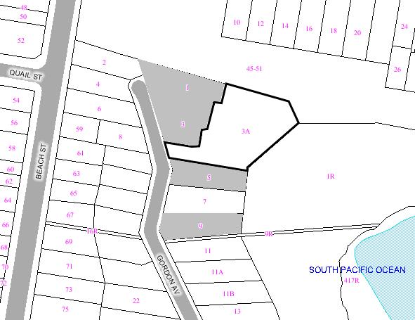
|
|
|
Subject
Site
|
|
|
|
|
|
|
|
|
|
Submissions
received
|
|
Ù
North
|
|
LOCALITY
PLAN
|
1. EXECUTIVE SUMMARY
The proposed development involves demolition
of the existing dwelling house and construction of a new 3 level dwelling house
plus a double garage at street level and a new swimming pool and associated
pool house comprising two levels and replacement of the existing tennis court
and associated landcaping
The site has a long development
application history which has involved approval for a new dwelling house in mid
2000 and subsequent court proceedings which were later withdrawn and another
approval of a new dwelling house in late 2000 which has since lapsed.
The site is unusual compared to
its residential neighbours given its large size and irregular shape. It is also
located in a visually prominent area adjoining the foreshore when viewed from Gordons Bay.
The main planning issue involves
the potential loss of views from adjoining properties. In that regard the
applicant was requested to erect height poles to enable a proper assessment of
the view impacts. The proposal will result in view loss from adjoining
properties however, when assessed in accordance with the view loss principles
established by the Land and Environment Court, it is considered the view sharing is reasonable and would not
warrant refusal of the application.
The amount of floor space proposed
is reasonable given it is well below Council’s preferred solution for floor
space. The critical issue is the distribution of floor space across the site
and how that affects adjoining properties and the scenic quality of Gordons Bay and the foreshore.
To that end this assessment
identified a number of areas of concern with the original proposal and some of
those issues have been addressed by the applicant and/or by way of conditions
of consent.
The appearance of the site will
change when viewed in the context of Gordons Bay. The proposal will sit below the
balcony at the first floor of No. 3 and steps down the site to the existing
stone wall bordering the tennis court. The proposal will read as three
residential levels similar to other development and in keeping with the visual
qualities of the Foreshore Scenic Protection Area.
Subject to the imposition of
appropriate conditions the proposal is considered suitable for approval subject
to the imposition of conditions.
2. THE PROPOSAL
Approval is sought for demolition
of the existing dwelling house and construction of a new 3 level dwelling house
plus a double garage at street level and a new swimming pool and associated
pool house comprising two levels and replacement of the existing tennis court
and associated landcaping.
The proposal will comprise 3 distinct building elements:
1. The main dwelling
house will comprise of 3 levels:
- 3 x bedrooms,
study, ensuite, lobby and bathroom (first floor)
- Family, dining,
kitchen, living, laundry and lobby (ground floor)
- Cellar,
bathroom, guest bedroom and gym (lower ground floor)
2. The pool
house (and adjoining swimming pool) will be located on the northern side of the
dwelling house. It will comprise 2 levels as follows:
- 2 x bedroom and
adjoining ensuites (first floor)
- Pool house and
open porch (ground floor)
3. A double
garage at street level which will be accessed via a driveway off Gordon Avenue. The main entry will be provided
adjacent to the garage. A lift will allow access to each level of the main
house.
3. THE SUBJECT SITE AND
SURROUNDING AREA:
The subject site is legally described as Lot 12 DP584076.
The battleaxe allotment has a 9.25m frontage to Gordon Avenue and site area of 2,30m2
The site sloped down steepy from west to east representing
a change in level of about 13m.
A Right of
Carriageway (ROW) 6.055m wide) burdens the subject property in favour of the
adjoining property at No.
3 Gordon Avenue.
A The subject site
contains a 1 and 2 storey dwelling house at the northen end of the site and a
detached two storey brick garage for two cars at the southen end of the site
and a tennis court.
The adjoining
property to the north contains the UNSW Cliffbrook campus (45 Beach Street). It is listed as a heritage item
under Randwick Local Environmental Plan 1998 (Inventory No.90).
Adjoining to the
south is a 3 level dwelling house under construction (DA 1087/2002).
Land adjoining to the
northwest contains a a freestanding building used in conjunction with the
residence at No. 1
Gordon Avenue.
The adjoining
property to the east contains a 2 storey dwelling house at No. 3 Gordon Avenue. Further east is a recreational
reserve and coastal walk and a fishing club and boats at the waters edge.
Beyond is Gordons Bay.
4. DEVELOPMENT APPLICATION
HISTORY
A DA (No. 1632/1999) for the
partial demolition of the existing building and erection of a dwelling house
and double garage was approved by Council on 23 June 2000.
The owner of No. 1 Gordon Avenue subsequently instituted Class 4
proceedings with the Land and Environment Court under Section 123 of the Environmental Planning and Assessment Act against
Council’s decision. The proceedings were in relation to the accuracy of the
information submitted and procedural fairness in the Council’s assessment of
potential impacts on views from No. 1 Gordon Avenue.
A new application (DA No.
872/2000) seeking approval to partially demolish the existing dwelling house
and erect part 2/part 3 storey dwelling house was lodged in September 2000 and
the legal action over the first approval was withdrawn. DA No. 872/2000 was
subsequently approved by Council on 15 December 2000.
A section 96 application was
lodged in May 2001 which sought changes to the approved building design. The
Section 96 application was approved by Council in August 2001. That consent was
not acted upon and has since lapsed.
Development application No.
1110/2006 was lodged with Council on 19 December 2006 for the erection of a new 3
storey single dwelling house, new swimming pool and garage. The application
was subsequently amended on 16 August 2007
to delete the proposed roof garden and reconfigure the entry to the lobby.
Given that the amendments lessen the amenity impacts on adjoining properties
and do not represent a significant change to the nature of the application, the
amended plans were not re-exhibited.
5. COMMUNITY CONSULTATION:
The proposal has been notified for a period of 14 days
from 13 February 2007 until 27 February 2007 in accordance with the DCP – Public Notification.
The submissions received are summarised in the table below.
5.1 Objections
|
3
Gordon Avenue
|
|
Issue
|
Comment
|
|
Legibility and accuracy of plans
|
The plans are considered satisfactory to undertake a
proper assessment of the proposal
|
|
Drawings are difficult to read
|
The multiple interconnecting levels associated with the
proposal make the plans difficult to read however clarification has been
sought where necessary.
|
|
Natural ground level shown is
not verifiable from survey plan
Cross sections do not show
relationship with neighbouring buildings
|
The Survey Plan Issue A dated 13 June 2007 shows levels across the site and natural ground level
shown on the section plans.
The outline of buildings on adjoining properties is
shown on Section Plans.
|
|
Site plan does not show
planting, pathway, stairs below roof level
|
The information on the Site Plan is adequate to enable a
proper assessment of the proposal.
|
|
Inconsistencies between what is
shown as an overhang element in relation to external stairs on north-west
elevation but no overhang shown on the north-eastern elevation or plans
|
Refer to comment above.
|
|
View loss
|
|
Views from the ground floor and
private open space will be completely lost.
|
Refer to Section 8 View Loss
|
|
Views from upper level will be
obscured to a critical degree
|
As above
|
|
The balustrading to the roof
terrace does not comply with the height controls and adds to the amount of
view loss
|
The amended proposal has deleted the roof terrace.
|
|
Roof terrace will be elevated above the level of
existing terrace and open space at No. 3 and result in adverse visual and
acoustic privacy impacts
|
As
above
|
|
Plantings on the eastern (sic)
western edge of roof terrace would further block views and have little effect
to mitigate privacy impacts
|
As above
|
|
Proposed trees along the common
boundary will further add to view loss.
Cantilevered roof extending
north from the garage adjacent to the proposed roof terrace has little
practical function and adds to extent of view loss
|
This can be dealt with by condition of consent.
The amended plans show the cantilevered roof over the
entry as reduced in size to provide greater setback to No. 3.
|
|
Foreshore Scenic Protection Area
|
|
Overall height and bulk will
result in detrimental impact to the Foreshore Scenic Protection Area
|
Refer to Section 8 Visual Impact/Foreshore Scenic
Protection Area
|
|
The dwelling sits significantly
higher at an artificial level above what would have been the natural ground
level due to a retaining wall along the FBL which will read as part of the
building and appear as 4 storeys when viewed from the foreshore.
|
The proposed dwelling house will read as 3 residential
levels above the existing stone wall to be retained. The adjoining property
to the south also contains 3 residential levels above landscaped terrace
areas.
|
|
The main building will be 20-25m
wide at the upper levels and the pool house and garage that are constructed
of similar materials will read as part of the overall development and ad to
the bulky appearance of the proposal.
|
Refer to Section 8 Visual Impact/Foreshore Scenic
Protection Area
|
|
Nos. 1 & 1A Gordon Avenue
|
|
Issue
|
Comment
|
|
Inadequacy of documentation
|
Sufficient information has been provided to enable a
proper assessment of the application.
|
|
Survey plan does not provide
info in respect of RLs.
|
The Survey Plan Issue A dated 13 June 2007 shows levels across the site
|
|
No overlay of the existing
house.
|
The footprint of the existing house is shown on the
architectural plans
|
|
No long cross section.
|
Long cross sections have been provided
|
|
Site analysis plan does not show adjoining private open
space
|
The
Site Analysis Plan is sufficient to enable a proper assessment of the
application.
|
|
Landscape plan does not provide spread and height of
trees.
|
Suitable
conditions are included in the recommendation requiring any new trees to be
of a height and species that will not adversely impact on views.
|
|
Two coastal banksia trees block the view
|
|
The absence of height poles do
not enable a proper assessment of the view impacts
|
The applicant erected height poles registered by a
Surveyor
|
|
View loss from planters on roof
terrace of main house
|
The amended plans delete the roof terrace
|
|
Roof terrace will result in
acoustic and visual impacts
|
A above
|
|
Light spill from roof terrace
and garden on main dwelling house
|
As above
|
|
Proposal is inconsistent with
objectives of the 2(a) zone because it is significantly higher, more bulky
and forward of prevailing building alignments
|
Refer to Section 7 Randwick Local Environmental Plan 1998.
|
|
5 Gordon Avenue
|
|
Issue
|
Comment
|
|
Height, setback, scale and bulk
of the proposed building along the common boundary will result in negative
impacts.
|
Refer to the discussion in Section 7 of this report.
|
|
South facing exterior wall which
encloses the first floor study and bathroom and ground floor living area have
excessive bulk and scale and exceed Councils 7m height standard by 1.84m.
|
See above.
|
|
Proposal will result in 3.57m
deep excavation to enable construction of southern exterior wall and extends
within 0.9m of a side boundary.
|
See above
|
|
The side setback of southern
exterior wall at the third storey is 2.4m which does not comply with 3m
minimum.
|
See above
|
|
The southern exterior wall of
the existing garage at 3A Gordon Avenue abuts the side boundary and is non-compliant with the DCPs standard
required to be 0.9m.
|
The nil setback of the garage wall is appropriate given
the existing garage also has a nil setback.
|
|
The concentration of bulk in close proximity to and
abutting the boundary creates significant visual amenity impacts
|
See
comments in Section 7 – Setbacks.
|
|
View from the bedroom window in the northern side of the
lower level will be obscured by the proposal
|
Refer
to Section 8 Visual Impact/Foreshore Scenic Protection Area
|
|
The non-compliances with
setbacks, height and excavation significantly impact on solar access on
northern side of lower floor deck and the lower floor bedroom window
|
Refer to Section 7 Solar Access and Energy Efficiency
|
|
The window from the proposed
study located in the south facing exterior wall will result in overlooking of
the pool and lawn terrace.
|
See comments in Section 7 – Setbacks
|
|
Appropriate separation and
screening has not been provided.
|
See comments in Section 7 – Setbacks.
|
|
Potential impact of emissions
from the chimney on the adjoining property.
|
The proposed heating system stipulated under the BASIX
Certificate is a gas fixed flued heater and must be designed in accordance
with the relevant Australian Standards.
|
|
The south east elevation in
drawing no. 0613/8 shows two windows in the southern exterior wall to the
west of the proposed chimney.
These windows do not appear on the
plans
|
The windows are shown in plan.
|
|
Proposed planting of 8 Angophora
tree along the boundary between 3a and 5 Gordon Avenue will create overshadowing and cause structural damage
to walls and landscape features
|
The amended landscape plan has reduced the number of
Angophora trees to a single tree.
|
|
Plans and elevations that
accompany DA 1110/2006 underestimate building heights
|
The proposed building heights are accurately drawn.
|
|
The street elevation on drawing
number 0613/8 fails to detail the garage
|
The garage will not be readily visible from the street.
|
|
Ground levels shown on the south
east elevation are inaccurate. Ground levels used in the elevation reflect
those on the boundary between 3a and 5 Gordon Avenue and not those at the foot of the proposed exterior
walls
|
The ground levels appear to be correct based on the
survey plans submitted with the DA. The elevation drawing shows the ground
level at the boundary.
|
|
Elevations do not make it clear
that the southern exterior walls are 3 storeys high
|
See comments in Section 7 – Setbacks
|
|
9 Gordon Avenue
|
|
Issue
|
Comment
|
|
The property looks across into
other properties in Gordon
Avenue
|
There will be no adverse visual impact to properties to
the south fronting Gordon
Avenue
|
|
The south elevation exceeds
Councils 7m external wall height
|
See comments in Section 7 – Height.
|
|
Proposal will have an adverse visual impact when viewed
from the foreshore
|
Refer
to Section 8 Visual Impact/Foreshore Scenic Protection Area
|
6. TECHNICAL OFFICERS
COMMENTS
The application has been referred
to the relevant technical officers, including where necessary external bodies
and the following comments have been provided:-
Landscape Comments
The previous landscape report
(dated 9th May 2007) was forwarded to the applicant in the form of
an issues paper, given that a total of 16 separate points had been identified
relating to Council’s concerns for hard and soft landscape works, tree and
bushland protection and preservation, as well as site and area amenity issues
due to the prominent location of the site and the impact such a proposal could
have on the public domain.
The required amendments and
additional information has now been received as requested, and as it is deemed
to satisfactorily address the issues, conditions can now be provided, and have
been included in this report.
Drainage Comments
The applicant proposes to demolish
the existing garage and construct a new garage at its current location,
adjacent to the southern site boundary.
There is a Council controlled
stormwater pipeline located adjacent to the southern site boundary and
therefore under the existing and proposed garage. Council’s Drainage
Investigations Engineer, in consultation with the Development Engineer and the
applicant’s hydraulic consultant, has agreed to allow the new garage to be
constructed over the existing pipeline subject to a number of
conditions/requirements. The required conditions have been included within this
report.
Any footings of any proposed
structure adjacent to/over the pipeline and associated drainage easement must
be founded on rock, or; extend below a 30 degrees line taken from the level of
the pipe invert at the edge of the easement (angle of repose). The building
works must be inspected by the applicant's engineer to ensure that these
footings and/or piers extend below the "angle of repose" and
documentary evidence of compliance is to be submitted to Council, prior to
proceeding to the subsequent stages of construction.
Environmental Health
Council’s Environmental Health Officer considered the
potential noise impacts from the pool plant and equipment and air-conditioning
units and is satisfied there will be minimal impact to surrounding properties
subject to the imposition of conditions.
The
proposal
Council is in receipt of a development application for the
above mentioned property requesting approval for a new two storey dwelling with
a new swimming pool, basement cellar, gym, double garage, separate pool house,
retention of tennis court and new roof garden.
Key Issues
Noise
Spoke to
applicant Luigi 9281 1498 on 16/01/07, who advised:
·
that the plant and equipment for the swimming pool are going to be
located in the basement,
·
air conditioning unit will not be installed as the house is not been
cooled and is heated through a gas system,
It is
considered the proposed location of the swimming pool pump and submersible pump
located in the retention tank underneath the tennis courts are likely to have a
minimal potential to impact upon the amenity of neighbouring residences due to
the location of the units.
7. RELEVANT ENVIRONMENTAL
PLANNING INSTRUMENTS
The Development application has been assessed in
accordance with the provisions of the following relevant planning documents:
7.1 Statutory Controls
(a) State Environmental Planning
Policy No. 71 – Coastal Protection (SEPP 71)
The subject site adjoins the
foreshore at Gordons Bay and is contained within a coastal zone and therefore SEPP
71 is relevant to the proposal. The Council is required to consider the aims of
the policy and other environmental criteria when considering a development
application in the Coastal zone. The aims of the policy seek to minimise the
impact of development on the coastal zones and ensure their ongoing protection.
The matters contained in clause 8 are as follows:
(a) the
aims of this Policy set out in clause 2,
(b) existing public
access to and along the coastal foreshore for pedestrians or persons with a
disability should be retained and, where possible, public access to and along the
coastal foreshore for pedestrians or persons with a disability should be
improved,
(c) opportunities to
provide new public access to and along the coastal foreshore for pedestrians or
persons with a disability,
(d) the suitability of
development given its type, location and design and its relationship with the
surrounding area,
(e) any detrimental
impact that development may have on the amenity of the coastal foreshore,
including any significant overshadowing of the coastal foreshore and any
significant loss of views from a public place to the coastal foreshore,
(f) the scenic
qualities of the New
South Wales
coast, and means to protect and improve these qualities,
(g) measures to
conserve animals (within the meaning of the Threatened Species Conservation
Act 1995) and
plants (within the meaning of that Act), and their habitats,
(h) measures to
conserve fish (within the meaning of Part 7A of the Fisheries Management Act
1994) and marine vegetation (within the meaning of that Part), and their
habitats
(i) existing wildlife
corridors and the impact of development on these corridors,
(j) the likely impact
of coastal processes and coastal hazards on development and any likely impacts
of development on coastal processes and coastal hazards,
(k) measures to reduce
the potential for conflict between land-based and water-based coastal
activities,
(l) measures to protect
the cultural places, values, customs, beliefs and traditional knowledge of
Aboriginals,
(m) likely impacts of
development on the water quality of coastal waterbodies,
(n) the conservation
and preservation of items of heritage, archaeological or historic significance,
(o) only in cases in
which a council prepares a draft local environmental plan that applies to land
to which this Policy applies, the means to encourage compact towns and cities,
(p) only in cases in
which a development application in relation to proposed development is
determined:
(i) the cumulative
impacts of the proposed development on the environment, and
(ii) measures to ensure
that water and energy usage by the proposed development is efficient.
The proposal is considered
generally consistent with the relevant aims of the policy given it will not
affect the existing public access along the Gordons Bay foreshore or result in additional
overshadowing to the coastal foreshore or a significant loss of views from a
public place.
The amended proposal is considered
to be an appropriate design, bulk, scale and size considering the large and
irregular shape of the allotment. The existing tennis court (to be replaced)
and the existing retaining stone wall to be mostly retained on the site will
provide a buffer between the proposed dwelling house and the foreshore
boundary.
The proposal is considered
generally acceptable with respect to the matters for consideration under SEPP
71.
The requirements under the NSW
Coastal Policy are also similar to those contained in SEPP 71. The proposal is
therefore considered to be consistent with NSW Coastal Policy.
(b) State Environmental Planning
Policy No. BASIX 2004
A BASIX certificate has been
submitted with the application. The proposal satisfies the water and energy
targets required for new dwelling houses. If approved, a condition should be
imposed requiring compliance with the various commitments identified in the
BASIX assessment.
(c) Randwick Local Environmental Plan 1998
The site is zoned 2(a) Residential
'A' under Randwick Local Environmental Plan 1998 and the proposed dwelling
house is permissible with Council’s consent.
The objectives of the 2(a) zone
are as follows:
(a)
to maintain the character of established residential areas, and
(b) to
allow for a range of community facilities to be provided to serve the needs of
residents, workers and visitors, and
(c) to enable
redevelopment for low density housing forms, including dwelling houses, dual
occupancy, semi-detached housing, and the like, where such development does not
compromise the amenity of surrounding residential areas and is compatible with
the dominant character of existing development, and
(d) to allow people to carry out
a range of activities from their homes, where such activities are not likely to
adversely affect the environment of the locality, and
(e) to enable a mix of housing
types to encourage housing affordability.
The proposal is consistent with
the relevant objectives of the zone in that the proposed dwelling house will
maintain the residential character of the area. The proposed built form is
consistent with other multi-level dwelling houses on sloping sites that are
orientated to Gordons Bay. The proposal will not have any significant adverse
impact on the amenity of adjoining properties (refer to discussion below under Section
7 and 8).
The following Clauses of the LEP 1998 apply to the proposal:-
Clause 29 – Foreshore Scenic Protection Area
The subject site is contained in a
Foreshore Scenic Protection area. Council is required to consider the aesthetic
appearance of the proposed development in relation to the foreshore.
The existing house is located at
the northern end of the site and is partially obscured by landform and
vegetation. The southern end of the site contains a garage at street level.
Therefore the proposal will change the appearance of the site when viewed from Gordons Bay.
The horizontal form of the
proposed dwelling house and the pool house will contrast with the more vertical
forms of residential development to the south of the site. The large and
irregular shape of the lot affords a degree of flexibility in the design and
location of the buildings on the site. The building steps down the site and is
below the height of the first floor balcony at No.3 Gordon Avenue. In that regard the proposal combined with
appropriate landscaping is acceptable and will not have any significant adverse
impact on the visual quality of the foreshore when viewed from Gordons Bay.
Clause 46 – Development in the vicinity of heritage items,
heritage conservation areas and known or potential archaeological sites
The northern boundary of the site
adjoins Cliffbrook at No.
45 Beach Road which
is listed as a heritage item under Schedule 3 of LEP 1998. Due to distance
separation to the original Cliffbrook cottage and intervening development the
proposal is not likely to have any adverse impact on the item or its setting.
7.2 Policy Controls
(a) Dwelling Houses and
Attached Dual Occupancies Development Control Plan
Clause 2.1 & 2.2 - Good Site
Planning and Neighbourhood Character
The DCP requires an understanding
of the development context of the site in the design process. The site is
unusual compared to its residential neighbours as it is a battleaxe shape with
a narrow access handle to Gordon Avenue.
It is considerably larger than surrounding residential properties and the
proposed horizontal form that steps down the site will not have any adverse
impact on the neighbourhood character.
Clause 2.3 - A Vision for Randwick Desired Future Character
The proposed contemporary infill development does not fit
into the building categories identified in the DCP. The design features of the
proposal and its suitability for the site is discussed throughout this report.
Clause 2.4 - Site Analysis
A Site Analysis Plan was submitted with the development
application. The site plan identifies the constraints and opportunities
associated with the site. The proposal is generally consistent with the
requirements for site analysis.
Clause 3.1 – Solar Access and
Energy Efficiency
The design and siting of new
buildings is to minimise the loss of solar access to neighbouring properties.
In that regard the north facing living room windows on the adjoining properties
are to receive a minimum 3 hours solar access during the winter solstice
between 9:00am and 3:00pm.
The proposal will not overshadow
the principal living areas at the upper levels of the dwelling house to the
south at No. 5 Gordon
Avenue.
The principal private open space
on adjoining properties is also required to have a minimum 3 hours of solar
access during the winter solstice between 9:00am and 3:00pm.
The revised hourly shadow diagrams
submitted with the application show that the additional shadow cast by the
proposal will affect one window at the lower level and a small part of the
swimming pool deck at 9:00am at No. 5 Gordon Avenue.
At 10:00am the shadow starts to encroach upon the northern end of
the pool and between 11:00am and 12 noon approximately 25% of the swimming pool and its deck are
affected by the proposal.
At 1:00pm approximately 50% of the swimming pool and its adjoining
deck and the lower open terrace are affected by the proposal.
At 2:00pm the swimming pool is overshadowed due to landform and
existing buildings and the lower terraces are subject to additional shadow from
the proposal.
At 3:00pm the entire property at No. 5 is overshadowed by existing
buildings and the landform to the north and there is no additional
overshadowing as a result of the proposal.
The majority of the swimming pool
and its adjoining deck will receive a minimum of three hours sunlight in the
morning at the winter solstice. In that regard the proposal is considered
acceptable.
Clause 3.2 – Water Management
The sustainable water management
practices contained in the DCP are now covered by BASIX.
Clause 4.1 Landscaped Area and
Private Open Space
The objectives and performance
requirements of the DCP with regard to landscaping are that existing
significant trees and landscaping are retained and enhanced, dwellings are
provided with useable outdoor recreation area, storm water management and he
appearance, amenity and energy efficiency of the dwelling is improved through
integrated landscape design and the native wildlife populations are preserved
and enhanced through appropriate planting of indigenous vegetation.
A minimum of 40% of the site area
is required as landscaped area. The proposal will have a landscaped area of
1,736m2 which equates to 75% of the site and therefore complies with
Council’s requirement.
A minimum of 20% of the landscaped
area is to be permeable (soft landscaped) treatment. The proposal will have a
soft landscaped area of 874m2 which equates to 38% and therefore
complies with Council’s requirement.
A dwelling house is required to
have 25m2 of useable private open space with a minimum dimension of
3m x 4m. The proposal will provide alternative areas of private open space both
covered and uncovered. The terrace on the northern side of the family room has
an area of about 90m2. Approximately 50% of this area is covered by
the balcony and awning above. The additional open space areas are adjacent to
the living room and the balcony adjacent to the master bedroom plus a swimming
pool and tennis court. The proposal is acceptable in terms of the provision of
useable private open space.
Clause 4.2 – Floor Area
Building bulk must be compatible
with surrounding built forms and minimise impacts on neighbours, streets and
public open space.
The floor space ratio of the new
dwelling is not to exceed 0.5:1. The proposed dwelling house will have a gross
floor area of 742.33m2 which equates to an FSR of 0.32:1 and
therefore is below Council’s maximum requirement.
Clause 4.3 – Height, Form and
Materials
The objectives seek to ensure
development is not excessive in height and scale and compatible with the
existing character of the locality. The relevant performance requirements are
that the height of buildings should relate to those in the existing streetscape
and buildings be designed to enhance the existing desirable built form
character of the street by adopting where relevant characteristics of mass and
proportion, materials and finishes, roof form and pitch, faced articulation,
window and door location and proportions, verandahs, eaves and parapets.
The proposed dwelling will not
exceed Council’s 9.5m maximum height control. The roof of the dwelling house
will be below the balcony on the first floor at No. 3 Gordon Avenue when viewed from Gordons Bay. The horizontal form of the
building is different to other residential properties to the south which are
vertical in nature. The sloping roof and combination of materials and finishes
including render, stone and metal will create visual interest.
The pool house although sits in
approximately the same position as the existing dwelling house but with a
footprint about a third the size. Its height is about 2m higher than existing
dwelling house and is slightly higher than the boundary adjacent to the
existing bluestone wall but lower than the outdoor terrace and swimming pool
deck adjoining the house.
The external wall height is not to
exceed 7m. The proposal exceeds Council’s preferred wall height solutions in
the following locations:
·
Part of the
balustrade of the roof terrace along the north east elevation;
·
Part of the
southern wall to the study;
·
The eastern
facing wall to the study; and
·
The south
eastern balustrade to the roof terrace.
The maximum external wall height
departure is 900mm. The purpose of the control is to ensure development does
not exceed a height and scale that is compatible with the character of the
locality. In that regard development is required to relate to the desired built
form character and minimise impacts to adjoining properties. The height is
satisfactory and similar to its neighbours which also read as 3 residential
levels. The additional height is attributed to the steep site topography. There
will be no significant material impact to the adjoining properties in terms of
solar access, privacy or view loss due to the departures from the maximum wall
height.
Cut and fill is not to exceed 1m
to ensure the development responds to the topography of the site. The proposed
development involves excavation up to 6.5m which is a significant departure
from Council’s control. Development should maintain the visual impression of
the natural ground level when viewed from Gordons Bay. It is considered that the
development generally steps down the site and sits below the first floor level
of the existing dwelling house at No. 3 Gordon Avenue. The main excavation below natural ground level makes way
for the plant room, cellar and guest bedroom which is not visible from Gordons Bay as it will be obscured by the existing stone wall to the
tennis court. The extent of cut is therefore satisfactory.
Clause 4.4 – Setbacks
The irregular shape of the site is
unusual compared to its residential neighbours which are generally rectangular
or square and have a primary frontage to the street. The subject site has a
narrow access handle and is not readily visible from the street. The front
setback requirement is therefore not relevant to this proposal.
The side setback control requires
any part of the building at ground level to be setback 900mm and 1.5m at first
floor level, and 3m above 2 storeys and that no part of the building is closer
than 4.5m from the rear boundary.
The Performance Requirements for
side boundary setbacks under the DCP are criteria for ensuring the amenity of
adjoining properties in terms of solar access and access to natural light,
daylight and fresh air. The proposed garage with a bathroom and laundry below will
have a nil setback to the southern common boundary with No. 5.
The non-compliance is acceptable
given the existing garage is situated in the same location. The proposed garage
will be 2.5m longer and about 300mm higher, however, it will not have any additional
adverse impacts to the adjoining property at No. 5 because it does not adjoin
any windows at that elevation.
The southern wall to the living
room and study will be setback 2.4m from the boundary. If approved, a condition
should be imposed requiring suitable species along the southern boundary to
assist in screening the building when viewed from the adjoining property at No.
5.
The northwest elevation of the
pool house will be between 3m and 8m from the boundary with No. 1 and its rear
stair will be setback 2.3m. The southern end of the pool house will be 3.24m
from the boundary with No. 3. The setbacks of the pool house are considered
acceptable.
The original plans showed the
entry stairs and roof over within 900mm of the boundary to No. 3. Council
issued a letter to the applicant requesting the roof over the entry lobby be
reconfigured and the stairs modified so as to provide a greater setback and
allow for some landscaping along the boundary adjacent to the entry lobby. The
applicant submitted amended plans which show the roof over the entry lobby 1.8m
from the boundary. The entry door to the lobby was reconfigured to create a
greater setback and a 0.5m planter box provided along the boundary. This change
is considered acceptable.
Clause4.5 – Visual and Acoustic
Privacy
The objective of the DCP is to
ensure that new buildings meet the occupant and neighbours requirements for
visual and acoustic privacy. The performance requirements seek to minimise
overlooking of internal private living areas through appropriate building
layout, location and design of windows and balconies and where necessary,
separation, screening and devices and landscaping.
The site is generally lower than
adjoining properties and therefore the potential for overlooking is limited.
Notwithstanding, the roof terrace shown on the original plans was at RL27.2
with a setback between 5.5m and 12m from the common boundary with No. 3. Due to
potential privacy impacts to the ground floor and adjoining private open space
of No. 3 (RL 26.60) the Council requested the applicant delete the roof terrace
altogether. The amended proposal removes the roof terrace over the main
dwelling house.
There will be no overlooking from
the pool house upper floor bedroom window to Nos. 1 and 1A given it is at a
lower level at RL24.3 and the ground floor of No. 1A is at RL27.6.
The potential for overlooking from
the study window to No. 5 is minor given its small size.
The views from bedroom 2 are
orientated to the southeast and may result in oblique views the rear of No. 5.
However, due to distance separation (minimum 10m from the common boundary)
there will be no adverse overlooking impacts which are otherwise captivated
towards Gordons Bay.
The proposed development is not
considered to result in any adverse noise impacts to adjoining properties. If
approved, a condition should be imposed requiring all plant and equipment
associated with the swimming pool and air conditioners to be noise mitigated in
accordance with Australian Standards.
Clause 4.6 – Safety and Security
The objectives and performance
requirements of the DCP seek to ensure that a safe physical environment and
crime prevention is promoted through design, including that buildings are
designed to face the street and other public areas to provide for surveillance,
dwellings and their entrances are readily identifiable by street numbering and
design of front fences and landscaped areas allows for safe access to the
dwelling.
The site is a battleaxe shape with
a narrow access handle fronting Gordon Avenue. Therefore the front door is not visible from the street.
However, a direct and obvious pedestrian entry will be provided to the dwelling
house. A security controlled vehicular entry will be provided for the garage.
The upper levels of the dwelling
house will allow for casual surveillance of the adjoining foreshore area.
The proposal is acceptable with
regard to safety and security.
Clause 4.7 – Garages, Carports and
Driveways
The garage design/location
controls are not applicable as they apply to more conventional lots which have
a primary frontage to a street. A double garage will be provided forward of the
dwelling house however, it will not be readily visible from the street due to
its setback and intervening fence. The garage is in the same location as the
existing garage and is considered a satisfactory response to the
characteristics of the site.
Driveway and parking spaces are
not to occupy more than 35% of the width of the site. The proposed double
garage will have a width of 4.7m when viewed from the street which equates to
38% of the width of the boundary frontage. This is considered acceptable given
the unique characteristics of the site.
Driveways are to have a minimum
width of 3m and setback minimum 1m from the boundary. The proposed driveway
will be 5m in width and is setback 1m from the side boundary and therefore
complies with Council’s requirement.
Clause 4.8 – Fences
The front fence is required to be
integrated with the streetscape at a preferred maximum height of 1.2m when
solid but allowed up to a maximum of 1.8m so long as he upper two thirds is at
least 50% open. A curved 1.8m high solid fence will be provided along the
street boundary. If approved, a condition should be imposed requiring the upper
two third to be at least 50% open.
8. ENVIRONMENTAL ASSESSMENT
The site has been inspected and the application has
been assessed having regard to Section 79C of the Environmental Planning and
Assessment Act, 1979, as amended.
Visual Impact/Foreshore Protection Area
The existing view of the site from
the waterway and foreshore areas comprises a two storey detached dwelling house
at the northern end of the site and a detached 2 level garage at the southern
end of the site and a stone wall largely obscured by existing vegetation. The
view of the site from the foreshore and Gordons Bay will change compared to the
existing situation.
The site is unusual compared to
its residential neighbours in that it is a larger with an irregular shape that
has only a small frontage to the street. Therefore the built form is also
likely to be different to its neighbours as there is more flexibility in the
design process and varying site constraints. The linear configuration of the
house will be massed towards the southern end of the site and combined with the
proposed pool house will appear as more built form compared to the existing
situation.
For a new development to be
visually compatible with its context, it should contain, or at least respond
to, the essential elements that make up the character of the surrounding urban
environment. In this case the critical determinant is how the building relates
to its context and its physical impact on adjoining properties.
In that regard the proposal will
sit below the first floor balcony at No. 3 and step down the site above the
existing stone wall. It is proposed to provide a range of material and finishes
such as metal, render, stone and, timber and glass. This will add visual
interest and subject to those material and finishes being appropriate for the
character of the area the proposal will be in keeping with the visual qualities
of Gordons Bay.
Impacts to adjoining properties
View Loss
The applicant was requested to
erect height poles to ensure an accurate assessment of the view related impacts
of the proposed scheme from surrounding residential properties.
Certification as to the accuracy
of the placement of the poles was provided by Rygate & Company Pty Ltd.
In order to make an assessment of
the reasonableness of the proposal, in terms of view-loss, we refer to the
Planning Principle established by the Land and Environment Court in Tenacity Consulting Pty Ltd vs Warringah
Council.
The following paragraphs provide
an assessment of the proposal in accordance with the four (4) step process
established in these proceedings.
What is the value of the view?
The Court said:
“ The first step is the assessment of views to be affected.
Water views are valued more highly than land views. Iconic views (eg of the
Opera House, the Harbour Bridge or North
Head) are valued more highly than views without icons. Whole views are valued
more highly than partial views, eg a water view in which the interface between
land and water is visible is more valuable than one in which it is obscured.”
No. 3 Gordon Avenue currently obtains the
following views:
·
Full views of Gordons Bay when
standing at ground level in the rear yard adjacent to the bluestone wall;
·
Partial views of Gordons Bay from
inside the ground level bedrooms due to intervening vegetation and landform;
·
Full views of Gordons Bay when
standing on the terrace outside the first floor lounge and dining room;
·
Full views of Gordons Bay when
standing inside the first floor lounge and dining room close to the window;
·
Partial views of Gordons Bay when
sitting at table in lounge room and dining room due to intervening balcony;
No. 1 &
1A Gordon Avenue currently obtains the following views:
·
Partial views of Gordons Bay when standing in rear yard proximate
the bluestone wall including the southern land/water interface and both
headlands and ocean (horizon) beyond. The views of the northern and foreground
land/water interface are mostly obscured by the existing dwelling house at No.
3A and existing vegetation.
·
Partial views of Gordons Bay from the swimming
pool deck and the outdoor terrace including both headlands and the ocean
(horizon) beyond. The views of the northern and foreground foreshore are
obscured by the existing dwelling house at No. 3A, vegetation, the bluestone
wall and landform.
·
Partial views of Gordons Bay when
sitting and standing in the living areas inside the dwelling including both
headlands (depending on which side of the dwelling) and the ocean (horizon)
beyond. The views of the northern and foreground land/water interface are obscured
by the existing dwelling house at No. 3A, vegetation, the bluestone wall and
landform.
No. 5
Gordon Avenue currently obtains the following views:
·
Full views of Gordons Bay at each
level of the dwelling house.
No. 9
Gordon Avenue currently obtains the following views:
·
Full views of Gordons Bay at each
level of the existing dwelling house.
From what
part of the property are views obtained?
The Court
said:
“ The second step is to consider from what part of the
property the views are obtained. For example the protection of views across
side boundaries is more difficult than the protection of views from front and
rear boundaries. In addition, whether the view is enjoyed from a standing or
sitting position may also be relevant. Sitting views are more difficult to
protect than standing views. The expectation to retain side views and
sitting views is often unrealistic.”
The views from No. 3 Gordons Bay are as
follows:
·
Views of Gordons Bay are across the eastern rear boundary.
·
Views are
obtained in both sitting and standing positions within the living room and
dining room at first floor. Sitting views are limited due to existing
vegetation and the intervening terrace balustrade and landform.
The views from Nos. 1 & 1A Gordons Bay are as
follows:
·
Views of Gordons Bay are across the eastern rear boundary.
·
Views are
obtained in both sitting and standing positions from the outdoor terrace, pool
deck and living areas inside the dwelling. Sitting views are limited due to
existing vegetation, the intervening terrace/ bluestone wall and landform.
·
The views from
inside the dwelling are limited more so when sitting than standing.
The views from No. 5 Gordons Bay are as
follows:
·
Views of Gordons Bay are across the eastern rear boundary.
The views from No. 9 Gordons Bay are as
follows:
·
Views of Gordons Bay are across the eastern rear boundary.
What is the extent of the impact?
The Court said:
“ The third step is to assess the extent of the impact. This
should be done for the whole of the property, not just for the view that is
affected. The impact on views from living areas is more significant than from
bedrooms or service areas (though views from kitchens are highly valued because
people spend so much time in them). The impact may be assessed quantitatively,
but in many cases this can be meaningless. For example, it is unhelpful to say
that the view loss is 20% if it includes one of the sails of the Opera House. It
is usually more useful to assess the view loss qualitatively as negligible,
minor, moderate, severe or devastating.”
The table below provides an
assessment of the impact on views from No. 3 and No.5. The proposal will not
result in any adverse loss of views of Gordons Bay from surrounding properties.
Impacts on views from No. 3 Gordon Avenue
|
Location Of View
|
Existing Views
|
Proposed Views
|
Level Of Impact
|
|
Figure 1
Standing inside the bedrooms at
ground level
Image 7020
|
Gordons Bay, the southern land/water interface, the headlands,
ocean and horizon is visible
The
Gordons Bay northern land/water interface and foreshore in the foreground is
obscured by existing vegetation and landform
|
Gordons Bay and the headlands are obscured but horizon is visible.
|
Severe.
|

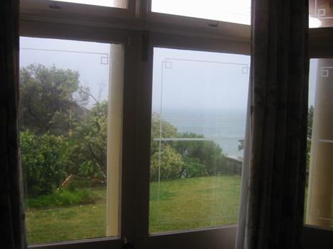
Figure 1: View standing inside the bedrooms at ground level
|
Location Of View
|
Existing Views
|
Proposed Views
|
Level Of Impact
|
|
Figures 2, 3 & 4
Standing on terrace at first
floor
Image Nos. 7046,
7047 & 7049
|
Gordons Bay including southern and northern land/water interface
and foreground foreshore and headlands and horizon is unobscured
|
About
1/3 third of the foreground of Gordons Bay and part of southern land
/water interface is obscured, and northern land/water interface and the
headlands and horizon remains unobscured.
|
Moderate
|


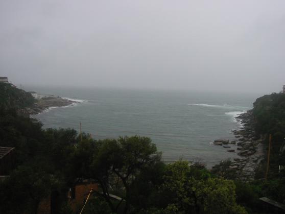
Figure 2: View standing on terrace at first floor


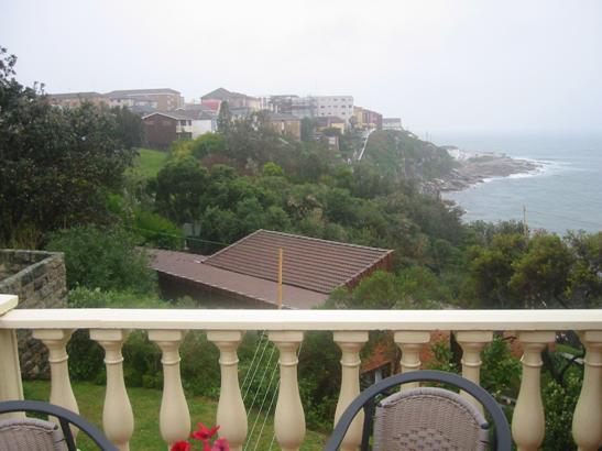
Figure 3: View standing on terrace at first floor


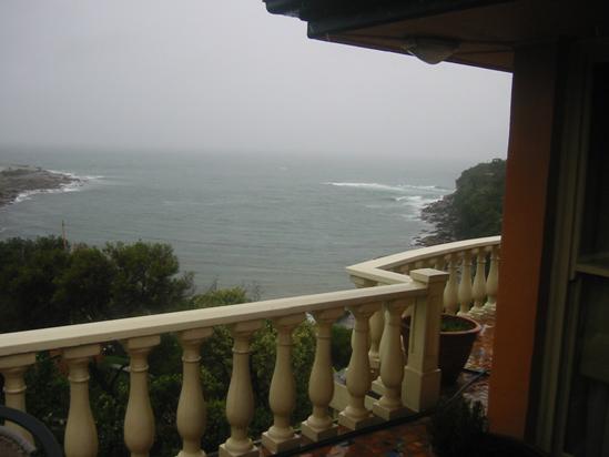
Figure 4: View standing on terrace at first floor
|
Location Of View
|
Existing Views
|
Proposed Views
|
Level Of Impact
|
|
Figures: 5,6 & 7
Standing inside the living areas
at first floor close to the window
Image Nos. 7027
7029 & 7030
|
Gordons Bay and headlands and horizon is unobscured
The foreshore foreground is
visible though the balustrade.
|
About
30% of the view of Gordons Bay and foreshore will be obscured.
The
headlands and horizon remain visible
|
Moderate
|


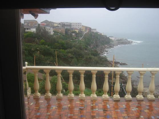
Figure
5: View standing
inside the living areas at first floor close to the window


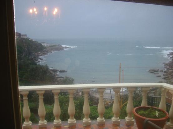
Figure
6: View standing
inside the living areas at first floor close to the window


Figure
7: View standing
inside the living areas at first floor close to the window
|
Location Of View
|
Existing Views
|
Proposed Views
|
Level Of Impact
|
|
Figures: 8
Sitting inside the living areas
at first floor
Image 7044
|
Gordons Bay in the foreground is obscured
The
headlands and horizon are unobscured
|
About
30% of the view of Gordons Bay and foreshore will be obscured.
The
headlands and horizon remain visible
|
Minor
|
Figure 8: View sitting inside the living areas at first floor
|
Impacts on views from No. 1
Gordon Avenue
|
|
Location Of View
|
Existing Views
|
Proposed Views
|
Level Of Impact
|
|
Figures: 9 & 10
Standing at outdoor area next
bluestone wall
Image Nos. 7009
& 7010
|
Full views of Gordons Bay are available except the foreshore foreground which is
obscured by existing dwelling house at No. 3
|
Gordons Bay headlands are unobscured however part of Gordons Bay and southern land/water interface is obscured.
|
Moderate
|


Figure 9: View standing at outdoor area next bluestone wall

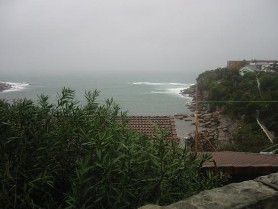
Figure 10: View standing at outdoor area next bluestone wall
|
Location Of View
|
Existing Views
|
Proposed Views
|
Level Of Impact
|
|
Figure 11
Standing at outdoor terrace
Image No. 7015
|
Northern headland and southern
land/water interface of Gordons Bay and
horizon is unobscured
Gordons Bay foreshore in foreground is obscured by the terrace and
landform
|
Northern headland and part of
the southern land/water interface to Gordons Bay and horizon remain unobscured
More of the Gordons Bay is obscured compared to existing situation
|
Minor
|
Figure 11: View standing at outdoor terrace
|
Location Of View
|
Existing Views
|
Proposed Views
|
Level Of Impact
|
|
Figure 12
Standing on pool deck
Image No 7018
|
Southern foreshore and northern
headland and horizon is unobscured
Gordons Bay foreground foreshore is obscured
|
The majority of the southern
foreshore and northern headland and horizon is unobscured
Gordons Bay foreground foreshore remains obscured
|
Minor
|
Figure 12: View standing on pool deck
|
Location Of View
|
Existing Views
|
Proposed Views
|
Level Of Impact
|
|
Figure 13
Standing in living area
Image No. 7016
|
Gordons Bay southern and northern headland and horizon is
unobscured
Gordons Bay foreground foreshore is obscured by landform
|
Gordons Bay southern and northern headland and horizon is
unobscured
Gordons Bay foreground foreshore is obscured by landform
|
Negligible
|
Figure 13: View standing in living area
|
Location Of View
|
Existing Views
|
Proposed Views
|
Level Of Impact
|
|
Figure 14
Sitting in living area
Image No. 7017
|
Gordons Bay southern and northern headland and horizon is
unobscured
Gordons Bay foreground foreshore is obscured
|
Gordons Bay southern and northern headland and horizon is
unobscured
Gordons Bay foreground foreshore is obscured
|
Negligible
|
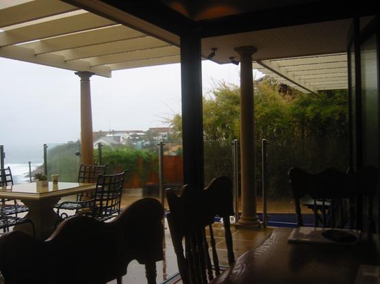
Figure 14: View sitting in living area
The proposal will result in a loss
of existing views enjoyed from the ground level and partial loss of views from
first floor terrace and living areas of Gordons Bay from the property at No. 3.
There will be partial loss of
foreground foreshore/water views from the pool deck the view loss from the
outdoor terrace and living area inside the dwelling is negligible from the
property at No. 1.
What is the
reasonableness of the proposal causing the impact?
The Court
said:
“ The fourth step is to assess the reasonableness of the
proposal that is causing the impact. A development that complies with all
planning controls would be considered more reasonable than one that breaches
them. Where an impact on views arises as a result of non-compliance with one
or more planning controls, even a moderate impact may be considered
unreasonable. With a complying proposal, the question should be asked whether a
more skilful design could provide the applicant with the same development
potential and amenity and reduce the impact on the views of neighbours. If the
answer to that question is no, then the view impact of a complying development
would probably be considered acceptable and the view sharing reasonable.”
The proposal generally complies
with Council’s planning controls, applicable to the site:
·
maximum FSR;
·
minimum
landscaped area; and
·
maximum
height.
There is some minor non-compliance
with the setback and external wall height controls however, these departures do
not result in any significant view loss.
The existing water views from both
levels of the dwelling house at No. 3 Gordon Avenue are relatively unimpeded. The proposed dwelling house
will be sited in the southern part of the site which results in a significant
view loss from the ground floor bedrooms. If the main dwelling house was sited
in the northern part of the site the views from No. 1 would suffer a greater
impact. Given existing the views of the majority of the land/water interface on
both the southern and northern shores and the headlands and ocean beyond are
retained from the first floor terrace and living areas the proposal is
reasonable with regard to view sharing. The amended proposal deleted the roof
terrace and associated balustrade and therefore the roof structure is about
300mm lower which will assist in further reducing view loss.
The existing views from the edge
of the property boundary of No. 1 include the foreshore foreground and most of Gordons Bay. The proposed pool house will result in a loss of the
foreshore foreground view from this position. This is considered acceptable
because these views can only enjoyed from a very limited vantage point, which
is not part of the recreational/entertaining part of the dwelling and not highly
utilised.
The existing headland and ocean
views from the pool deck, terrace and living areas of the house will remain
unobscured and therefore the proposal is reasonable with respect to view
sharing from No. 1.
The proposal will not result in
any significant view loss from Nos. 5 or 9 Gordon Avenue.
Overshadowing
The proposal will result in some
minor additional overshadowing to the adjoining property to the south at No. 5.
The majority of the swimming pool and adjoining deck will receive a minimum of
three hours sunlight during the winter solstice and therefore generally
complies with Council’s solar access requirements.
Visual Privacy
The potential privacy impacts have
been addressed by the deletion of the roof terrace above the dwelling house.
The proposal is therefore considered acceptable with regards to overlooking of
adjoining properties.
Visual Bulk
The potential visual impact from the southern study wall
to the swimming pool at No.
5 Gordon Avenue can
be offset with sufficient planting along the southern boundary to assist in
screening.
8.1 Site
Suitability
The subject site is suitable in
that it is large enough to accommodate a substantial dwelling in an area
characterised by multi level dwelling houses orientated to Gordon Bay.
CONCLUSION
The heads of consideration under Section 79C of the
Environmental Planning and Assessment Act, 1979 as of relevance to the
application have been taken into account in the assessment of the application.
The proposal will satisfactorily comply with the relevant
preferred solutions of Development Control Plan – Dwelling Houses and Attached
Dual Occupancies despite some minor non-compliances regarding setback and
external wall height.
The proposal has been assessed in relation to the
Performance Requirements of the DCP and is generally consistent in terms of
solar access, privacy, visual bulk and views.
The proposal complies with Council’s FSR, landscaping and
height controls and will not have any adverse impact on adjoining properties.
The proposal will not have any adverse visual impact on
the Foreshore Protection Area.
The application is considered suitable for approval
subject to the imposition of appropriate terms and conditions.
RECOMMENDATION:
A. THAT Council as the
responsible authority grant its development consent under Section 80 and 80A of
the Environmental Planning and Assessment Act 1979 (as amended) to Development
Application No DA/1110/2006 for New 3 storey single dwelling house, new
swimming pool and garage at 3A Gordon Avenue, Coogee subject to the following
conditions:
DEVELOPMENT CONSENT CONDITIONS
1. The
development must be implemented substantially in accordance with the plans
numbered 0613/1A, 0613/2A, 0613/3, 0613/4, 0613/5, 0613/6A & 0613/7A dated
September 2006, the application form and on any supporting information received
with the application, except as may be amended by the following conditions and
as may be shown in red on the attached plan:
2. The south
facing study room window shall be obscure glazing to minimise potential privacy
impacts to the adjoining property at No. 5.
3. The
colours, materials and finishes of the external surfaces to the building are to
be compatible with the adjacent development to maintain the integrity and
amenity of the building and the streetscape.
Details of the proposed colours,
materials and textures (i.e. a schedule and brochure/s or sample board) are to
be submitted to and approved by Council’s Director of City Planning, in
accordance with section 80A (2) of the Environmental Planning and Assessment
Act 1979 prior to a construction certificate being issued for the
relevant building works.
The following conditions have been applied to ensure that
noise emissions from the development satisfy legislative requirements and
maintain reasonable levels of amenity to the area:
4. The
operation of all plant and equipment associated with the swimming pool and
retention tank shall not give rise to an ‘offensive noise’ as defined in the Protection
of the Environment Operations Act 1997 and Regulations.
In this
regard, the operation of the plant and equipment associated with the swimming
pool and retention tank shall not give rise to an LAeq, 15 min
sound pressure level at any affected premises that exceeds the background LA90,
15 min noise level, measured in the absence of the noise source/s
under consideration by more than 5dB(A) in accordance with relevant NSW
Department of Environment & Conservation Noise Control Guidelines.
5. There are
to be no emissions or discharges from the premises, which will give rise to a
public nuisance or result in an offence under the Protection of the
Environment Operations Act 1997 and Regulations.
The following conditions are applied to provide
adequate security against damage to Council’s infrastructure:
6. The following damage/civil works
security deposit requirement is to be complied with prior to a construction
certificate being issued for the development, as security for making good any
damage caused to the roadway, footway, verge or any public place; or as security
for completing any public work; and for remedying any defect on such public
works, in accordance with section 80A(6) of the Environmental Planning and
Assessment Act 1979:
a) $1000.00 - Damage
/ Civil Works Security Deposit
The damage/civil works security deposit may be
provided by way of a cash or cheque with the Council and is refundable upon:
·
A satisfactory
inspection by Council that no damage has occurred to the Council assets such as
roadway, kerb, guttering, drainage pits footway, or verge; and
·
Completion of
the civil works as conditioned in this development consent by Council.
The applicant is to advise
Council, in writing, of the completion of all building works and/or obtaining
an occupation certificate, if required.
The applicant is to advise Council
in writing and/or photographs of any signs of existing damage to the Council
roadway, footway, or verge prior to the commencement of any building/demolition
works.
The following conditions are applied to provide adequate
provisions for access, transport and infrastructure:
7. Prior to
the issuing of a final occupation certificate the applicant must meet the full
cost for Council or a Council approved contractor to remove the existing
damaged concrete driveway and layback and to construct a new concrete vehicular
crossing and layback at kerb opposite the vehicular entrance to the site.
8. The
applicant must meet the full cost for Council or a Council approved contractor
to repair/replace any damaged sections of Council's footpath, kerb &
gutter, nature strip etc which are due to building works being carried out at
the above site. This includes the removal of cement slurry from Council's
footpath and roadway.
9. The
applicant shall note that all external work, carried out on Council property,
shall be in accordance with Council's Policy for "Vehicular Access and
Road and Drainage Works". An application for the cost of the Council civil
works is to be submitted to Council at the completion of the internal building
works. An application fee shall be payable to Council for the quotation of the
required works. The applicant may elect to use his contractor for the required
works, subject to Council approval, however a design and supervision fee based
on the lowest quotation from Council's nominated contractor will be required to
be paid prior to the commencement of any works.
The following conditions are applied to provide adequate
provisions for future civil works in the road reserve:
10. The
Council’s Development Engineer has inspected the above site and has determined
that the design alignment level at the property boundary for driveways, access
ramps and pathways or the like, must match the back of the existing footpath
along the full site frontage.
The design alignment
level at the property boundary must be strictly adhered to.
11. The design
alignment levels (concrete/paved/tiled level) issued by Council and their
relationship to the roadway/kerb/footpath must be indicated on the building
plans for the construction certificate. The design alignment level at the
street boundary, as issued by the Council, must be strictly adhered to.
12. The above
alignment levels and the site inspection by Council’s Department of Asset &
Infrastructure Services have been issued at a prescribed fee of $121.00. This
amount is to be paid prior to a construction certificate being issued for the
development.
13. The top of
footings of any structures constructed on the boundary alignment must be at
least 150mm below the alignment level as specified for the vehicular access.
This condition has been attached to accommodate future footpath construction at
this location.
The following conditions are
applied to provide adequate consideration for service authority assets:
14. A public
utility impact assessment must be carried out on all public utility services on
the site, roadway, nature strip, footpath, public reserve or any public areas
associated with and/or adjacent to the development/building works and include
relevant information from public utility authorities and exploratory trenching
or pot-holing, if necessary, to determine the position and level of service.
15. The
applicant must meet the full cost for telecommunication companies, gas
providers, Energy Australia and Sydney Water to
adjust/repair/relocate their services as required. The applicant must make the
necessary arrangements with the service authority.
The following conditions are applied to provide adequate
provisions for drainage and associated infrastructure:
16. Prior to the
issuing of a construction certificate the applicant must submit to council for
approval, and have approved a detailed design and specification for the
following works:
·
Reconstruction
of the existing Council controlled stormwater drainage pipeline located within
the development site, along the southern site boundary and under the proposed
garage, (refers to Hydraulic Layout Plan drawing number 5179 – PH01 Revision 2
by Rooney and Bye for general details). Note: provision is to be made to
Council’s satisfaction for stormwater overland flow to pass through or around
the proposed garage. Provision is also to be made for a stormwater overland
flowpath within the development site towards the eastern end of the pipeline to
Council’s satisfaction.
·
Surface inlet
pit, weir, pipeline details for the drainage system collecting overland flow
that drains across the driveway serving 3 and 3A Gordon Avenue, (refer to Hydraulic Layout Plan drawing number 5179 –
PH01 Revision 2 by Rooney and Bye for general location details). The applicant
shall note the following with respect to this drainage system:
(i) The
surface inlet pit shown as a 1200 x 1200 pit on Hydraulic Layout Plan drawing
number 5179 – PH01 Revision 2 by Rooney and Bye must be designed with
sufficient inlet capacity to take all flows up to the 1 in 100 year ARI event
assuming a 70% blockage factor.
(ii) The
pipeline draining from the above referenced surface inlet pit must be extended
across to join the existing Council controlled pipeline located adjacent to the
southern site boundary. The capacity of the pipeline must be such that it is
capable of draining flows up to the 1 in 100 year ARI storm event assuming a
50% blockage factor.
The applicant must liaise with
Council’s Drainage Investigations Engineer (9399 0882) and Council’s
Development Engineer Coordinator (9399 0924) to obtain Council’s requirements
for the design of the new drainage system and reconstruction of a portion of
the existing Council controlled drainage system.
17. The
applicant shall meet the full cost for the creation of a minimum 3.0 metre wide
drainage easement over the existing Council controlled stormwater pipeline
located adjacent to the southern site boundary and burdening the development
site. The easement shall be created in favour of Randwick City Council and must
be created to Council’s satisfaction prior to the issuing of a final occupation
certificate.
18. The
applicant must create a minimum 3.0 metre wide drainage easement over the
internal driveway of the development site in favour of Randwick City Council.
The easement is to ensure that the existing overland flowpath down the subject
driveway is not blocked or altered without Council’s prior approval. The
easement must be created to Council’s satisfaction prior to the issuing of a
final occupation certificate.
19. The
applicant must create a minimum 3.0 metre wide drainage easement over the line
of the new reinforced concrete pipeline and surface inlet pit that is to be
constructed to collect the overland flow that drains across the driveway
serving 3 and 3A Gordon Avenue, (refer to Hydraulic Layout Plan drawing number
5179 – PH01 Revision 2 by Rooney and Bye for general location details as
modified by the above conditions). The easement must identify the owner,
(current and future), of 3A Gordon Avenue
as the person/authority responsible for maintenance of the inlet pit and
pipeline and must be to Council’s satisfaction. The easement must be created to
Council’s satisfaction prior to the issuing of a final occupation certificate.
20. All proposed
footings must be located clear of the proposed 3.0 metre wide drainage easement
over the line of the new reinforced concrete pipeline and surface inlet pit
that is to be constructed to collect the overland flow that drains across the
driveway serving 3 and 3A Gordon Avenue. All proposed footings located adjacent
to the drainage easement shall:
A. be
founded on rock, or;
B. extend
below a 30 degrees line taken from the level of the pipe invert at the edge of
the drainage reserve (angle of repose).
(Structural details demonstrating
compliance with this condition shall be submitted with the construction
certificate application.)
C. be
inspected by the applicant's engineer to ensure that these footings are either
founded on rock or extend below the "angle of repose."
(Documentary evidence of
compliance with this condition is to be submitted to Council, prior to
proceeding to the subsequent stages of construction.)
21. All proposed
footings located within or adjacent to the proposed minimum 3.0 metre wide
drainage easement over the existing Council controlled stormwater pipeline
must:
A. be
founded on rock, or;
B. extend
below a 30 degrees line taken from the level of the pipe invert at the edge of
the drainage reserve (angle of repose).
(Structural details demonstrating
compliance with this condition shall be submitted with the construction
certificate application.)
C. be
inspected by the applicant's engineer to ensure that these footings are either
founded on rock or extend below the "angle of repose."
(Documentary evidence of
compliance with this condition is to be submitted to Council, prior to
proceeding to the subsequent stages of construction.)
22. Detailed
site drainage plans for the proposed drainage system, excluding the above
referenced drainage lines which are to be approved by Council, shall be
submitted to and approved by the certifying authority prior to the issue of a
construction certificate. The drainage plans shall demonstrate compliance with
the conditions of this development approval.
23. Should a
charged system be required to drain any portion of the site, the charged system
must be designed with suitable clear-outs/inspection points at pipe bends and
junctions.
24. All
stormwater run-off naturally draining to the site must be collected and
discharged through this property's stormwater system. Such drainage must, if
necessary, be constructed prior to the commencement of building work.
25. All site
stormwater must be discharged to the existing Council controlled drainage pipeline
located within the development site along the southern site boundary. The
discharge into Council’s pipeline shall occur either directly or via the
proposed drainage system that is to collect the overland flow that drains
across the driveway serving 3 and 3A Gordon Avenue, (refer to Hydraulic Layout Plan drawing number 5179 –
PH01 Revision 2 by Rooney and Bye for general location details).
26. Should a
charged system be required to drain any portion of the site, the charged system
must be designed with suitable clear-outs/inspection points at pipe bends and
junctions.
27. Should a
pump system be required to drain any portion of the site the system must be
designed with a minimum of two pumps being installed, connected in parallel
(with each pump capable of discharging at the required discharge rate) and
connected to a control board so that each pump will operate alternatively. The
pump wet well shall be sized for the 1 in 100 year, 2 hour storm assuming both
pumps are not working.
The pump system must also be
designed and installed strictly in accordance with Randwick City Council's
Stormwater Code.
28. All site stormwater which is
discharged from the site must be taken through a sediment/silt arrester pit.
The sediment/silt arrestor pit shall be constructed with:-
- The base of the pit located a
minimum 300mm under the invert level of the outlet pipe.
- The pit must be constructed
from cast in-situ concrete, precast concrete or double brick.
- The grate is to be a
galvanised heavy-duty grate that has a provision for a child proof
fastening system.
- A minimum of 4 x 90 mm
diameter weep holes located in the walls of the pit at the floor level
with a suitable geotextile material with a high filtration rating located
over the weep holes.
·
A galvanised
heavy-duty screen located over the outlet pipe (Mascot GMS Multi-purpose filter
screen or similar).
- A child proof and corrosion
resistant fastening system for the access grate (spring loaded j-bolts or
similar).
- The inlet pipeline located on
the side of the pit so that the stormwater will discharge across the face
of the screen.
- A sign adjacent to this pit
stating that:
“This sediment/silt arrester pit
shall be regularly inspected and cleaned.”
Note: Sketch
details of a standard sediment/silt arrester pit can be obtained from Council’s
Drainage Engineer.
Landscape/Bushland Conditions
The following conditions are applied to provide adequate
provisions for landscaping and to maintain reasonable levels of environmental
amenity:
29. Landscaping at the site shall be
installed substantially in accordance with the Landscape Plans prepared by
Secret Gardens of Sydney, drawing numbers LP 01 & 02, revision B, dated
29-06-07, with the following additional requirements to be provided, to the
satisfaction of the Principal Certifying Authority (PCA), prior to a
construction certificate being issued (with a copy of the required information
to be forwarded to Council if Council is not the PCA for the site):
a) Inclusion
of planting in the area between the south-western site boundary and
south-western wall of that part of the proposal which adjoins the eastern edge
of the proposed garage, for the full length and height of this specific area,
selecting those species which will afford effective screening of this part of
the proposal when viewed from the adjoining property at No. 5 Gordon Avenue.
The drying court currently nominated for this area of the site shall be
suitably relocated elsewhere.
b) Confirmation,
through the provision of spot levels, expected mature height of planting,
elevations/sections etc that any new planting in the northwest corner of the
site will not result in a loss of view for the adjoining properties to the
northwest. As such, alternative species to the Banksia integrifolia
(Coastal Banksia’s) which are currently shown may be required in this area.
c) Confirmation
that the applicant has entered into a formal agreement with Council’s Community
Nursery to produce the required quantity of those species which are nominated
for use at the site, but which are also identified as occurring naturally in
Gordons Bay Reserve (refer species list in previous report/issues paper, and
Note 6 on the submitted Landscape Plan);
d) Confirmation
that the applicant has entered into a formal agreement with Council’s Bushland
Field Officer to assist with the removal and eradication of all invasive,
noxious and environmental weeds from throughout the site (refer Note 7 on
submitted Landscape Plan).
30. Certification
from a Landscape Architect who is eligible for membership with the Australian Institute of Landscape
Architects (AILA), is to be provided, to the satisfaction of the PCA, prior to
the issue of a final occupation certificate, which confirms that the landscape
works have been installed in accordance with the approved documentation and
relevant conditions of consent.
31. Prior to
the physical commencement of any works at the site, the applicant shall
contact Council’s Landscape Development Officer on 9399-0613 to arrange for an
inspection to confirm that straw/hay bales, sandbag filtration barriers or
similar approved erosion control measures have been installed along the length
of the southern boundary, and that shade cloth has been attached to the
existing chainwire fencing for its full height and length along the southern
boundary, to Council’s satisfaction, in order to ensure that Council’s reserve
is fully protected from the adverse effects of the proposed works.
32. Other than
specifically for the installation of protective/silt fencing, reconstruction of
the retaining wall and connection of stormwater at the southern boundary, no
access through/over Council’s reserve is permitted at any time during the
course of the works (refer also Note 9 on submitted Landscape Plan).
33. The informal
timber steps at the southeast corner of the site shall be demolished as part of
the site works, with fencing along this boundary to be continuous to completely
enclose the site (refer also Note 13 on submitted Landscape Plan).
34. Given the
impact that inappropriate species selection can have on areas of remnant
bushland in Council’s Gordons Bay Reserve beyond the southern site boundary,
the selection of any alternative species to those already listed on the
landscape plans will require the written approval of Council’s Landscape
Development Officer, prior to installation.
35. A refundable
deposit in the form of cash, cheque or bank guarantee (with no expiry date) for
an amount of $10,000 shall be lodged with Council prior to the issue of
a construction certificate, to ensure full and correct implementation of the
protection measures relating to the public reserve as described in this report.
a) Any
contravention of Council's conditions relating to the reserve/bushland
throughout the course of the works may result in Council claiming all or part
of the lodged security for the purpose of remedying or completing any works
associated with this proposal.
b) The
refundable deposit will be eligible for release following the issue of a final
occupation certificate, pending a satisfactory inspection by Council’s
Landscape Development Officer, who can be contacted on 9399-0613.
36. The
applicant will be required to forward a completed ‘Security Deposit Refund
Application Form’ to facilitate this site inspection.
37. The
naturestrip upon Council's Gordon Avenue
footway shall be excavated to a depth of 150mm, backfilled with topsoil
equivalent with 'Organic Garden Mix' as supplied by Australian Native
Landscapes, and re-turfed with Kikuyu Turf or similar. Such works shall be
installed prior to the issue of a final Occupation Certificate.
Tree Management
38. The
following trees shall be removed in order to accommodate the proposed works as
shown, subject to implementation of landscape works in accordance with the
landscape plan which is approved by the PCA for the construction certificate:
a) One Hibiscus tiliaceus (Cottonwood)
in the lowest terrace, towards the western boundary, between the existing
garage and western edge of the existing tennis court;
To be replaced with 1 x 100 litre Plumeria
acutifolia (Frangipani), as the 200mm pot size currently shown is inadequate.
b) The group of Metrosideros excelsa (NZ
Xmas Trees) beyond the southeast corner of the existing dwelling, along the
eastern boundary, surrounding the existing grassed play area;
To be replaced with a suitable quantity of
appropriate species to afford screening and privacy, but which will not result
in loss of view for the adjoining property to the north.
39. Prior to the
physical commencement of any tree pruning or tree removal work, the applicant
will be required to contact Council’s Landscape Development Officer on
9399-0613, to arrange a site inspection for the purposes of confirming the
correct identification of those trees to be retained and removed, implementation
of protection measures, and the extent of pruning permissible, with the
applicant required to comply fully with the Council Officers verbal
instructions.
40. Should the
selective pruning of any branches from the trees being retained at the site be
desired/required at any stage throughout the course of the works, for whatever
reason, the applicant will be required to contact Council’s Landscape
Development Officer on 9399-0613, to arrange for an inspection for the purpose
of confirming the location and extent of pruning which is permissible.
41. All pruning
must be undertaken in accordance with the verbal instructions issued by
Council’s Officer, by an Arborist who holds a minimum of AQF Level V in
Arboriculture, and is a registered member of a nationally recognised
organisation, to the requirements of Australian Standard AS 4373-1996 'Pruning
of Amenity Trees.’
Tree Protection Measures
42. In order to
ensure the retention of the two groves of existing native trees, being three Banksia
integrifolia (Coastal Banksia’s) and one Melaleuca quinquinervia
(Broad Leafed Paperbark) in the northeast corner of the site, as well as three Eucalyptus
robusta (Swamp Mahogany’s) and two Banksia aemula (Wallum Banksia’s)
in the southeast corner of the site, the following measures are to be
undertaken:
a. All
detailed architectural, building, demolition, engineering (structural,
stormwater & drainage, services), and landscape documentation submitted for
the construction certificate application shall show the retention of all nine
existing specimens, with the position of their trunks and full diameter of
their canopies clearly shown on all drawings.
b. Detailed
architectural, building, demolition, engineering (structural, stormwater &
drainage, services), and landscape documentation submitted for the construction
certificate application will be required to confirm that existing soil levels
beneath the full extent of the driplines of all of these trees will be
maintained, with no structures, services, footings, detention tanks, stormwater
infiltration systems, pipes, cutting or battering of the existing soil profile,
or any excavations to be performed within these areas.
c. These
two groups of trees are to be physically protected by the installation of 1.8
metre high steel mesh/chainwire fencing (or an approved alternative
material/method given the difficult, sloping nature of the site), and will be
located at the full extent of the driplines of both groups, linking up with
relevant site boundaries, to completely enclose both groups of trees for the
duration of the works.
d. This
fencing shall be installed prior to the commencement of demolition and
construction works and shall remain in place until all works are completed,
with signage containing the following words to be clearly displayed and
permanently attached: “TREE PROTECTION ZONE, DO NOT ENTER".
e. Within
this zone there is to be no storage of materials or machinery or site
office/sheds, nor is cement to be mixed or chemicals spilt/disposed of and no
stockpiling of soil or rubble.
f. Any
excavations associated with minor landscape works within the zones specified in
point c above, such as planting and paving, shall be initially undertaken by
hand in order to minimise compaction of the soil profile and disturbance of the
rootzone that would ordinarily be caused by machinery.
g. All
site services will need to be suitably designed to ensure they are located
outside the zones specified in point c above.
h. Woodchip
mulch to a minimum depth of 75mm shall be maintained within both protection
zones for the duration of the works.
The following conditions are applied to ensure that the
development satisfies the provisions of the Environmental Planning and
Assessment Act 1979 and Regulations:
43. The
requirements and provisions of the Environmental Planning & Assessment Act
1979 and Environmental Planning & Assessment Regulation 2000, must be fully
complied with at all times.
Failure to comply with these legislative requirements is
an offence and may result in the commencement of legal proceedings, issuing of
`on-the-spot` penalty infringements or service of a notice and order by
Council.
44. All new
building work must be carried out in accordance with the provisions of the Building
Code of Australia (BCA), in accordance with Clause 98 of the Environmental
Planning and Assessment Regulation 2000.
45. Prior to
the commencement of any building works, a construction certificate must be
obtained from the Council or an accredited certifier, in accordance with the
provisions of the Environmental Planning & Assessment Act 1979 and
Environmental Planning & Assessment Regulation 2000.
A copy of the construction
certificate, the approved plans & specifications and development consent
conditions must be kept on the site at all times and be made available to the
Council officers and all building contractors for assessment.
46. Prior to
the commencement of any building works, the person having the benefit of
the development consent must:-
i) appoint a
Principal Certifying Authority for the building work, and
ii) appoint a
principal contractor for the building work, or in relation to
residential building work, obtain an owner-builder permit in accordance
with the requirements of the Home Building Act 1989, and notify the Principal
Certifying Authority and Council accordingly in writing, and
iii) unless
the person having the benefit of the consent is the principal contractor
(i.e. owner-builder), notify the principal contractor of the
required critical stage inspections and other inspections to be carried
out, as specified by the Principal Certifying Authority, and
iv) give at
least two days notice to the Council, in writing, of the person’s intention to
commence building works.
In relation to residential
building work, the principal contractor must be the holder of a contractor
licence, in accordance with the provisions of the Home Building Act 1989.
47. The building
works must be inspected by the Principal Certifying Authority (or
another certifying authority if the Principal Certifying Authority
agrees), in accordance with sections 109 E (3) of the Environmental Planning
& Assessment Act 1979 and clause 162A of the Environmental Planning &
Assessment Regulation 2000, to monitor compliance with the relevant standards
of construction, Council’s development consent and the construction
certificate.
The Principal Certifying
Authority must specify the relevant stages of construction to be inspected
in accordance with section 81A (2) (b1) (ii) of the Environmental Planning
& Assessment Regulation 2000 and a satisfactory inspection must be carried
out, to the satisfaction of the Principal Certifying Authority, prior to
proceeding to the subsequent stages of construction or finalisation of the
works (as applicable).
Documentary evidence of the
building inspections carried out and details of compliance with Council’s
consent is to be maintained by the Principal Certifying Authority.
Details of critical stage inspections carried out and copies of
certification relied upon must also be forwarded to Council with the occupation
certificate.
The principal contractor or
owner-builder (as applicable) must ensure that the required critical
stage and other inspections, as specified in the Principal Certifying
Authority’s “Notice of Critical Stage Inspections”, are carried out to the
satisfaction of the Principal Certifying Authority and at least 48 hours
notice (excluding weekends and public holidays) is to be given to the Principal
Certifying Authority, to carry out the required inspection, before carrying
out any further works.
48. A sign must
be erected and maintained in a prominent position on the site for the duration
of the works, which contains the following details:
· name, address, contractor licence number
and telephone number of the principal contractor, including a telephone
number at which the person may be contacted outside working hours, or owner-builder
permit details (as applicable)
· name, address and telephone number of the Principal
Certifying Authority,
· a statement stating that “unauthorised
entry to the work site is prohibited”.
49. An Occupation
Certificate must be obtained from the Principal Certifying Authority prior
to any occupation of the building work encompassed in this development
consent (including alterations and additions to existing buildings), in
accordance with the relevant provisions of the Environmental Planning &
Assessment Act 1979.
An Occupation Certificate must not
be issued for the development if the development is inconsistent with the
development consent. The relevant requirements of the Environmental Planning
& Assessment Act 1979 and conditions of development consent must be
satisfied prior to the issuing of an occupation certificate.
50. Prior to
the issuing of an interim or final occupation certificate, a statement is
required to be obtained from the Principal Certifying Authority, which confirms
that the development is not inconsistent with the development consent and the
relevant conditions of development consent have been satisfied.
Details of critical stage
inspections carried out by the principal certifying authority together with any
other certification relied upon and must also be provided to Council with the
occupation certificate.
51. In
accordance with clause 98 of the Environmental Planning and Assessment
Regulation 2000, it is a prescribed condition, that in the case of residential
building work, a contract of insurance must be obtained and in force, in
accordance with the provisions of the Home Building Act 1989.
Where the work is to be done by a licensed
contractor, excavation or building work must not be carried out unless the
Principal Certifying Authority (PCA):
· has been informed in
writing of the licensee’s name and contractor number; and
· is satisfied that the
licensee has complied with the insurance requirements of Part 6 of the Home Building Act 1989, or
Where the work to be done by any
other person (i.e. an owner-builder), excavation or building work must
not be carried out unless the Principal Certifying Authority:
· has been informed of the
person’s name and owner-builder permit number, or
· has been given a
declaration, signed by the owner of the land that states that the market cost
of the labour and materials involved in the work does not exceed $5,000.
Details of the principal building
contractor and compliance with the provisions of the Home Building Act 1989 (i.e. Details of the
principal licensed building contractor and a copy of the Certificate of
Insurance) are to
be submitted to Council prior to the commencement of works, with the
notice of appointment of the PCA / notice of intention to commence building
work.
52. The required
Long Service Levy payment, under the Building and Construction Industry Long
Service Payments Act 1986, is to be forwarded to the Long Service Levy
Corporation or the Council, prior to the issuing of a Construction
Certificate, in accordance with Section 109F of the Environmental Planning
& Assessment Act 1979.
At the time of this development consent, Long
Service Levy payment is applicable on building work having a value of $25,000
or more, at the rate of 0.35% of the cost of the works.
53. Smoke alarms
are required to be installed in each Class 1 building or residential dwelling
in accordance with the relevant provisions of Part 3.7.2 of the B.C.A. –
Housing Provisions.
Smoke alarms must comply with AS3786 – Smoke alarms and be
connected to the consumer mains electric power supply and provided with a
battery back-up.
The smoke alarms are to be installed in suitable locations
on or near the ceiling, in any storey containing bedrooms; located between each
part of the dwelling containing the bedrooms and the remainder of the dwelling,
or where bedrooms are served by a hallway, the smoke alarms are to be located
in that hallway; and smoke alarms are to be installed in any other storey not
containing bedrooms, to the satisfaction of the certifying authority.
Smoke alarms are not to be located in ‘dead-air-spaces’,
in the corner junction of walls and ceilings between exposed rafters/joists or
at the apex of raked ceilings, as detailed in Part 3.7.2 of the Building Code
of Australia – Housing Provisions.
Details of compliance with the provisions of the Building
Code of Australia must be included in the plans / specification for the construction
certificate.
The following conditions are applied to ensure that the
development satisfies relevant standards of construction, and to maintain
adequate levels of health, safety and amenity during construction:
54. The
demolition of buildings and the removal, storage, handling and disposal of
building materials must be carried out in accordance with the following
regulations:
• The
requirements and Guidelines of WorkCover NSW
· Occupational Health and Safety Act 2000
·
Australian
Standard 2601 (2001) – Demolition of Structures
·
The Protection
of the Environment Operations Act 1997
·
Protection of
the Environment Operations (Waste) Regulation 1996.
55. A Demolition
Work Plan must be prepared for the development in accordance with Australian
Standard AS2601-2001, Demolition of Structures.
The Work Plan must include the following information (as
applicable):
·
The name,
address, contact details and licence number of the Demolisher /Asbestos Removal
Contractor
·
Details of
hazardous materials, including asbestos
·
Method/s of
demolition and removal of asbestos
·
Measures and
processes to be implemented to ensure the health & safety of workers and
community
·
Measures to be
implemented to minimise any airborne asbestos and dust
·
Methods and
location of disposal of any asbestos or other hazardous materials
·
Other relevant
details, measures and requirements to be implemented as identified in the
Asbestos Survey
·
Date the
demolition and removal of any asbestos materials will commence
The Demolition Work Plan must be submitted to Council and
the Principal Certifying Authority (PCA) if the Council is not the PCA, not
less than two (2) working days before commencing any demolition works
involving asbestos products or materials. A copy of the Demolition Work Plan
must also be maintained on site and be made available to Council officers upon
request.
Note it is the responsibility of the
persons undertaking demolition work to obtain the relevant WorkCover licences
and permits.
56. Any work
involving the demolition, storage and disposal of asbestos products and
materials must be carried out in accordance with the following requirements:
a. Relevant
Occupational Health & Safety legislation and WorkCover NSW requirements
b. Randwick
City Council’s Asbestos Policy (adopted 13 September 2005)
c. A
WorkCover licensed demolition or asbestos removal contractor must undertake
removal of more than 50 m2 of bonded asbestos (or as otherwise specified by
WorkCover or relevant legislation).
Removal of friable asbestos
material must only be undertaken by contractor that holds a current friable
asbestos removal licence.
d. On sites
involving the removal of asbestos, a sign must be clearly displayed in a
prominent visible position at the front of the site, containing the words
‘DANGER ASBESTOS REMOVAL IN PROGRESS’ and include details of the licensed
contractor.
e. Asbestos
waste must be stored, transported and disposed of in compliance with the
Protection of the Environment Operations Act 1997 and the Protection of the
Environment Operations (Waste) Regulation 1996.
f. A
Clearance Certificate or Statement, prepared by a suitably qualified person (ie
an occupational hygienist, licensed asbestos removal contractor, building
consultant, architect or experienced licensed building contractor), must be
provided to Council upon completion of the works prior to an Occupation
Certificate being issued, which confirms that the asbestos material have been
removed appropriately and the relevant conditions of consent have been
satisfied.
A copy of Council’s Asbestos
Policy is available on Council’s web site at www.randwick.nsw.gov.au in the
Building & dev can be obtained from Council’s Customer Service Centre.
57. All
excavations and backfilling associated with the erection or demolition of a
building must be executed safely in accordance with appropriate professional
standards and excavations are to be properly guarded and supported to prevent
them from being dangerous to life, property or buildings.
Retaining
walls, shoring or piling must be provided to support land which is excavated in
association with the erection or demolition of a building, to prevent the
movement of soil and to support the adjacent land and buildings, if the soil
conditions require it. Adequate provisions are also to be made for drainage.
Retaining
walls, shoring, or piling must be designed and installed in accordance with
appropriate professional standards and the relevant requirements of the
Building Code of Australia and Australian Standards. Details of proposed
retaining walls, shoring or piling are to be submitted to and approved by the
Principal Certifying Authority for the development prior to commencing such
excavations or works.
58. A
dilapidation report prepared by a professional engineer, accredited building
surveyor or other suitably qualified person must be submitted to the
satisfaction of the Principal Certifying Authority prior to commencement
of any demolition, excavation or building works, in the following cases:
· new dwellings or additions
to dwellings sited up to the property boundaries (including additions to a
semi-detached dwelling),
· excavations for new
dwellings, additions to dwellings, swimming pools or the like which are
proposed to be located within the zone of influence of the footings of any
dwelling, associated garage or other substantial structure located upon an
adjoining premises,
· excavations for new
dwellings, additions to dwellings, swimming pools or the like which are within
rock and may result in vibration and or potential damage to any dwelling,
associated garage or other substantial structure located upon an adjoining
premises,
· as otherwise required by the
Principal Certifying Authority.
The report (including photographs)
is to detail the current condition and status of any dwelling, associated garage
or other substantial structure located upon the adjoining premises, which may
be affected by the subject works.
59. The
adjoining land and buildings located upon the adjoining land must be
adequately supported at all times.
If an excavation associated with
the erection or demolition of a building extends below the level of the base of
the footings of any building located on an adjoining allotment of land, the
person causing the excavation must:
· preserve and protect the
building /s on the adjoining land from damage; and
· effectively support the
excavation and building; and
· at least seven (7) days
before excavating below the level of the base of the footings of a building on
an adjoining allotment of land (including a public road or public place), give
notice of the intention and particulars of the works to the owner of the
adjoining land.
Notes
· This consent and condition
does not authorise any trespass or encroachment upon any adjoining or supported
land or building whether private or public. Where any underpinning, shoring,
soil anchoring (temporary or permanent) or the like is proposed to be carried
out upon any adjoining or supported land, the principal contractor or
owner-builder must obtain:
a) the
consent of the owners of such adjoining or supported land to trespass or
encroach, or
b) an access
order under the Access to Neighbouring Land
Act 2000, or
c) an
easement under section 88K of the Conveyancing Act 1919, or
d) an
easement under section 40 of the Land & Environment Court Act 1979, as
appropriate.
· Section 177 of the
Conveyancing Act 1919 creates a statutory duty of care in relation to support
of land. Accordingly, a person has a duty of care not to do anything on or in
relation to land being developed (the supporting land) that removes the support
provided by the supporting land to any other adjoining land (the supported
land).
60. Except with
the written approval of Council’s Manager of Health, Building & Regulatory
Services, all building, demolition and associated site works (including site
deliveries) must only be carried out between the hours of 7.00am to 5.00pm on
Monday to Friday inclusive and between 8.00am to 5.00pm on Saturdays and all
building activities are strictly prohibited on Sundays and Public Holidays.
In addition, the use of any rock
excavation machinery or any mechanical pile drivers or the like, is restricted
to the hours of 8.00am to 5.00pm (maximum) on Monday to Friday only, to
minimise the noise levels during construction and loss of amenity to nearby residents.
61. Noise and
vibration emissions during the construction of the building and associated site
works must not result in damage to nearby premises or result in an unreasonable
loss of amenity to nearby residents and the relevant provisions of the Protection
of the Environment Operations Act 1997 must be satisfied at all times.
Noise and vibration from any rock excavation machinery and
pile drivers (or the like) must be minimised by using appropriate plant and
equipment and silencers and a construction noise and vibration minimisation
strategy, prepared by a suitably qualified consultant is to be implemented
during the works, to the satisfaction of the Principal Certifying Authority.
62. A Registered
Surveyor’s check survey certificate or compliance certificate is to be
forwarded to the principal certifying authority (and a copy is to be
forwarded to the Council, if the Council is not the principal certifying
authority), detailing compliance with Council’s approval at the following
stage/s of construction:
a) Prior to construction of
the footings or first completed floor slab (prior to the pouring of concrete),
showing the area of the land, building and boundary setbacks and levels of the
building.
b) On completion of the
erection of the building showing the area of the land, the position of the
building and boundary setbacks and verifying the building has been constructed
at the approved levels.
63. Temporary
toilet facilities are to be provided, at or in the vicinity of the work site
throughout the course of demolition and construction, to the satisfaction of
WorkCover NSW and the toilet facilities must be connected to a public sewer or
other sewage management facility approved by Council.
64. Public
safety must be maintained at all times and public access to the site and
building works, materials and equipment on the site is to be restricted, when
work is not in progress or the site is unoccupied.
A temporary safety fence is to be provided to protect the
public, located to the perimeter of the site (unless the site is separated from
the adjoining land by an existing structurally adequate fence, having a minimum
height of 1.5 metres). Temporary fences are to have a minimum height of 1.8
metres and be constructed of cyclone wire fencing, with geotextile fabric
attached to the inside of the fence to provide dust control, or other material
approved by Council.
Temporary site fences are to be structurally adequate,
safe and be constructed in a professional manner and the use of poor quality
materials or steel reinforcement mesh as fencing is not permissible.
The public safety provisions and temporary fences must be
in place prior to the commencement of any demolition, excavation or building
works and be maintained throughout construction.
If it is proposed to locate any site fencing, hoardings or
amenities upon any part of the footpath, nature strip or public place, the
written consent from Council’s Building Services section must be obtained
beforehand and detailed plans are to be submitted to Council for consideration,
together with payment of the weekly charge in accordance with Council’s adopted
fees and charges.
65. A
Construction Site Management Plan is to be submitted to and approved by the
principal certifying authority prior to the commencement of demolition,
excavation or building works. The site management plan must include the
following measures, as applicable to the type of development:
· location and construction of protective
fencing / hoardings to the perimeter of the site;
· location of site storage
areas/sheds/equipment;
· location of building materials for
construction;
· provisions for public safety;
· dust control measures;
· site access location and construction
· details of methods of disposal of demolition
materials;
· protective measures for tree preservation;
· provisions for temporary sanitary
facilities;
· location and size of waste containers/bulk
bins;
· details of proposed sediment and erosion
control measures;
·
construction
noise and vibration management;
·
construction
traffic management provisions.
The site management measures are to be implemented prior
to the commencement of any site works and be maintained throughout the works,
to maintain adequate levels of public health and safety. A copy of the
approved Construction Site Management Plan must be maintained on site and be
made available to Council officers upon request.
66. During
construction stages, sediment laden stormwater run-off shall be controlled
using the sediment control measures outlined in the manual for Managing Urban
Stormwater – Soils and Construction, published by the NSW Department of
Housing.
Details of the proposed sediment control measures are to
be detailed in the Construction Site Management Plan which must be submitted to
and approved by the principal certifying authority prior to the commencement
of any site works. The sediment and erosion control measures must be
implemented prior to the commencement of any site works and be maintained
throughout construction. A copy of the approved details must be forwarded to
the Council and a copy is to be maintained on-site and be made available to
Council officers upon request.
Details of proposed sediment and erosion control measures
shall include; a site plan; indicating the slope of land, access points &
access control measures, location and type of sediment & erosion controls,
location of existing vegetation to be retained, location of material stockpiles
and storage areas, location of building operations and equipment, methods of
sediment control, details of drainage systems and details of existing and
proposed vegetation.
67. Public
safety and convenience must be maintained at all times during demolition,
excavation and construction works and the following requirements must be
complied with:
a. Building materials, sand,
soil, waste materials, construction equipment or5 other activities must not be
placed upon the footpath, roadway or nature strip at any time and the footpath,
nature strip and road must be maintained in a clean condition and free from any
obstructions, soil and debris at all times.
b. Stockpiles of soil, sand,
aggregate or other materials must not be located on any footpath, roadway,
nature strip, drainage line or any public place and the stockpiles must be
protected with adequate sediment control measures.
c. Building operations such
as brick cutting, washing tools or equipment and mixing mortar are not
permitted on public footpaths, roadways, nature strips, in any public place or
any location which may lead to the discharge of materials into the stormwater
drainage system.
d. A warning sign for soil
and water management must be displayed in a prominent position on the building
site, visible to both the public and site workers. The sign must be displayed
throughout the construction period. Copies of a suitable warning sign are
available at Council’s Customer Service Centre for a nominal fee.
e. Bulk bins/waste
containers must not be located upon the footpath, roadway or nature strip at
any time without the prior written approval of the Council, unless the waste
container is located upon the road in accordance with the Roads & Traffic
Authority Guidelines and Requirements and the container is exempt from an
approval under Development Control Plan for Exempt & Complying Development
and Council’s Local Approvals Policy. Applications to place a waste container
in a public place can be made to Council’s Health Building and Regulatory
Services section.
f. Any part of Council’s
nature strip which is damaged as a result of the work must be back-filled,
top-soiled and re-turfed with kikuyu turf prior to occupation or finalisation
of the development, to Council’s satisfaction.
The following conditions are applied to ensure compliance
with the Swimming Pools Act 1992 and to maintain public safety and amenity:
68. Swimming
pools are to be provided with childproof fences and self-locking gates, in
accordance with the Swimming Pools Act 1992 and regulations.
The swimming pool is to be surrounded by a fence having a
minimum height of 1.2m, that separates the pool from any residential building
situated on the premises and from any place (whether public or private)
adjoining the premises; and that is designed, constructed and installed in
accordance with AS 1926-1986.
Gates to pool area shall be a maximum width of 1 metre,
and be self-closing and latching; the gate is required to open outwards from
the pool area and prevent a small child opening the gate or door when the gate
or door is closed.
Temporary pool safety fencing is to be provided pending
the completion of all building work and the pool must not be filled until a
fencing inspection has been carried out and approved by the principal
certifying authority.
A sign shall be erected in a prominent position in the
immediate vicinity of the swimming pool, in accordance with the document
entitled “Policy Statement No.9.4.1: Guidelines for the Preparation of Posters
on Resuscitation”, published in 1985 by the Australian Resuscitation Council
and the sign must bear a notice that contains the words “YOUNG CHILDREN SHOULD
BE SUPERVISED WHEN USING THIS SWIMMING POOL”, together with details of
resuscitation techniques (for adults, children and infants) set out in
accordance with the document entitled “Cardio Pulmonary Resuscitation”
published by the Australian Resuscitation Council.
69. Spa pools
are to be provided with a child resistant barrier, in accordance with the
provisions of the Swimming Pools Act 1992 and regulations.
A sign shall be erected in a prominent position in the
immediate vicinity of the swimming pool, in accordance with the document
entitles “Policy Statement No. 9.4.1; Guidelines for the Preparation of Posters
on Resuscitation”, published in 1985 by the Australian Resuscitation Council
and the sign must bear a notice that contains the words “YOUNG CHILDREN SHOULD
BE SUPERVISED WHEN USING THIS SWIMMING POOL”, together with details of
resuscitation techniques (for adults, children and infants) set out in
accordance with the document entitles “Cardio Pulmonary Resuscitation: published
by the Australian Resuscitation Council.
70. Swimming
pools are to be designed, installed and operated in accordance with the
following general requirements: -
a. Backwash
of the pool filter and other discharge of water is to be drained to the sewer
in accordance with the requirements of the Sydney Water Corporation; and
b. All pool overflow water is
to be drained away from the building and adjoining premises, so as not to
result in a nuisance or damage to premises; and
c. Water recirculation and
filtrations systems are required to comply with AS 1926.3 – 2003: Swimming
Pool Safety – Water Recirculation and Filtration Systems; and
d. Pool plant and equipment is
to be enclosed in a sound absorbing enclosure or installed within a building,
to minimise noise emissions and possible nuisance to nearby residents; and
e. The pool plant and
equipment shall not be operated during the following hours if the noise emitted
can be heard within a habitable room in any other residential premises, or, as
otherwise specified in relevant Noise Control Regulations:
i. before 8.00am or after 8.00pm on any Sunday or public holiday;
or
ii. before 7.00am or after 8.00pm on any other day.
Advisory Conditions
The applicant is to advise Council in writing and/or
photographs of any signs of existing damage to the Council roadway, footway, or
verge prior to the commencement of any building/demolition works.
ATTACHMENT/S:
Nil
Development Application Report
|
REPORT
BY: DIRECTOR,
CITY PLANNING
|
|
PROPOSAL:
|
Section
96(2) - Modification of the approved development by internal alterations, new
lift, reconfiguration of parking, alteration to garbage storage, provision of
traffic signalling system, provision of pedestrian entrances from Mount
Street, deletion of Unit 7, alteration to landscaping and exterior wall,
alteration to windows and exterior plus modification of Conditions Nos 1, 7,
81, 101 and 127; and delete Conditions Nos. 31 and 72.
|
|
PROPERTY:
|
143 - 147 Coogee Bay Road, Coogee
|
|
WARD:
|
East Ward
|
|
APPLICANT:
|
East No. 1 Pty Ltd
|
|
OWNER:
|
Mr S O
Ahlgren, Mr A Ahlgren & Ms E Ahlgren
|
|
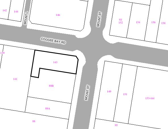
|
|
|
Subject
Site
|
|
|
|
|
|
|
|
|
|
Submissions
received
|
|
Ù
North
|
|
LOCALITY
PLAN
|
1. EXECUTIVE SUMMARY
The application is referred to
Committee as the original application was determined by Council.
The original development
application that proposed the demolition of the existing service station and
construction of a four storey multi-unit housing development containing 7 x one
bedroom dwellings and the strata subdivision of the building was approved at
the Ordinary Council meeting on 26 August 2003 subject to conditions.
The subject application under the
provisions of Section 96(2) of the Environmental Planning Assessment Act, 1979
(as amended) seeks to undertake a number of modifications including
physical/design changes to the building and reduces the number of dwellings
contained within the building from seven to six. The subject application also
proposed to modify/delete several conditions of consent, as follows:
·
modify
Condition No. 1 (approved documentation);
·
modify
Condition No. 7 (power supply);
·
delete Condition
No. 31 (fitout and use of commercial tenancies);
·
delete
Condition No. 72 (waste management area);
·
modify
Condition No. 81 (landscape bond);
·
modify
Condition No. 101 (dilapidation report; and
·
modify
Condition No. 127 (S94 Contributions).
The proposed modifications have
been notified and advertised in accordance with the Development Control Plan
for Public Notification of Development Proposals and Council Plans. As a result
of this process, no submission was received.
It is considered that the proposed
modifications are minor and will not result in any unreasonable additional
impact on the amenity of the adjoining properties in that the height of the
approved building will be retained and the additional gross floor area will be
generally within the same building envelope as the approved development. The
size, bulk and scale of the amended proposal will still be consistent with the
existing built form in the locality. All of the north facing windows of the
dwellings within the building at 88B Mount Street will continue to receive at least 3 hours of solar access
and the proposal will reduce the shadow impact on the northern-most balconies
and living areas on the eastern side of 141 Coogee Bay Road at 9.00am.
The proposed
modifications/deletions of the conditions of consent are also considered to be
reasonable and the works will result in an application that is substantially
the same as that for which consent was originally granted.
For the above reasons, it is
recommended that the subject application should be approved by Council.
2. THE SUBJECT SITE AND
SURROUNDING AREA:
The subject site is situated on
the south-west corner Coogee
Bay Road and Mount Street, Coogee and is irregular in
shape, having a total site area of 496.9m2. Existing on the site is
a single storey service station and workshop buildings and ancillary structures
(see Figure 1).
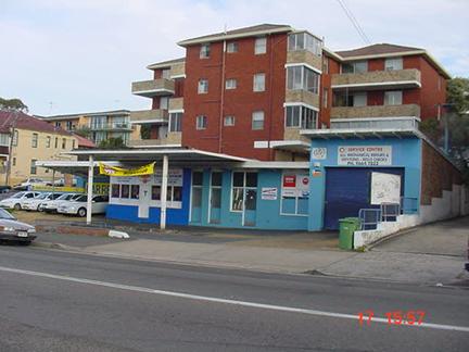
Figure 1 – subject site from Coogee Bay Road with 88B Mount Street to the rear
The site to the
south (88B Mount
Street) is
significantly elevated (approximately 2m to 2.5m) with respect to the subject
site and is contained by a retaining wall along the southern boundary of the
site. Located on the adjoining site to the south (88B Mount Street) is a four storey residential
flat building (its relationship with the subject site can be seen in Figure 1).
Adjoining the site to the west on
Coogee Bay Road is a four (4) level residential flat building (141 Coogee Bay
Road) consisting of three (3) residential levels, with parking at grade to the
street (see Figure 2).
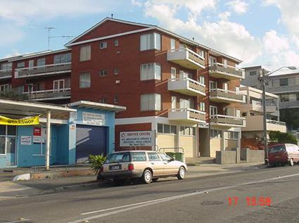
Figure 2 – 141 Coogee Bay Road
3. SITE HISTORY
a. APPLICATION HISTORY
The original Development
Application (DA/1049/2002) for the demolition of the existing service station
and construction of a four storey multi-unit housing development containing 7 x
one bedroom dwellings and the strata subdivision of the building was approved
at the Ordinary Council meeting on 26 August 2003 subject to conditions.
b. HISTORY OF SITE USAGE
The site has a previous history of
use as a petrol station and mechanical workshop from approximately 1956,
documented by Council records, to the present day.
4. THE PROPOSED MODIFICATIONS
The subject application seeks
consent to modify the consent in the following manner:
4.1 Physical/Design Modifications
Basement Floor Level
- repositioning of internal stairs
to dwellings above;
- repositioning/reconfiguration of
fire stairs;
- provision of a lift in the
south-eastern corner of the level to service the dwelling at second floor (i.e.
Dwelling No. 6);
- reconfiguration of parking spaces
(no change in number of spaces);
- provision of storage areas along
the northern edge of the basement;
- provision for all seven (7)
parking spaces to also be carwash bays (as per Condition No. 66);
- minor reduction in the eastern
extent of the basement;
- provision of a garbage storage
room in the western end of the basement (previously provided at the eastern end
of the site at ground floor level);
- provision of a traffic signalling
system, as per Condition No. 43;
- adjustment to driveway ramp
gradients;
- provision of vertical bicycle
racks in the western end of the basement;
Ground Floor Level
- reconfiguration of fire stairs on
the eastern side of the building;
- change to eastern side of driveway
to accommodate the reconfigured fire stair;
- minor change to arrangement of
stair access to the units from Coogee Bay Road;
- reconfiguration of the dwellings;
- relocation of garbage storage area
from the eastern end of the level to the basement;
- deletion of the steps and
associated space on the north-eastern corner of the site;
- provision of two (2) pedestrian
entrances from Mount
Street;
First Floor Level
- reconfiguration of the dwellings
and conversion from five (5) x one bedroom to five (5) x two bedroom;
Second Floor Level
- deletion of Dwelling No. 7;
- re-planning of Dwelling No. 6 into
a three (3) bedroom apartment with associated terrace;
- enlargement and re-planning of
planter bed, as per Condition No. 4;
Elevations:
- relocation/reconfiguration of
various windows; and
- continuation of stone perimeter
wall along the Mount
Street boundary.
4.2 Modification of
Conditions
4.2.1 Modify Condition No. 1 (approved plans)
Condition No. 1 currently reads as
follows:
“The development must be
implemented substantially in accordance with the plans numbered DA01-13, dated
4th June 2003, prepared by Turner Associates, Landscape Plans sk01
and 02 prepared by McGregor and Partners and Draft Strata Plans with Surveyor
Reference 22154D.T./Coogee Bay, Sheets 1-5 prepared by David John Tremain of
Harrison Friedmann and Associates P/L dated the 2nd June 2003, all
received by Council on the 12th June 2003, the application form and
on ay supporting information received with the application, except as may be
amended by the following conditions and as may be shown in red on the attached
plans:”
It is proposed to modify Condition
No. 1 to read as follows (modifications in bold):
“The development must be
implemented substantially in accordance with the plans numbered DA01-13, dated
4th June 2003, prepared by Turner Associates, Landscape Plans sk01
and 02 prepared by McGregor and Partners and Draft Strata Plans with Surveyor
Reference 22154D.T./Coogee Bay, Sheets 1-5 prepared by David John Tremain of
Harrison Friedmann and Associates P/L dated the 2nd June 2003, all
received by Council on the 12th June 2003, the application form and
on ay supporting information received with the application, and as modified
by Section 96 documentation including plans numbered DA01 Rev. A, DA02 Rev. C,
DA03 Rev. C, DA04 Rev. D; DA05 Rev. D, DA06 Rev. C, DA07 Rev. D, DA08 Rev. D,
DA09 Rev. D, DA10 Rev. D, DA11 Rev. C, DA12 Rev. B, DA13 Rev. B, DA14 Rev. C,
DA15 Rev. A dated 12 June 2007, prepared by Turner and Associates, and draft
strata plan 25984 DT/Coogee, dated 14 June 2007 prepared by Harris Freidman and
Associates, and stamped received by Council on 15 June 2007 except as may
be amended by the following conditions and as may be shown in red on the
attached plans.”
4.2.2 Modify
Condition No. 7 (power supply)
Condition No. 7 currently reads as
follows:
“Power supply and
telecommunications cabling to the development shall be underground.”
It is proposed to modify Condition
No. 7 to read as follows (modifications in bold):
“New power supply and
telecommunications cabling to the development (connecting to existing above
ground cabling) shall be underground.”
4.2.3 Delete Condition No. 31 (fit-out of
commercial tenancies)
Condition No. 31 currently reads
as follows:
“The use of commercial tenancies
and internal fitouts shall be subject to a separate development application and
consent, in accordance with the provisions of the Environmental Planning and
Assessment Act 1979.”
It is proposed to delete this
Condition.
4.2.4 Delete
Condition No. 72 (waste management area)
Condition No. 72 currently reads
as follows:
“The proposed waste management
area shall be constructed at grade with Council’s footpath level at the gate
entrance from Mount
Street.
Details of such shall be provided prior to the issue of the construction
certificate.”
It is proposed to delete this
condition.
4.2.5 Modify
Condition No. 81 (Landscape bond)
Condition No. 81 currently reads
as follows:
“A refundable deposit in the form
of cash or cheque for the amount of $7,000.00 shall be lodged with Council
prior to a construction certificate being issued for the proposed development
to ensure the implementation and maintenance of the landscape works in
accordance with the approved landscape documentation.
a) The
refundable deposit will be released twelve (12) months after the issue of a
final occupation certificate by the principle certifying authority providing
the landscape works have been successfully implemented and maintained in
accordance with the approved landscape documentation. Throughout the
maintenance/bond period, the applicant shall be responsible for all routine
maintenance such as grass cutting, weeding, watering, fertilizing, spraying,
staking and replacement of all failed plant stock. There must be no alteration
to the original design, including substitution of trees and shrubs, without the
prior approval of the Principal Certifying Authority.
b) Any
contravention of Council’s Landscape conditions at any time during the
construction period or prior to the expiration of a period of twelve (12)
months from the date of a final occupation certificate is issued will result in
the Council claiming all or part of the lodged security.”
It is proposed to re-word this
condition so that it reads as follows (modifications in bold):
“The applicant shall provide
Council with certification from a suitably qualified Landscape Architect (who
is eligible for membership with the Australian Institute of Landscape
Architects), confirming that they have inspected the site 12 months after the
issue of an occupation certificate and that the landscape works have been
successfully implemented and maintained in accordance with the approved
landscape documentation.”
4.2.6 Modify
Condition No. 101 (dilapidation report)
Condition No. 101 currently reads
as follows:
“A dilapidation report prepared by
a professional engineer or suitably qualified and experienced building surveyor
shall be submitted to the certifying authority prior to the commencement of
demolition, excavation or building works detailing the current condition and
status of all buildings, including ancillary structures (ie including
dwellings, residential flat buildings, commercial/industrial buildings,
garages, carports, verandahs, fences, retaining walls, swimming pools and
driveways etc) located upon all of the adjoining premises.
The report is to be supported with
photographic evidence of the status and condition of the buildings and a copy
of the report must also be forwarded to the Council and to the owners of each
of the abovestated premises, prior to the commencement of any works.”
It is proposed to modify Condition
No. 101 to read as follows (modifications in bold):
“A dilapidation report prepared by
a professional engineer or suitably qualified and experienced building surveyor
shall be submitted to the certifying authority prior to the commencement of
demolition, excavation or building works detailing the current condition and
status of all buildings, including ancillary structures (ie including
dwellings, residential flat buildings, commercial/industrial buildings,
garages, carports, verandahs, fences, retaining walls, swimming pools and
driveways etc) located upon all of the adjoining premises.
The report is to be supported with
photographic evidence of the status and condition of the buildings and a copy
of the report must also be forwarded to the Council and to the owners of each
of the abovestated premises, prior to the commencement of any works.
In the event that a neighbouring
property owner denies consent to the engineer or building surveyor to undertake
the dilapidation report, documentary evidence demonstrating that all reasonable
attempts have been made to access these properties, shall be submitted to the
principal certifying authority prior to the commencement of any works.”
4.2.7 Modify
Condition No. 127 (S94 Contributions)
Condition No. 127 currently reads
as follows:
“In accordance with Council’s
Section 94 Contributions Plan effective from 2 September 1999, the following
monetary contribution is to be paid to Council:
a) for the provision or
improvement of open space $8366.95
b) for the provision or
improvement of community facilities $3696.00
c) Administration fee $425.00
The contribution must be paid in
cash or by bank cheque prior to a construction certificate being issued for the
proposed development together with payment of the required Section 94
Administration Fee of $425.00. Council’s Section 94 Contribution Plans may be
inspected at the Customer Service Centre, Administrative Centre, 30 Frances Street, Randwick.”
It is proposed to modify Condition
No. 101 to read as follows (modifications in strikethrough and bold):
“In accordance with Council’s
Section 94 Contributions Plan effective from 2 September 1999, the following
monetary contribution is to be paid to Council:
a) for the provision or
improvement of open space $11696.40
b) for the provision or
improvement of community facilities $5171.60
c) Administration fee $425.00
The contribution must be paid in
cash or by bank cheque prior to a construction certificate being issued for the
proposed development Council’s Section 94 Contribution Plans may be inspected
at the Customer Service Centre, Administrative Centre, 30 Frances Street,
Randwick.”
5 COMMUNITY CONSULTATION:
The proposal has been notified and
advertised in accordance with the Development Control Plan for Public
Notification. As a result, no submission was received.
6 TECHNICAL OFFICERS COMMENTS
6.1 Development
Engineer
Council’s
Development Engineer advises as follows:
“An application has been received to modify development
consent for construction of a residential flat building at the above site
containing 7 x 1 bedroom units and basement carparking.
The major modification is convert the development to 5 x 2
bedroom units and 1 x 3 bedroom unit.
Carspace Numbers
The modified development would require 9 car spaces which
was the same requirement for the original proposal however the development was
approved with only 7 car spaces. Council’s Traffic Engineer in August 2003
advised that “considering site constraints and the addition of a further on
street parking space the parking was considered satisfactory” and thus the
original application was approved with 7 car spaces. Development Engineering
believes this to be the same with this modification.
Basement Carpark Comments
One of the modifications to the development consent relate
to the re-organisation of the basement carpark layout which shows the deletion
of the turning bay and the allocating of all 7 carspaces along the northern
basement carpark wall.
The assessing officer is advised that the turning path
diagrams, received by Council (7/8/07) and the associated comments from
TRAFFIX conclude that:
“ car space No 7 can only be
accessed via a 50th percentile car and will need to be signposted as
a small car space”
In regards to the comments made by TRAFFIX the assessing
officer is advised that Development Engineering does not support the
allocation of “small car space” in residential developments and these
are only supported in commercial parking developments.
Should the assessing officer consider approving the S96
application then car space No 7 (the eastern most car space) shall be allocated
to Unit 6 of the development proposal and be signposted as recommended.
The following conditions shall be included should
the S96 application be approved:
1) Prior to the
issuing of a Final Occupation Certificate car space No 7 shall be signposted as
a “small car space”.
2) Car space No
7 shall be shown on the title of Unit No 6 as a small car space.
3) Internal
driveway gradients shall be constructed in accordance with ramp sections for
the inside edge, middle of ramp and outside edge as shown on the submitted
plans to Council by Turner & Associates marked Job No 02029, Drwg No DA02,
Rev F, Printed 20 July 07
Deletion of Condition No. 72
The Planning Officer is advised that as the proposed
garbage area has been relocated from the Mount Street frontage to the basement carpark, Condition No 72
of the DA Consent, which states:
“The proposed waste management
area shall be constructed to be at grade with Council’s footpath level at the
gate entrance from Mount Street. Details of such shall be provided prior to the issue of the
construction certificate.”
There are no objections to the deletion of
Condition No. 72 of the Development Consent
The applicant has stated that they are willing to accept a
condition of consent requiring the registration of a Section 88B instrument
noting the transfer of bins between the basement and kerb for weekly collection
is the responsibility of the Owners Corporation. Development Engineering
believes this to be unnecessary as the grade of the internal driveway on its
outer edge is at 1:8 and thus no condition has been included.
Modification of Condition No. 81
The Planning Officer is advised that discussions with
Council’s Landscape Development Officer have taken place regarding the proposed
modification of Condition No 81 of the Development Consent and the Landscape
Development Officer has advised that there are no objections to Condition No 81
being modified to read as follows:
Prior to the issuing of a final
occupation certificate the applicant shall supply Council with certification
from a suitably qualified Landscape Architect, (who is eligible for membership with
the Australian Institute of Landscape Architects), stating:
The Development
Consent Condition number that the inspection relates to
The date the site
was inspected.
That landscape works have been
successfully implemented in accordance with the approved landscape
documentation.
The Planning Officer is advised that the remaining
conditions which seek modification or deletion are not Development Engineering
Conditions.”
7 SECTION 96 ASSESSMENT
Under the provisions of Section 96 of the Environmental
Planning and Assessment Act, 1979, as amended, Council may only agree to a
modification of an existing Development Consent if the following criteria has
been complied with:
7.1 Substantially the same
Council may only approve an application under section 96(2)
of the Act if “it is satisfied that the development to which the consent as
modified relates is substantially the same development as the development for
which the consent was originally granted and before that consent as originally
granted was modified (if at all) under this section”.
The proposed modifications will not change the nature of
the development and the works will result in an application that is
substantially the same as that for which consent was originally granted. The
proposed modifications to the approved development are considered to be minor
and will not result in any significant additional impacts upon either the
amenity of the adjoining premises or the streetscape.
7.2 Consideration of
submissions
The owners of adjoining and neighbouring properties were
notified of the proposed modifications in accordance with the DCP – Public
Notification. The proposal was also advertised in the local press. As a result
of this process, no submission was received.
8 ENVIRONMENTAL ASSESSMENT
The subject site has the benefit of existing use rights
and accordingly was not required to conform with the development controls that
would otherwise be applicable. As such, the assessment has been made on the
merits of the proposed modifications.
8.1 Bulk
and Scale
The proposed modifications will
introduce approximately 50sqm of additional gross floor area (calculated in
accordance with the current definition). It is not considered that the
additional floor space will result in any significant adverse environmental
impacts on the amenity of the adjoining properties as the additional area is
generally located within the same building envelope as the approved
development. The size, bulk and scale of the amended proposal will still be
consistent with the existing built form in the locality.
8.2 Setbacks
A comparison of the numerical aspects of the approved and
proposed modified development is provided in Table 1 below.
Table 1: Comparison of the setbacks of the approved and
proposed modified development from site boundaries
|
Setbacks
|
Approved
|
Proposed
|
|
Front (Coogee Bay Road)
|
·
nil at
basement level
·
3.2m – 4m at
Level 1
·
3.2m – 5.1m
at Level 2
·
4.5m at
Level 3
|
·
nil at
basement level
·
3.16m at
Level 1
·
2.4m at
Level 2
·
4.6m to 5.9m
at Level 3
|
|
Rear (south)
|
·
nil at
basement level
·
1.695m –
3.06m over all habitable levels
|
·
nil at
basement level
·
1.4m over
all habitable levels
|
|
Side (Mount Street)
|
·
0.2m at
basement level
·
1.3m over
all habitable levels
|
·
1.2m at
basement level
·
1.2m over
all habitable levels
|
|
Side (west)
|
·
6.3m at
basement level
·
7m – 8.33m
over all habitable levels
|
·
6.3m at
basement level
·
7.6m at
Levels 1 & 2
·
11.8m at
Level 3
|
As indicated above, the setbacks of the approved
development will be slightly altered by the proposed modifications. However, it
is considered that the variations are minor and will not result in any
unreasonable impacts with regard to views and overshadowing.
8.3 View Sharing
It is considered that the degree of view loss from the
affected properties would be minimal as the proposed modifications do not alter
the height of the approved development and the variation with the setbacks will
not result in any significant additional view loss from the adjoining
properties. On this basis, the proposed modifications are considered acceptable
in the context.
8.4 Overshadowing
Shadow diagrams have been submitted with the subject
application for 9.00am, 11.00am, 1.00pm and 3.00pm for the winter solstice showing the shadow impacts of the
approved and proposed modified development. The shadow diagrams indicate that
the proposed modifications will have minimal additional overshadowing impact on
the adjoining property at No. 88B Mount Street. All of the north facing windows of the dwellings within
the building will continue to receive at least 3 hours of solar access required
under the Development Control Plan for Multi-Unit Housing. It should be also
noted that the proposal will reduce the shadow impact on the northern-most
balconies and living areas on the eastern side of 141 Coogee Bay Road at 9.00am.
8.5 Parking
The proposed modifications will not result in any
additional parking demand as the variation with the dwelling types will still
require the same amount of parking spaces under the DCP for Parking.
Notwithstanding, as noted previously in the Development Engineer’s comments
that car space No. 7 is only suitable for small car and as such an additional
condition is to be included should the subject application be approved to
ensure car space No. 7 is signposted as a small car space and the space be
shown on the title of Dwelling No. 6.
8.6 Assessment
of the modifications to the conditions
As noted previously, the subject application also seeks
consent to modify/delete several conditions of consent, as follows:
· modify Condition No. 1 (approved
documentation);
Condition No. 1 currently reads as follows:
“The development must be implemented substantially in
accordance with the plans numbered DA01-13, dated 4th June 2003,
prepared by Turner Associates, Landscape Plans sk01 and 02 prepared by McGregor
and Partners and Draft Strata Plans with Surveyor Reference 22154D.T./Coogee
Bay, Sheets 1-5 prepared by David John Tremain of Harrison Friedmann and
Associates P/L dated the 2nd June 2003, all received by Council on
the 12th June 2003, the application form and on ay supporting
information received with the application, except as may be amended by the
following conditions and as may be shown in red on the attached plans:”
Comment:
Condition No. 1 relates to the approved documentation and
therefore the wording of the condition will need to be amended to include the
plans lodged with the subject Section 96 application.
· modify Condition No. 7 (power
supply);
Condition No. 7 currently reads as follows:
“Power supply and telecommunications cabling to the
development shall be underground.”
It is proposed to modify Condition No. 7 to read as
follows (modifications in bold):
“New power supply and telecommunications cabling to
the development (connecting to existing above ground cabling) shall be
underground.”
Comment:
No objection to the modification of this condition.
It is noted that the original approval does not contain
any condition requiring the power supply and telecommunications cabling to be
relocated underground and therefore it is considered that the retention of this
condition is unnecessary.
· delete Condition No. 31 (fitout
and use of commercial tenancies);
Condition No. 31 currently reads as follows:
“The use of commercial tenancies and internal fitouts
shall be subject to a separate development application and consent, in
accordance with the provisions of the Environmental Planning and Assessment Act
1979.”
Comment:
It is considered that the retention of the above condition
is unnecessary as the approved development does not contain any commercial
tenancies.
· delete Condition No. 72 (waste
management area);
Condition No. 72 currently reads as follows:
“The proposed waste management
area shall be constructed at grade with Council’s footpath level at the gate
entrance from Mount
Street.
Details of such shall be provided prior to the issue of the construction
certificate.”
Comment:
As note in the Development Engineer’s comments above,
there are no objections to the deletion of this condition.
· modify Condition No. 81
(landscape bond);
Condition No. 81 currently reads as follows:
“A refundable deposit in the form of cash or cheque for
the amount of $7,000.00 shall be lodged with Council prior to a construction
certificate being issued for the proposed development to ensure the
implementation and maintenance of the landscape works in accordance with the
approved landscape documentation.
a) The
refundable deposit will be released twelve (12) months after the issue of a
final occupation certificate by the principle certifying authority providing
the landscape works have been successfully implemented and maintained in
accordance with the approved landscape documentation. Throughout the
maintenance/bond period, the applicant shall be responsible for all routine
maintenance such as grass cutting, weeding, watering, fertilizing, spraying,
staking and replacement of all failed plant stock. There must be no alteration
to the original design, including substitution of trees and shrubs, without the
prior approval of the Principal Certifying Authority.
b) Any
contravention of Council’s Landscape conditions at any time during the
construction period or prior to the expiration of a period of twelve (12)
months from the date of a final occupation certificate is issued will result in
the Council claiming all or part of the lodged security.”
Comment:
As noted previously in the Development Engineer’s comments
that there are no objections to Condition No. 81 being modified to read as
follows:
“Prior to the issuing of a final occupation certificate
the applicant shall supply Council with certification from a suitably qualified
Landscape Architect, (who is eligible for membership with the Australian
Institute of Landscape Architects), stating:
- The Development Consent Condition
number that the inspection relates to.
- The date the site was inspected.
- That landscape works have been
successfully implemented in accordance with the approved landscape
documentation.”
· modify Condition No. 101
(dilapidation report; and
Condition No. 101 currently reads as follows:
“A dilapidation report prepared by a professional engineer
or suitably qualified and experienced building surveyor shall be submitted to
the certifying authority prior to the commencement of demolition, excavation or
building works detailing the current condition and status of all buildings,
including ancillary structures (ie including dwellings, residential flat
buildings, commercial/industrial buildings, garages, carports, verandahs,
fences, retaining walls, swimming pools and driveways etc) located upon all of
the adjoining premises.
The report is to be supported with photographic evidence
of the status and condition of the buildings and a copy of the report must also
be forwarded to the Council and to the owners of each of the abovestated
premises, prior to the commencement of any works.”
It is proposed to modify Condition No. 101 to read as
follows (modifications in bold):
“A dilapidation report prepared by a professional engineer
or suitably qualified and experienced building surveyor shall be submitted to
the certifying authority prior to the commencement of demolition, excavation or
building works detailing the current condition and status of all buildings,
including ancillary structures (ie including dwellings, residential flat
buildings, commercial/industrial buildings, garages, carports, verandahs,
fences, retaining walls, swimming pools and driveways etc) located upon all of
the adjoining premises.
The report is to be supported with photographic evidence
of the status and condition of the buildings and a copy of the report must also
be forwarded to the Council and to the owners of each of the abovestated
premises, prior to the commencement of any works.
In the event that a neighbouring property owner
denies consent to the engineer or building surveyor to undertake the
dilapidation report, documentary evidence demonstrating that all reasonable
attempts have been made to access these properties, shall be submitted to the
principal certifying authority prior to the commencement of any works.”
Comment:
Council’s Building Surveyor has advised that there are no
objections to the proposed modification of Condition No. 101.
· modify Condition No. 127 (S94
Contributions).
Condition No. 127 currently reads as follows:
“In accordance with Council’s
Section 94 Contributions Plan effective from 2 September 1999, the following
monetary contribution is to be paid to Council:
a) for the provision or
improvement of open space $8366.95
b) for the provision or
improvement of community facilities $3696.00
c) Administration fee $425.00
The contribution must be paid in
cash or by bank cheque prior to a construction certificate being issued for the
proposed development together with payment of the required Section 94
Administration Fee of $425.00. Council’s Section 94 Contribution Plans may be
inspected at the Customer Service Centre, Administrative Centre, 30 Frances Street, Randwick.”
Comment:
The proposed mix of dwellings is changed by the subject
Section 96 application, as such, the contribution levies will have to be
amended to correlate with the new mix of dwellings. In this regard, Condition
No. 127 is to be modified to read as follows:
“In accordance with Council’s
Section 94 Contributions Plan effective from 2 September 1999, the following
monetary contribution is to be paid to Council:
a) for the provision or improvement
of open space $11,696.40
b) for the provision or improvement
of community facilities $ 5,171.60
c) Administration fee $
425.00
The contribution must be paid in
cash or by bank cheque prior to a construction certificate being issued for the
proposed development. Council’s Section 94 Contribution Plans may be inspected
at the Customer Service Centre, Administrative Centre, 30 Frances Street, Randwick.”
9 RELATIONSHIP TO CITY PLAN
The relationship with the City
Plan is as follows:
Outcome 4: Excellence in urban design and
development.
Direction 4a: Improve design
and sustainability across all development
10 FINANCIAL IMPACT STATEMENT
There is no direct financial impact for this matter.
11 CONCLUSION
It is considered that the proposed
modifications to the original consent satisfy the provisions of Section 96(2)
of the Environmental Planning and Assessment Act, 1979 (as amended) and will
constitute substantially the same development.
The proposed modifications are
considered acceptable and the works will not result in any unreasonable
additional impact on the amenity of the adjoining properties. As such, the
subject application is recommended for approval.
RECOMMENDATION:
A. THAT
Council as the responsible authority grant its consent under Section 96 of the
Environmental Planning and Assessment Act 1979 (as amended) to Modify
Development Consent No.. 1049/2002 on property at 143-147 Coogee Bay Road, Coogee, in the following manner:
·
Amend
Condition No. 1 to read:
1. The
development must be implemented substantially in accordance with the plans
numbered DA01-13, dated the 4th June, 2003 prepared by Turner Associates,
Landscape Plans sk 01 and 02 prepared by McGregor and partners and Draft Strata
Plans with Surveyor’ Reference 22154 D.T./Coogee Bay, Sheets 1 – 5, prepared by
David John Tremain of Harrison Friedmann and Associates P/L dated the2nd June,
2003, all received by Council on the 12th June, 2003, the application form and
on any supporting information received with the application, and as
modified by Section 96 documentation including plans numbered DA01 Rev. A, DA02
Rev. D, DA03 Rev. D, DA04 Rev. D; DA05 Rev. E, DA06 Rev. D, DA07 Rev. E, DA08
Rev. E, DA09 Rev. E, DA10 Rev. E, DA11 Rev. D, DA12 Rev. C, & DA13 Rev. C,
dated 12 June 2007, prepared by Turner and Associates, and draft strata plans,
Sheets 1-5, dated 14 June 2007, prepared by Harris Freidman and Associates, and
all stamped received by Council on 15 June 2007, except as may be
amended by the following conditions and as may be shown in red on the attached
plans:
·
Amend
Condition No. 7 to read:
7. New power supply and
telecommunications cabling to the development (connecting to existing above
ground cabling) shall be underground.
·
Delete
Condition No. 31
·
Delete
Condition No. 72
·
Amend
Condition No. 81 to read:
81. Prior to the
issuing of a final occupation certificate the applicant shall supply Council
with certification from a suitably qualified Landscape Architect, (who is
eligible for membership with the Australian Institute of Landscape Architects),
stating:
- The Development Consent Condition
number that the inspection relates to.
- The date the site was inspected.
- That landscape works have been
successfully implemented in accordance with the approved landscape
documentation.
·
Amend
Condition No. 101 to read:
101. A
dilapidation report prepared by a professional engineer or suitably qualified
and experienced building surveyor shall be submitted to the certifying
authority prior to the commencement of demolition, excavation or building works
detailing the current condition and status of all buildings, including
ancillary structures (ie including dwellings, residential flat buildings,
commercial/industrial buildings, garages, carports, verandahs, fences,
retaining walls, swimming pools and driveways etc) located upon all of the
adjoining premises.
The report is to be supported with
photographic evidence of the status and condition of the buildings and a copy
of the report must also be forwarded to the Council and to the owners of each
of the above stated premises, prior to the commencement of any works.
In the event that a neighbouring
property owner denies consent to the engineer or building surveyor to undertake
the dilapidation report, documentary evidence demonstrating that all reasonable
attempts have been made to access these properties, shall be submitted to the
principal certifying authority prior to the commencement of any works.
·
Amend
Condition No. 127 to read:
127. In accordance
with Council’s Section 94 Contributions Plan effective from 2 September 1999, the following monetary
contribution is to be paid to Council:
a) for the provision or
improvement of open space $11,696.40
b) for the provision or improvement
of community facilities $ 5,171.60
c) Administration fee
$ 425.00
The contribution must be paid in
cash or by bank cheque prior to a construction certificate being issued for the
proposed development. Council’s Section 94 Contribution Plans may be inspected
at the Customer Service Centre, Administrative Centre, 30 Frances Street, Randwick.
·
Add the
following conditions:
a. Prior to the
issuing of a Final Occupation Certificate car space No. 7 shall be signposted
as a “small car space”.
b. Car space No
7 shall be shown on the title of Dwelling No. 6 as a small car space.
136. Internal
driveway gradients shall be constructed in accordance with ramp sections for
the inside edge, middle of ramp and outside edge as shown on the submitted
plans to Council by Turner & Associates marked Job No. 02029, Drwg No DA02,
Rev F, Printed 20 July 07.
ATTACHMENT/S:
Nil
Development Application Report
|
REPORT
BY: DIRECTOR,
CITY PLANNING
|
|
|
|
|
Subject
Site
|
|
|
|
|
|
|
|
|
|
Submissions
received
|
|
Ù
North
|
|
LOCALITY
PLAN
|
1. EXECUTIVE SUMMARY
The application is for a Section 96(2) Modification of
Development Consent 303/01 by altering the internal stair layout and increasing
the length of the upper level.
The application is referred to Council for determination
at the request of Councillors Tracey, Procopiadis and White.
One objection has been received from No.28 Mawson Parade
raising concern with the bulk and scale of the proposal, overshadowing and loss
of light and ventilation.
There will not be any significant additional impacts upon
the amenity of the adjoining property.
The application is recommended for approval.
2. THE
PROPOSAL
The proposed modification seeks consent to reconfigure the
internal stair layout and increase the length of the upper level by 1.21m and
carryout alterations to the window placement in the rear and northern side
elevation of the building. The modification will provide for 7m² of additional
floor area to the building.
3. THE
SUBJECT SITE AND SURROUNDING AREA:
The subject site is on the western side of Mawson Parade
on the corner of Melba
Avenue and has a
splayed frontage of up to 5.2m to Mawson Parade and 27.04m to Melba Avenue, the site area is 158m². The
premises is within a small strip of local business premises containing a
variety of uses. The site is bounded to the west and east by a variety of
development including single storey dwellings and a number of small scale multi
unit public housing development.
4. SITE
HISTORY
The current approval details alterations and additions to
the existing building to provide a first floor addition to the building to
provide a larger dwelling component. Approval was granted to the application on
the 15 May 2001. Excavation and stormwater works
have been carried out before the expiration of the consent, which has been
confirmed by the Certifying Authority.
5. SECTION 96
ASSESSMENT:
Under the provisions of Section 96 of the Environmental
Planning and Assessment Act, 1979, as amended, Council may only agree to a
modification of an existing Development Consent if the development is
substantially the same development. The proposed modifications to the approved
plans will result in the development being substantially the same development
as the proposed enlargement in the building is relatively minor and will only
be increased in length by 1.2m.
6. COMMUNITY
CONSULTATION:
The proposal has been notified in accordance with the
Local Environmental Plan 1998. The following submission was received:
A Niland and V Urboniene-Niland of 28 Mawson Parade
Chifley
|
Issue
|
Comment
|
|
The development is substantially larger and higher that
the previously approved plans.
|
The development is 1.2m longer than the approved upper
level and the ridge height is identical to the approved application.
|
|
The new plans will block light, sun and air to their
windows.
|
The proposed modification will not result in any
significant difference in the impacts upon their property.
|
|
The lack of light and ventilation affect their health.
|
The development remains substantially the same and will
not result in any difference to the light and ventilation to their property.
|
|
Their out door balcony will be adversely affected.
|
The development remains substantially the same and will
not result in any difference to the light and ventilation to their property
or adversely affect their balcony.
|
|
The development will result in heavy overshadowing to
their backyard.
|
The proposed modification will not result in any
significant difference in the impacts upon their property.
|
|
The plans are a dramatic change from what was originally
approved.
|
The modifications represent substantially the same
development as is required by the definition of a Section 96 application.
|
|
The proposed development is less than 1m from their
boundary and should be amended to satisfy current council requirements.
|
A section 96 application is not an opportunity to
revisit the merits of the original application.
|
7. RELEVANT
ENVIRONMENTAL PLANNING INSTRUMENTS
The site is zoned 3B under
Randwick Local Environmental Plan 1998 and the proposed activity is permissible
with Council’s consent and is generally consistent with the general aims of
RLEP 1998 and the specific objectives of the zone in that the proposed activity
and built form will enhance and compliment the aesthetic character,
environmental qualities and social amenity of the locality.
8. ENVIRONMENTAL
ASSESSMENT
The site has been inspected and
the application has been assessed having regard to Section 79C of the
Environmental Planning and Assessment Act, 1979, as amended.
8.1 Bulk
and Scale of development
The immediate locality contains a mixture of two storey
public housing development, single and two storey free standing dwellings and
adjoining two storey commercial premises. All of the other commercial premises,
except one, have similar scale upper levels and the original proposal was
designed to be consistent in bulk and scale with the adjoining premises,
particularly with respect to the roof pitch and ridge height. The proposed
modification to the approved development maintains the consistency with the
adjoining buildings and overall the building remains compatible with the
character of the locality.
The floor space ratio within 3B
zones is defined in the LEP as being 1:1, the additional floor space to the
building will result in a floor space ratio of 1.04:1 which in the context of
the approved bulk is considered negligible and will not result in any
significant additional impacts upon the amenity of the adjoining property.
8.2 Overshadowing
With the original application shadow
diagrams indicated the extent of additional overshadowing that would result
from the new upper level. The proposed modification will not result in any
substantial additional overshadowing to the adjoining premises and the minimum
of three hours of solar access is maintained.
8.3 Privacy
The modifications to the approved development will not
result in any additional loss of privacy as the continuation of the blade wall
upon the southern boundary will act as a screening device which will prevent
direct overlooking of the adjoining property. With respect to the impact upon
the premises to the rear and north the setback of the building from both of
these premises is substantial enough to provide for a degree of privacy from
the balconies and windows within the upper level.
8.4 Setbacks
The approved alterations and additions to the building
maintains the existing southern setback up to the boundary with the
continuation of the party wall which is consistent with the other buildings in
this group of buildings which have continued the party wall upon the side boundary,
and will not result in any significant impact upon the amenity of the adjoining
building. The northern side boundary setback also maintains the existing
setback to the boundary which is to the corner of Melba Avenue and will not detract from the local
streetscape or adversely impact upon any nearby building.
8.5 Landscaping
The proposed modification will not have any impact upon
the approved levels of landscaping on the site.
8.6 Relationship
to adjacent premises
As has been discussed the proposed
upper level addition has been designed to be in keeping with the established
bulk and scale of the adjoining premises and the proposed modification to the
approved development will not alter the compatibility with the adjoining
buildings.
9. RELATIONSHIP
TO CITY PLAN
The relationship with the City
Plan is as follows:
Outcome 4: Excellence in urban design and development.
Direction 4a: Improved design and sustainability
across all development.
10. CONCLUSION
The proposed modification to the approved plans complies
with the relevant assessment criteria and will not result in any significant
additional adverse impacts upon either the amenity of the adjoining premises or
the character of the locality.
RECOMMENDATION:
THAT Council as the consent authority,
grant its consent under Section 96 of the Environmental Planning and Assessment
Act 1979 as amended to modify Development Consent No DA/303/2001 for permission
to carryout alterations and additions to the building in the following manner:
Amend Condition 1 to read:
The development must be implemented substantially in
accordance with the plans numbered 1-15 inclusive, dated July 2000 and received
by Council on the 11th April 2001, the application form and on any
supporting information received with the application, as amended by the Section
96 plans dated March 2007 and received by Council on the 2nd April
2007, only in so far as they relate to the modifications highlighted on the
Section 96 plans and detailed in the Section 96 application, except as
may be amended by the following conditions and as may be shown in red on the
attached plans.
ATTACHMENT/S:
Nil
Development Application Report
|
REPORT
BY: DIRECTOR,
CITY PLANNING
|
|
|
|
|
Subject
Site
|
|
|
|
|
|
|
|
|
|
Submissions
received
|
|
Ù
North
|
|
LOCALITY
PLAN
|
1. EXECUTIVE SUMMARY
The application is referred to Council for determination
at the request of Councillors Woodsmith, Matson and Hughes.
The application details alterations and additions to the
dwelling including a new first floor and extension to ground floor, an in
ground swimming pool in the rear yard and car space to the front of the
dwelling.
The main issues are the impacts upon the amenity of the
adjoining properties in terms of overshadowing and loss of privacy and the
impact of the proposal on the streetscape.
The application is recommended for approval.
2. THE PROPOSAL
The application details alterations and additions to the
rear of the dwelling to provide for an open plan kitchen and living room
opening onto a paved courtyard and a light well within the eastern side of the
dwelling. The existing floor plan at the front of the dwelling will be
reconfigured to provide for one bedroom and a bathroom. It is also proposed to
erect an upper level comprising three bedrooms, a bathroom and balcony to the
front of the dwelling. The alterations and additions to the dwelling will
provide for 107m² of additional floor area to the dwelling.
The application also proposes the installation of a hard
stand car space to the front of the dwelling and an in ground swimming pool and
attached outbuilding within the rear yard.
3. THE SUBJECT SITE AND
SURROUNDING AREA
The site is on the northern side of Hooper Street and has street frontage of 6.28m
and side boundary depth of 41.27m and overall site area of 259m². The site
falls from the rear towards the street with a difference in level of up to 2m.
The locality is residential in nature and contains a mixture of terrace style,
semi detached and free standing dwellings and multi unit housing development.
4. COMMUNITY CONSULTATION:
The
proposal has been notified in accordance with the DCP - Notification. The
following submissions were received:
4.1 Objections
to original exhibition
Owners of Strata Plan 44290, 46 Pine Street Randwick
|
Issue
|
Comment
|
|
Request that Council impose a condition to ensure that
there is no encroachment upon their property and that the stability of their
laundry building which is close to the rear boundary be protected.
|
These matters are adequately addressed by conditions of
consent.
|
J & E Parsons of 38 Hooper Street Randwick
|
Issue
|
Comment
|
|
The proposed floor space ratio
of the development will be over the allowable limit.
|
See detailed assessment of floor
space ratio and compliance with the DCP controls in Section 7.
|
|
The proposed height of the eaves
is over the maximum.
|
The overall height of the
building, as amended, complies with the maximum controls in the DCP.
|
|
All properties to the east and
west are over shadowed by the development.
|
The subject and adjoining sites
are orientated with the rear yard and rear portion of the dwellings being
sited directly to the north and additional shadows are cast primarily upon
the side windows and roofs of the adjoining properties with the existing rear
yard and north facing windows within the adjoining dwellings not being
subject to any significant additional overshadowing.
|
|
The design of the development is
not in keeping with the other houses in Hooper Street.
|
Hooper Street contains a wide
variety of building forms and styles including terrace style and semi
detached dwellings, free standing dwellings and three and four storey multi
unit housing development of varying ages, with some in original form and many
altered. An argument cannot be made that the existing character of
development in the street is consistent and would be compromised by the
nature of this proposal.
|
|
The plans provided do not
accurately indicate the position of the sewer line.
|
The location of the sewer line
is not directly relevant to the assessment of this application, if consent is
granted the applicant must ensure compliance with Sydney Water guidelines for
building works adjacent to sewer line.
|
L O’Donnell & C Kelly of 42 Hooper Street Randwick
|
Issue
|
Comment
|
|
The proposed redevelopment has a
major negative impact upon the streetscape by altering the roof design, being
inconsistent with the scale and appearance of the street, and retains none of
the Victorian characteristics of the original cottage.
|
Hooper Street contains a wide
variety of building forms and styles including terrace style and semi
detached dwellings, free standing dwellings and three and four storey multi
unit housing development of varying ages, with some in original form and many
altered. An argument cannot be made that the existing character of
development in the street is consistent and would be compromised by the
nature of this proposal.
|
|
The proposed driveway threatens
the existing Fig tree in the front of their property.
|
Council’s Landscape Technician
has recommended conditions be imposed with any consent granted to protect the
tree and prune roots to this tree, and a tree preservation bond is to be paid
prior to the issue of a construction certificate.
|
|
No site analysis or street
elevation has been supplied.
|
The visual inspection of the
subject and adjoining properties and the streetscape as a whole has allowed
for a proper and detailed assessment of the impacts of the proposal upon the
adjoining development and immediate locality.
|
|
The proposed first floor
addition is not set back from the side boundary and the DCP recommends a 1.5m
setback.
|
See detailed assessment of upper
level setbacks in Section 7.
|
|
The overall height of the wall
will be 7.5m which will remove sunlight and warmth from their dwelling and
limits sustainability in terms of demand for heating and limits opportunity
for future solar energy installation.
|
The height of the wall, as
amended, complies with the maximum of 7m as detailed in the preferred
solution of the DCP for Dwellings and Attached Dual Occupancies.
|
|
The rear balcony and full length
window will look directly into their rear open space.
|
See discussion below with
respect to mediation result.
|
|
The sewer line is shown in the
wrong location, and the pool is sited close to the sewer.
|
The location of the sewer line
is not directly relevant to the assessment of this application, if consent is
granted the applicant must ensure compliance with Sydney Water guidelines for
building works adjacent to sewer line.
|
|
The installation of the swimming
pool and raising of land near the existing eucalyptus tree in the adjoining
rear yard may have an impact upon the ongoing health of the tree.
|
Conditions of consent are
recommended by Council’s Landscape Technician to maintain permeable deep soil
along the western boundary of the site to protect the health of the tree.
|
|
The minimum soft landscaping is
not provided and does not comply with the DCP minimum.
|
Soft landscaping provided to the
site complies with the minimum preferred solution of the DCP for Dwellings
and Attached Dual Occupancies.
|
|
The design has no regard for
sustainability.
|
The design complies with the
BASIX sustainability index and a BASIX Certificate has been provided with the
application.
|
D Magoffin Architect on behalf of
the owners of 46 Hooper Street Randwick
|
Issue
|
Comment
|
|
The proposed first floor extends
beyond the alignment of the adjoining dwelling and will result in
overshadowing to their garden.
|
The distance of the dwelling
from the rear boundary complies with the minimum distance from the rear as
detailed in the preferred solution of the DCP and will not result in a
significant degree of overshadowing into the rear yard of the adjoining
dwellings.
|
|
The rooms and balcony within the
first floor will overlook the garden and the proposed balcony to the front of
the building will overlook the front yard and privacy screens should be
installed
|
With respect to privacy, the
upper level windows within the eastern elevation of the building have a high
sill and a timber privacy screen is proposed to the rear balcony. A fixed
privacy screen is also proposed to be installed to the light well void.
|
|
The proposed car space will
detract from the streetscape and design of the dwelling will not blend in
with the rest of the street.
|
There are a number of car spaces
in this street which are similarly sited to the front of the dwelling,
including to nearby dwellings and the provision of a car space to the front
of this dwelling will be compatible with the other existing and recently
approved car spaces.
|
|
The first floor addition is very
bulky and should have setbacks of 1.5m from the side boundary which is
Council’s policy.
|
See detailed assessment of side
boundary setbacks in Section 7.
|
|
The proposed floor space ratio
is substantially over the allowable 0.65:1.
|
See detailed assessment of floor
space ratio and compliance with the DCP controls in Section 7.
|
|
There is very little soft
landscaping to the site.
|
The soft landscaping provided to
the site complies with the minimum of 20% of the site area as required in the
preferred solutions of the Development Control Plan for Dwellings.
|
|
A BASIX report should be
submitted.
|
A BASIX report has been
submitted with the application.
|
|
The proposed eaves are over the
allowable.
|
There is no maximum standard for
eave overhang.
|
A Fenech owner of 48 Hooper Street
Randwick
|
Issue
|
Comment
|
|
The proposal will result in
overshadowing.
|
The subject and adjoining sites
are orientated with the rear yard and rear portion of the dwellings being
sited directly to the north and additional shadows are cast primarily upon
the side windows and roofs of the adjoining properties with the existing rear
yard and north facing windows within the adjoining dwellings not being
subject to any significant additional overshadowing.
|
|
The proposal is out of character
with the streetscape which is predominantly single storey terraces and upper
level additions have been sited behind the original roofline with dormers to
the front and modern building materials are completely out of keeping with
the streetscape.
|
Hooper Street contains a wide
variety of building forms and styles including terrace style and semi
detached dwellings, free standing dwellings and three and four storey multi
unit housing development of varying ages, with some in original form and many
altered. An argument cannot be made that the existing character of
development in the street is consistent and would be compromised by the
nature of this proposal.
|
|
The sewer line is shown in the
wrong location.
|
The location of the sewer line
is not directly relevant to the assessment of this application, if consent is
granted the applicant must ensure compliance with Sydney Water guidelines for
building works adjacent to sewer line.
|
|
The proposed height of the eaves
is 500mm over the maximum allowed by Council.
|
There is no maximum standard for
eave overhang.
|
|
The floor space ratio is over
the allowable ratio.
|
See detailed assessment of floor
space ratio and compliance with the DCP controls in Section 7.
|
|
The car space to the front loses
the front garden.
|
There are a number of car spaces
in this street which are similarly sited to the front of the dwelling,
including to nearby dwellings and the provision of a car space to the front
of this dwelling will be compatible with the other existing and recently
approved car spaces. The proposal includes landscaping areas to the side of
the car space which will soften the visual impact of the car space.
|
A Stocker of 50 Hooper Street
Randwick
|
Issue
|
Comment
|
|
The alterations and additions to
the dwelling will alter the whole character of the dwelling. The scale of the
additions is considered excessive and is out of character with the street and
neighbouring dwellings.
|
Hooper Street contains a wide
variety of building forms and styles including terrace style and semi
detached dwellings, free standing dwellings and three and four storey multi
unit housing development of varying ages, with some in original form and many
altered. An argument cannot be made that the existing character of
development in the street is consistent and would be compromised by the
nature of this proposal.
|
|
The loss of privacy and sunlight
are factors to be considered
|
The subject and adjoining sites
are orientated with the rear yard and rear portion of the dwellings being
sited directly to the north and additional shadows are cast primarily upon
the side windows and roofs of the adjoining properties with the existing rear
yard and north facing windows within the adjoining dwellings not being
subject to any significant additional overshadowing.
|
As a result of the submissions received, a mediation
session was organised between the applicant and objectors which was facilitated
by “Resolve by Mediation”. All objectors were invited to attend. The owners of
No.42 Hooper Street and No.46 Hooper Street and the applicant attended the
mediation.
An agreement was
reached at the mediation to amend the plans as follows;
a) that the upper
level rear balcony to be removed and replaced by balustrade in front of bedroom
sliding doors.
b) the applicant
agrees to reduce the western rear wall height by approximately 240mm.
c) the front
overhang of the roof is to be reduced from 1200mm to 600mm.
d) the eaves on
the eastern side be reduced in width.
e) the placement
of windows in the upper level façade be altered to be two windows in lieu of
one large window.
No agreement was reached at the meeting with respect to
the appearance of the facade and the overall bulk and scale and floor space
ratio of the building.
As a result of the mediation, amended plans where
prepared, which also lowered the overall height of the building by an
additional 300mm, and the owners of adjoining properties were again notified
and invited to comment on the amended plans. The following submissions were
received;
J
& E Parsons of 38 Hooper Street Randwick
|
Issue
|
Comment
|
|
The front of the development is
not in keeping with the street and whilst Hooper Street is not a heritage
listed area it is incumbent upon the Council to maintain the integrity of the
area.
|
Hooper Street contains a wide
variety of building forms and styles including terrace style and semi
detached dwellings, free standing dwellings and three and four storey multi
unit housing development of varying ages, with some in original form and many
altered. An argument cannot be made that the existing character of
development in the street is consistent and would be compromised by the
nature of this proposal.
|
|
The proposed additions will
cause a significant loss of light in the winter months to the properties in
west.
|
The subject and adjoining sites
are orientated with the rear yard and rear portion of the dwellings being
sited directly to the north and additional shadows are cast primarily upon
the side windows and roofs of the adjoining properties with the existing rear
yard and north facing windows within the adjoining dwellings not being
subject to any significant additional overshadowing.
|
L
O’Donnell and C Kelly of 42 Hooper Street Randwick
|
Issue
|
Comment
|
|
The amended plans are not faithful to the mediation as
the wall height at the rear of the building has been reduced to 3m in height
however with the fascia board this is 3.4m.
|
The mediation agreement stated that the applicant agreed
to reduce the height of the western wall by approximately 240mm. The actual
height of the rear western wall including the fascia board has been reduced
by 400mm which exceeds the agreed reduction.
|
|
The reduction in wall height has been applied to the
wall adjacent to the breezeway along the western side boundary which will
have an impact with respect to audio privacy as it adjoins their main
interior and exterior living areas.
|
The wall height adjacent to the breezeway was included
as part of the amendments to reduce the impact of the extent of wall upon the
western boundary and the wall will provide for a reasonable acoustic barrier.
It should also be noted that the breezeway is primarily for ventilation to
the dwelling and is not a usable outdoor area for recreation.
|
|
Previously objected to the glass
window on the boundary looking down into their kitchen and outdoor living
area and were informed at the mediation that this would be opaque, there is
no note on the plans that it will be opaque.
|
A condition of consent is
recommended that this window be opaque.
|
|
Still object to the position of
the upper level not being behind the existing hip roof and the development
will still be out of character with the scale and proportion of every other
dwelling in the street.
|
Hooper Street contains a wide
variety of building forms and styles including terrace style and semi
detached dwellings, free standing dwellings and three and four storey multi
unit housing development of varying ages, with some in original form and many
altered. An argument cannot be made that the existing character of
development in the street is consistent and would be compromised by the
nature of this proposal.
|
|
The front section of the first
floor addition is still over height and has no setback from the boundary, the
DCP recommends a 1.5m setback however any setback from the boundary to break
the scale and mass of the building would be positive.
|
See detailed assessment of side
boundary setbacks in Section 7.
|
|
The amended drawings show the
overall height of the building being lowered by approximately 300mm and
advice has been provided that this is achieved by lowering the ground floor
ceilings. Drawings 4 and 5 show the ceiling space remains the same, the
ground level has simply been raised by 300mm to give the effect of a
reduction in the height of the development. Confirmation should be provided
explaining how the 300mm reduction in height is achieved.
|
The amended plans do not alter
the existing or proposed ground levels and the reduction in height of the
building has been achieved by the lowering of the existing ground floor
ceiling height from 3300mm to 3000mm which is indicated in Section A-A plans,
and therefore reduces the overall height of the building by 300mm, and result
in the external wall height measured from the street footpath level being
lowered from 7500mm to 7200mm and overall building height being lowered from
9000mm to 8700mm.
|
|
The plans are difficult to
interpret with no overlay of existing and proposed building and levels and no
notes to explain the proposal and amendments.
|
The plans as submitted provide
for an understanding of the existing building and proposed development and a
comparison between the plans as originally submitted and amended clearly
indicates the nature of the amendments which have arisen as a result of the
mediation.
|
T & G O’Brien of 46 Hooper Street Randwick
|
Issue
|
Comment
|
|
The bulk of the building as viewed in the rear yard will
dominate and overpower their open space and the uninterrupted view of fibro
will be an eyesore.
|
The view directly to the north in which direction the
private open space is orientated will remain completely unobstructed by the
development and conditions of consent are recommended to require the
provision of a schedule of colours, materials and finishes for the
development to ensure that the external finishes of the development will not
adversely impact upon the amenity of the adjoining dwellings.
|
|
The front of the house remains a serious issue as it is
not in keeping with what is common in this part of the street, any
development should take place behind the roof hip as is common in the area.
|
As stated the streetscape is not characterised by any
dominant building form. Upper level additions to semi detached dwellings in
this street have been set behind the existing front of the building which is
required by the controls of the DCP and does not apply to free standing
dwellings.
|
|
The floor space ratio is well over what is common to the
area.
|
See detailed assessment of floor space ratio and
compliance with the DCP controls in Section 7.
|
|
The second storey addition is sited to the rear of the
property which is not common in the area,
|
There is no established rear setback for upper levels to
dwellings.
|
|
There will be a loss of sun to their dining room window
in the west and kitchen in the north.
|
The subject and adjoining sites are orientated with the
rear yard and rear portion of the dwellings being sited directly to the north
and additional shadows are cast primarily upon the side windows and roofs of
the adjoining properties with the existing rear yard and north facing windows
within the adjoining dwellings not being subject to any significant
additional overshadowing.
|
A Stocker of 50 Hooper Street Randwick
|
Issue
|
Comment
|
|
The amended plans have very little difference to the
original plans, and the addition still extends mid way down the building.
|
The amended plans have been submitted as a result of the
agreements made at the mediation, and in addition further amendments were
made to the roof form of the front of the dwelling and the overall height of
the building was lowered by a further 300mm.
|
|
The provision of off street
parking will detract from the appearance of the dwelling.
|
There are a number of car spaces
in this street which are similarly sited to the front of the dwelling,
including to nearby dwellings and the provision of a car space to the front
of this dwelling will be compatible with the other existing and recently
approved car spaces.
|
|
The development will be out of
character with the atmosphere of the street.
|
Hooper Street contains a wide
variety of building forms and styles including terrace style and semi
detached dwellings, free standing dwellings and three and four storey multi
unit housing development of varying ages, with some in original form and many
altered. An argument cannot be made that the existing character of
development in the street is consistent and would be compromised by the
nature of this proposal.
|
5. RELEVANT ENVIRONMENTAL
PLANNING INSTRUMENTS
The site
is zoned 2A under Randwick Local Environmental Plan 1998 and the proposed
activity is permissible with Council’s consent.
6. ENVIRONMENTAL ASSESSMENT
The site has been inspected and
the application has been assessed having regard to Section 79C of the
Environmental Planning and Assessment Act, 1979, as amended.
Development
Control Plan - Dwelling Houses and Attached Dual Occupancies
The DCP for Dwelling Houses and Attached Dual Occupancies
states that a proposal is deemed to satisfy the Objectives and Performance
Requirements of the DCP if it complies with the corresponding Preferred
Solutions. Therefore, the tables below assess the proposal against the
Preferred Solutions, and where non-compliance results, assessment is made
against the relevant Objectives and Performance Requirements.
Landscaping
|
|
Preferred
Solution
|
Assessment
|
|
S1
|
40%
of the total site area is provided as landscaped area.
|
55%
of the site is landscaped area. Complies.
|
|
S1
|
A
minimum of 25m² of useable private open space is to be provided.
|
The
rear yard has an area of 75sqm. Complies.
|
|
S1
|
Each
dwelling must provide an area of private open space capable of containing a
rectangle of minimum dimensions of 3m x 4m with minor changes in level.
|
The
above area has dimensions of 6.2m x 12m. Complies.
|
|
S1
|
Private
open space in the front yard area is located behind the building line.
|
The
above area is located in the rear yard. Complies.
|
|
S6
|
20%
of the total site area has permeable treatment.
|
20%
of the site is permeable. Complies.
|
Floor
Area
|
|
Preferred
Solution
|
Assessment
|
|
S1
|
The
preferred solution for an allotment of this area is that a maximum floor
space ratio of 0.65:1 applies.
|
The
proposed FSR is 0.76:1. Does not comply – see assessment below.
|
The Objectives and Performance Requirements of the DCP are that
developments are not excessive in bulk or scale; are compatible with the
existing character of the locality; and minimise adverse effects of bulk on
neighbours and the street.
The proposed floor space ratio of the dwelling does not comply with
the preferred solution and an assessment must be made as to whether the
proposal complies with the objectives and performance requirements of the DCP
and whether or not these are satisfied and the overall bulk and scale of the
development will not be out of keeping with the existing character of the
locality.
Hooper Street and the immediate locality contains a variety of single
and two storey semi detached and terrace style dwellings, single and two storey
dwellings, and a number of three and four storey multi unit housing
developments. A comparison of the proposed bulk and scale of this development
with the adjoining development and established character of the locality
determines that the proposed bulk and scale of this development will not be
inconsistent and therefore satisfies the objectives and performance
requirements.
Height,
Form & Materials
|
|
Preferred Solution
|
Assessment
|
|
S1
|
External wall height of the building not exceed 7m
|
The proposed dwelling has a maximum external wall height
of 6.8 metres. Complies.
|
|
S3
|
No excavation within 900mm of a side boundary.
|
Excavation for the rear addition will be in part up to
the western side boundary, conditions of consent are recommended to ensure
the stability of the adjoining property during the building works.
|
|
S3
|
No excavation within 4m of a rear boundary.
|
The excavation for the proposed swimming pool and
attached outbuilding will be up to the rear boundary and conditions of
consent are recommended to ensure that the rear boundary is properly retained
during and after the excavation for the building works.
|
The objectives of the DCP for Dwellings and Attached Dual Occupancies
seek to ensure that developments are not excessive in height and scale, are
compatible with the existing character of the locality, do not detract from the
individual character and appearance of the existing dwelling and relate to the
predominant neighbourhood character.
In addition, the performance requirements include that buildings are
designed to enhance the existing desirable built form character of the street
by adopting where relevant the existing characteristics of mass and proportion,
materials and finishes, roof form and pitch, façade articulation and window and
door location.
Within the immediate locality of Hooper Street there is a wide variety
of building forms and styles, including rows of terrace style single storey
dwellings, semi detached dwellings, many of which have been altered to provide
for an upper level and car spaces to the front, free standing single and two
storey dwellings and three and four storey multi unit housing development. It
is evident that the original building form within the immediate locality was of
single storey scale. Over time this has been altered by modifications to
existing dwellings and redevelopment of sites to provide multi unit housing
development which has resulted in a streetscape which is now not consistent in
bulk and scale. Notwithstanding, it is considered that the street elevation of the
proposed development could be improved in order to integrate it more
effectively with the detail, form and character of the neighbouring cottages. A
suitable condition is included in the recommendation requiring the balustrade
to the front balconies at ground and first floor level to be of an open design.
The inclusion of a fanlight over the French doors to the ground floor bedroom
4, and amendment to the roof over the upper level front balcony so that it is
not roofed under main hipped roof, but under a separate skillion roof, would
also assist in providing a more cohesive streetscape presentation. Subject to
the above changes and in the context of the existing local streetscape the
development is acceptable and will not compromise the established neighbourhood
character.
Building Setbacks
|
|
Preferred Solution
|
Assessment
|
|
S1
|
Front setback is average of adjoining dwellings or 6m.
|
The existing front boundary setback is maintained.
|
|
S2
|
No part of the building is closer than 4.5m from rear
boundary.
|
The proposed dwelling is 14.6 metres from the rear
boundary. Complies.
|
|
S3
|
Side setbacks be 900mm for any part of the building at
ground level.
|
The ground floor side boundary setbacks are 1100m to the
eastern side boundary and up to the western side boundary. Does not comply to
the western boundary, see assessment below.
|
|
S3
|
Side setbacks be 1.5m at second floor level.
|
The proposed development is set back 1100 from the
eastern side boundary and between 900mm and upon the western side boundary,
does not comply see assessment below.
|
The Objectives and Performance Requirements of the DCP seek to ensure
that there is adequate access to sunlight, daylight and fresh air to building
occupants and neighbours; and with respect to front boundary setbacks the
proposal generally conform to the adjoining development or dominant
streetscape.
With respect to the rear ground floor portion of the dwelling not
complying with the preferred solution at the western side boundary setback
there are no significant objections in that this setback maintains the existing
western side boundary and extends only 3.5m past the existing rear section of
the building and will not result in any significant impact upon the amenity of
the adjoining property.
With respect to the upper level setbacks of the dwelling these also
maintain the existing side boundary setbacks. The eastern side boundary side
boundary setback is consistent with the upper level setbacks of nearby and
adjoining two storey dwellings and will not result in any significant impacts upon
the amenity of that adjoining dwelling. The western side boundary for two
thirds of the building length is sited upon the boundary and for the remainder
is setback 900mm. The setback upon the western side boundary maintains the
existing setback of the front portion of the dwelling and will not result in
any significant impact upon the adjoining dwelling in that it does not adjoin
the main private living areas of that dwelling. The 900mm setback at the rear
of the dwelling maintains the amenity of the adjoining dwelling in that the
building wall at this point is opposite the main living areas at the rear of
the adjoining dwelling. Having regard to the width of the site and that there
will not be any significant adverse impact upon the amenity of the adjoining
dwellings strict compliance with the preferred solution controls is considered
unreasonable, and as the proposed setbacks maintain adequate access to sunlight
and fresh air to the adjoining buildings the objectives and performance
requirements of the DCP are satisfied.
Visual
& Acoustic Privacy
The Objective of the DCP is to ensure that new buildings and additions
meet the occupant and neighbours requirements for visual and acoustic privacy.
The Performance Requirements include that overlooking of internal
private living areas is minimised through appropriate building layout, location
and design of windows and balconies; and separation, screening devices and
landscaping be used to assist in minimising privacy impacts.
The development will not result in any significant loss of privacy to
the adjoining dwellings in that the upper level windows within the eastern side
elevation are of high light style or of obscured glazing, the proposed rear
balcony has been deleted from the application as part of the mediation
agreement and timber privacy screens extend past the rear of the dwelling which
prevent direct overlooking from the rear upper level bedroom windows.
Garages
& Driveways
|
|
Preferred
Solution
|
Assessment
|
|
S1
|
Car
parking spaces have a minimum dimension of 5.5m x 2.5m.
|
The
dimensions of the parking spaces are 3.5m x 5.5m. Complies.
|
|
S1
|
Driveways
have minimum width of 3m and are set back at least 1m from the side boundary.
|
The
proposed driveway is 3 metres wide and is set back at least 1 metre from the
side boundary. Complies.
|
|
S1
|
Driveway
gradients should not exceed a maximum of 1 in 8 for the first 5m from street
alignment and 1 in 6 thereafter.
|
The
proposed driveway gradient is less than 1 in 8. Complies.
|
|
S2
|
Driveways,
car parking spaces and structures do not occupy more than 35% of the width of
the allotment
|
The
proposed garage occupies 55 % of the width of the site frontage. Does not
comply – see assessment below.
|
The Objectives and Performance Requirements of the DCP include that
car parking and driveways are not visually obtrusive and do not detract from
the appearance of the dwelling and the street scape; and structures are
compatible in scale, form, materials and finishes with the associated dwelling.
The width of the car space exceeds the preferred solution maximum,
however there are no significant objections in that the width of the car space
in comparison to the width of the allotment is not out of character with the
other car spaces in the street, and is less than some others which occupy the whole
width of the site. The car space includes areas of planting to each side which
will reduce the impact of the car space upon the streetscape and therefore
whilst the application does not comply with the preferred solutions the
objectives and performance requirements of the DCP are satisfied.
Fences
Generally, the Objectives and Performance Requirements for fences in
the DCP are to ensure that front fencing is integrated with the street scape
and is compatible with the appearance of the dwelling and any established local
fence form and material.
The application details the rendering and painting of the existing
dwarf wall and installation of new timber gates to the car space and entry
path. The painting of the existing wall and new entry gates will be compatible
with the established local fence form and satisfies the objectives and
performance requirements of the DCP.
Solar Access and Energy
Efficiency
|
|
Preferred Solution
|
Assessment
|
|
S2
|
Private open space receives at least 3 hours sunlight
over part of its area between 9am and 3pm on 21 June.
|
The rear yards will receive at least 3 hours of
sunlight. Complies.
|
|
S2,8
|
North-facing windows to living areas receive at least 3
hours sunlight over part of its area between 9am and 3pm on 21
June.
|
The proposal includes north-facing windows that will
receive at least 3 hours of sunlight. Complies.
|
|
S9
|
Solar access to existing or future solar collectors on
adjacent buildings is maintained between 9am and 3pm each throughout the year.
|
The proposal will not overshadow solar collectors on
adjoining properties. Complies.
|
|
S9
|
North-facing windows to living areas of neighbouring
dwellings receive at least 3 hours sunlight over part of its area between 9am and 3pm on 21
June. If currently less than 3 hours, it is not further reduced.
|
The proposal will not reduce solar access to less than 3
hours on north-facing windows. Complies.
|
|
S9
|
Principal outdoor recreation a space of neighbouring
dwellings receive at least 3 hours sunlight over part of its area between 9am
and 3pm on 21 June. If currently less than 3 hours, it is not further
reduced.
|
The proposal will not reduce solar access to private
open space to less than 3 hours. Complies.
|
7. RELATIONSHIP TO CITY PLAN
The relationship with the City Plan is as follows:
Outcome
4: Excellence in urban design and development.
Direction
4a: Improved design and sustainability across all development.
8. CONCLUSION
The proposed alterations and additions to the existing
dwelling satisfy the relevant assessment criteria and will not result in any
significant adverse impact upon the amenity of the adjoining dwellings or the
character of the area. The condition includes in the recommendation with regard
to the presentation of the front elevation and roof of the proposal will allow
it to positively integrate with the streetscape.
For the above reasons the amended proposal is recommended
for approval subject to conditions.
RECOMMENDATION:
THAT Council as the consent authority grant development consent under
Section 80 and 80A of the Environmental Planning and Assessment Act 1979 (as
amended) to Development Application No. DA/389/2007 for permission to carryout
alterations and additions to the dwelling, install an in ground swimming pool
and hard stand car space at 44 Hooper Street, RANDWICK subject to the following conditions:
The following conditions are applied to satisfy the
provisions of section 79C of the Environmental Planning and Assessment Act 1979
and to maintain reasonable levels of environmental amenity:
1. The
development must be implemented substantially in accordance with the plans
numbered 0721, sheets 1-7, dated May 2007 and received by Council on the 20th
July 2007, the application form and on any supporting information received with
the application, except as may be amended by the following conditions and as
may be shown in red on the attached plans:
2. The colours, materials and
finishes of the external surfaces to the building are to be compatible with the
adjacent development to maintain the integrity and amenity of the building and
the streetscape.
Details of the proposed colours,
materials and textures (i.e. a schedule and brochure/s or sample board) are to
be submitted to and approved by Council’s Director of Planning & Community
Development, in accordance with section 80A (2) of the Environmental
Planning and Assessment Act 1979 prior to a construction certificate
being issued for the relevant building works.
3. Metal roof sheeting is to be
painted or colour bonded to minimise reflection and to be sympathetic and
compatible with the building and surrounding environment.
4. There must be no encroachment of
the structures onto any adjoining premises or onto Council’s road reserve,
footway or public place, unless permission has been obtained from the owners of
the adjoining land accordingly.
5. The proposed upper level front
balcony shall not be roofed under the main hipped roof but under a separate
skillion roof. Details are to be submitted to and approved by Council’s
Director City Planning, in accordance with Section 80A(2) of the Environmental
Planning and Assessment Act 1979 prior to construction certificate being issued
for the development.
6. The French doors to the ground
floor front elevation shall be provided with a fanlight to the height of the
fanlight over the front door. Details are to be submitted to and approved by
Council’s Director City Planning, in accordance with Section 80A(2) of the
Environmental Planning and Assessment Act 1979 prior to construction
certificate being issued for the development.
7. The balustrades to the front
balconies shall be of an open design. Details are to be submitted to and
approved by Council’s Director City Planning, in accordance with Section 80A(2)
of the Environmental Planning and Assessment Act 1979 prior to construction
certificate being issued for the development.
8. To
maintain a reasonable level of privacy to the adjoining property the rear
window to the upper level stair landing shall be opaque or obscure glass.
The following condition is imposed to satisfy relevant
requirements of the Sydney Water Corporation.
9. All
building, plumbing and drainage work must be carried out in accordance with the
requirements of the Sydney Water Corporation.
The approved Construction Certificate plans must be
submitted to a Sydney Water Quick Check agent or Customer Centre prior to
commencing any building or excavation works, to determine whether the
development will affect Sydney Water’s sewer and water mains, stormwater drains
and/or easements, and if any further requirements need to be met.
If suitable, the plans will be appropriately stamped. For
Quick Check agent details please refer to Sydney Water’s web site at
www.sydneywater.com.au and go to the Building, Developing and Plumbing, then
Quick Check or Building and Renovating or telephone 13 20 92.
The principal certifying authority is required to ensure
that a Quick Check Agent/Sydney Water has appropriately stamped the plans
before commencing works.
The following conditions are imposed to promote
ecologically sustainable development and energy efficiency.
10. In
accordance with Section 80A (11) of the Environmental Planning and Assessment
Act 1979 and Clause 97A of the Environmental Planning and Assessment Regulation
2000, it is a prescribed condition that all of the required commitments listed
in the relevant BASIX Certificate for this development are fulfilled.
11. In
accordance with the provisions of the Environmental Planning & Assessment
Regulation 2000, a relevant BASIX Certificate and associated documentation must
be submitted to the Certifying Authority with the Construction Certificate
application for this development.
The required commitments listed
and identified in the BASIX Certificate are to be included on the plans,
specifications and associated documentation for the proposed development, to
the satisfaction of the Certifying Authority.
The design of the building must
not be inconsistent with the development consent and any proposed variations to
the building to achieve the BASIX commitments may necessitate a new development
consent or amendment to the existing consent to be obtained, prior to a
construction certificate being issued.
12. The following provisions
are to be implemented in accordance with the relevant BASIX Certificate and details are
to be included in the Construction Certificate documentation (as applicable),
to the satisfaction of the Certifying Authority:
·
Stormwater
management (i.e. rainwater tanks)
·
Water
efficiency (i.e. triple A rated taps and showers, dual flush toilets and water
re-use)
·
Landscaping
provisions
·
Thermal
comfort (i.e. construction materials, glazing and insulation)
·
Energy
efficiency (i.e. cooling & heating provisions and hot water systems)
13. In
accordance with Clause 154B of the Environmental Planning & Assessment
Regulation 2000, a Certifying Authority must not issue a final Occupation
Certificate for this development, unless it is satisfied that each of the
required BASIX commitments has been fulfilled.
Relevant documentary evidence of
compliance with the BASIX commitments is to be forwarded to the Council upon
issuing the final Occupation Certificate.
The following group of conditions have been applied to
ensure that adequate drainage is provided from the premises and to maintain
adequate levels of health and amenity in the locality:
14. Surface
water/stormwater must be drained and discharged to the street gutter or
suitably designed absorption pit, to the satisfaction of the Certifying
Authority and details are to be included in the construction certificate
application for the development.
Absorption pits must be located
not less than 3m from any adjoining premises and the stormwater must not be
directed or flow onto any adjoining premises or cause a nuisance.
Details of any works proposed to
be carried out in or on a public road/footway are to be submitted to and
approved by Council prior to commencement of works.
15. External
paths and ground surfaces are to be constructed at appropriate levels and be
graded and drained away from the building and adjoining premises, so as not to
result in the entry of water into the building, or cause a nuisance or damage
to the adjoining premises.
The following conditions are applied to ensure that the
development satisfies the provisions of the Environmental Planning and
Assessment Act 1979 and Regulations:
16. The
requirements and provisions of the Environmental Planning & Assessment Act
1979 and Environmental Planning & Assessment Regulation 2000, must be fully
complied with at all times.
Failure to comply with these legislative requirements is
an offence and may result in the commencement of legal proceedings, issuing of
`on-the-spot` penalty infringements or service of a notice and order by
Council.
17. All
new building work must be carried out in accordance with the provisions of the Building
Code of Australia (BCA), in accordance with Clause 98 of the Environmental
Planning and Assessment Regulation 2000.
18. Prior
to the commencement of any building works, a construction certificate must
be obtained from the Council or an accredited certifier, in accordance with the
provisions of the Environmental Planning & Assessment Act 1979 and
Environmental Planning & Assessment Regulation 2000.
A copy of the
construction certificate, the approved plans & specifications and
development consent conditions must be kept on the site at all times and be
made available to the Council officers and all building contractors for
assessment.
19. Prior
to the commencement of any building works, the person having the benefit of the development
consent must: -
i) appoint a Principal
Certifying Authority for the building work; and
ii) appoint a principal
contractor for the building work, or in relation to residential building
work, obtain an owner-builder permit in accordance with the requirements
of the Home Building Act 1989, and notify the Principal Certifying Authority
and Council accordingly in writing; and
iii) unless the
person having the benefit of the consent is the principal contractor
(i.e. owner-builder), notify the principal contractor of the
required critical stage inspections and other inspections to be carried
out, as specified by the Principal Certifying Authority; and
iv) give at
least two days notice to the Council, in writing, of the persons intention to
commence building works.
In relation
to residential building work, the principal contractor must be the holder of a
contractor licence, in accordance with the provisions of the Home Building Act
1989.
20. The
building works must be inspected by the Principal Certifying Authority
(or another certifying authority if the Principal Certifying
Authority agrees), in accordance with sections 109 E (3) of the
Environmental Planning & Assessment Act 1979 and clause 162A of the
Environmental Planning & Assessment Regulation 2000, to monitor compliance
with the relevant standards of construction, Council’s development consent and
the construction certificate.
The Principal Certifying
Authority must specify the relevant stages of construction to be inspected
in accordance with section 81A (2) (b1) (ii) of the Environmental Planning
& Assessment Regulation 2000 and a satisfactory inspection must be carried
out, to the satisfaction of the Principal Certifying Authority, prior to
proceeding to the subsequent stages of construction or finalisation of the
works (as applicable).
Documentary evidence of the
building inspections carried out and details of compliance with Council’s
consent is to be maintained by the Principal Certifying Authority.
Details of critical stage inspections carried out and copies of
certification relied upon must also be forwarded to Council with the occupation
certificate.
The principal contractor or
owner-builder (as applicable) must ensure that the required critical
stage and other inspections, as specified in the Principal Certifying
Authority’s “Notice of Critical Stage Inspections”, are carried out to the
satisfaction of the Principal Certifying Authority and at least 48 hours
notice (excluding weekends and public holidays) is to be given to the Principal
Certifying Authority, to carry out the required inspection, before carrying
out any further works.
21. A
sign must be erected and maintained in a prominent position on the site for the
duration of the works, which contains the following details:
·
name, address,
contractor licence number and telephone number of the principal contractor,
including a telephone number at which the person may be contacted outside
working hours, or owner-builder permit details (as applicable);
·
name, address
and telephone number of the Principal Certifying Authority; and
·
a statement
stating that “unauthorised entry to the work site is prohibited”.
22. An
Occupation Certificate must be obtained from the Principal Certifying
Authority prior to any occupation of the building work encompassed in
this development consent (including alterations and additions to existing
buildings), in accordance with the relevant provisions of the Environmental
Planning & Assessment Act 1979.
An
Occupation Certificate must not be issued for the development if the
development is inconsistent with the development consent. The requirements of
the Environmental Planning & Assessment Act 1979 and conditions of
development consent must be satisfied prior to the issuing of an occupation
certificate.
23. Prior
to the issuing of an interim or final occupation certificate, a statement is required to be
obtained from the Principal Certifying Authority, which confirms that the
development is not inconsistent with the development consent and the relevant
conditions of development consent have been satisfied.
Details of critical stage
inspections carried out by the principal certifying authority together with any
other certification relied upon and must also be provided to Council with the
occupation certificate.
24. In
accordance with clause 98 of the Environmental Planning and Assessment
Regulation 2000, it is a prescribed condition, that in the case of residential
building work, a contract of insurance must be obtained and in force, in
accordance with the provisions of the Home Building Act 1989.
Where the work is to be done by a
licensed contractor, excavation or building work must not be carried out unless
the Principal Certifying Authority (PCA): -
·
has been
informed in writing of the licensee’s name and contractor number; and
·
is satisfied
that the licensee has complied with the insurance requirements of Part 6 of the
Home Building Act 1989, or
Where the work to be done by any
other person (i.e. an owner-builder), excavation or building work must
not be carried out unless the Principal Certifying Authority:
·
has been
informed of the person’s name and owner-builder permit number; or
·
has been given
a declaration, signed by the owner of the land that states that the market cost
of the labour and materials involved in the work does not exceed $5,000.
Details of the principal building
contractor and compliance with the provisions of the Home Building Act 1989
(i.e. Details of the principal licensed building contractor and a copy of the
Certificate of Insurance) are to be submitted to Council prior to the
commencement of works, with the notice of appointment of the PCA / notice
of intention to commence building work.
25. The
required Long Service Levy payment, under the Building and Construction
Industry Long Service Payments Act 1986, is to be forwarded to the Long Service
Levy Corporation or the Council, prior to the issuing of a Construction
Certificate, in accordance with Section 109F of the Environmental Planning
& Assessment Act 1979.
At the time of this development
consent, Long Service Levy payment is applicable on building work having a
value of $25,000 or more, at the rate of 0.35% of the cost of the works.
26. Smoke
alarms are required to be installed in each Class 1 building or residential
dwelling in accordance with the relevant provisions of Part 3.7.2 of the B.C.A.
– Housing Provisions.
Smoke alarms must comply with AS3786 – Smoke alarms and be
connected to the consumer mains electric power supply and provided with a
battery back-up.
The smoke alarms are to be installed in suitable locations
on or near the ceiling, in any storey containing bedrooms; located between each
part of the dwelling containing the bedrooms and the remainder of the dwelling,
or where bedrooms are served by a hallway, the smoke alarms are to be located
in that hallway; and smoke alarms are to be installed in any other storey not
containing bedrooms, to the satisfaction of the certifying authority.
Smoke alarms are not to be located in ‘dead-air-spaces’,
in the corner junction of walls and ceilings between exposed rafters/joists or
at the apex of raked ceilings, as detailed in Part 3.7.2 of the Building Code
of Australia – Housing Provisions.
Details of compliance with the provisions of the Building
Code of Australia must be included in the plans/specification for the construction
certificate.
The following conditions are applied to ensure that the
development satisfies relevant standards of construction, and to maintain
adequate levels of health, safety and amenity during construction:
27. The
demolition of buildings and the removal, storage, handling and disposal of
building materials (including asbestos) must be carried out in accordance with
the relevant requirements of WorkCover NSW, the NSW Department of Environment &
Conservation (formerly the Environment Protection Authority) and Randwick City
Council policies and conditions, including:
· Occupational Health and Safety Act 2000
· Occupational Health and Safety (Hazardous
Substances) Regulation 2001
· Occupational Health and Safety (Asbestos
Removal Work) Regulation 2001
· WorkCover NSW Code of Practice for the Safe
Removal of Asbestos
·
Australian
Standard 2601 (2001) – Demolition of Structures
·
The Protection
of the Environment Operations Act 1997 and Protection of the Environment
Operations (Waste) Regulation 1996.
·
Relevant Department of Environment &
Conservation (DEC) / Environment Protection Authority (EPA) and WorkCover NSW
Guidelines.
·
Randwick City
Council Asbestos Policy (adopted 13 September 2005)
A copy of Council’s Asbestos Policy is available on Council’s web
site at www.randwick.nsw.gov.au in the Building & Development section or a
copy can be obtained from Council’s Customer Service Centre.
28. A
Demolition Work Plan must be prepared for the development in accordance
with Australian Standard AS2601-2001, Demolition of Structures.
The Work Plan must include the following information (as
applicable):
· The name, address, contact details and
licence number of the Demolisher /Asbestos Removal Contractor
· Details of hazardous materials, including
asbestos
· Method/s of demolition and removal of
asbestos
· Measures and processes to be implemented to
ensure the health & safety of workers and community
· Measures to be implemented to minimise any
airborne asbestos and dust
· Methods and location of disposal of any
asbestos or other hazardous materials
· Other relevant details, measures and
requirements to be implemented as identified in the Asbestos Survey
· Date the demolition and removal of asbestos
will commence
The Demolition Work Plan must be submitted to Council and
the Principal Certifying Authority (PCA) if the Council is not the PCA, not
less than two (2) working days before commencing any demolition works
involving asbestos products or materials. A copy of the Demolition Work Plan
must also be maintained on site and be made available to Council officers upon
request.
Note it is the responsibility of the
persons undertaking demolition work to obtain the relevant WorkCover licences
and permits.
29. An
Asbestos Survey prepared by a suitably qualified person (i.e. an occupational
hygienist, licensed asbestos removal contractor or building consultant), must
be submitted prior to the commencement of works. The asbestos survey shall
include details for managing the removal of asbestos from the site. The
demolition, removal and disposal of any asbestos materials must be carried out
in accordance with Council’s Asbestos Policy and relevant workcare
requirements.
30. A
WorkCover licensed demolition or asbestos removal contractor must undertake
removal of more than 200 m2 of bonded asbestos (or as otherwise specified by
WorkCover or relevant legislation). Removal of friable asbestos material must
only be undertaken by contractor that holds a current friable asbestos removal
licence.
31. On
demolition sites involving the removal of asbestos, a professionally
manufactured sign must be clearly displayed in a prominent visible position at
the front of the site, containing the words ‘DANGER ASBESTOS REMOVAL IN PROGRESS”
and include details of the licensed contractor. The sign shall measure not less
than 400mm x 300mm and the sign is to be installed prior to demolition work
commencing and is to remain in place until such time as all asbestos has been
safely removed from the site.
32. Asbestos
waste must be stored, transported and disposed of in compliance with the
Protection of the Environment Operations Act 1997 and the Protection of the
Environment Operations (Waste) Regulation 1996.
Asbestos waste must be disposed of at an approved waste
disposal depot (refer to the DEC or Waste Service NSW for details of sites).
Copies of all receipts detailing method and location of disposal must be
maintained on site and be provided to Council officers upon request, as
evidence of correct disposal.
33. A
Certificate or Statement, prepared by a suitably qualified person (ie an
occupational hygienist, licensed asbestos removal contractor, building
consultant, architect or experienced licensed building contractor), must be
provided to Council upon completion of the works (prior to an Occupation
Certificate being issued), which confirms that the relevant requirements
contained in the Asbestos Survey and conditions of consent, in relation to the
safe removal and disposal of asbestos, have been satisfied.
34. All
excavations and backfilling associated with the erection or demolition of a
building must be executed safely in accordance with appropriate professional
standards and excavations are to be properly guarded and supported to prevent
them from being dangerous to life, property or buildings.
Retaining
walls, shoring or piling must be provided to support land which is excavated in
association with the erection or demolition of a building, to prevent the
movement of soil and to support the adjacent land and buildings, if the soil
conditions require it. Adequate provisions are also to be made for drainage.
Retaining
walls, shoring, or piling must be designed and installed in accordance with
appropriate professional standards and the relevant requirements of the
Building Code of Australia and Australian Standards. Details of proposed
retaining walls, shoring or piling are to be submitted to and approved by the
Principal Certifying Authority for the development prior to commencing such
excavations or works.
35. Except
with the written approval of Council’s Manager of Health, Building &
Regulatory Services, all building, demolition and associated site works
(including site deliveries) must only be carried out between the hours of 7.00am
to 5.00pm on Monday to Friday inclusive and between 8.00am to 5.00pm on
Saturdays and all building activities are strictly prohibited on Sundays and
Public Holidays.
In addition, the use of any rock
excavation machinery or any mechanical pile drivers or the like, is restricted
to the hours of 8.00am
to 5.00pm (maximum)
on Monday to Friday only, to minimise the noise levels during construction and
loss of amenity to nearby residents.
36. Noise
and vibration emissions during the construction of the building and associated
site works must not result in damage to nearby premises or result in an
unreasonable loss of amenity to nearby residents and the relevant provisions of
the Protection of the Environment Operations Act 1997 must be satisfied
at all times.
37. Public
safety and convenience must be maintained at all times during demolition,
excavation and construction works.
The roadway, footpath and nature strip must be maintained
in a good, safe condition and free from any obstructions, materials, soils or
debris at all times. Any damage caused to the road, footway or nature strip
must be repaired immediately, to the satisfaction of Council.
A Road Opening Permit must be obtained from the Council
and other relevant Authorities prior to excavating or opening-up the road or
footway for services or the like.
Any part of Council’s nature strip which is damaged as a
result of the work must be back-filled, top-soiled and re-turfed with kikuyu
turf prior to occupation or finalisation of the development, to Council’s
satisfaction.
38. Building
materials, sand, soil, waste materials or construction equipment must not be
placed upon the footpath, roadway or nature strip at any time and the footpath,
nature strip and road must be maintained in a clean condition and free from any
obstructions, soil and debris at all times.
Bulk bins/waste containers must not be located upon the
footpath, roadway or nature strip at any time without the prior written
approval of the Council, unless the waste container is located upon the road in
accordance with the Roads & Traffic Authority Guidelines and Requirements,
and the container is exempt from an approval under Development Control Plan for
Exempt & Complying Development and Council’s Local Approvals Policy.
Applications to place a waste container in a public place can be made to
Council’s Building Services section.
39. During
construction stages, sediment laden stormwater run-off shall be controlled
using the sediment control measures outlined in the manual for Managing Urban
Stormwater – Soils and Construction, published by the NSW Department of Housing
Stockpiles of soil, sand, aggregate or other materials
must not be located on any footpath, roadway, nature strip, drainage line or
any public place and the stockpiles must be protected with adequate sediment
control measures.
Building operations such as brick cutting, washing tools
or equipment and mixing mortar are not permitted on public footpaths, roadways,
nature strips, in any public place or any location which may lead to the
discharge of materials into the stormwater drainage system.
A warning sign for soil and water management must be
displayed in a prominent position on the building site, visible to both the
public and site workers. The sign must be displayed throughout the
construction period. Copies of a suitable warning sign are available at
Council’s Customer Service Centre for a nominal fee.
40. Public
safety must be maintained at all times and public access to the site and
building works, materials and equipment on the site is to be restricted, when
work is not in progress or the site is unoccupied.
A temporary safety fence is to be provided to protect the
public, located to the perimeter of the site (unless the site is separated from
the adjoining land by an existing structurally adequate fence, having a minimum
height of 1.5 metres). Temporary fences are to have a minimum height of 1.8
metres and be constructed of cyclone wire fencing, with geotextile fabric
attached to the inside of the fence to provide dust control, or other material
approved by Council.
Temporary site fences are to be structurally adequate,
safe and be constructed in a professional manner and the use of poor quality
materials or steel reinforcement mesh as fencing is not permissible.
The public safety provisions and temporary fences must be
in place prior to the commencement of any demolition, excavation or building
works and be maintained throughout construction.
If it is proposed to locate any site fencing, hoardings or
amenities upon a footpath or public place, the written consent from Council’s
Building Services section must be obtained beforehand and detailed plans are to
be submitted to Council for consideration, together with payment of the weekly
charge in accordance with Council’s adopted fees and charges.
41. A
local approval application must be submitted to and be approved by Council's
Building Services section prior to commencing any of the following activities
on a footpath, road, nature strip or in any public place:-
·
Install or
erect any site fencing, hoardings or site structures
·
Operate a
crane or hoist goods or materials over a footpath or road
·
Placement of a
waste skip (greater than 3m in length) or any container or other article.
The following group of conditions have been applied to
ensure the structural adequacy and integrity of the proposed building and
adjacent premises:
42. A
Certificate of Adequacy supplied by a professional engineer shall be
submitted to the certifying authority (and the Council, if the Council is
not the certifying authority) prior to a construction certificate being
issued for the development, certifying the structural adequacy of the
existing structure to support the additional storey/upper floor addition.
The following conditions are applied to ensure compliance
with the Swimming Pools Act 1992 and to maintain public safety and amenity:
43. Swimming
pools are to be provided with childproof fences and self-locking gates, in
accordance with the Swimming Pools Act 1992 and regulations.
The swimming pool is to be surrounded by a fence having a
minimum height of 1.2m, that separates the pool from any residential building
situated on the premises and from any place (whether public or private)
adjoining the premises; and that is designed, constructed and installed in
accordance with AS 1926-1986.
Gates to pool area shall be a maximum width of 1 metre,
and be self-closing and latching; the gate is required to open outwards from
the pool area and prevent a small child opening the gate or door when the gate
or door is closed.
Temporary pool safety fencing is to be provided pending
the completion of all building work and the pool must not be filled until a
fencing inspection has been carried out and approved by the principal
certifying authority.
A sign shall be erected in a prominent position in the
immediate vicinity of the swimming pool, in accordance with the document
entitled “Policy Statement No.9.4.1: Guidelines for the Preparation of Posters
on Resuscitation”, published in 1985 by the Australian Resuscitation Council
and the sign must bear a notice that contains the words “YOUNG CHILDREN SHOULD
BE SUPERVISED WHEN USING THIS SWIMMING POOL”, together with details of
resuscitation techniques (for adults, children and infants) set out in accordance
with the document entitled “Cardio Pulmonary Resuscitation” published by the
Australian Resuscitation Council.
44. Swimming
pools are to be designed, installed and operated in accordance with the
following general requirements: -
·
Backwash of
the pool filter and other discharge of water is to be drained to the sewer in
accordance with the requirements of the Sydney Water Corporation; and
·
All pool
overflow water is to be drained away from the building and adjoining premises,
so as not to result in a nuisance or damage to premises; and
·
Pool plant and
equipment is to be enclosed in a sound absorbing enclosure or installed within
a building, to minimise noise emissions and possible nuisance to nearby
residents; and
·
The pool plant
and equipment shall not be operated during the following hours if the noise
emitted can be heard within a habitable room in any other residential premises,
or, as otherwise specified in relevant Noise Control Regulations:
·
before 8.00am or after 8.00pm on any Sunday or public holiday; or
·
before 7.00am or after 8.00pm on any other day.
The following conditions have been applied to ensure that
noise emissions from the development satisfy legislative requirements and
maintain reasonable levels of amenity to the area:
45. The
operation of all plant and equipment shall not give rise to an ‘offensive
noise’ as defined in the Protection of the Environment Operations Act 1997
and Regulations.
In this regard, the operation of
the plant and equipment shall not give rise to an LAeq, 15 min
sound pressure level at any affected premises that exceeds the background LA90,
15 min noise level, measured in the absence of the noise source/s
under consideration by more than 5dB(A) in accordance with relevant NSW
Department of Environment & Conservation Noise Control Guidelines.
The following conditions are applied to satisfy the
relevant pollution control criteria and to maintain reasonable levels of
health, safety and amenity to the locality:
46. The
use and operation of the premises shall not give rise to an environmental
health or public nuisance.
47. There
are to be no emissions or discharges from the premises which give rise to a
public nuisance or result in an offence under the Protection of the
Environment Operations Act 1997 and Regulations.
The following conditions are applied to provide adequate
provisions for access, transport and infrastructure:
48. Prior
to the issuing of a final occupation certificate the applicant must meet the
full cost for Council or a Council approved contractor to:
a. Construct concrete
vehicular crossing and layback at kerb opposite the vehicular entrance to the
site.
49. The
applicant must meet the full cost for Council or a Council approved contractor
to repair/replace any damaged sections of Council's footpath, kerb &
gutter, nature strip etc which are due to building works being carried out at
the above site. This includes the removal of cement slurry from Council's
footpath and roadway.
50. The
applicant shall note that all external work, carried out on Council property,
shall be in accordance with Council's Policy for "Vehicular Access and
Road and Drainage Works". An application for the cost of the Council civil
works is to be submitted to Council at the completion of the internal building
works. An application fee shall be payable to Council for the quotation of the
required works. The applicant may elect to use his contractor for the required
works, subject to Council approval, however a design and supervision fee based
on the lowest quotation from Council's nominated contractor will be required to
be paid prior to the commencement of any works.
The following conditions
are applied to provide adequate provisions for future civil works in the road
reserve:
51. The
Council’s Development Engineer has inspected the above site and has determined
that the design alignment level (concrete/paved/tiled level) at the property
boundary for driveways, access ramps and pathways or the like, must match the
back of the existing footpath along the full site frontage.
52. The
design alignment levels (concrete/paved/tiled level) issued by Council and
their relationship to the footpath must be indicated on the building plans for
the construction certificate. The design alignment level at the street
boundary, as issued by the Council, must be strictly adhered to.
53. The
above alignment levels and the site inspection by Council’s Development
Engineer have been issued at a prescribed fee of $121.00 (inclusive of GST).
This amount is to be paid prior to a construction certificate being issued for
the development.
The following conditions are
applied to provide adequate consideration for service authority assets:
54. A
public utility impact assessment must be carried out on all public utility
services on the site, roadway, nature strip, footpath, public reserve or any
public areas associated with and/or adjacent to the development/building works
and include relevant information from public utility authorities and
exploratory trenching or pot-holing, if necessary, to determine the position
and level of service.
55. The
applicant must meet the full cost for telecommunication companies, gas
providers, Energy Australia and Sydney Water to
adjust/repair/relocate their services as required. The applicant must make the
necessary arrangements with the service authority.
The following conditions are applied to provide adequate
provisions for landscaping and to maintain reasonable levels of environmental
amenity:
56. That
part of the naturestrip upon Council's footway which is damaged during the
construction of the proposed works shall be excavated to a depth of 150mm,
backfilled with topsoil equivalent with 'Organic Garden Mix' as supplied by
Australian Native Landscapes, and re-turfed with Kikuyu turf or similar. Such
works shall be completed at the applicant’s expense prior to the issue of a
final Occupation Certificate.
Tree Management
57. Approval
is granted for the removal of all existing vegetation from within the site in
order to accommodate the proposed works as shown, as they were all observed to
be too small to be covered by Council’s Tree Preservation Order (TPO).
58. Permission
is granted for the selective pruning of only that one, lowest growing branch,
leading to the east, from the eastern aspect of the Melia azederach (White
Cedar) growing in the front yard of the adjoining property to the west, 42
Hooper Street, which needs to be pruned in order to avoid damage/conflict
during the course of the proposed works.
59. This
approval does not imply any right of entry onto a neighbouring property nor
does it allow pruning beyond a common boundary; however, where such measures
are desirable in the best interests of correct pruning procedures, the
applicant will be required to obtain written permission from the neighbour/tree
owner for such work.
60. All
pruning must be undertaken by an Arborist holding a minimum of AQF Level III in
Arboriculture, and to the requirements of Australian Standard 4373-1996
'Pruning of Amenity Trees.’
Tree Protection Measures
61. In
order to ensure the retention of the Ficus microcarpa var. ‘Hillii’ (Hills
Weeping Fig) located on Council’s Hooper Street nature strip, beyond the western boundary in good health,
the following measures are to be undertaken:
a. All
detailed documentation submitted for the construction certificate application
shall show the retention of this existing street tree, with the position of its
trunk and full diameter of its canopy clearly shown on all drawings.
b. All
documentation submitted for the construction certificate application will be
required to show that the western side of the proposed vehicle crossing over
the nature strip shall be located a minimum distance of 3.5 metres from the
outside edge of the trunk of this street tree, with the crossing to be no more than
3 metres in width.
c. Prior
to commencing any works associated with the proposed vehicle crossing, the
applicant will be required to expose the one large woody root which is growing
to the east across the nature strip, by hand dug trenches, at a point measured
3.5 metres off the outside edge of its trunk.
d. The applicant will then be required to contact Council’s Landscape
Development Officer on 9399-0613, giving at least two working days notice, to
arrange for Council or Council’s authorised agents, to perform the required
level of root pruning to the required standard.
e. The applicant will be required to
cover all costs associated with this work, with written advice on the cost to
be provided to the applicant upon completion of root pruning works, and shall
be paid into Tree Amenity Income account no 4001.768401 at the Cashier on the Ground Floor of the Administrative
Centre, prior to a final occupation certificate being issued for the
development.
f. There
is to be no storage of materials or machinery or site office/sheds, nor is
cement to be mixed or chemicals spilt/disposed of and no stockpiling of soil or
rubble beneath the dripline of this street tree.
g. A
refundable deposit in the form of cash, cheque or bank guarantee (with no
expiry date) for an amount of $2,000.00 (no GST) shall
be lodged with Council prior to issue of a construction certificate, to ensure
preservation of this street tree in accordance with the requirements described
in this condition.
h. The
refundable deposit will be eligible for release following issue of the final
occupation certificate, providing the applicant has adhered to the requirements
outlined in this condition, and the street tree has been retained in good
health, with written application for this refund to made via ‘Council’s
Security Deposit Refund Application Form’.
i. Any
contravention of conditions relating to this street tree at any time during the
course of the works may result in Council with holding all or part of the
lodged security in order to perform any rectification works necessary.
62. In
order to ensure the retention of the Eucalyptus scoparia (Wallangarra
White Gum) located in the rear yard of the adjoining property to the west, 42 Hooper Street, close to the common boundary in
good health, the following measures are to be undertaken:
a. All
detailed documentation submitted for the construction certificate application
shall show the retention of this specimen with the position of its trunk and
full diameter of its canopy clearly shown on all drawings.
b. All plans
submitted for the construction certificate shall also show that permeable, deep
soil will be maintained along the western boundary, for the full length of the
proposed raised terrace/pool area, measuring a minimum of 1 metre in width,
with any new hydraulic services in the rear yard to be restricted to the
eastern side of the property.
c. Any
excavations associated with footings for retaining walls, or the western edge
of the proposed pool, within 1.5 metres of the western boundary, beneath the
dripline of this tree, shall be initially undertaken by hand, with any roots
encountered to be cut cleanly by hand.
d. There is
to be no storage of materials or machinery or site office/sheds, nor is cement
to be mixed or chemicals spilt/disposed of and no stockpiling of soil or rubble
beneath the dripline of this tree.
ADVISORY MATTERS:
A1 Building or excavations
works must not be commenced until a construction certificate has been obtained
from Council's Building Certification Services or an Accredited Certifier and
either Council's Building Certification Services or an Accredited Certifier has
been appointed as the Principal Certifying Authority (PCA) for this
development.
Failure to obtain a Construction Certificate and appoint a
PCA before commencing works is an offence, which renders the responsible person
liable to a maximum penalty of $1.1 million under the Environmental Planning
& Assessment Act 1979.
A2 The applicant is advised
that the Construction Certificate plans and specification must comply with the
provisions of the Building Code of Australia (BCA) and the construction
certificate must not be inconsistent with the development consent.
In this regard, the development consent plans do not
detail compliance with the deemed-to-satisfy provisions of the BCA.
Details of compliance with the relevant provisions of the
Building Code of Australia and conditions of development consent are to be
provided in the plans and specifications for the construction certificate.
You are therefore advised to ensure that the development
is not inconsistent with Council's consent and to consult with Council’s
Building Certification Services or an accredited certifier prior to submitting
your construction certificate application to enable these matters to be
addressed accordingly.
A3 The
applicant is to advise Council in writing and/or photographs of any signs of
existing damage to the Council roadway, footway, or verge prior to the
commencement of any building/demolition works.
ATTACHMENT/S:
Nil
Development Application Report
|
REPORT
BY: DIRECTOR,
CITY PLANNING
|
|
|
|
|
Subject
Site
|
|
|
|
|
|
|
|
|
|
Submissions
received
|
|
Ù
North
|
|
LOCALITY
PLAN
|
1. EXECUTIVE SUMMARY
The application has been referred
to the Health, Building and Planning Committee for determination at the request
of Councillors Hughes, Matson and Woodsmith.
The subject development
application proposes alterations and additions to the existing semi-detached
dwelling including new first floor addition and removal of existing carport at
the rear of the site.
The subject site is located on the
eastern side of Earl
Street in Randwick and has a rear access to Castle Street. The site is occupied by an
existing single storey semi-detached dwelling and a detached single carport at
the rear of the site with access from Castle Street. The subject dwelling is one of a pair and grouping of
semi-detached cottages within the North Randwick Heritage Conservation Area.
The site has a width of 6.31m to Earl Street and Castle Street,
a maximum side boundary depth of 31.37m and an overall site area of 197.31m².
Neighbouring the property to the north at 43 Earl Street is the other half of
the single storey semi-detached dwelling and to the south is a pair of single
storey semi-detached dwellings. The surrounding area is residential in
character and consists predominantly of one and two storey semi-detached
dwellings and freestanding dwelling houses.
The proposed development was
subject to a substantial number of objections mainly concerned with visual bulk
and scale, overshadowing, setbacks and impact of the proposal on the character
and streetscape of Earl Street and Castle Street and the heritage significance
of the North Randwick heritage conservation area. The proposal has been amended
by reducing the height of the southern external wall of the proposed ground
floor addition to minimise the visual impact as viewed from Earl Street, Castle
Street and the southern adjoining dwelling at No. 47 Earl Street.
Whilst the amended proposal deviates
from a number of preferred solutions of the Dwelling Houses and Attached Dual
Occupancies DCP (i.e. landscaped area, floor area, wall height, side setbacks
and solar access), it is demonstrated in this report that the relevant
objectives and performance requirements of the DCP have been achieved in that
the proposed development will not result in any unreasonable adverse impacts on
the amenity of the adjoining dwellings and the character of the locality,
including the heritage significance of the North Randwick heritage conservation
area.
For these reasons, it is
considered that the proposal, in balance, is satisfactory from an environmental
planning perspective. The recommendation is for approval subject to conditions.
2. THE PROPOSAL
The application proposes
alterations and additions to the existing semi-detached dwelling including new
first floor addition and removal of existing carport at the rear of the site.
The details of the proposed works
are as follows:
· Demolition of the rear
section of the existing dwelling and construction of new rear ground floor
extension providing a new combined kitchen, living & dining area, laundry
and bathroom.
· Construction of a new first
floor addition to the existing dwelling providing a master bedroom, built-in
wardrobe and a bathroom.
· Demolition of the existing
carport including the associated roller door at the rear of the site.
· Construction of new 1.8m
high timber sliding gate on Castle Street
boundary.
· Construction of new posts to
the front of the dwelling to match adjoining properties.
· Replace the existing front
window to match the front window of No. 43 Earl Street.
· Existing front wall paint to
be stripped and restored to face brick.
3. THE SUBJECT SITE AND
SURROUNDING AREA:
The subject site is located on the
eastern side of Earl Street in Randwick and has a rear access to Castle Street.
The site is occupied by an existing single storey semi-detached dwelling and a
detached single carport at the rear of the site with access from Castle Street.
The subject dwelling is one of a pair and grouping of semi-detached cottages
within the North Randwick Heritage Conservation Area. The site has a width of
6.31m to Earl Street and Castle Street, a maximum side boundary depth of 31.37m
and an overall site area of 197.31m². Neighbouring the property to the north
at 43 Earl Street is the other half of the single storey semi-detached dwelling
and to the south is a pair of single storey semi-detached dwellings. The
surrounding area is residential in character and consists predominantly of one
and two storey semi-detached dwellings and freestanding dwelling houses. Figure
1 is an aerial view of the subject site and surrounding area.
Figure 1: The subject site and
surrounding area
4. APPLICATION HISTORY
The subject application attracted
a substantial number of objections mainly concerned with visual bulk and scale,
overshadowing, setbacks and impact of the proposal on the character and
streetscape of Earl and Castle Streets and the heritage significance of the
North Randwick heritage conservation area. The proposal has been amended by
reducing the height of the southern external wall of the proposed ground floor
addition to minimise the visual impact as viewed from Earl Street, Castle
Street and the southern adjoining dwelling at No. 47 Earl Street.
5. COMMUNITY CONSULTATION:
The original and amended proposals
have been notified in accordance with the Development Control Plan – Public
Notification. The following submissions were received:
5.1 Objections
A) Original
Proposal
The following objections were
received in respond to the notification of the original proposal:
1) Vivien
Ferrucci, owner of 33 Earl Street, Randwick
2) Ms Kara Hill,
resident at 39 Earl Street, Randwick
3) Mike Wheatley,
resident at 41 Earl Street, Randwick
4) Ross M. Knight,
owner of 43 Earl Street, Randwick
5) MJB Urban
Planning, acting on behalf of the owners of 47 Earl Street, Randwick
6) George Daldry,
resident at 49 Earl Street, Randwick
7) Michail
Tsagaris, owner of 15 Castle Street, Randwick
The following issues were raised in the objections:
·
The proposed
development exceeds the maximum floor space ratio for the site and is excessive
in bulk and will dominate the streetscape when viewed from both Earl Street and Castle Street.
·
The proposal
does not comply with the side setback requirements and will affect the
symmetrical form maintained by the six identical Edwardian semis being numbers
39 through 49 Earl
Street.
·
The wall
located on the southern side boundary will eliminate all solar access including
natural light to the kitchen and sunroom windows of the southern adjoining
dwelling at 47 Earl
Street.
·
The design and
style of the proposed building will be totally out of character with the
existing dwellings in the locality.
·
The proposed
development will seriously detract from the appearance and value of the
adjoining semi.
·
Potential for
overlooking the rear courtyard of the adjoining semi from the proposed first
floor master bedroom.
·
The windows in
the western elevation should be matched to the authentic casement windows as
exemplified in the adjoining dwellings.
B) First
Amendment
The owners of the adjoining and
neighbouring properties were notified of the first amendment to the original
proposal and the following submissions were received:
1) Kathy Neilson,
President, Randwick Precinct Committee
2) Ms Kara Hill,
resident at 39 Earl
Street, Randwick
3) Mike Wheatley,
resident at 41 Earl
Street, Randwick
4) Ross M. Knight,
owner of 43 Earl
Street, Randwick
5) Peter and Judy
Bruce, owners of 47
Earl Street, Randwick
6) George Daldry,
resident at 49 Earl
Street, Randwick
7) Michail
Tsagaris, owner of 15
Castle Street, Randwick
The following issues were raised in the objections:
·
It is
unacceptable to build to boundary because it reduces air flow and light to both
the adjoining properties and takes direst sunlight from the property to the
South.
·
The addition
is not consistent with the Castle Street
streetscape where small scale Edwardian rears predominate. Whilst there are two
other 2 storey additions facing Castle Street, they are not built to the side boundaries and have
pitched roofs.
·
The additional
floor space and the encroaching setbacks will result in a loss of sunlight and
air to the adjoining properties and loss of views of the Canary Palms in Castle Street.
·
The proposed
addition does not respect the heritage item.
·
The subject
property has two full width street frontages in a heritage conservation area
and both need consideration.
·
The
differential settlement of the footing beneath the party wall due to the
line-load applied by the proposed slab system will lead to cracking of the
party wall where differential loading/settlement occurs along the length of the
wall.
C) Final
Amendment
The owners of the adjoining and neighbouring
properties were notified of the final amendment to the original proposal and
the following submissions were received:
Ms Kara Hill, owner of 39 Earl
Street, Randwick
|
Issue
|
Comment
|
|
Building
to the fence line between Nos. 45 and 47 Earl Street will spoil the symmetry of the six semi-detached
cottages between Nos. 39 and 49 Earl Street.
|
An
assessment of the reasonableness of the amended proposal, in terms of side
setbacks, using the planning principle established by the Land and Environment Court in Galea v Marrickville
Council is provided in Section 8.3 of this report.
|
Peter and Judy Bruce, owners of 47
Earl Street, Randwick
|
Issue
|
Comment
|
|
The floor space ratio of 0.85:1 is too large. The bulky
design still overshadows No. 47 Earl Street more than necessary and impacting severely on the amenity of the
kitchen/sunroom opposite the two easternmost windows.
|
The amended proposal has reduced the floor space ratio
to 0.8:1. It is considered that the proposed bulk and scale of the
development is compatible with the surrounding built form. Given the
orientation of the site, a degree of overshadowing to the southern adjoining
property will be unavoidable.
|
|
The proposed development does not comply with the side
setback requirements.
|
This issue has been addressed above.
|
|
The style of proposed development is not compatible with
the heritage conservation area.
|
The proposal’s compliance with the Draft DCP for North Randwick heritage conservation area is
assessed in the Heritage Planner’s comments in Section 6.2 of this report.
|
Ross & Stacey Knight, owners
of 43 Earl Street, Randwick
|
Issue
|
Comment
|
|
The proposal results in a floor space ratio nearly
doubling the target of 0.5 proposed within the conservation area and exceed
the 0.65 in the Dwelling House DCP by 30%. The proposed development does in
fact impact the adjoining properties due to overshadowing, overlooking, bulk
and scale.
|
It is considered that the variation with the
preferred floor space ratio is acceptable and the relevant objective and performance
requirement of the standard have been achieved in that the proposed bulk and
scale will not be inconsistent with the existing development in the locality
where the nearby properties along the street have had first floor additions
constructed on similar sized blocks (i.e. Nos. 35 and 37 Earl Street) and
there are existing two storey dwellings on the eastern side of Castle Street
(i.e. 11 and 15 Castle Street). The issues in relation to overshadowing and
overlooking are addressed separately in Section 8.3 of this report.
|
|
The proposed development is far too close to the
property boundary on the southern side and blatantly contravenes the DCP
requirement and will severely impact the amenity of the southern neighbour.
|
This issue has been addressed above.
|
|
The differential settlement of the footing beneath the
party wall due to the line-load applied by the proposed slab system will lead
to cracking of the party wall where differential loading/settlement occurs
along the length of the wall.
|
No concrete slab system is proposed at the first floor
level. The floor
for the proposed first floor level will be constructed of timber as shown on
the submitted drawings and should not result in any damage to the party wall.
|
|
The proposed development overshadows the southern
neighbour.
|
Due the orientation of the site on an east and west
axis, there will be an unavoidable degree of overshadowing to the southern
adjoining property at No.
47 Earl Street.
An assessment of the reasonableness of the amended proposal, in terms of
overshadowing impact, is provided in Section 8.3 of this report.
|
|
The proposed development will not be compatible with the
built form and streetscape of Earl Street and Castle Street and the significance of the heritage conservation area.
|
This issue has been addressed above.
|
George Daldry, owner of 49 Earl
Street, Randwick
|
Issue
|
Comment
|
|
The
floor space ratio is too large and the building will dominate the other five
semi-detached cottages being 39-49 Earl Street.
|
This
issue has been addressed above.
|
|
Building
in the passageway next to 47 Earl Street does not comply with the required Council setbacks and the bulk of
the building will unnecessarily overshadow No. 47.
|
This
issue has been addressed above.
|
|
Castle
Street is in a
designated heritage area and the proposed style is not sympathetic to or
complementary to the other five cottages.
|
This
issue has been addressed above.
|
Mike Wheatley, owner of 41 Earl
Street, Randwick
|
Issue
|
Comment
|
|
The
alterations overshadow No.
47 Earl Street.
|
This
issue has been addressed above.
|
|
The
alterations far exceed the permissible floor space ratio.
|
This
issue has been addressed above.
|
|
The
expansion of the property towards the boundary of No. 47 Earl Street crowds that property.
|
This
issue has been addressed above.
|
6. TECHNICAL OFFICERS COMMENTS
The
application including the amendments has been referred to the relevant
technical officers and the following comments have been provided:-
6.1 Development Engineer
Council’s Development Engineer advises as follows:
“An application has been
received for alterations and additions at the above site.
This report is based on the
following plans and documentation:
Sheets
1-6 by designeffect dated Jan 2007
Landscape Comments
There are no existing trees, (covered by Council's
Tree Preservation Order), that will be affected by this proposal.”
Comment: The Engineer’s recommended
consent conditions are included in the recommendation of this report.
6.2 Heritage Planner
Council’s Heritage Planner has provided the following
comments relating to the amended proposal:
“The subject site is within the
North Randwick Heritage Conservation Area with frontages to Earl Street and
Castle Street and is occupied by a single storey cottage, part of a
semi-detached pair comprising nos.43 and 45 Earl Street. The pair is part of a
group of semi-detached cottages comprising nos.39- 49 Earl Street. The
cottages in the group largely retain original front fencing, face brick walls,
terracotta tiled roofs and timber windows. Other cottages in the group have
ground level additions only, but upper level additions have been carried out at
nos.35 and 37 Earl Street. The original Federation character of the cottage
has been somewhat lost, due to replacement of original front windows,
replacement of verandah detail and painting of face brickwork. It is
considered that, as part of the semi-detached group, the dwelling makes a
positive contribution to the streetscape of Earl Street and the heritage value
of the North Randwick Conservation Area. This group value would be enhanced by
restoration of front façade detail. To the south of the site at nos. 55-61
Earl Street is a group of detached and semi-detached weatherboard cottages
listed as heritage items under Randwick LEP 1998.
The application proposes
alterations and additions including an upper level. At ground level it is
proposed to demolish the existing rear wing and to construct a rear addition
comprising laundry, bathroom, kitchen, dining and living area. At first floor
level it is proposed to provide a bedroom, bathroom and walk-in robe. The
front facade is to be reconstructed and the rear carport is to be demolished.
The existing roof of the dwelling consists of a front section under the main
pitched tiled roof, a centre section under a lower pitched roof corrugated iron
roof and a rear section under a corrugated iron skillion roof. The proposed
upper level addition is to be located mainly within the centre section of the
existing roof.
The application has been accompanied
by a Statement of Heritage Impact which notes that the property is within the
North Randwick conservation area and considers that the dwelling is an
important element in the Earl Street Streetscape and as contributory to the
adjacent semis to the north and south. The HIS notes that change has been
confined to the rear of the property with the first floor addition designed to
be as inconspicuous as possible when viewed from Earl Street, while the rear
(Castle Street) elevation will be concealed behind the roof line and the
existing chimney.
In relation to the height and
scale, and form and massing of the proposal, the Draft Development Control Plan
for the North Randwick Heritage Conservation Area recommends that second level
additions only be permitted in very limited circumstances, including where the
existing building has no particular significance, and the height and scale are
modest and compatible with neighbouring development; where roof space is
converted to provide accommodation without intruding on the streetscape
presentation of an otherwise reasonably intact building; or where the second
level is confined to the rear, either out of sight or set back far enough to
appear as a separate structure. It is noted that the proposed upper level is set
well back, towards the rear of the existing pitched roof. It is noted that the
primary frontage of the dwelling is to Earl Street, with the secondary frontage
to Castle Street. It is through the effort and expense devoted to the
materials and detailing of the front façades as compared to the rear parts of
the buildings, which are generally subject to more extensive change, that the
dwellings make their main contribution to the conservation area. It is noted
that the scale and bulk of the addition has been minimised to around 160mm
below the existing ridge line by reducing ground and upper level ceiling
heights.
Concerns were raised in relation
to the Setbacks and Siting of the proposal. An on site meeting was held to
discuss these issues and plans have been received indicating some design
amendments. Further amended plans have now been received. As compared to the
original plans, the current proposal has relocated the stairway so that the
addition has a zero setback to the southern boundary at ground level only,
rather than at ground and first floor level, considerably reducing the bulk of
the addition.
In relation to detailing, the
Draft Development Control Plan for the North Randwick Heritage Conservation Area notes
that additions should not dominate the original building or be out of character
with the existing building. It is noted that the form, character and detailing
of the current proposal avoids change to the more significant fabric at the
front of the dwelling and allows the addition to be seen as a separate element,
clearly distinguished from the original fabric.
In relation to the detailing the
proposed reconstruction of the front façade, the Draft DCP notes in relation to
Detailing, that the reinstatement of detailing is encouraged, and that only
detailing known to be original is acceptable. The streetscape elevation
drawing indicates removal of paint and restoration of face brickwork, and new
verandah posts to match the adjoining property. The HIA notes that the
existing front window is to be replaced by a second-hand or new window to match
no.43. The streetscape elevation however does not indicate replacement of the
existing front window but simply indicates pairs of double hung windows to each
of the 6 cottages in the group. It is noted however that the other 5 cottages
in the group have front windows consisting of a group of four fixed and
casement sashes with fixed highlights. The front elevation should be amended
to accurately indicate that the replacement front window will match the other
cottages in the group.
The following conditions should be included in any
consent:
·
The
existing front window is to be replaced by a second-hand or new window to match
as closely as possible the front window of no.43 Earl Street and other cottages in the group
comprising nos. 39-
49 Earl Street.
The replacement front window is to consist of a group of four fixed and
casement sashes with fixed highlights. An amended front elevation is to be
submitted to and approved by Council’s Director City Planning, in accordance
with Section 80A (2) of the Environmental Planning and Assessment Act 1979
prior to a construction certificate being issued for the development.
·
The colours, materials and
finishes of the external surfaces to the building are to be compatible with the
existing building and surrounding buildings in the heritage conservation area.
Details of the proposed colours, materials and textures (ie- a schedule and
brochure/s or sample board) are to be submitted to and approved by Council’s
Director City Planning, in accordance with Section 80A (2) of the Environmental
Planning and Assessment Act 1979 prior to a construction certificate being
issued for the development.”
Comment: The above conditions are included as part of conditions of
consent in the recommendation of this report.
7. RELEVANT ENVIRONMENTAL
PLANNING INSTRUMENTS
The
Development application has been assessed in accordance with the provisions of
the following relevant planning documents:
·
Environmental
Planning and Assessment Act, 1979, as amended
·
Randwick Local Environmental Plan 1998
·
Development
Control Plan – Dwelling Houses and Attached Dual Occupancies
·
Draft
Development Control Plan – North Randwick
Conservation Area
8. ENVIRONMENTAL ASSESSMENT
The site has been inspected and the application has
been assessed having regard to Section 79C of the Environmental Planning and
Assessment Act, 1979, as amended.
8.1 Randwick Local Environmental Plan 1998
(RLEP)
The site is zoned Residential 2A
and is located within the North Randwick Heritage Conservation Area under RLEP
and the proposed development is permissible with Council’s consent. The
following Clauses of the RLEP apply to the amended proposal:-
Clause 10 – Zone No 2A
(Residential A Zone)
The amended proposal is consistent
with the relevant objectives of the Residential 2A zone in that the amenity of
surrounding residential areas will be maintained and the amended proposal will
not result in any unreasonable adverse impact on the amenity of the adjoining
dwellings and the existing character of the streetscape.
Clause 43 – Protection of heritage
items, heritage conservation area and relics
The subject site is located within
the North Randwick Conservation Area.
Under Clause 43 of
the RLEP, Council must consider the likely effect of the proposal upon the
significance of the heritage item or heritage conservation area.
As noted in Section
6.2 above, the proposals including the amendments have been referred to
Council’s Heritage Planner for assessment and appropriate conditions are to be
included with any consent.
8.2 Draft
Development Control Plan – North Randwick Heritage Conservation Area
The overall objective of the Draft
DCP is to ensure that new building work is compatible in scale, siting and
proportion in relation to the existing and adjoining buildings. With particular
respect to additions to existing buildings, an addition should not dominate or
be out of character with the original building, and it is important that there
be a distinction between the new and old building work. The proposal compliance
with the Draft DCP is assessed in the Heritage Planner’s comments in Section
6.2 above.
8.3 Development Control Plan –
Dwelling Houses and Attached Dual Occupancies
The DCP for Dwelling Houses and
Attached Dual Occupancies states that a proposal is deemed to satisfy the
Objectives and Performance requirements of the DCP if it complies with the
corresponding Preferred Solutions. Therefore, the tables below assess the
proposal against the Preferred Solutions, and where non-compliance results,
assessment is made against the relevant Objectives and Performance
Requirements.
Landscaping
|
|
Preferred
Solution
|
Assessment
|
|
S1
|
40%
of the total site area is provided as landscaped area.
|
Approximately
31% of the site is landscaped area. Does not comply – see assessment below.
|
|
S1
|
A
minimum of 25m² of useable private open space is to be provided.
|
The
rear yard has an area of approximately 25sqm. Complies.
|
|
S1
|
Each dwelling must provide an area of private open space
capable of containing a rectangle of minimum dimensions of 3m x 4m with minor
changes in level.
|
The above area has minimum dimensions of approximately
6m x 3.3m. Complies.
|
|
S1
|
Private open space in the front yard area is located
behind the building line.
|
The above area is located in the rear yard. Complies.
|
|
S6
|
20% of the total site area has permeable treatment.
|
20.23 % of the site is permeable. Complies.
|
The Objectives
of the DCP with regard to landscaping are that existing significant trees and
landscaping are retained and enhanced; dwellings are provided with usable
outdoor recreation space; storm water management and the appearance, amenity
and energy efficiency of the dwelling is improved through integrated landscape
design; and the native wildlife populations are preserved and enhanced through
appropriate planting of indigenous vegetation.
The Performance
Requirements are that the size and dimensions of landscaping suit the needs of
the occupants; location and design of open space takes advantage of aspect for
year round use; indigenous species are used and existing vegetation is recycled
where possible; planting does not obstruct or interfere with entries; and
unpaved areas are maximised to allow stormwater infiltration.
The amended
proposal does not comply with the Preferred Solution above. However, the
existing development currently does not provide adequate landscaped area to
comply (i.e. approximately 37%) and the proposal will only reduce the
landscaped area along the southern side of the dwelling and a small portion of
the paved area at the rear of the existing dwelling, the remaining landscaped
areas at the front and rear of the site are largely unchanged and the rear yard
of the site still provide a sizable outdoor area for recreation purposes. Further,
the rear yard area readily satisfies the 25 sqm minimum usable open space
requirement. It should be also noted that the proposal will still provide more
than 20% of permeable landscaped area, which will maintain the stormwater
infiltration for the site.
The amended
proposal essentially satisfies the performance requirements and objectives of
the DCP and is acceptable in this regard.
Floor Area
|
|
Preferred
Solution
|
Assessment
|
|
S1
|
The
preferred solution for an allotment of this area is that a maximum floor
space ratio of 0.65:1 or approximately 128.25sqm applies.
|
The
amended proposal has a FSR of approximately 0.8:1 or 157.08sqm (excluding 10%
void area). Does not comply – see assessment below.
|
The Objectives and Performance
Requirements of the DCP are that developments are not excessive in bulk or
scale; are compatible with the existing character of the locality; and minimise
adverse effects of bulk on neighbours and the street.
A summary of the non-compliance is
provided below:
Site Area: 197.31m²
Maximum allowable FSR: 0.65:1
or 128.25m²
Proposed FSR (excluding 10% void
area): 0.8:1 or 157.08m²
Area exceeding
maximum FSR: 28.83m²
The site
is relatively small with a total site area of approximately 197sqm. As such,
any reasonable first floor addition will result in a development that exceeds
the preferred floor space ratio. Whilst the amended proposal exceeds the
preferred numerical FSR solution, it is considered that the variation is
acceptable and the relevant objective and performance requirement of the
standard have been achieved in that the proposed bulk and scale will not be
inconsistent with the existing development in the locality where the nearby
properties along the street have had first floor additions constructed on
similar sized blocks (i.e. Nos. 35 and 37 Earl Street) and there are existing
two storey dwellings on the eastern side of Castle Street (i.e. Nos. 11 and 15
Castle Street). The
proposed first floor addition to the dwelling is sited at the rear of the
existing dwelling and will retain the existing built form and front façade
design as viewed from Earl Street, which is the main intention for
redevelopment of properties in heritage conservation areas. In addition, the
height of the southern wall of the proposed ground floor additions has been
substantially reduced to minimise the visual impact as viewed from the southern
adjoining dwelling at No.
47 Earl Street.
Height, Form & Materials
|
|
Preferred
Solution
|
Assessment
|
|
S1
|
External
wall height of the building not exceed 7m
|
The
proposed dwelling has a maximum external wall height of approximately 7.2
metres. Does not comply – see assessment below.
|
|
S1
|
External
wall height of buildings or additions to the rear does not exceed 3.5 m.
|
The
proposed rear ground floor addition has a maximum external wall height of
approximately 2.9 metres. Complies.
|
|
S3
|
Cut
or fill does not exceed 1m.
|
Not
applicable.
|
|
S3
|
No
excavation within 900mm of a side boundary.
|
Not
applicable.
|
|
S3
|
No
excavation within 4m of a rear boundary.
|
Not
applicable.
|
|
S4
|
The
length of a second storey portion is no greater than 12m at less than 1.5m
from a southern boundary.
|
The
southern elevation of the proposed first floor addition is approximately 9.2
metres in length.
|
|
S5
|
The
second storey portion of a semi-detached dwelling be confined to within the
existing roof space or be set back from the front elevation behind a
substantial portion of the existing roof form and the design respects the
symmetry of the adjoining semi-detached dwelling.
|
The
proposed first floor addition is setback from the front elevation behind the
main roof of the existing semi-detached dwelling and the setback for the
first floor addition is more consistent with the characteristic gaps between
the detached and semi-detached dwelling houses in the conservation area,
minimising the visibility of the addition in the single storey streetscape.
|
The Objectives of the DCP are that developments should not
be excessive in height and scale and be compatible with the existing character
of the locality; to ensure impacts in terms of privacy, natural light and views
are minimised; and with respect to additions that they not detract from the
individual character and appearance of the existing dwelling.
The relevant Performance Requirements are that the height
of buildings should relate to those in the existing streetscape and the
topography; buildings be designed to enhance the existing desirable built form
character of the street by adopting where relevant characteristics of mass and
proportion, materials and finishes, roof form and pitch, facade articulation,
window and door location and proportions, and verandahs, eaves and parapets;
with respect to additions to semi-detached dwellings they integrate with the
attached dwelling; and views are shared.
The above non-compliance is considered to be minor and
will not result in any significant adverse impacts upon the amenity of the
adjoining properties. The amended proposal has considerably reduced the
streetscape visibility of the second storey portion from Earl Street by
maintaining the setback of the existing dwelling from southern side boundary
and the height of the addition on the southern side of the dwelling has also
been reduce to minimise the visual impact as viewed from the streets and the
southern adjoining dwelling. It is not considered that a fully compliant
building would result in any substantial difference in terms of the impacts as
the variation to the wall height control is only up to 200mm. For these
reasons, the amended proposal is considered to be acceptable and achieves the
relevant objectives and performance requirements of the DCP.
Concerns were raised regarding the potential impact of the
proposed first floor addition on the streetscape and character of Castle Street
including the heritage significance of the North Randwick heritage conservation
area. Following the inspections of the site and nearby properties, a
considerable degree of consistency/pattern in respect to the built form and
siting of existing dwelling houses in this portion of Earl Street is evident
and the proposal to restore the Earl Street façade to match the adjoining semi
will further improve the character of Earl Street and the heritage value of the
conservation area. In contrast, the streetscape of Castle Street exhibits a mixture
of architectural styles of varying quality. It is acknowledged that the
proposal is contemporary in design and would be in marked contrast to the
surrounding dwellings. The proposal should be considered as adding a layer of
development which illustrates the ways of life and design approaches of the
early 21st century and will contribute to the rich history of North
Randwick heritage conservation area. It is considered that the proposal is a
good contemporary addition which retains the evidence of the characteristics
and original form of buildings constructed during the predominant historical
period of development of the area and will provide a positive contribution to
the continued history of the heritage conservation area.
Building Setbacks
|
|
Preferred
Solution
|
Assessment
|
|
S1
|
Front
setback is average of adjoining dwellings or 6m.
|
The
setback of the existing dwelling from the front boundary remains unaltered.
|
|
S2
|
No
part of the building is closer than 4.5m from rear boundary.
|
The
proposed development is approximately 6 metres from the rear boundary.
Complies.
|
|
S3
|
Side
setbacks are 900mm for any part of the building at ground level.
|
The
proposed development is setback a minimum of 200mm from the southern side
boundary. Does not comply – see assessment below.
|
|
S3
|
Side
setbacks are 1.5m at second floor level.
|
The
proposed development is setback a minimum of 1.21m from the southern side
boundary. Does not comply – see assessment below.
|
|
S3
|
Side
setbacks are 3.0m at third floor level.
|
Not
applicable.
|
The Objectives and Performance
Requirements of the DCP seek to ensure that there is adequate access to
sunlight, daylight and fresh air to building occupants and neighbours; and with
respect to front boundary setbacks the proposal generally conform to the adjoining
development or dominant streetscape.
Concerns have been raised
regarding the appropriateness of the setback of the proposed additions from the
southern side boundary. The planning principle established by the Land and
Environment Court in Galea v Marrickville Council [2005] NSWLEC 113 is
used to make an assessment of the reasonableness of the amended proposal, in
terms of side setback. The following paragraphs provide an assessment of the
amended proposal in accordance with the five (5) step process established in
the proceedings.
1) Is the
street characterised by terrace housing?
Building to the boundary is likely
to be appropriate in streets where the existing form of development is terrace
houses or villa homes, i.e. where building to the boundary follows the existing
pattern of development.
Comment: Earl Street and Castle Street are
not characterised by terrace housing.
2) What is
the height and length of the wall on the boundary?
Short lengths
of single storey walls (such as garages) are usually acceptable on the
boundary.
Comment:
The proposed southern wall of the ground floor addition is setback 200mm from
the southern side boundary and is 7.1m in length and approximately 2.6m in
height.
3) Has the
applicant control over the adjoining site(s) or the agreement of their owners?
Where the
applicant has control over the development of the adjoining sites or their
owners agree to a wall on the common boundary, such walls are likely to be
appropriate.
Comment:
The applicants have no control over the adjoining sites and the owners of the
adjoining sites have objected.
4) What are the impacts
on the amenity and/or development potential of adjoining sites?
Building
to the boundary may be appropriate, even where the above tests are not answered
favourably, provided it can be shown that a wall on the boundary does not
diminish the amenity or the development potential of the adjoining site.
Comment:
It is not considered that a development which complies with the side setback
requirements would result in any substantial difference in terms of the visual
amenity impacts as the southern external wall of the proposed ground floor
addition will be approximately a metre above the top of the existing southern
side boundary fence and
therefore will not be visually intrusive as viewed from the southern adjoining
dwelling. In addition, the variation with the side setback control at the first
floor level is only up to 290mm, which is considered to be acceptable as the
site is limited in width and pulling the wall back to comply with the 1.5m
limit would not improve the amenity of the southern adjoining dwelling in terms
of visual bulk and solar access.
The
non-compliance to the northern side boundary is unavoidable given the dwelling
is one half of a semi-detached dwelling. Strict compliance with the first floor
setback requirements on both sides would result in an awkward shaped first
level that would be too narrow to be rendered usable and would appear out of
character in the streetscape.
The proposed
setbacks are therefore considered reasonable and do not result in adverse
amenity impacts to adjacent neighbours.
5) Are there
arrangements in place for the maintenance of the wall or gutters?
The
question of maintenance should be considered at the time of the development
application to avoid disputes later.
Comment:
A condition is to be included with any consent requiring the owners of the
subject dwelling to take full responsibility in maintaining the southern
external wall adjacent to the southern side boundary fence and the section of
the wall above the fence line is to be rendered and painted to match the
proposed additions.
Visual & Acoustic Privacy
|
|
Preferred
Solution
|
Assessment
|
|
S1
|
Habitable room windows within 9m of another dwelling’s
windows are offset by 45 degrees or have fixed obscure glazing below 1.5m
above floor level.
|
The proposal does not have any habitable room windows
that overlook those of adjoining dwellings within 9 metres. Complies.
|
|
S1
|
Direct view into open space of an adjoining dwelling is
obscured or screened within 9m and is beyond a 45 degree angle.
|
The proposed windows on the eastern elevation at the
first floor level will have the potential to overlook the rear yard areas of
the adjoining properties. A condition is to be included with any consent
requiring the windows to be provided with obscured glazing below 1.3m above
floor level.
|
|
S1
|
Windows
have sill heights of 1.5m or more or fixed obscure glazing below that height.
|
Overlooking
from the rear bedroom window will be restricted by the roof over the ground
floor addition and in conjunction with the recommended obscure glazing will
not have an adverse impact in terms of privacy
|
|
S3
|
Buildings
comply with AS 371 and AS 2107.
|
Conditioned
to comply with the BCA.
|
Fences
|
|
Preferred
Solution
|
Assessment
|
|
S1
|
Existing
sandstone fences and walls are retained/recycled.
|
Not
applicable.
|
|
S1
|
Solid
front fences or on street frontages in front of the building line are no
higher than 1.2m.
|
Not
applicable.
|
|
S1
|
Fences
in front of the building line or on street frontages may be up to 1.8m
provided that the upper two thirds is at least 50% open.
|
The
existing roller door will be replaced with a new 1.8m high timber sliding
gate on Castle
Street boundary.
It is considered that the style and height of the proposed gate are
consistent with the existing fence form in Castle street and will contribute positively to the
streetscape of Castle
Street. Complies.
|
Solar Access and Energy
Efficiency
|
|
Preferred Solution
|
Assessment
|
|
S1
|
New dwellings comply with a minimum of 3.5 stars on the
NatHERS.
|
Not applicable as the proposal is only for alterations
and additions to the existing dwelling house.
|
|
S2
|
Private open space receives at least 3 hours sunlight
over part of its area between 9am and 3pm on 21 June.
|
The rear yard will receive at least 3 hours of sunlight.
Complies.
|
|
S2,8
|
North-facing windows to living areas receive at least 3
hours sunlight over part of its area between 9am and 3pm on 21
June.
|
No windows will be provided in the north elevation.
|
|
S9
|
Solar access to existing or future solar collectors on
adjacent buildings is maintained between 9am and 3pm each throughout the year.
|
No existing solar collectors noted on the southern
adjoining dwelling at 47
Earl Street.
|
|
S9
|
North-facing windows to living areas of neighbouring
dwellings receive at least 3 hours sunlight over part of its area between 9am and 3pm on 21
June. If currently less than 3 hours, it is not further reduced.
|
There will be loss of sunlight in mid-winter to the
north facing windows of the adjoining southern property. Does not comply –
see assessment below.
|
|
S9
|
Principal outdoor recreation space of neighbouring
dwellings receive at least 3 hours sunlight over part of its area between 9am and 3pm on 21
June. If currently less than 3 hours, it is not further reduced.
|
The principal private open space at the rear of the
southern adjoining dwelling will receive at least 3 hours sunlight over part
of its area between 9am and 3pm on 21 June. Complies.
|
The overall Objectives of the DCP seek
to ensure that development promotes and has regard to the concept of
Ecologically Sustainable Development. In this respect the objectives promote
energy efficiency in design and construction; encourage the use of appropriate
resources and passive solar design; and protect solar access enjoyed by the
adjoining premises.
Due to the orientation of the site
on an east-west axis, there will be an unavoidable degree of overshadowing to
the southern adjoining property at No. 47 Earl Street. The submitted shadow diagrams indicate that the sunroom
window at the rear of No. 47 will receive three hours sunlight over part of its
surface between 9am and 3pm in winter solstice and the remaining north facing windows
will be overshadowed by the proposal.
Suggestion was made by the
objectors to move the proposed first floor addition further towards the front
of the existing dwelling to allow some sunlight into the kitchen window of No.
47 during winter period. Whilst it is acknowledged that this suggestion may improve
solar access to the kitchen window, substantial alterations to the existing
fabric of the dwelling will be required to achieve this (i.e. removal of a
large portion of the main roof) and the proposed first floor addition will be
more prominent from Earl Street and thus will have greater impact on the
streetscape of Earl Street. Further, it should be noted that any further
setback from southern side boundary and reduction in wall height to comply with
Council’s preferred solutions would not result in any substantial difference in terms of the solar
access to No. 47 Earl Street.
For the above reasons, it is
considered that the suggestion made by the objectors is unsupportable in the
circumstances of the case as the benefit will be outweighted by the potential
impact on the streetscape and character of Earl Street, which features a
consistent pattern of single storey built form. Further, it is not considered
that the overshadowing impact should be seen as a reason for refusing this
proposal as the additional impact is a direct and natural consequence of the
orientation of the site rather than an indication of an inappropriate design.
9. RELATIONSHIP TO CITY PLAN
The relationship with the City
Plan is as follows:
Outcome 4: Excellence in urban design.
Direction 4a: Improved design
and sustainability across all development.
10. FINANCIAL IMPACT STATEMENT
There is no direct financial impact for this matter.
11. CONCLUSION
For the most part, the proposed
development complies with the relevant assessment criteria and the objectives,
performance requirements and preferred solutions of the DCP for Dwellings and
Attached Dual Occupancies. Where compliance with the relevant preferred
solutions has not been achieved, the proposal is considered to be acceptable.
Having regard to all relevant matters for consideration, the amended proposal
will not result in any significant adverse impacts upon either the amenity of
the adjoining premises or the character of the locality, including the heritage
significance of the North Randwick heritage conservation area.
For the above reasons, the amended
proposal is recommended for approval subject to conditions.
RECOMMENDATION:
A. THAT Council as the
responsible authority grant its development consent under Section 80 and 80A of
the Environmental Planning and Assessment Act 1979 (as amended) to Development
Application No DA/165/2007 for Alterations and additions to the existing
semi-detached dwelling including new first floor addition and demolition of
existing carport at the rear of the site. at 45 Earl Street, Randwick, subject to the following
conditions:
1. The
development must be implemented substantially in accordance with the amended
plans numbered DA-2D to DA-4D, dated 21 August 2007 and received by Council on
22 August 2007, the application form and on any supporting information received
with the application, except as may be amended by the following conditions and
as may be shown in red on the attached plans:
The following conditions are
applied to satisfy the provisions of section 79C of the Environmental Planning
and Assessment Act 1979 and to maintain reasonable levels of environmental
amenity:
2. The section
of the proposed southern external masonry wall above the top of the existing
southern side boundary fence must be rendered and painted to match the proposed
additions to the existing dwelling.
3. The windows
to the bedroom on the eastern elevation at first floor level are to be provided
with obscured glazing below 1.3m above floor level to minimise the potential
overlooking of the rear yards of adjoining properties. Details of compliance
are to be provided in the construction certificate plans.
4. The
existing front window is to be replaced by a second-hand or new window to match
as closely as possible the front window of no.43 Earl Street and other cottages in the group comprising nos. 39- 49 Earl Street. The replacement front window is
to consist of a group of four fixed and casement sashes with fixed highlights.
An amended front elevation is to be submitted to and approved by Council’s
Director City Planning, in accordance with Section 80A (2) of the Environmental
Planning and Assessment Act 1979 prior to a construction certificate being
issued for the development.
5. The
colours, materials and finishes of the external surfaces to the building are to
be compatible with the existing building and surrounding buildings in the
heritage conservation area. Details of the proposed colours, materials and
textures (i.e.- a schedule and brochure/s or sample board) are to be submitted
to and approved by Council’s Director City Planning, in accordance with Section
80A (2) of the Environmental Planning and Assessment Act 1979 prior to a
construction certificate being issued for the development.
6. Metal roof sheeting
is to be painted or colour bonded to minimise reflection and to be sympathetic
and compatible with the building and surrounding environment.
7. There must
be no encroachment of the structure/s onto any adjoining premises or onto
Council’s road reserve, footway or public place, unless permission has been
obtained from the owner/s of the adjoining land accordingly.
8. Any gate
openings shall be constructed so that the gates, when hung, will be fitted in
such a manner that they will not open over the footway or public place.
9. Street
numbering must be provided to the premises in a prominent position, to the
satisfaction of Council.
10. The
finished ground levels external to the building are to be consistent with the
development consent and are not to be raised (other than for the provision of
paving or the like on the ground) without the written consent of Council.
11. All
building, plumbing and drainage work must be carried out in accordance with the
requirements of the Sydney Water Corporation.
The approved Construction Certificate plans must be
submitted to a Sydney Water Quick Check agent or Customer Centre prior to
commencing any building or excavation works, to determine whether the
development will affect Sydney Water’s sewer and water mains, stormwater drains
and/or easements, and if any further requirements need to be met.
If suitable, the plans will be appropriately stamped. For
Quick Check agent details please refer to Sydney Water’s web site at
www.sydneywater.com.au and go to the Building, Developing and Plumbing, then
Quick Check or Building and Renovating or telephone 13 20 92.
The principal certifying authority is required to ensure
that a Quick Check Agent/Sydney Water has appropriately stamped the plans
before commencing works.
The following conditions are
imposed to promote ecologically sustainable development and energy efficiency.
12. In accordance with
Section 80A (11) of the Environmental Planning and Assessment Act 1979 and
Clause 97A of the Environmental Planning and Assessment Regulation 2000, it is
a prescribed condition that all of the required commitments listed in the
relevant BASIX Certificate for this development are fulfilled.
13. In accordance with the
provisions of the Environmental Planning & Assessment Regulation 2000, a
relevant BASIX Certificate and associated documentation must be submitted to
the Certifying Authority with the Construction Certificate application
for this development.
The required commitments listed
and identified in the BASIX Certificate are to be included on the plans,
specifications and associated documentation for the proposed development, to
the satisfaction of the Certifying Authority.
The design of the building must
not be inconsistent with the development consent and any proposed variations to
the building to achieve the BASIX commitments may necessitate a new development
consent or amendment to the existing consent to be obtained, prior to a
construction certificate being issued.
14. The following
provisions are to be implemented in accordance with the relevant BASIX Certificate and details are
to be included in the Construction Certificate documentation (as applicable),
to the satisfaction of the Certifying Authority:
·
Stormwater
management (i.e. rainwater tanks)
·
Water
efficiency (i.e. triple A rated taps and showers, dual flush toilets and water
re-use)
·
Landscaping
provisions
·
Thermal
comfort (i.e. construction materials, glazing and insulation)
·
Energy
efficiency (i.e. cooling & heating provisions and hot water systems)
15. In accordance with
Clause 154B of the Environmental Planning & Assessment Regulation 2000, a
Certifying Authority must not issue a final Occupation Certificate for this
development, unless it is satisfied that each of the required BASIX commitments
has been fulfilled.
Relevant documentary evidence of
compliance with the BASIX commitments is to be forwarded to the Council upon
issuing the final Occupation Certificate.
The following conditions are applied to ensure that the
development satisfies the provisions of the Environmental Planning and
Assessment Act 1979 and Regulations:
16. The
requirements and provisions of the Environmental Planning & Assessment Act
1979 and Environmental Planning & Assessment Regulation 2000, must be fully
complied with at all times.
Failure to comply with these legislative requirements is
an offence and may result in the commencement of legal proceedings, issuing of
`on-the-spot` penalty infringements or service of a notice and order by
Council.
17. All new
building work must be carried out in accordance with the provisions of the Building
Code of Australia (BCA), in accordance with Clause 98 of the Environmental
Planning and Assessment Regulation 2000.
18. Prior
to the commencement of any building works, a construction certificate must
be obtained from the Council or an accredited certifier, in accordance with the
provisions of the Environmental Planning & Assessment Act 1979 and
Environmental Planning & Assessment Regulation 2000.
19. Prior to
the commencement of any building works, the person having the benefit of
the development consent must: -
i) appoint a Principal
Certifying Authority for the building work; and
ii) appoint a principal
contractor for the building work, or in relation to residential building
work, obtain an owner-builder permit in accordance with the requirements
of the Home Building Act 1989, and notify the Principal Certifying Authority
and Council accordingly in writing; and
iii) unless the
person having the benefit of the consent is the principal contractor
(i.e. owner-builder), notify the principal contractor of the
required critical stage inspections and other inspections to be carried
out, as specified by the Principal Certifying Authority; and
iv) give at
least two days notice to the Council, in writing, of the person’s intention to
commence building works.
In
relation to residential building work, the principal contractor must be the
holder of a contractor licence, in accordance with the provisions of the Home
Building Act 1989.
20. The building
works must be inspected by the Principal Certifying Authority (or
another certifying authority if the Principal Certifying Authority
agrees), in accordance with sections 109 E (3) of the Environmental Planning
& Assessment Act 1979 and clause 162A of the Environmental Planning &
Assessment Regulation 2000, to monitor compliance with the relevant standards
of construction, Council’s development consent and the construction
certificate.
The Principal Certifying
Authority must specify the relevant stages of construction to be inspected
in accordance with section 81A (2) (b1) (ii) of the Environmental Planning
& Assessment Regulation 2000 and a satisfactory inspection must be carried
out, to the satisfaction of the Principal Certifying Authority, prior to
proceeding to the subsequent stages of construction or finalisation of the
works (as applicable).
Documentary evidence of the
building inspections carried out and details of compliance with Council’s
consent is to be maintained by the Principal Certifying Authority.
Details of critical stage inspections carried out and copies of
certification relied upon must also be forwarded to Council with the occupation
certificate.
The principal contractor or
owner-builder (as applicable) must ensure that the required critical
stage and other inspections, as specified in the Principal Certifying
Authority’s “Notice of Critical Stage Inspections”, are carried out to the
satisfaction of the Principal Certifying Authority and at least 48 hours
notice (excluding weekends and public holidays) is to be given to the Principal
Certifying Authority, to carry out the required inspection, before carrying
out any further works.
21. A sign must
be erected and maintained in a prominent position on the site, which contains
the following details:
·
name,
address, contractor licence number and telephone number of the principal
contractor, including a telephone number at which the person may be
contacted outside working hours, or owner-builder permit details (as
applicable);
·
name, address
and telephone number of the Principal Certifying Authority; and
·
a
statement stating that “unauthorised entry to the work site is prohibited”.
22. An
Occupation Certificate must be obtained from the Principal Certifying
Authority prior to any occupation of the building work encompassed in
this development consent (including alterations and additions to existing
buildings), in accordance with the relevant provisions of the Environmental
Planning & Assessment Act 1979.
An
Occupation Certificate must not be issued for the development if the
development is inconsistent with the development consent. The requirements of
the Environmental Planning & Assessment Act 1979 and conditions of
development consent must be satisfied prior to the issuing of an occupation
certificate.
23. Prior
to the issuing of an interim or final occupation certificate, a statement
is required to be obtained from the Principal Certifying Authority, which
confirms that the development is not inconsistent with the development consent
and the relevant conditions of development consent have been satisfied.
Details of critical stage
inspections carried out by the principal certifying authority together with any
other certification relied upon and must also be provided to Council with the occupation
certificate.
24. In
accordance with clause 98 of the Environmental Planning and Assessment
Regulation 2000, it is a prescribed condition, that in the case of residential
building work, a contract of insurance must be obtained and in force, in accordance
with the provisions of the Home Building Act 1989.
Where the
work is to be done by a licensed contractor, excavation or building work must
not be carried out unless the Principal Certifying Authority (PCA): -
·
has been
informed in writing of the licensee’s name and contractor number; and
·
is satisfied
that the licensee has complied with the insurance requirements of Part 6 of the
Home Building Act 1989, or
Where the
work to be done by any other person (i.e. an owner-builder), excavation
or building work must not be carried out unless the Principal Certifying
Authority: -
·
has been
informed of the person’s name and owner-builder permit number; or
·
has been given
a declaration, signed by the owner of the land that states that the market cost
of the labour and materials involved in the work does not exceed $5,000.
Details of the principal building
contractor and compliance with the provisions of the Home Building Act 1989 (i.e. Details of the
principal licensed building contractor and a copy of the Certificate of
Insurance) are to
be submitted to Council prior to the commencement of works, with the
notice of appointment of the PCA / notice of intention to commence building
work.
25. The
required Long Service Levy payment, under the Building and Construction
Industry Long Service Payments Act 1986, is to be forwarded to the Long Service
Levy Corporation or the Council, prior to the issuing of a Construction
Certificate, in accordance with Section 109F of the Environmental Planning
& Assessment Act 1979.
At the
time of this development consent, Long Service Levy payment is applicable on
building work having a value of $25,000 or more, at the rate of 0.35% of the cost of the works.
26. Smoke alarms are required
to be installed in each Class 1 building or residential dwelling in accordance
with the relevant provisions of Part 3.7.2 of the B.C.A. – Housing Provisions.
Smoke alarms must comply with AS3786 – Smoke alarms and be
connected to the consumer mains electric power supply and provided with a
battery back-up.
The smoke alarms are to be installed in suitable locations
on or near the ceiling, in any storey containing bedrooms; located between each
part of the dwelling containing the bedrooms and the remainder of the dwelling,
or where bedrooms are served by a hallway, the smoke alarms are to be located
in that hallway; and smoke alarms are to be installed in any other storey not
containing bedrooms, to the satisfaction of the certifying authority.
Smoke alarms are not to be located in ‘dead-air-spaces’,
in the corner junction of walls and ceilings between exposed rafters/joists or
at the apex of raked ceilings, as detailed in Part 3.7.2 of the Building Code
of Australia – Housing Provisions.
Details of compliance with the provisions of the Building
Code of Australia must be included in the plans/specification for the construction
certificate.
The following conditions are applied to ensure that the
development satisfies relevant standards of construction, and to maintain
adequate levels of health, safety and amenity during construction:
27. The
demolition, removal, storage, handling and disposal of building products and
materials must be carried out in accordance with the relevant requirements of
WorkCover NSW, the NSW Department of Environment & Conservation (formerly
the Environment Protection Authority) and Randwick City Council policies and
conditions, including:
· Occupational Health and Safety Act 2000
· Occupational Health and Safety (Hazardous
Substances) Regulation 2001
· Occupational Health and Safety (Asbestos
Removal Work) Regulation 2001
· WorkCover NSW Code of Practice for the Safe
Removal of Asbestos
·
Australian
Standard 2601 (2001) – Demolition of Structures
·
The Protection
of the Environment Operations Act 1997 and Protection of the Environment
Operations (Waste) Regulation 1996.
·
Relevant Department of Environment &
Conservation (DEC) / Environment Protection Authority (EPA) and WorkCover NSW
Guidelines.
·
Randwick City
Council Asbestos Policy (adopted 13 September 2005)
A copy of Council’s Asbestos Policy is available on Council’s web
site at www.randwick.nsw.gov.au in the Building & Development section or a
copy can be obtained from Council’s Customer Service Centre.
28. A copy of
the construction certificate, the approved plans & specifications and
development consent conditions must be kept on the site at all times and be
made available to the Council officers and all building contractors for
assessment.
29. All
excavations and backfilling associated with the erection or demolition of a building
must be executed safely in accordance with appropriate professional standards
and excavations are to be properly guarded and supported to prevent them from
being dangerous to life, property or buildings.
Retaining walls, shoring or piling
must be provided to support land which is excavated in association with the
erection or demolition of a building, to prevent the movement of soil and to
support the adjacent land and buildings, if the soil conditions require it.
Adequate provisions are also to be made for drainage.
Retaining walls, shoring, or
piling must be designed and installed in accordance with appropriate
professional standards and the relevant requirements of the Building Code of
Australia and Australian Standards. Details of proposed retaining walls,
shoring or piling are to be submitted to and approved by the Principal
Certifying Authority for the development prior to commencing such excavations
or works.
30. Except with the written
approval of Council’s Manager of Health, Building & Regulatory Services,
all building, demolition and associated site works (including site deliveries)
must only be carried out between the hours of 7.00am to 5.00pm on Monday to
Friday inclusive and between 8.00am to 5.00pm on Saturdays and all building activities
are strictly prohibited on Sundays and Public Holidays.
In addition, the use of any rock
excavation machinery or any mechanical pile drivers or the like, is restricted
to the hours of 8.00am
to 5.00pm (maximum)
on Monday to Friday only, to minimise the noise levels during construction and
loss of amenity to nearby residents.
31. Noise and vibration
emissions during the construction of the building and associated site works
must not result in damage to nearby premises or result in an unreasonable loss
of amenity to nearby residents and the relevant provisions of the Protection
of the Environment Operations Act 1997 must be satisfied at all times.
32. Public safety and
convenience must be maintained at all times during demolition, excavation and
construction works.
The roadway, footpath and nature strip must be maintained
in a good, safe condition and free from any obstructions, materials, soils or
debris at all times. Any damage caused to the road, footway or nature strip
must be repaired immediately, to the satisfaction of Council.
A Road Opening Permit must be obtained from the Council
and other relevant Authorities prior to excavating or opening-up the road or
footway for services or the like.
33. Building materials, sand,
soil, waste materials or construction equipment must not be placed upon the
footpath, roadway or nature strip at any time and the footpath, nature strip
and road must be maintained in a clean condition and free from any
obstructions, soil and debris at all times.
Bulk bins/waste containers must not be located upon the
footpath, roadway or nature strip at any time without the prior written
approval of the Council, unless the waste container is located upon the road in
accordance with the Roads & Traffic Authority Guidelines and Requirements,
and the container is exempt from an approval under Development Control Plan for
Exempt & Complying Development and Council’s Local Approvals Policy.
Applications to place a waste container in a public place can be made to
Council’s Building Services section.
34. During construction stages,
sediment laden stormwater run-off shall be controlled using the sediment
control measures outlined in the manual for Managing Urban Stormwater – Soils
and Construction, published by the NSW Department of Housing
Stockpiles of soil, sand, aggregate or other materials
must not be located on any footpath, roadway, nature strip, drainage line or
any public place and the stockpiles must be protected with adequate sediment
control measures.
Building operations such as brick cutting, washing tools
or equipment and mixing mortar are not permitted on public footpaths, roadways,
nature strips, in any public place or any location which may lead to the
discharge of materials into the stormwater drainage system.
A warning sign for soil and water management must be
displayed in a prominent position on the building site, visible to both the
public and site workers. The sign must be displayed throughout the
construction period. Copies of a suitable warning sign are available at
Council’s Customer Service Centre for a nominal fee.
35. Public safety must be
maintained at all times and public access to the site and building works,
materials and equipment on the site is to be restricted, when work is not in
progress or the site is unoccupied.
A temporary safety fence is to be provided to protect the
public, located to the perimeter of the site (unless the site is separated from
the adjoining land by an existing structurally adequate fence, having a minimum
height of 1.5 metres). Temporary fences are to have a minimum height of 1.8
metres and be constructed of cyclone wire fencing, with geotextile fabric
attached to the inside of the fence to provide dust control, or other material
approved by Council.
Temporary site fences are to be structurally adequate,
safe and be constructed in a professional manner and the use of poor quality
materials or steel reinforcement mesh as fencing is not permissible.
The public safety provisions and temporary fences must be
in place prior to the commencement of any demolition, excavation or building
works and be maintained throughout construction.
If it is proposed to locate any site fencing, hoardings or
amenities upon a footpath or public place, the written consent from Council’s
Building Services section must be obtained beforehand and detailed plans are to
be submitted to Council for consideration, together with payment of the weekly
charge in accordance with Council’s adopted fees and charges.
36. A local approval
application must be submitted to and be approved by Council's Building Services
section prior to commencing any of the following activities on a footpath,
road, nature strip or in any public place:-
·
Install or
erect any site fencing, hoardings or site structures
·
Operate a crane
or hoist goods or materials over a footpath or road
·
Placement of a
waste skip (grater than 3m in length) or any container or other article.
The following condition has been applied to ensure the
structural adequacy and integrity of the proposed building and adjacent
premises:
37. A
Certificate of Adequacy supplied by a professional engineer shall be
submitted to the certifying authority (and the Council, if the Council is
not the certifying authority) prior to a construction certificate being
issued for the development, certifying the structural adequacy of the
existing structure to support the additional storey.
The following conditions are applied to provide adequate
provisions for access, transport and infrastructure:
38. Prior to the
issuing of an occupation certificate the applicant must meet the full cost for
Council or a Council approved contractor to:
a. Construct
concrete vehicular crossing opposite the vehicular entrance to the site in
Castle Street, if required.
39. The
applicant must meet the full cost for Council or a Council approved contractor
to repair/replace any damaged sections of Council's footpath, kerb &
gutter, nature strip etc which are due to building works being carried out at
the above site. This includes the removal of cement slurry from Council's
footpath and roadway.
40. The
applicant shall note that all external work, carried out on Council property,
shall be in accordance with Council's Policy for "Vehicular Access and
Road and Drainage Works". An application for the cost of the Council civil
works is to be submitted to Council at the completion of the internal building
works. An application fee shall be payable to Council for the quotation of the
required works. The applicant may elect to use his contractor for the required
works, subject to Council approval, however a design and supervision fee based
on the lowest quotation from Council's nominated contractor will be required to
be paid prior to the commencement of any works.
The following condition is applied
to provide adequate consideration for service authority assets:
41. The
applicant must meet the full cost for telecommunication companies, gas
providers, Energy Australia and Sydney Water to
adjust/repair/relocate their services as required. The applicant must make the
necessary arrangements with the service authority.
The following condition is applied to provide adequate
provisions for landscaping and to maintain reasonable levels of environmental
amenity:
42. That part of the
naturestrip upon Council's footway which is damaged during the construction of
the proposed works shall be excavated to a depth of 150mm, backfilled with
topsoil equivalent with 'Organic Garden Mix' as supplied by Australian Native
Landscapes, and re-turfed with Kikuyu turf or similar. Such works shall be
completed at the applicant’s expense prior to the issue of a final Occupation
Certificate.
Advisory Conditions
A1 The applicant is advised that the
Construction Certificate plans and specification must comply with the
provisions of the Building Code of Australia (BCA) and the construction
certificate must not be inconsistent with the development consent.
In this regard, the development consent plans do not show
compliance with the deemed-to-satisfy provisions of the BCA.
Details of compliance with the relevant provisions of the
Building Code of Australia and conditions of development consent are to be
provided in the plans and specifications for the construction certificate.
You are advised to ensure that the
development is not inconsistent with Council's consent and if necessary consult
with Council’s Building Certification Services or your accredited certifier
prior to submitting your construction certificate application to enable these
matters to be addressed accordingly.
A2 The applicant
is to advise Council in writing and/or photographs of any signs of existing
damage to the Council roadway, footway, or verge prior to the commencement of
any building/demolition works.
ATTACHMENT/S:
Nil
Development Application Report
|
REPORT
BY: DIRECTOR,
CITY PLANNING
|
|
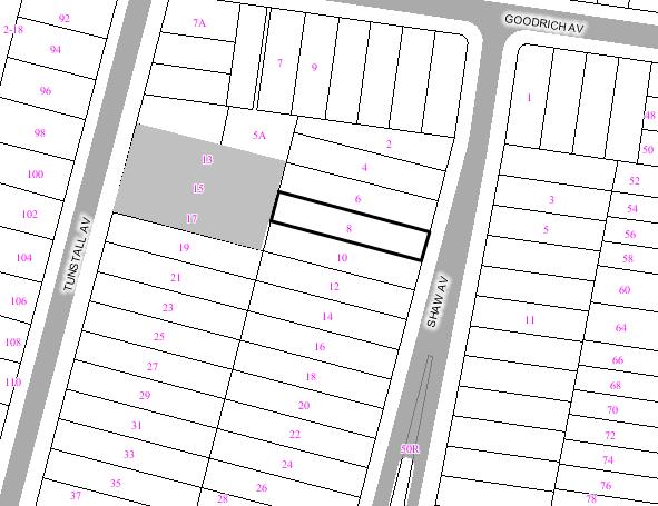
|
|
|
Subject
Site
|
|
|
|
|
|
|
|
|
|
Submissions
received
|
|
Ù
North
|
|
LOCALITY
PLAN
|
1. EXECUTIVE SUMMARY
The application has been referred
to the Health, Building and Planning Committee for determination at the request
of Councillors Bradley Hughes, Murray Matson and Margaret Woodsmith.
The application was notified to
adjoining and nearby property owners and three objections were received. The
main issues raised in the submissions related to the bulk & scale of the
rear first floor addition and overshadowing to the adjoining properties.
The applicant has amended the plan
to address a number of the objectors concerns by reducing the height of the
rear structure by 750mm. This amendment is considered reasonable and
satisfactorily addresses the objectives and performance requirements of the DCP
for Dwelling Houses and Attached Dual Occupancies.
The recommendation is for approval subject to conditions.
2. THE PROPOSAL
It proposed to remove the
colorbond corrugated iron roof on the single storey brick ‘pool house’
structure to the rear of the site and to construct a first floor studio/office
extension. The proposal also includes a new carport structure over the
existing hardstand carspace at the front of the dwelling.
3. THE
SUBJECT SITE AND SURROUNDING AREA:
The subject site is located on the
western side of Shaw
Avenue near the
northern end where it intersects with Goodrich Avenue. The site is presently occupied by an existing two
storey dwelling with an ingound pool and ‘pool house’ to the rear of the site.
The site has a fall from the rear to the front of approximately 3 metres. The
site has a frontage width of 12.19m, a side boundary depth of 62.22m and has an
overall site area of 758.46m².
Neighbouring the property to the north is a single
storey dwelling, to the south is a two storey dwelling and to the rear is an
elevated single storey dwelling. The surrounding area is residential in
character and consists predominantly of single and two storey dwellings.
4. SITE HISTORY
There is no relevant history related to this development
application.
5. COMMUNITY CONSULTATION:
The owners of the adjoining and neighbouring
properties were notified of the proposed development in accordance with the DCP
– Public Notification. As a result of this notification, the following
submissions were received:
5.1 Objections
Peter Zaverdinos acting on behalf
of Mr King Shun Tan and Mrs Mang Hung Ko – 15 Tunstall Avenue, Kingsford
|
Issue
|
Comment
|
|
The two storey addition does not comply with
councils DCP requirements for side and rear setbacks.
|
An amended plan was received
reducing the height of the structure by 750mm; this was deemed satisfactory
and will reduce the overall intrusive nature of the structure on the
boundary. Furthermore, due to the topography of the land a structure of this
nature along the side and rear boundary is not considered to significantly
comprise the amenity of the adjoining owners. The shadow diagrams received
indicate that the proposal will not be significantly affect the amount of natural
light received to the private open rear yards of the adjoining properties and
the objectives and performance requirement for setbacks in the DCP for
Dwelling Houses and Attached Dual Occupancy are met.
|
|
The rear addition also does not comply with councils
DCP height limit requirement of 3.5m, exceeding the height limit by over
2.25m
|
Refer to comments above. An
assessment of the height of the structure is contained in Section 9 of this
report.
|
|
The proposal will create
excessive overshadowing on the rear adjoining neighbours, particularly during
winter.
|
The plan submitted indicates
that the proposal will not significantly compromise the amount of natural day
light to the rear yards of the adjoining properties. The majority of the
rear yards of adjoining properties will receive at least 3 hours of natural
sunlight to their private open space as required by the DCP for Dwelling
Houses and Attached Dual Occupancy.
|
|
Parts of the timber framed
structure of the balcony and stairs are within 900mm from the boundary as
such does not comply with the BCA part 3.7.1.7.
|
The proposal is a class 1A
building and will comply with the BCA requirement.
|
|
The continuous structure along
the rear boundary due to the height will appear visually unsightly, out of
scale and excessively bulky to the rear adjoining neighbours.
|
An amended plan was received
reducing the height of the structure by 750mm; this was deemed satisfactory
and will reduce the intrusive nature of the structure on the boundary.
Furthermore, due to the topography of the land a structure of this nature
along the side and rear boundary is not considered to significantly comprise
the amenity of the adjoining owners. The properties that back onto the
subject site facing Tunstall Avenue have large yards and some of the
dwellings (including 15 Tunstall Avenue) are elevated from the yard area
making it difficult to access and use the space. The height of the structure
will be in line with the terraced areas which face Tunstall Avenue and the
development will satisfy the relevant objectives and performance requirements
of the DCP for Dwelling Houses and Attached Dual Occupancy.
|
James Lynch and Judith Lynch – 17 Tunstall Avenue, Kingsford
|
Issue
|
Comment
|
|
The statement claims that the
proposal would be unobtrusive and have minimal impact on the neighbours.
However, the wall height of the continued structure along the rear eastern
boundary will not fit into the established environment and will be unsightly
intrusive to the neighbour facing Tunstall Avenue.
|
Discussed above.
|
|
Concern if the development was
approved that this would set a precedent for similar structures to be
developed to the rear properties of Shaw Avenue disadvantaging the properties
which face Tunstall Avenue.
|
Each application presented to
Council must be assessed on its individual merits. The subject application
is deemed satisfactory and complies with the relevant assessment criteria of
the DCP for Dwelling Houses and Attached Dual Occupancy.
|
Kevin a. Brodie and Associates P/L acting on behalf of – 13, 15 &
17 Tunstall Avenue, Kingsford
|
Issue
|
Comment
|
|
Loss of view to the east from
their rear yards which will be to varying degrees, depending on the
respective dwelling house.
|
The existing district view is
somewhat obscured by the existing vegetation. Furthermore, the proposal does
not represent a dominant element in the visual catchment surrounding the rear
of the adjoining properties, given the considerable rear setbacks of the
objector’s dwellings.
|
|
Loss of existing landscape
outlook when the extended outbuilding will impinge upon and replace existing
landscape views.
|
There will be minimal pruning of
the canopies to facilitate the addition of the outbuilding. This is not
considered to be substantial and there are numerous mature trees within the
visual catchment.
|
|
Lack of architectural integrity
and aesthetics. The extended outbuilding will appear bland, featureless,
unrelieved, massed brick structure (wall) incorporating no architectural or
visual relief.
|
Amended plans have been received
which reduce the height of the rear outbuilding addition. The design meets
the relevant objectives and performance requirements of the DCP for Dwelling
Houses and Attached Dual Occupancies.
|
|
The potential use of the
extended building which may include activities which would impinge upon their
privacy and quite enjoyment.
|
It is not envisaged that the
studio will create a significant disruption to the adjoining dwellings as
these dwellings are located well away from the proposed structure.
Furthermore a condition is included to ensure that the outbuilding is not
used as a separate residential accommodation.
|
|
Potential loss of privacy to No.
13 and 17 Tunstall Avenue created by “looking back” from the northern and
southern ends of the elevated first floor balcony.
|
It is not envisaged that the
balcony will be intensively used to the extent that it would pose a
significant privacy concern. The balcony faces the rear yard of the subject
site and dense vegetation exists within the surround and subject site
minimising potential privacy loss. Furthermore, the dwellings which face
Tunstall Avenue are located well away from the outbuilding and the immediate
area adjacent to the outbuilding is currently not used by the owners given
the slope of the land and the formalised use of the terraced areas.
|
|
The proposal does not comply
with the LEP zone objectives.
|
Given the reduction in height of
the outbuilding, it is considered the proposed development will be consistent
with the relevant Residential 2A (Residential A Zone) objectives. (Refer to
Section 9).
|
|
The proposal does not comply with the objectives
of the DCP specifically in relation to Height, Form & Materials and
Setback.
|
A detailed assessment has been carried out in
Section 9 of the report. The proposal satisfies the relevant objectives and
performance requirements in the DCP for Dwelling Houses & Attached Dual
Occupancies.
|
5.2 Support
A supporting letter was received from the adjoining owners
at no.’s 6, 7 and 10 Shaw Avenue. The letter noted that they had no objections
to the proposal.
6. TECHNICAL OFFICERS COMMENTS
The
application has been referred to the relevant technical officers, including
where necessary external bodies and the following comments have been provided:-
6.1 Development Engineers
The
application has been referred to Development Engineering for comment,
conditions that have been provided for inclusion with any consent granted. The
following comments were provided:
This report is based on the
following plans and documentation:
Survey
plans dated 28 January 2007;
Statement
of Environmental Effects by Brian O’Dowd dated October 2006
Landscape Comments
Beyond the
northeast corner of the subject site, within the front yard of the adjoining
property to the north, 6 Shaw Avenue, close to the common boundary, there is
one mature Acmena smithii (Lilly Pilly) of approximately 10 metres in height
which appears in excellent health and condition, is covered by Council’s Tree
Preservation Order (TPO) and provides a positive contribution to the
streetscape given both its size and attractive form, also offering a food
source to native fauna who are attracted to this species abundant fruit supply.
The plans show
the construction of an open style carport over the eastern half of the existing
internal hardstand, setback 900mm off the northern boundary, with the site
inspection confirming that one secondary leader would need to be removed from
its southern side, completely back to the main trunk, in order to avoid
conflict with the pitched roof as shown.
While this will
undoubtedly affect the appearance of the tree when viewed from the street,
ultimately, it is not considered to pose a threat to its survival, and as it
would not be possible to relocate the carport elsewhere within the front portion
of the site, a relevant condition requiring such work to be performed by a
qualified and professional Arborist has been included in this report.
There are
several large Cocos Palms in the existing terraced garden/rockery between the
house and upper level/pool area, and while not directly affected by any works
proposed in this application, selective removal of some of these as well as
other smaller palms, tree ferns and shrubs may still be required during the
course of works in order to accommodate material delivery to the rear half of
the yard.
While the
applicant was advised during the site inspection that consent for the removal
of Cocos Palms is technically not required as they are exempt from Council’s
TPO, permission for their removal should the need arise has still been included
for the information of the applicant.
Still in the
rear yard, further to the west, along the northern boundary, there are two 8
metre tall Ficus benjamina (Weeping Figs) which provide an effective vegetative
screen between the subject site and the adjoining property to the north, 6 Shaw
Avenue, but are considered an undesirable species in this location given their
large size at maturity, but more importantly, their invasive and aggressive
root system and the resulting ability to cause structural damage, which is a
concern given the proximity of retaining walls/steps and the pool to the south.
While not
directly affected by the works contained in this application, permission for
the removal of both trees has been included in order to avoid the possibility
of future damage, with replacement planting of more favourable native species
deemed the most desirable course of action in this instance.
Beyond the
western edge of the pool, there are further Cocos Palms which can be removed if
required for the same reasons as described earlier in this report.
Towards the
northwest corner of the site, beyond the northeast corner of the existing
studio, there is one Schinus areira (Peppercorn Tree) of approximately 6 metres
in height with a canopy spread of 5 metres, which while not considered a
significant specimen at this point in time, appears in good health and
condition, and is covered by the provisions of Council’s TPO.
Retention of
this tree will be required as part of this application as it will ensure a
reasonable level of environmental amenity is maintained given its ability to
soften the visual appearance of the studio when viewed from both within the
site and from adjoining properties, particularly upon completion of the first
floor as proposed.
Therefore,
relevant protection measures to ensure its preservation have been included,
together with permission for canopy lifting (by an Arborist) in order to avoid
interference/conflict to the southern side of its canopy during the course of
construction.
Growing close
to the western wall of the existing single level studio, in the rear yard of
the adjoining property to the west, 15 Tunstall Avenue, there is one Eucalyptus
nicholii (Willow Leafed Peppermint), of around 5 metres in height which appears
in poor health and condition, with a sparse canopy and an existing lean to the
northeast.
Pruning will be
required in order to avoid conflict with the first floor as shown; however,
given the exiting poor state of this tree, it is unlikely that this would
contribute further to its already declining condition.
7. MASTER PLANNING REQUIREMENTS
The site is less than 4000m² and therefore a master plan
is not necessary.
8. RELEVANT ENVIRONMENTAL
PLANNING INSTRUMENTS
The
Development application has been assessed in accordance with the provisions of
the following relevant planning documents:
(a) Randwick Local Environmental Plan 1998
The site is zoned Residential 2A under Randwick Local
Environmental Plan 1998 and the proposed activity is permissible with Council’s
consent.
8.1 Policy
Controls
The proposal has been assessed in
relation to compliance with the following controls:
- Randwick Local Environmental Plan 1998.
- Environmental Planning and
Assessment Act 1979 as amended.
- Development
Control Plan - Dwelling Houses and Attached Dual Occupancies
- Development
Control Plan - Parking
- Building Code
of Australia.
9. ENVIRONMENTAL
ASSESSMENT
The site has been inspected and the application has
been assessed having regard to Section 79C of the Environmental Planning and
Assessment Act, 1979, as amended.
a. Randwick LEP 1998
Clause 10 Zone No 2A (Residential
A Zone)
The proposal is consistent with
the general aims of RLEP 1998 and the specific objectives of the 2A zone in
that the proposed activity and built form will enhance and compliment the
aesthetic character, environmental qualities and social amenity of the
locality.
a. Development Control Plan No.
·
Dwelling
Houses and Attached Dual Occupancies DCP
The DCP for Dwelling Houses and Attached Dual Occupancies
states that a proposal is deemed to satisfy the Objectives and Performance
requirements of the DCP if it complies with the corresponding Preferred
Solutions. Therefore, the proposal has been assessed against the Preferred
Solutions below, and where non-compliance results, assessment is made against
the relevant Objectives and Performance Requirements.
Landscaping
The Objectives
of the DCP with regard to landscaping are that existing significant trees and
landscaping are retained and enhanced; dwellings are provided with usable
outdoor recreation space; storm water management and the appearance, amenity
and energy efficiency of the dwelling is improved through integrated landscape
design; and the native wildlife populations are preserved and enhanced through
appropriate planting of indigenous vegetation.
The Performance
Requirements are that the size and dimensions of landscaping suit the needs of
the occupants; location and design of open space takes advantage of aspect for
year round use; indigenous species are used and existing vegetation is recycled
where possible; planting does not obstruct or interfere with entries; and
unpaved areas are maximised to allow stormwater infiltration.
The proposed
first floor studio addition is constructed over the existing foot print of the
outbuilding and the carport structure is located over the existing hardstand
carspace. The existing landscaped area will not be altered on the site.
Floor Area
|
|
Preferred
Solution
|
Assessment
|
|
S1
|
The
preferred solution for an allotment of this area (758.46m²) is that a maximum
floor space ratio of 0.5:1 applies.
|
The
proposed FSR is 0.47:1. Complies.
|
The Objectives and Performance
Requirements of the DCP are that developments are not excessive in bulk or
scale; are compatible with the existing character of the locality; and minimise
adverse effects of bulk on neighbours and the street.
With the reduced height the overall design, proportioning,
scale and form of the proposed rear studio addition will be appropriate and
will also meet the objectives and performance requirements of this section of
the DCP for Dwelling Houses & Attached Dual Occupancies.
Height, Form & Materials
|
|
Preferred
Solution
|
Assessment
|
|
S1
|
External
wall height of the building not exceed 7m
|
Not
applicable.
|
|
S1
|
External wall height of buildings or additions to the
rear does not exceed 3.5 m.
|
The proposed outbuilding to the rear of the site has a
maximum external wall height of 5.35 metres. Does not comply – see assessment
below
|
|
S3
|
Cut or fill does not exceed 1m.
|
Not applicable.
|
|
S3
|
No excavation within 900mm of a side boundary.
|
Not applicable.
|
|
S3
|
No excavation within 4m of a rear boundary.
|
Not applicable.
|
|
S4
|
The length of a second storey portion is no greater than
12m at less than 1.5m from a southern boundary.
|
Not applicable.
|
|
S5
|
The second storey portion of a semi-detached dwelling be
confined to within the existing roof space or be set back from the front
elevation behind a substantial portion of the existing roof form and the
design respects the symmetry of the adjoining semi-detached dwelling.
|
Not applicable.
|
The Objectives of the DCP are that developments should not
be excessive in height and scale and be compatible with the existing character
of the locality; to ensure impacts in terms of privacy, natural light and views
are minimised; and with respect to additions that they not detract from the
individual character and appearance of the existing dwelling.
The relevant Performance Requirements are that the height
of buildings should relate to those in the existing streetscape and the
topography; buildings be designed to enhance the existing desirable built form
character of the street by adopting where relevant characteristics of mass and
proportion, materials and finishes, roof form and pitch, facade articulation,
window and door location and proportions, and verandahs, eaves and parapets;
with respect to additions to semi-detached dwellings they integrate with the
attached dwelling; and views are shared.
Given concerns raised by the adjoining land owners and
that the structure not comply with the preferred solution of the DCP, the
applicant has reduced the height of the rear studio addition to 5.35 metres
rather than 6.1 metres. This is considered to be acceptable and the reduced
height of the structure will relate better with the topography of the site.
Furthermore when the structure is viewed from the adjoining properties, the
height of the structure is consistent with existing elevated terrace areas on
properties fronting Tunstall
Avenue. It is
considered that the proposal achieves the performance requirements and
objectives of the DCP in relation to height, form and materials.


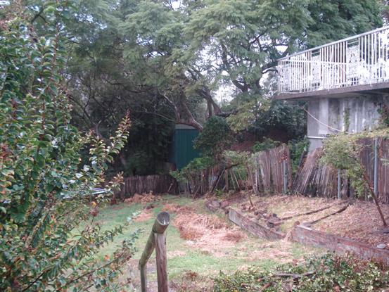
Figure 1: Relationship of adjoining terrace area at No. 15 Turnstall Avenue and rear outbuilding of the
subject site.
Building Setbacks
|
|
Preferred
Solution
|
Assessment
|
|
S1
|
Front
setback is average of adjoining dwellings or 6m.
|
The
proposed carport structure is sited on the front street alignment. Does not
comply – see assessment under Garages & driveways.
|
|
S2
|
No
part of the building is closer than 4.5m from rear boundary.
|
The
proposed studio addition to the rear is sited on the rear boundary. Does not
comply – see assessment below.
|
|
S3
|
Side
setbacks be 900mm for any part of the building at ground level.
|
The
proposed development is sited on the side boundaries. Does not comply – see
assessment below.
However the carport structure is setback 900mm from the
northern side boundary.
Complies.
|
|
S3
|
Side
setbacks be 1.5m at second floor level.
|
The
proposed development is sited on the side boundaries. Does not comply – see
assessment below.
|
|
S3
|
Side
setbacks be 3.0m at third floor level.
|
Not
applicable.
|
The Objectives and Performance
Requirements of the DCP seek to ensure that there is adequate access to
sunlight, daylight and fresh air to building occupants and neighbours; and with
respect to front boundary setbacks the proposal generally conform to the
adjoining development or dominant streetscape.
The proposed first floor studio addition will be
constructed over the rear ‘pool house’ maintaining the existing nil side and
rear boundary setbacks. This does not comply with the preferred solutions
requirement of 1.5m for side boundary setbacks and 4.5m for rear boundary
setback. Notwithstanding the above, the walls to the sides of the first floor
studio addition are minor in length and the height of the structure has been
reduced by 750mm. This will minimise the impact on adjoining neighbours and
will ensure that adequate access to natural light, daylight and fresh air to
adjoining building occupants and neighbours are maintained.
The proposal is not considered to
detract from the character and appearance of the existing dwelling and
streetscape. The non-compliance with the side setbacks preferred solutions is
considered acceptable and the proposal will meet the objectives and performance
requirements of this section.
Visual & Acoustic
Privacy
|
|
Preferred
Solution
|
Assessment
|
|
S1
|
Habitable
room windows within 9m of another dwelling’s windows are offset by 45 degrees
or have fixed obscure glazing below 1.5m above floor level.
|
The
proposal does not have any habitable room windows that overlook those of
adjoining dwellings within 9 metres. Complies.
|
|
S1
|
Direct
view into open space of an adjoining dwelling is obscured or screened within
9m and is beyond a 45 degree angle.
|
Number
6 and 10 Shaw Avenue support the application and have not raised any concerns
in regards to privacy. Also heavy vegetation existing in the rear yard of
the subject site minimises overlooking into the adjoining dwellings rear yard
areas.
|
|
S1
|
Windows
have sill heights of 1.5m or more or fixed obscure glazing below that height.
|
Not
applicable.
|
|
S3
|
Buildings
comply with AS 371 and AS 2107.
|
Conditioned
to comply with the BCA.
|
Garages &
Driveways
The Objectives and Performance
Requirements of the DCP include that car parking and driveways are not visually
obtrusive and do not detract from the appearance of the dwelling and the street
scape; and structures are compatible in scale, form, materials and finishes
with the associated dwelling.
The siting of the carport structure to the front boundary
is not considered to detract from the individual character and appearance of
the existing dwelling. The existing vegetation surrounding the front of the
site, front fencing and the relationship of the carport being close to a corner
allotment will make the carport appear less intrusive at the front of the
dwelling
Furthermore, the carport structure will not occupy more
than 35% of the site width frontage (23.8%) and the relevant objectives and
performance requirements for this section will be satisfied.
Solar Access and Energy Efficiency
|
|
Preferred
Solution
|
Assessment
|
|
S1
|
New dwellings comply with a minimum of 3.5 stars on the
NatHERS.
|
Not applicable.
|
|
S2
|
Private open space receives at least 3 hours sunlight
over part of its area between 9am and 3pm on 21 June.
|
The rear yard will receive at least 3 hours of sunlight.
Complies.
|
|
S2,8
|
North-facing windows to living areas receive at least 3
hours sunlight over part of its area between 9am and 3pm on 21 June.
|
Not applicable.
|
|
S9
|
Solar access to existing or future solar collectors on
adjacent buildings is maintained between 9am and 3pm each throughout the
year.
|
The proposal will not overshadow solar collectors on
adjoining properties. Complies.
|
|
S9
|
North-facing windows to living areas of neighbouring
dwellings receive at least 3 hours sunlight over part of its area between 9am
and 3pm on 21 June. If currently less than 3 hours, it is not further
reduced.
|
The proposal will not reduce solar access to any
north-facing windows. Complies.
|
|
S9
|
Principal outdoor recreation space of neighbouring
dwellings receive at least 3 hours sunlight over part of its area between 9am and 3pm on 21
June. If currently less than 3 hours, it is not further reduced.
|
The proposal will not reduce solar access to private
open space to less than 3 hours. Complies.
|
10. RELATIONSHIP TO CITY PLAN
The relationship with the City
Plan is as follows:
Outcome 4: Excellence in urban design and
development.
Direction 4a: Improved design
and sustainability across all development.
Direction 4b: New and
existing development is managed by a robust framework.
11. FINANCIAL IMPACT STATEMENT
There is no direct financial impact for this matter.
12. CONCLUSION
The main issues in the assessment
of the application relate to the size, bulk and scale of the rear first floor
studio and overshadowing. Amended plans were received from the applicant to
address some of these potential issues by reducing the overall height of the
structure.
The amended proposal is considered
reasonable and should not result in any significant adverse impacts upon either
the amenity of the adjoining premises or the character of the locality. The
proposal satisfies the relevant assessment criteria and objectives and
performance of the DCP for Dwelling Houses and Attached Dual Occupancies.
RECOMMENDATION:
A. THAT Council as the
responsible authority grant its development consent under Section 80 and 80A of
the Environmental Planning and Assessment Act 1979 (as amended) to Development
Application No. DA/195/2007 for Construction of first floor studio/office
addition above the existing pool house and construction of a carport structure
to the front of the existing dwelling. at 8 Shaw Avenue, KINGFORD subject to the following conditions:
1. The
development must be implemented substantially in accordance with the amended
plans received by Council on 16 July 2007, the carport details shown on the
unnumbered drawing dated 28/01/07 & received by council on the 16 March
2007, the application form and on any supporting information received with the
application, except as may be amended by the following conditions and as may be
shown in red on the attached plans:
The following conditions are applied to satisfy the
provisions of section 79C of the Environmental Planning and Assessment Act 1979
and to maintain reasonable levels of environmental amenity:
2. The rear and
side elevations of the outbuilding shall be rendered and painted in a neutral
colour to soften the visual impact of the development on properties to the
rear.
3. The colours,
materials and finishes of the external surfaces to the proposed building works
are to be compatible with the existing dwelling and adjacent development to
maintain the integrity and amenity of the building and the streetscape.
Details of the proposed colours,
materials and textures (i.e. a schedule and brochure/s or sample board) are to
be submitted to and approved by Council’s Director of Planning & Community
Development, in accordance with section 80A (2) of the Environmental
Planning and Assessment Act 1979 prior to a construction certificate
being issued for the relevant building works.
4. Metal roof
sheeting is to be painted or colour bonded to minimise reflection and to be
sympathetic and compatible with the building and surrounding environment.
5. There must be
no encroachment of the carport and rear outbuilding structure/s onto any
adjoining premises or onto Council’s road reserve, footway or public place,
unless permission has been obtained from the owner/s of the adjoining land
accordingly.
6. The proposed
first floor studio addition must only be used for the purposes specified in the
development consent and the building must not be used for separate residential
accommodation or as a separate residential occupancy at any time.
The following condition is imposed to satisfy relevant
requirements of the Sydney Water Corporation.
7. All building,
plumbing and drainage work must be carried out in accordance with the
requirements of the Sydney Water Corporation.
The approved Construction Certificate plans must be
submitted to a Sydney Water Quick Check agent or Customer Centre prior to
commencing any building or excavation works, to determine whether the
development will affect Sydney Water’s sewer and water mains, stormwater drains
and/or easements, and if any further requirements need to be met.
If suitable, the plans will be appropriately stamped. For
Quick Check agent details please refer to Sydney Water’s web site at
www.sydneywater.com.au and go to the Building, Developing and Plumbing, then
Quick Check or Building and Renovating or telephone 13 20 92.
The principal certifying authority is required to ensure
that a Quick Check Agent/Sydney Water has appropriately stamped the plans
before commencing works.
The following conditions are imposed to promote
ecologically sustainable development and energy efficiency.
8. Any new
external timber or metal framed and brick veneer walls and roofs are to be
provided with insulation (i.e. bulk insulation and a reflective building
membrane/reflective sarking/foil insulation), having a minimum total thermal
resistance R–value of 3.0 in roofs and 1.5 in external walls. The insulation
and reflective building membrane is to be installed in accordance with the
relevant requirements of the Building Code of Australia and the manufacturers
details.
Details of
compliance with the requirements for insulation are to be included in the construction
certificate application.
The following group of conditions have been applied to
ensure that adequate drainage is provided from the premises and to maintain
adequate levels of health and amenity in the locality:
9. Surface
water/stormwater must be drained and discharged to the street gutter or
suitably designed absorption pit, to the satisfaction of the Certifying
Authority and details are to be included in the construction certificate
application for the development.
Absorption
pits must be located not less than 3m from any adjoining premises and the
stormwater must not be directed or flow onto any adjoining premises or cause a
nuisance.
Details of any works
proposed to be carried out in or on a public road/footway are to be submitted
to and approved by Council prior to commencement of works.
10. External paths
and ground surfaces are to be constructed at appropriate levels and be graded
and drained away from the building and adjoining premises, so as not to result
in the entry of water into the building, or cause a nuisance or damage to the
adjoining premises.
The following conditions are applied to ensure that the
development satisfies the provisions of the Environmental Planning and
Assessment Act 1979 and Regulations:
11. The
requirements and provisions of the Environmental Planning & Assessment Act
1979 and Environmental Planning & Assessment Regulation 2000, must be fully
complied with at all times.
Failure to comply with these legislative requirements is
an offence and may result in the commencement of legal proceedings, issuing of
`on-the-spot` penalty infringements or service of a notice and order by
Council.
12. All new
building work must be carried out in accordance with the provisions of the Building
Code of Australia (BCA), in accordance with Clause 98 of the Environmental
Planning and Assessment Regulation 2000.
13. Prior
to the commencement of any building works, a construction certificate must
be obtained from the Council or an accredited certifier, in accordance with the
provisions of the Environmental Planning & Assessment Act 1979 and
Environmental Planning & Assessment Regulation 2000.
A copy of the
construction certificate, the approved plans & specifications and
development consent conditions must be kept on the site at all times and be
made available to the Council officers and all building contractors for
assessment.
14. Prior to
the commencement of any building works, the person having the benefit of
the development consent must: -
i) appoint a Principal
Certifying Authority for the building work; and
ii) appoint a principal
contractor for the building work, or in relation to residential building
work, obtain an owner-builder permit in accordance with the requirements
of the Home Building Act 1989, and notify the Principal Certifying Authority
and Council accordingly in writing; and
iii) unless the
person having the benefit of the consent is the principal contractor
(i.e. owner-builder), notify the principal contractor of the
required critical stage inspections and other inspections to be carried
out, as specified by the Principal Certifying Authority; and
iv) give at least
two days notice to the Council, in writing, of the persons intention to
commence building works.
In relation to residential building work, the
principal contractor must be the holder of a contractor licence, in accordance
with the provisions of the Home Building Act 1989.
15. The building
works must be inspected by the Principal Certifying Authority (or
another certifying authority if the Principal Certifying Authority
agrees), in accordance with sections 109 E (3) of the Environmental Planning
& Assessment Act 1979 and clause 162A of the Environmental Planning &
Assessment Regulation 2000, to monitor compliance with the relevant standards
of construction, Council’s development consent and the construction
certificate.
The Principal Certifying
Authority must specify the relevant stages of construction to be inspected
in accordance with section 81A (2) (b1) (ii) of the Environmental Planning
& Assessment Regulation 2000 and a satisfactory inspection must be carried
out, to the satisfaction of the Principal Certifying Authority, prior to
proceeding to the subsequent stages of construction or finalisation of the
works (as applicable).
Documentary evidence of the
building inspections carried out and details of compliance with Council’s
consent is to be maintained by the Principal Certifying Authority.
Details of critical stage inspections carried out and copies of
certification relied upon must also be forwarded to Council with the occupation
certificate.
The principal contractor or
owner-builder (as applicable) must ensure that the required critical
stage and other inspections, as specified in the Principal Certifying
Authority’s “Notice of Critical Stage Inspections”, are carried out to the
satisfaction of the Principal Certifying Authority and at least 48 hours
notice (excluding weekends and public holidays) is to be given to the Principal
Certifying Authority, to carry out the required inspection, before carrying
out any further works.
16. A sign must be
erected and maintained in a prominent position on the site for the duration of
the works, which contains the following details:
·
name, address,
contractor licence number and telephone number of the principal contractor,
including a telephone number at which the person may be contacted outside
working hours, or owner-builder permit details (as applicable);
·
name, address
and telephone number of the Principal Certifying Authority; and
·
a statement stating
that “unauthorised entry to the work site is prohibited”.
17. An
Occupation Certificate must be obtained from the Principal Certifying
Authority prior to any occupation of the building work encompassed in
this development consent (including alterations and additions to existing
buildings), in accordance with the relevant provisions of the Environmental
Planning & Assessment Act 1979.
An
Occupation Certificate must not be issued for the development if the
development is inconsistent with the development consent. The requirements of
the Environmental Planning & Assessment Act 1979 and conditions of
development consent must be satisfied prior to the issuing of an occupation
certificate.
18. Prior
to the issuing of an interim or final occupation certificate, a statement
is required to be obtained from the Principal Certifying Authority, which
confirms that the development is not inconsistent with the development consent
and the relevant conditions of development consent have been satisfied.
Details of critical stage
inspections carried out by the principal certifying authority together with any
other certification relied upon and must also be provided to Council with the
occupation certificate.
19. In accordance
with clause 98 of the Environmental Planning and Assessment Regulation 2000, it
is a prescribed condition, that in the case of residential building work, a
contract of insurance must be obtained and in force, in accordance with the
provisions of the Home Building Act 1989.
Where the work is to be done
by a licensed contractor, excavation or building work must not be carried out
unless the Principal Certifying Authority (PCA): -
·
has been
informed in writing of the licensee’s name and contractor number; and
·
is satisfied
that the licensee has complied with the insurance requirements of Part 6 of the
Home Building Act 1989, or
Where the work to be done by
any other person (i.e. an owner-builder), excavation or building work
must not be carried out unless the Principal Certifying Authority: -
· has been informed of the
person’s name and owner-builder permit number; or
· has been given a
declaration, signed by the owner of the land that states that the market cost
of the labour and materials involved in the work does not exceed $5,000.
Details of the principal building
contractor and compliance with the provisions of the Home Building Act 1989 (i.e. Details of the
principal licensed building contractor and a copy of the Certificate of
Insurance) are to
be submitted to Council prior to the commencement of works, with the
notice of appointment of the PCA / notice of intention to commence building
work.
20. The required
Long Service Levy payment, under the Building and Construction Industry Long
Service Payments Act 1986, is to be forwarded to the Long Service Levy
Corporation or the Council, prior to the issuing of a Construction
Certificate, in accordance with Section 109F of the Environmental Planning
& Assessment Act 1979.
At the time of this
development consent, Long Service Levy payment is applicable on building work
having a value of $25,000 or more, at the rate of 0.35% of the cost of the works.
The following conditions are applied to ensure that the
development satisfies relevant standards of construction, and to maintain
adequate levels of health, safety and amenity during construction:
21. The demolition
of buildings and the removal, storage, handling and disposal of building
materials (including asbestos) must be carried out in accordance with the
relevant requirements of WorkCover NSW, the NSW Department of Environment &
Conservation (formerly the Environment Protection Authority) and Randwick City
Council policies and conditions, including:
· Occupational Health and Safety Act 2000
· Occupational Health and Safety (Hazardous
Substances) Regulation 2001
· Occupational Health and Safety (Asbestos
Removal Work) Regulation 2001
· WorkCover NSW Code of Practice for the Safe
Removal of Asbestos
·
Australian
Standard 2601 (2001) – Demolition of Structures
·
The
Protection of the Environment Operations Act 1997 and Protection of the
Environment Operations (Waste) Regulation 1996.
·
Relevant
Department of
Environment & Conservation (DEC) / Environment Protection Authority (EPA)
and WorkCover NSW Guidelines.
·
Randwick
City Council Asbestos Policy (adopted 13 September 2005)
A copy of Council’s Asbestos Policy is available on Council’s web
site at www.randwick.nsw.gov.au in the Building & Development section or a
copy can be obtained from Council’s Customer Service Centre.
22. All
excavations and backfilling associated with the erection or demolition of a
building must be executed safely in accordance with appropriate professional
standards and excavations are to be properly guarded and supported to prevent
them from being dangerous to life, property or buildings.
23. Except with the written
approval of Council’s Manager of Health, Building & Regulatory Services,
all building, demolition and associated site works (including site deliveries)
must only be carried out between the hours of 7.00am to 5.00pm on Monday to
Friday inclusive and between 8.00am to 5.00pm on Saturdays and all building
activities are strictly prohibited on Sundays and Public Holidays.
24. Noise and vibration emissions
during the construction of the building and associated site works must not
result in damage to nearby premises or result in an unreasonable loss of
amenity to nearby residents and the relevant provisions of the Protection of
the Environment Operations Act 1997 must be satisfied at all times.
25. Public safety and convenience
must be maintained at all times during demolition, excavation and construction
works.
The roadway, footpath and nature strip must be maintained
in a good, safe condition and free from any obstructions, materials, soils or
debris at all times. Any damage caused to the road, footway or nature strip
must be repaired immediately, to the satisfaction of Council.
A Road Opening Permit must be obtained from the Council
and other relevant Authorities prior to excavating or opening-up the road or
footway for services or the like.
Any part of Council’s nature strip which is damaged as a
result of the work must be back-filled, top-soiled and re-turfed with kikuyu
turf prior to occupation or finalisation of the development, to Council’s
satisfaction.
26. Building materials, sand,
soil, waste materials or construction equipment must not be placed upon the
footpath, roadway or nature strip at any time and the footpath, nature strip
and road must be maintained in a clean condition and free from any obstructions,
soil and debris at all times.
Bulk bins/waste containers must not be located upon the
footpath, roadway or nature strip at any time without the prior written
approval of the Council, unless the waste container is located upon the road in
accordance with the Roads & Traffic Authority Guidelines and Requirements,
and the container is exempt from an approval under Development Control Plan for
Exempt & Complying Development and Council’s Local Approvals Policy.
Applications to place a waste container in a public place can be made to
Council’s Building Services section.
27. During construction stages,
sediment laden stormwater run-off shall be controlled using the sediment
control measures outlined in the manual for Managing Urban Stormwater – Soils
and Construction, published by the NSW Department of Housing.
Stockpiles of soil, sand, aggregate or other materials
must not be located on any footpath, roadway, nature strip, drainage line or
any public place and the stockpiles must be protected with adequate sediment
control measures.
Building operations such as brick cutting, washing tools
or equipment and mixing mortar are not permitted on public footpaths, roadways,
nature strips, in any public place or any location which may lead to the
discharge of materials into the stormwater drainage system.
28. A local approval application
must be submitted to and be approved by Council's Building Services section
prior to commencing any of the following activities on a footpath, road, nature
strip or in any public place:-
·
Install or
erect any site fencing, hoardings or site structures
·
Operate a
crane or hoist goods or materials over a footpath or road
·
Placement of a
waste skip (greater than 3m in length) or any container or other article.
The following conditions are applied to
provide adequate provisions for access, transport and infrastructure:
29. Prior to the
issuing of an occupation certificate the applicant must meet the full cost for
Council or a Council approved contractor to:
a. Extend/reconstruct
the concrete vehicular crossing and layback at kerb opposite the vehicular
entrance to the site, if required.
30. The
applicant must meet the full cost for Council or a Council approved contractor
to repair/replace any damaged sections of Council's footpath, kerb &
gutter, nature strip etc which are due to building works being carried out at
the above site. This includes the removal of cement slurry from Council's
footpath and roadway.
31. The
applicant shall note that all external work, carried out on Council property,
shall be in accordance with Council's Policy for "Vehicular Access and
Road and Drainage Works". An application for the cost of the Council civil
works is to be submitted to Council at the completion of the internal building
works. An application fee shall be payable to Council for the quotation of the
required works. The applicant may elect to use his contractor for the required
works, subject to Council approval, however a design and supervision fee based
on the lowest quotation from Council's nominated contractor will be required to
be paid prior to the commencement of any works.
The following conditions are
applied to provide adequate consideration for service authority assets:
32. The
applicant must meet the full cost for telecommunication companies, gas
providers, Energy Australia and Sydney Water to
adjust/repair/relocate their services as required. The applicant must make the
necessary arrangements with the service authority.
The following conditions are applied to provide adequate
provisions for landscaping and to maintain reasonable levels of environmental
amenity:
33. That part of the naturestrip upon
Council's footway which is damaged during the construction of the proposed
works shall be excavated to a depth of 150mm, backfilled with topsoil
equivalent with 'Organic Garden Mix' as supplied by Australian Native
Landscapes, and re-turfed with Kikuyu turf or similar. Such works shall be
completed at the applicant’s expense prior to the issue of a final Occupation
Certificate.
Tree Management
34. While not directly affected by the
works proposed in this application, permission has still been granted for the
removal of the following specimens should the applicant wish. Should the trees
described in point b of this condition be removed, 2 x 25 litre (pot size at
the time of planting) broad canopied replacement trees (not palms) shall be
provided in this same area of the site, using those native species which will
attain a minimum height of 6 metres at maturity, in order to maintain the vegetative
screen in this area of the site.
a) Any Syagrus romanzoffianum
(Cocos Palms) throughout the site, whether affected by the proposed works or
not, as this species is exempt under Council’s Tree Preservation Order.
b) Two Ficus benjamina (Weeping
Figs) in the rear yard, to the north of the pool, along the northern boundary,
as this species is considered inappropriate in this location due to its large
size, invasive and aggressive root system and likelihood of causing structural
damage to surrounding structures.
35. Permission is granted for the
minimal and selective pruning of:
a. The one secondary leader from the
southern side of the Acmena smithii (Lilly Pilly), located in the front
yard of the adjoining property to the north, 6 Shaw Avenue, beyond the
northeast corner of the subject site, in order to accommodate construction of
the proposed carport as shown.
b. Only those lower growing branches
from the southern side of the Schinus areira (Peppercorn Tree) located
in the rear yard of the subject site, near the northwest corner, beyond the
northeast corner of the existing studio, which need to be pruned in order to
avoid damage/interference with the proposed works.
c. Those branches from the eastern side
of the Eucalyptus nicholii (Willow Leafed Peppermint), located in the
rear yard of the adjoining property to the west, 15 Tunstall Avenue, close to
the common boundary, which need to be removed in order to avoid conflict with
the proposed first floor addition of the studio as shown.
NOTE: The applicant may contact
Council’s Landscape Development Officer on 9399-0613 should clarification be
sought on the level of pruning required.
36. This approval does not imply any
right of entry onto a neighbouring property nor does it allow pruning beyond a
common boundary; however, where such measures are desirable in the best
interests of correct pruning procedures, it shall be necessary for the
applicant to negotiate with the tree owner.
37. The certifying authority will be
required to ensure that all pruning is undertaken by a professional Arborist
who holds a minimum of AQF Level IV in Arboriculture, and is a registered
member of a nationally recognized association, to the requirements of
Australian Standard AS 4373-1996 'Pruning of Amenity Trees.’
Tree Protection Measures
38. In order to ensure the retention of the Schinus
areira (Peppercorn Tree) located in the rear yard, towards the northwest
corner, beyond the northeast corner of the existing studio, in good health, the
following measures are to be undertaken:
a. All detailed
documentation submitted for the construction certificate application shall show
the retention of the existing specimen with the position of its trunk and full
diameter of its canopy clearly shown on all drawings.
b. The
tree is to be physically protected by the installation of 1.8 metre high steel
mesh/chainwire fencing which shall be located a minimum distance of 1 metre off
the outside edge of its trunk to its west, south and east, matching up with the
northern boundary, to completely enclose the tree.
c. This
fencing shall be installed prior to the commencement of demolition and
construction works and shall remain in place until all works are completed,
with signage containing the following words “TREE PROTECTION ZONE, DO NOT
ENTER", clearly displayed.
d. Within
this zone there is to be no storage of materials or machinery or site
office/sheds, nor is cement to be mixed or chemicals spilt/disposed of and no
stockpiling of soil or rubble.
ADVISORY MATTERS:
A1 Building or excavations
works must not be commenced until a construction certificate has been obtained
from Council's Building Certification Services or an Accredited Certifier and
either Council's Building Certification Services or an Accredited Certifier has
been appointed as the Principal Certifying Authority (PCA) for this
development.
Failure to obtain a Construction Certificate and appoint a
PCA before commencing works is an offence, which renders the responsible person
liable to a maximum penalty of $1.1 million under the Environmental Planning
& Assessment Act 1979.
A2 The applicant is advised that
the Construction Certificate plans and specification must comply with the
provisions of the Building Code of Australia (BCA) and the construction
certificate must not be inconsistent with the development consent.
In this regard, the development consent plans do not
detail compliance with the deemed-to-satisfy provisions of the BCA.
Details of compliance with the relevant provisions of the
Building Code of Australia and conditions of development consent are to be
provided in the plans and specifications for the construction certificate.
You are therefore advised to ensure that the development
is not inconsistent with Council's consent and to consult with Council’s Building
Certification Services or an accredited certifier prior to submitting your
construction certificate application to enable these matters to be addressed
accordingly.
A3 The applicant
is to advise Council in writing and/or photographs of any signs of existing
damage to the Council roadway, footway, or verge prior to the commencement of
any building/demolition works.
ATTACHMENT/S:
Nil

Director, City Planning Report
65/2007
|
SUBJECT:
|
7 TOWER STREET, COOGEE
|
REPORT BY: DIRECTOR,
CITY PLANNING
INTRODUCTION:
A report recommending approval of Development Application
No. 838/2006 for alterations and new first floor addition to the existing
single storey semi-detached dwelling house including new first floor balconies,
new front hardstand car space and associated landscaping was considered at the
Health, Building and Planning Committee meeting on 14 August 2007 where it was
resolved on the motion of Councillors Woodsmith and Tracey that:
“the application be
deferred to enable the consideration of amended plans providing for the set
back of the front wall to match the setback approved in conjunction with the
consent for DA No. 188/2004 and for mediation between the three parties
involved.”
ISSUES:
A mediation meeting was held on 23 August 2007 and the following comments are provided by the mediator:
“During the course of the session a number of issues had
been raised by the objector with the main concern being loss of views to No. 5 Tower Street, Coogee. It has been agreed by
all parties present that the applicant will investigate the possibility of
front wall set back including the splay by 400mm. It also has been suggested
that number 9
Tower Street
will also setback the front wall by 200mm.”
The owners of Nos. 7 and 9 Tower Street have advised Council in writing on 28 August 2007 that the above option is
considered to be unsuitable and no further amendments will be made.
CONCLUSION:
It is recommended the subject development application be
approved subject to conditions.
RECOMMENDATION:
A. THAT Council as the
responsible authority grant its development consent under Section 80 and 80A of
the Environmental Planning and Assessment Act 1979 (as amended) to Development
Application No. 838/2006 to carry out alterations and new first floor additions
to the existing single storey semi-detached dwelling house including new first
floor balconies, new front hardstand car space and associated landscaping at 7
Tower Street, Coogee subject to the following conditions:
1. The
development must be implemented substantially in accordance with the amended
plans numbered 1b and 2b, dated 2 July 2007 and received by Council on 2 July
2007, the application form and on any supporting information received with the
application, except as may be amended by the following conditions and as may be
shown in red on the attached plans:
The following conditions are
applied to satisfy the provisions of section 79C of the Environmental Planning
and Assessment Act 1979 and to maintain reasonable levels of environmental
amenity:
2. The
first floor addition to the subject premises must be constructed at the same
time as the adjoining dwelling at 9 Tower Street to the satisfaction of
Council.
3. A
Construction Certificate for DA consent 838/2006 must not be issued by Council
or an the Certifying Authority unless that Construction Certificate also
incorporates DA consent 837/2006.
Reason:
Council is of the opinion that
approval of both DA 838/2006 and DA 837/2006 is warranted only in circumstances
where both semi detached dwellings, known as Nos 7 & 9 Tower Street, Coogee
are acted upon concurrently. The condition is imposed to prevent the owner of
either property engaging a private certifier to issue an individual
construction certificate for their property. Failure to comply with this
condition would amount to an offence pursuant to the Environmental Planning and
Assessment Act. In the absence of both consents being acted upon concurrently a
streetscape issue may arise.
4. An
Occupation Certificate must not be issued for the first floor addition to the
subject development prior to the adjoining dwelling at 9 Tower Street
(DA/837/2006) being constructed at least up to “lock up” stage (completion of
all structural work, internal and external wall frame, roofing, guttering and
drainage and external walls/cladding and finishes) to the satisfaction of
Council.
5. The
colours, materials and finishes of the external surfaces to the building are to
be compatible with the existing and adjacent development to maintain the
integrity and amenity of the building and the streetscape.
Details of the proposed colours,
materials and textures (i.e. a schedule and brochure/s or sample board) are to
be submitted to and approved by Council’s Director of Planning & Community
Development, in accordance with section 80A (2) of the Environmental
Planning and Assessment Act 1979 prior to a construction certificate
being issued.
6. At no time
shall any privacy screening devices be placed or erected on the northern side
of the first floor balcony. The glazing to the first floor balustrade shall be
clear/transparent glass.
7. The proposed
sun louvres to the first floor level front balcony at the front elevation shall
be deleted.
8. A privacy
screen having a height of 1.8m, measured from the finished balcony level, is to
be provided to the northern side of the rear first floor balcony to minimise
overlooking into the rear yard of 5 Tower Street. Details of compliance are to
be provided in the construction certificate plans.
9. The
proposed roller shutter door and its associated structure on the front boundary
are to be deleted and the fence on the street alignment is to be a maximum
height of 1.8m at any point, to maintain reasonable levels of amenity to the
streetscape.
10. Metal roof
sheeting is to be painted or colour bonded to minimise reflection and to be
sympathetic and compatible with the building and surrounding environment.
11. There must
be no encroachment of the structure/s onto any adjoining premises or onto
Council’s road reserve, footway or public place, unless permission has been
obtained from the owner/s of the adjoining land accordingly.
12. Any gate
openings shall be constructed so that the gates, when hung, will be fitted in
such a manner that they will not open over the footway or public place.
13. Street
numbering must be provided to the premises in a prominent position, to the
satisfaction of Council.
14. The
finished ground levels external to the building are to be consistent with the
development consent and are not to be raised (other than for the provision of
paving or the like on the ground) without the written consent of Council.
The following conditions are imposed to promote
ecologically sustainable development and energy efficiency.
15. The
consumption of water within the building shall be minimised by the use of
triple A rated water efficient plumbing fixtures (taps and shower roses) and
water efficient dual flush toilets. Details of compliance are to be noted in
the construction certificate plans or specifications.
16. External
timber or metal framed and brick veneer walls and roofs are to be provided with
insulation (i.e. bulk insulation and a reflective building membrane/reflective
sarking/foil insulation), having a minimum total thermal resistance R–value of
3.0 in roofs and 1.5 in external walls. The insulation and reflective building
membrane is to be installed in accordance with the relevant requirements of the
Building Code of Australia and the manufacturers details.
Details of compliance with the
requirements for insulation are to be included in the construction
certificate application.
17. Hot water
service pipes are to be provided with insulation and must also satisfy any
relevant requirements of Building Code of Australia and AS 3500.
The following group of conditions have been applied to
ensure that adequate drainage is provided from the premises and to maintain
adequate levels of health and amenity in the locality:
18. Surface
water/stormwater must be drained and discharged to the street gutter to the
satisfaction of the certifying authority and details of the proposed stormwater
drainage system are to be included in the construction certificate details for
the development.
Details of
any works proposed to be carried out in or on a public road/footway are to be
submitted to and approved by Council prior to commencement of works.
19. External
paths and ground surfaces are to be graded and drained away from the building
and adjoining premises in such a manner so as not to result in the entry of
water into a building, or cause a nuisance or damage to the adjoining premises.
The following conditions are applied to ensure that the
development satisfies the provisions of the Environmental Planning and
Assessment Act 1979 and Regulations:
20. The
requirements and provisions of the Environmental Planning & Assessment Act
1979 and Environmental Planning & Assessment Regulation 2000, must be fully
complied with at all times.
Failure to comply with these
legislative requirements is an offence and may result in the commencement of
legal proceedings, issuing of `on-the-spot` penalty infringements or service of
a notice and order by Council.
21. All new
building work must be carried out in accordance with the provisions of the Building
Code of Australia (BCA), in accordance with Clause 98 of the Environmental
Planning and Assessment Regulation 2000.
22. Prior
to the commencement of any building works, a construction certificate must
be obtained from the Council or an accredited certifier, in accordance with the
provisions of the Environmental Planning & Assessment Act 1979 and
Environmental Planning & Assessment Regulation 2000.
23. Prior to
the commencement of any building works, the person having the benefit of
the development consent must: -
i) appoint a Principal
Certifying Authority for the building work; and
ii) appoint a principal
contractor for the building work, or in relation to residential building
work, obtain an owner-builder permit in accordance with the requirements
of the Home Building Act 1989, and notify the Principal Certifying Authority
and Council accordingly in writing; and
iii) unless the
person having the benefit of the consent is the principal contractor
(i.e. owner-builder), notify the principal contractor of the
required critical stage inspections and other inspections to be carried
out, as specified by the Principal Certifying Authority; and
iv) give at
least two days notice to the Council, in writing, of the persons intention to
commence building works.
In
relation to residential building work, the principal contractor must be the
holder of a contractor licence, in accordance with the provisions of the Home
Building Act 1989.
24. The
building works must be inspected by the Principal Certifying Authority
(or another certifying authority if the Principal Certifying
Authority agrees), in accordance with sections 109 E (3) of the
Environmental Planning & Assessment Act 1979 and clause 162A of the
Environmental Planning & Assessment Regulation 2000, to monitor compliance
with the relevant standards of construction, Council’s development consent and
the construction certificate.
The Principal Certifying
Authority must specify the relevant stages of construction to be inspected
in accordance with section 81A (2) (b1) (ii) of the Environmental Planning
& Assessment Regulation 2000 and a satisfactory inspection must be carried
out, to the satisfaction of the Principal Certifying Authority, prior to
proceeding to the subsequent stages of construction or finalisation of the
works (as applicable).
Documentary evidence of the
building inspections carried out and details of compliance with Council’s
consent is to be maintained by the Principal Certifying Authority.
Details of critical stage inspections carried out and copies of
certification relied upon must also be forwarded to Council with the occupation
certificate.
The principal contractor or
owner-builder (as applicable) must ensure that the required critical
stage and other inspections, as specified in the Principal Certifying
Authority’s “Notice of Critical Stage Inspections”, are carried out to the
satisfaction of the Principal Certifying Authority and at least 48 hours
notice (excluding weekends and public holidays) is to be given to the Principal
Certifying Authority, to carry out the required inspection, before carrying
out any further works.
25. A sign must
be erected and maintained in a prominent position on the site, which contains
the following details:
·
name, address,
contractor licence number and telephone number of the principal contractor,
including a telephone number at which the person may be contacted outside working
hours, or owner-builder permit details (as applicable);
·
name, address
and telephone number of the Principal Certifying Authority; and
·
a statement
stating that “unauthorised entry to the work site is prohibited”.
26. An
Occupation Certificate must be obtained from the Principal Certifying
Authority prior to any occupation of the building work encompassed in
this development consent (including alterations and additions to existing
buildings), in accordance with the relevant provisions of the Environmental
Planning & Assessment Act 1979.
An
Occupation Certificate must not be issued for the development if the
development is inconsistent with the development consent. The requirements of
the Environmental Planning & Assessment Act 1979 and conditions of
development consent must be satisfied prior to the issuing of an occupation
certificate.
27. Prior
to the issuing of an interim or final occupation certificate, a statement
is required to be obtained from the Principal Certifying Authority, which
confirms that the development is not inconsistent with the development consent
and the relevant conditions of development consent have been satisfied.
Details of critical stage
inspections carried out by the principal certifying authority together with any
other certification relied upon and must also be provided to Council with the
occupation certificate.
28. In
accordance with clause 98 of the Environmental Planning and Assessment
Regulation 2000, it is a prescribed condition, that in the case of residential
building work, a contract of insurance must be obtained and in force, in
accordance with the provisions of the Home Building Act 1989.
Where the
work is to be done by a licensed contractor, excavation or building work must
not be carried out unless the Principal Certifying Authority (PCA): -
·
has been
informed in writing of the licensee’s name and contractor number; and
·
is satisfied
that the licensee has complied with the insurance requirements of Part 6 of the
Home Building Act 1989, or
Where the
work to be done by any other person (i.e. an owner-builder), excavation
or building work must not be carried out unless the Principal Certifying
Authority: -
·
has been
informed of the person’s name and owner-builder permit number; or
·
has been given
a declaration, signed by the owner of the land that states that the market cost
of the labour and materials involved in the work does not exceed $5,000.
Details of the principal building
contractor and compliance with the provisions of the Home Building Act 1989
(i.e. Details of the principal licensed building contractor and a copy of the
Certificate of Insurance) are to be submitted to Council prior to the
commencement of works, with the notice of appointment of the PCA / notice
of intention to commence building work.
29. The
required Long Service Levy payment, under the Building and Construction
Industry Long Service Payments Act 1986, is to be forwarded to the Long Service
Levy Corporation or the Council, prior to the issuing of a Construction
Certificate, in accordance with Section 109F of the Environmental Planning
& Assessment Act 1979.
At the
time of this development consent, Long Service Levy payment is applicable on
building work having a value of $25,000 or more, at the rate of 0.35% of the cost of the works.
30. Smoke alarms are required
to be installed in each Class 1 building or residential dwelling in accordance
with the relevant provisions of Part 3.7.2 of the B.C.A. – Housing Provisions.
Smoke alarms must comply with AS3786 – Smoke alarms and be
connected to the consumer mains electric power supply and provided with a
battery back-up.
The smoke alarms are to be installed in suitable locations
on or near the ceiling, in any storey containing bedrooms; located between each
part of the dwelling containing the bedrooms and the remainder of the dwelling,
or where bedrooms are served by a hallway, the smoke alarms are to be located
in that hallway; and smoke alarms are to be installed in any other storey not
containing bedrooms, to the satisfaction of the certifying authority.
Smoke alarms are not to be located in ‘dead-air-spaces’,
in the corner junction of walls and ceilings between exposed rafters/joists or
at the apex of raked ceilings, as detailed in Part 3.7.2 of the Building Code
of Australia – Housing Provisions.
Details of compliance with the provisions of the Building
Code of Australia must be included in the plans/specification for the construction
certificate.
The following conditions are applied to ensure that the
development satisfies relevant standards of construction, and to maintain
adequate levels of health, safety and amenity during construction:
31. The
demolition, removal, storage, handling and disposal of building products and
materials must be carried out in accordance with the relevant requirements of
WorkCover NSW, the NSW Department of Environment & Conservation (formerly
the Environment Protection Authority) and Randwick City Council policies and
conditions, including:
· Occupational Health and Safety Act 2000
· Occupational Health and Safety (Hazardous
Substances) Regulation 2001
· Occupational Health and Safety (Asbestos
Removal Work) Regulation 2001
· WorkCover NSW Code of Practice for the Safe
Removal of Asbestos
·
Australian
Standard 2601 (2001) – Demolition of Structures
·
The Protection
of the Environment Operations Act 1997 and Protection of the Environment
Operations (Waste) Regulation 1996.
·
Relevant Department of Environment &
Conservation (DEC) / Environment Protection Authority (EPA) and WorkCover NSW
Guidelines.
·
Randwick City Council
Asbestos Policy (adopted 13
September 2005)
A copy of Council’s Asbestos Policy is available on Council’s web
site at www.randwick.nsw.gov.au in the Building & Development section or a
copy can be obtained from Council’s Customer Service Centre.
32. A copy of
the construction certificate, the approved plans & specifications and
development consent conditions must be kept on the site at all times and be
made available to the Council officers and all building contractors for
assessment.
33. All excavations
and backfilling associated with the erection or demolition of a building must
be executed safely in accordance with appropriate professional standards and
excavations are to be properly guarded and supported to prevent them from being
dangerous to life, property or buildings.
Retaining
walls, shoring or piling must be provided to support land which is excavated in
association with the erection or demolition of a building, to prevent the
movement of soil and to support the adjacent land and buildings, if the soil
conditions require it. Adequate provisions are also to be made for drainage.
Retaining
walls, shoring, or piling must be designed and installed in accordance with
appropriate professional standards and the relevant requirements of the Building
Code of Australia and Australian Standards. Details of proposed retaining
walls, shoring or piling are to be submitted to and approved by the Principal
Certifying Authority for the development prior to commencing such excavations
or works.
34. Except with the written
approval of Council’s Manager of Health, Building & Regulatory Services,
all building, demolition and associated site works (including site deliveries)
must only be carried out between the hours of 7.00am to 5.00pm on Monday to Friday
inclusive and between 8.00am to 5.00pm on Saturdays and all building activities
are strictly prohibited on Sundays and Public Holidays.
In addition, the use of any rock
excavation machinery or any mechanical pile drivers or the like, is restricted
to the hours of 8.00am to 5.00pm (maximum) on Monday to Friday only, to
minimise the noise levels during construction and loss of amenity to nearby
residents.
35. Noise and vibration
emissions during the construction of the building and associated site works must
not result in damage to nearby premises or result in an unreasonable loss of
amenity to nearby residents and the relevant provisions of the Protection of
the Environment Operations Act 1997 must be satisfied at all times.
36. Public safety and convenience
must be maintained at all times during demolition, excavation and construction
works.
The roadway, footpath and nature strip must be maintained
in a good, safe condition and free from any obstructions, materials, soils or
debris at all times. Any damage caused to the road, footway or nature strip
must be repaired immediately, to the satisfaction of Council.
A Road Opening Permit must be obtained from the Council
and other relevant Authorities prior to excavating or opening-up the road or
footway for services or the like.
37. Building materials, sand,
soil, waste materials or construction equipment must not be placed upon the
footpath, roadway or nature strip at any time and the footpath, nature strip
and road must be maintained in a clean condition and free from any
obstructions, soil and debris at all times.
Bulk bins/waste containers must not be located upon the
footpath, roadway or nature strip at any time without the prior written
approval of the Council, unless the waste container is located upon the road in
accordance with the Roads & Traffic Authority Guidelines and Requirements,
and the container is exempt from an approval under Development Control Plan for
Exempt & Complying Development and Council’s Local Approvals Policy.
Applications to place a waste container in a public place can be made to
Council’s Building Services section.
38. During construction
stages, sediment laden stormwater run-off shall be controlled using the
sediment control measures outlined in the manual for Managing Urban Stormwater
– Soils and Construction, published by the NSW Department of Housing
Stockpiles of soil, sand, aggregate or other materials
must not be located on any footpath, roadway, nature strip, drainage line or
any public place and the stockpiles must be protected with adequate sediment
control measures.
Building operations such as brick cutting, washing tools
or equipment and mixing mortar are not permitted on public footpaths, roadways,
nature strips, in any public place or any location which may lead to the
discharge of materials into the stormwater drainage system.
A warning sign for soil and water management must be
displayed in a prominent position on the building site, visible to both the
public and site workers. The sign must be displayed throughout the
construction period. Copies of a suitable warning sign are available at
Council’s Customer Service Centre for a nominal fee.
39. Public safety must be
maintained at all times and public access to the site and building works,
materials and equipment on the site is to be restricted, when work is not in
progress or the site is unoccupied.
A temporary safety fence is to be provided to protect the
public, located to the perimeter of the site (unless the site is separated from
the adjoining land by an existing structurally adequate fence, having a minimum
height of 1.5 metres). Temporary fences are to have a minimum height of 1.8
metres and be constructed of cyclone wire fencing, with geotextile fabric
attached to the inside of the fence to provide dust control, or other material
approved by Council.
Temporary site fences are to be structurally adequate,
safe and be constructed in a professional manner and the use of poor quality
materials or steel reinforcement mesh as fencing is not permissible.
The public safety provisions and temporary fences must be
in place prior to the commencement of any demolition, excavation or building
works and be maintained throughout construction.
If it is proposed to locate any site fencing, hoardings or
amenities upon a footpath or public place, the written consent from Council’s
Building Services section must be obtained beforehand and detailed plans are to
be submitted to Council for consideration, together with payment of the weekly
charge in accordance with Council’s adopted fees and charges.
40. A local approval
application must be submitted to and be approved by Council's Building Services
section prior to commencing any of the following activities on a footpath,
road, nature strip or in any public place:-
·
Install or
erect any site fencing, hoardings or site structures
·
Operate a
crane or hoist goods or materials over a footpath or road
·
Placement of a
waste skip (grater than 3m in length) or any container or other article.
The following group of conditions have been applied to
ensure the structural adequacy and integrity of the proposed building and
adjacent premises:
41. A
Certificate of Adequacy supplied by a professional engineer shall be
submitted to the certifying authority (and the Council, if the Council is
not the certifying authority) prior to a construction certificate being
issued for the development, certifying the structural adequacy of the
existing structure to support the additional storey.
The following conditions have been applied to ensure that
adequate security provisions are made for vehicular access, parking and public
infrastructure:
42. A Road Opening Permit must
be obtained from Council's City Services Department prior to opening-up or
carrying out any proposed works within the road, footpath, nature strip or
other public place and all works including repairs are to be carried out to
Council's satisfaction.
Civil Works Conditions
The following conditions are applied to provide adequate
provisions for access, transport and infrastructure:
43. Prior
to the issue of an occupation certificate, the applicant must meet the full
cost for Council or a Council approved contractor to:
a. Construct
concrete vehicular crossing and layback at kerb opposite the vehicular entrance
to the site.
44. The
applicant must meet the full cost for Council or a Council approved contractor
to repair/replace any damaged sections of Council's roadway, footpath, kerb
& gutter, nature strip etc which are due to building works being carried
out at the above site. This includes the removal of cement slurry from
Council's footpath and roadway.
45. The
applicant shall note that all external work, carried out on Council property,
shall be in accordance with Council's Policy for "Vehicular Access and
Road and Drainage Works". An application for the cost of the Council civil
works is to be submitted to Council at the completion of the internal building
works. An application fee shall be payable to Council for the quotation of the
required works. The applicant may elect to use his contractor for the required
works, subject to Council approval, however a design and supervision fee based
on the lowest quotation from Council's nominated contractor will be required to
be paid prior to the commencement of any works.
Alignment Level Conditions
The following conditions are applied to provide adequate
provision for future civil works in the road reserve:
46. The
Council’s Development Engineer has inspected the above site and have determined
that the design alignment level (concrete/paved/tiled level) at the property
boundary for driveway and pathway entrances shall be as follows:
Driveway Entrance –
match the existing Council kerb level at both the southern & northern edge
openings of the driveway.
Pedestrian Entrance –
match the existing Council footpath level.
47. The
design alignment levels (concrete/paved/tiled level) issued by Council and
their relationship to the kerb/footpath must be indicated on the building plans
for the construction certificate. The design alignment level at the street
boundary, as issued by the Council, must be strictly adhered to.
48. The
above alignment levels and the site inspection by Council’s Development
Engineer have been issued at a prescribed fee of $121.00 (inclusive of GST).
This amount is to be paid prior to a construction certificate being issued for
the development.
Drainage
Conditions
The following conditions are applied to provide adequate
provisions for drainage and associated infrastructure:
49. Detailed
drainage plans shall be submitted to and approved by the certifying authority
prior to the issue of a construction certificate. The drainage plans shall
demonstrate compliance with the conditions of this development approval.
50. Stormwater
runoff from the site shall be discharged either:
a) To
the kerb and gutter along the site frontage by gravity (without the use of a
charged system); OR
b) Through
a private drainage easement(s) to Council’s kerb and gutter (or underground
drainage system); OR
c) To
a suitably sized infiltration area. As a guide the infiltration area shall be
sized based on a minimum requirement of 1 m2 of infiltration area (together
with 1 m3 of storage volume) for every 20 m2 of roof/impervious area on the
site.
Prior to the use of infiltration
in rear draining lots (where there is no formal overland escape route to
Council’s kerb and gutter/street drainage system), a geotechnical
investigation will be required to determine whether the ground is suitable for
infiltration. Should rock and/or a water table be encountered within two metres
of the proposed base of the infiltration pit, or the ground conditions comprise
low permeability soils such as clay, infiltration may not be appropriate.
NOTE: Should the applicant be
unable to obtain a private drainage easement over properties to the rear of the
development site (to facilitate stormwater discharge in accordance with option
b)); and ground conditions preclude the use of infiltration (Option c),
consideration may be given to the use of a charged system or a pump out system
to drain that portion of the site that cannot be drained by gravity to the kerb
and gutter at the front of the property.
51. Should
a charged system be required to drain any portion of the site, the charged
system must be designed with suitable clear-outs/inspection points at pipe
bends and junctions.
52. Should
a pump system be required to drain any portion of the site the system must be
designed with a minimum of two pumps being installed, connected in parallel
(with each pump capable of discharging at the required discharge rate) and
connected to a control board so that each pump will operate alternatively. The
pump wet well shall be sized for the 1 in 100 year, 2 hour storm assuming both
pumps are not working.
The pump system must also be
designed and installed strictly in accordance with Randwick City Council's
Stormwater Code.
53. All
pump out water must pass through a stilling pit prior to being discharged by
gravity to the kerb and gutter.
Service
Authority Conditions
The following conditions are
applied to provide adequate consideration for service authority assets:
54. A
public utility impact assessment must be carried out on all public utility
services on the site, roadway, nature strip, footpath, public reserve or any
public areas associated with and/or adjacent to the development/building works
and include relevant information from public utility authorities and
exploratory trenching or pot-holing, if necessary, to determine the position
and level of service.
55. The
applicant must meet the full cost for telecommunication companies, gas
providers, Energy Australia and Sydney Water to adjust/repair/relocate their
services as required. The applicant must make the necessary arrangements with
the service authority.
Landscape Conditions
The following conditions are applied to provide adequate
provisions for landscaping and to maintain reasonable levels of environmental
amenity:
Tree Management
56. Approval is granted
for the removal of the Kentia Palm located in the front yard of the site.
Advisory Conditions
A1 The applicant is advised that the
Construction Certificate plans and specification must comply with the
provisions of the Building Code of Australia (BCA) and the construction
certificate must not be inconsistent with the development consent.
In this regard, the development consent plans do not show
compliance with the deemed-to-satisfy provisions of the BCA.
Details of compliance with the relevant provisions of the
Building Code of Australia and conditions of development consent are to be
provided in the plans and specifications for the construction certificate.
You are advised to ensure that the
development is not inconsistent with Council's consent and if necessary consult
with Council’s Building Certification Services or your accredited certifier
prior to submitting your construction certificate application to enable these
matters to be addressed accordingly.
A2 The
applicant is to advise Council in writing and/or photographs of any signs of
existing damage to the Council roadway, footway, or verge prior to the
commencement of any building/demolition works.
ATTACHMENT/S:
Development Application Report dated 24 July 2007.
Development Application Report
|
REPORT
BY: DIRECTOR,
CITY PLANNING
|
|
DATE:
|
24
July, 2007
|
FILE
NO:
|
DA/838/2006
& PROP002645
|
|
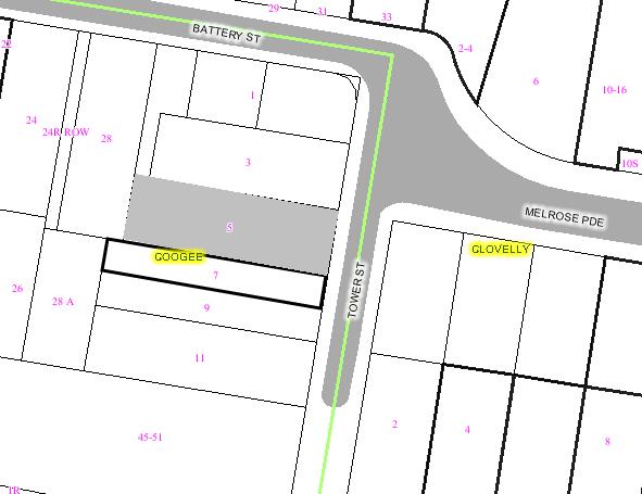
|
|
|
Subject
Site
|
|
|
|
|
|
|
|
|
|
Submissions
received
|
|
Ù
North
|
|
LOCALITY
PLAN
|
1. EXECUTIVE SUMMARY
The subject application has been
referred to the Health, Building and Planning Committee for determination at
the request of Councillors Bradley Hughes, Paul Tracey and Margaret Woodsmith.
The subject site is located on the
western side of Tower Street in Coogee and is currently occupied by a
semi-detached dwelling with 3 bedrooms (including one bedroom and an ensuite
located in the attic). The front fence to the site is a 1.8m high thatch fence.
Adjacent to the south of the site is the other half of the semi-detached
dwelling. Further to the south is a part two part three storey dwelling house.
The adjacent dwelling to the north is a two storey dwelling.
The subject application was
submitted to Council on 18 September 2006 which sought consent for alterations
and new first floor additions to the existing single story semi-detached
dwelling house including new first floor balconies, new front hard stand car
space and associated landscaping. The subject application was submitted
concurrently with a Development Application (DA/837/2006) for the adjoining
semi-detached dwelling house at 9 Tower Street, which also proposes an
identical new first floor addition to the existing dwelling and both dwellings
will share the same roof form.
Following the notification of the
proposal, Council received two submissions from the owners of 5 Tower Street
and a planning consultant acting on behalf of the owners of 5 Tower Street and
a letter of support from the owners of 11 Tower Street. The main issues raised
in the objections were view loss from 5 Tower Street and adverse visual &
acoustic privacy impacts associated with the north-facing first floor balcony.
As a result of the notification, a
meeting was held on the subject site with the applicants and the applicants’
consultants to discuss the issues raised by the objectors and height poles were
requested to be erected on the site to allow an understanding as to the view-related
impacts of the proposal on 5 Tower Street.
Subsequent to this process,
amended plans were lodged on 19 June 2007, which include the following changes
to the proposal:
·
Deletion of
the pitched roof overhang to the first floor east-facing balcony and
replacement with a flat form with a louvred attachment to provide solar
protection.
·
Deletion of
the centrally located first floor north-facing balcony.
·
Reduction and
repositioning of the study at ground floor level to provide greater setback
from the northern side boundary.
·
Repositioning
of the bathroom at ground floor to provide greater setback from the northern
side boundary.
·
Replanning of
the kitchen and living room at ground floor level to provide greater setback
from the northern side boundary.
·
Reduction in
the rear extent of the ground floor level to provide additional opportunities
for landscaping.
·
Reduction in
the length of the first floor level by replanning the master bedroom, so as to
comply with the maximum 12m building length control.
·
Correct
position of the existing dwelling at 5 Tower Street shown on the plans.
The applicants have also submitted
view analysis diagrams prepared by Cad Draft on 25 June 2007, providing a
comparison between the impacts of the approved and proposed developments.
The amended proposal generally
complies with the preferred solutions of the Dwelling Houses and Attached Dual
Occupancies DCP except the side setback requirement at the first floor level.
The assessment of the application reveals that whilst the proposal does not
comply with setback preferred solution, the proposal is consistent with the
bulk and scale of surrounding development, is appropriate in the streetscape
and will not result in adverse overshadowing, privacy, drainage or view loss
impacts subject to conditions.
The recommendation is for approval subject to conditions.
2. THE PROPOSAL
The proposal seeks consent for the
following works:
·
Demolition of
the rear section of the existing dwelling and construction of new rear
extension providing new living & dining areas, kitchen, study and bathroom.
·
Internal
alterations to the existing ground floor involving reconfiguration of rooms,
new laundry, staircase to new upper level, new walls to bedrooms and new
wardrobes to Bedrooms 2 and 3.
·
Construction
of new first floor containing a rumpus room with direct access to front
balcony, a bathroom and a bedroom with direct access to rear balcony.
·
Construction
of new hard stand car space at the front of the site.
·
Demolition of
the existing front boundary fence and construction of new roller shutter door
and associated structure on front boundary.
·
New rear paved
courtyard area and associated landscaped works to the front and rear yards.
3. THE SUBJECT SITE AND
SURROUNDING AREA:
The subject site is located on the
western side of Tower Street slightly south of its intersection with Melrose
Parade, Coogee. The site contains a rectangular shaped allotment with
dimensions 40.53m x 6.165m/6.24m and an area of 240.3 sq.m. The site contains a
semi-detached dwelling with 3 bedrooms (including one bedroom and an ensuite
located in the attic). The front fence to the site is a 1.8m high thatch fence.
Adjacent to the south of the site is the other half of the semi-detached
dwelling. Further to the south is a part two part three storey dwelling at 11
Tower Street. The adjacent dwelling to the north is a two storey dwelling.
The area consists primarily of
single and two storey residential dwellings exhibiting a variety of shapes and
forms interspersed with three to four storey multi-unit housing developments.
There is no consistent dwelling type, design or pattern in Tower Street.
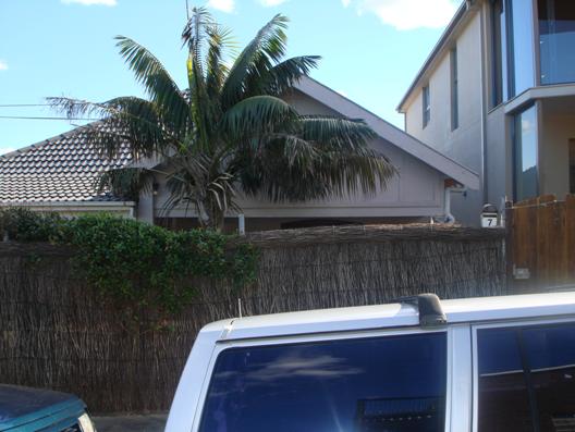
Photo 1: View of the subject site
from Tower Street
Photo 2: Adjoining semi-detached
dwelling at 9 Tower Street, Coogee
Photo 3: Neighbouring dwelling to
the south at 11 Tower Street
Photo 4: Dwelling adjacent to the
north of the site at 5 Tower Street.
4. SITE HISTORY
A. HISTORY OF SITE USAGE
Previous prelodgement and development applications
submitted for development on the site includes:
|
Application
No.
|
Description
|
Determination
|
|
PL/105/2003
|
Proposed alterations & additions to existing
dwelling.
|
Advice provided on 22 December 2003.
|
|
DA/188/2004
|
Demolish rear shed and attic, reconfigure ground floor
and new first floor addition containing bedroom, study and ensuite
|
Approved at Ordinary Council meeting on 19 October 2004.
|
B. PREVIOUS APPROVAL
As noted above, Council at its
Ordinary Council meeting held on 19 October 2004 resolved to grant development
consent to DA No. 188/2004 subject to conditions including the deletion of the
metal awning to the upper level front balcony and roof overhang at the front
elevation to preserve the predominant views from the side boundary living room
window at first floor level of 5 Tower Street.
C. APPLICATION HISTORY
The subject Development
Application was submitted to Council on 18 September 2006 which sought consent
for alterations and new first floor additions to the existing single story
semi-detached dwelling house including new first floor balconies, new front
hard stand car space and associated landscaping. Following the notification of
the proposal, Council received two submissions from the owners of 5 Tower
Street and a planning consultant acting on behalf of the owners of 5 Tower
Street and a letter of support from the owners of 11 Tower Street. The main
issues raised in the objections were view loss from 5 Tower Street and adverse
visual & acoustic privacy impacts associated with the north-facing first
floor balcony.
As a result of the notification, a
meeting was held on the subject site with the applicants and the applicants’
consultants to discuss the issues raised by the objectors and the height poles
were requested to be erected on the site to allow an understanding as to the
view-related impacts of the proposal on 5 Tower Street.
Subsequent to this process,
amended plans were lodged on 19 June 2007, which include the following changes
to the proposal:
·
Deletion of
the pitched roof overhang to the first floor east-facing balcony and
replacement with a flat form with a louvred attachment to provide solar
protection.
·
Deletion of
the centrally located first floor north-facing balcony.
·
Reduction and
repositioning of the study at ground floor level to provide greater setback
from the northern side boundary.
·
Repositioning
of the bathroom at ground floor to provide greater setback from the northern
side boundary.
·
Replanning of
the kitchen and living room at ground floor level to provide greater setback
from the northern side boundary.
· Reduction in the rear extent of
the ground floor level to provide additional opportunities for landscaping.
· Reduction in the length of the
first floor level by replanning the master bedroom, so as to comply with the
maximum 12m building length control.
· Correct position of the existing
dwelling at 5 Tower
Street shown on the
plans.
The applicants have also submitted
view analysis diagrams prepared by Cad Draft on 25 June 2007, providing a
comparison between the impacts of the approved and proposed developments.
5. COMMUNITY CONSULTATION:
The initial and amended proposals
have been notified in accordance with the Development Control Plan – Public
Notification. The following submissions were received:
5.1 Objections
A) Original Proposal
The following objection was
received in respond to the notification of the original proposal:
1) Planet Urban,
acting on behalf of the owners of 5 Tower Street, Coogee.
2) Jason Young
& Catherine Downs, owners of 5 Tower Street, Coogee
The following issues were raised
in the objection:
· Loss of views
· Excessive FSR
· Privacy and overlooking from the
northern side balcony at first floor level
· Request to maintain precedent from
DA No. 188/2004
B) Amended Proposal
The owners of the adjoining
dwellings were renotified of the amended proposal and the following objections
were received:
1) Planet Urban,
acting on behalf of the owners of 5 Tower Street, Coogee.
|
Issue
|
Comment
|
|
A four part assessment, using the planning principle
established in Tenacity v Warringah 2004 proceedings, demonstrates that the
amended proposal will still adversely affect the views from No. 5 Tower
Street and suggested that a compliant side setback would result in a lesser
view impact to No. 5 and the front first floor setback should be increased by
600mm to be consistent with the precedent set by the previous approved scheme
for No. 7 and further reduces the FSR from 0.69:1 to 0.68:1.
|
An assessment of the reasonableness of the amended
proposal, in terms of view loss, using the planning principle established by
the Land and Environment Court in Tenacity Consulting Pty Ltd vs Warringah
Council is provided in Section 9.3 of this report.
|
|
An assessment of amenity impacts on neighbouring
properties using the planning principle established in Pafburn v North Sydney
proceeding, demonstrates a reasonable and compliant development at No. 7
could avoid the view impact to No. 5 generated by the proposal.
|
The amended proposal generally complies with the
relevant controls of the DCP except the side setback of the proposed first
floor addition. The non-compliance is considered to be acceptable and any
further setback without increasing the setback of the front wall from front
boundary or altering the splay at the north-eastern corner of the first floor
addition, would not improve the outlook/view from the side living room window
of No. 5 Tower Street.
|
2) Jason Young
& Catherine Downs, owners of 5 Tower Street, Coogee
|
Issue
|
Comment
|
|
This
proposal achieves greater view amenity for No. 7 Tower Street than the previous
DA/188/2004 as purchased by the applicant.
|
The
proposal has been revised to provide a reasonable view sharing for the
occupants of subject and adjoining dwellings. An assessment of view loss is
provided in Section 9.3 of this report.
|
|
The view amenity from No. 7 Tower Street is similar
whether or not the front wall is altered in keeping with the setback from the
previous DA approval.
|
The view from 7 Tower Street will be affected if the
front wall is pulled back further from the front boundary and the design of
the first floor addition at 9 Tower Street will need to be significantly
altered to maintain the views across the front of the site.
It should be noted that the front wall of the previous
approved scheme was set at the concession of the previous owner/applicant of
the subject property.
|
|
In summary, a more skilful design, altering the position
of the proposed first floor front wall to 1m behind the existing ground floor
front wall, “could provide the applicant with the same development potential
and amenity.” This amenity is significantly greater than that of the DA
approval which was in place when this property was purchased by the
applicant.
|
The suggested design would allow full retention of the
views from the side living room window at first floor level of 5 Tower Street
and taking away the opportunity of reasonable view sharing from 7 Tower
Street unless the design of the proposed first floor additions at 9 Tower
Street is altered as well to maintain the views across the front of the site.
|
|
The amended design incorporates only a minor alteration
to the front of the roof and does not adequately address the view impact on 5
Tower Street. The front setback is unchanged and the awning has not been
deleted despite this being a condition of consent in 2004.
|
The proposal has been revised to achieve the concept of
view sharing. It is agreed that the deletion of the proposed louvered
structure would improve the view/outlook from 5 Tower Street.
|
|
The supporting photographic analysis and town planning
report submitted by the applicant for this amended proposal carry multiple
errors which result in the erroneous conclusion that the impact of this
design is similar to that of 2004. In fact the impact is in excess of the
previous approval.
|
The errors have been rectified and the amended view
analysis diagrams and floor plans have also been submitted.
|
|
A four part assessment, using Tenacity vs Warringah 2004
criteria, demonstrates that the existing views from No. 5 Tower Street
impacted by this design are highly prized views from the main living area of
our home, that these views are severely impacted by the current proposal and
that a more skilful design would reduce the impact.
|
As noted previously, an assessment of the reasonableness
of the amended proposal, in terms of view loss, using the planning principle
established by the Land and Environment Court in Tenacity Consulting Pty Ltd
vs Warringah Council is provided in Section 9.3 of this report.
|
5.2 Support
Two
letters of support were received from the following residents:
Jacki Goodridge and
Rick Roberts, owners of 11 Tower Street, Clovelly
Lynn Hunt, owner of
9 Tower Street, Clovelly
6. TECHNICAL OFFICERS COMMENTS
The
application has been referred to the relevant technical officers, including
where necessary external bodies and the following comments have been provided:
6.1 Development
Engineer
An application has been received
for alterations and additions at the above site.
This report is based on the
following plans and documentation:
Drwg
No’s 2, 3, S & V1 by Carroll & Carroll Architects dated 28 Sept 2006
Landscape Comments
There is a Kentia Palm located in
the front yard which is proposed for removal as its affected by the proposed
works. The subject palm is not a significant specimen and thus its retention is
not warranted. Permission is granted for its removal.
Comment: The Officer’s recommended consent
conditions are included in the recommendation of this report.
7. MASTER
PLANNING REQUIREMENTS
Not applicable as the site is less
than 4,000sqm.
8. RELEVANT
ENVIRONMENTAL PLANNING INSTRUMENTS
The Development application has been assessed in
accordance with the provisions of the following relevant planning documents:
·
Environmental
Planning and Assessment Act, 1979, as amended
·
Randwick Local Environmental Plan 1998
·
Development
Control Plan – Dwelling Houses and Attached Dual Occupancies
9. ENVIRONMENTAL ASSESSMENT
The site has been inspected and the application has
been assessed having regard to Section 79C of the Environmental Planning and
Assessment Act, 1979, as amended.
9.1 Randwick Local Environmental
Plan 1998
The site is zoned Residential 2A
under Randwick Local Environmental Plan 1998 and the proposed development is
permissible with Council’s consent. The following Clauses of the LEP 1998 apply
to the proposal:-
|
Residential
|
|
Clause
No.
|
Effect
|
Applies
|
Comment
|
|
29
|
Foreshore
Scenic Protection Area
|
Yes
|
No
adverse impact, site minimally visible from foreshore but blends in with two
storey context, shapes and forms.
|
9.2 Development
Control Plan – Dwelling Houses and Attached Dual Occupancies
The DCP for Dwelling Houses and
Attached Dual Occupancies states that a proposal is deemed to satisfy the
Objectives and Performance requirements of the DCP if it complies with the
corresponding Preferred Solutions. Therefore, the tables below assess the
proposal against the Preferred Solutions, and where non-compliance results,
assessment is made against the relevant Objectives and Performance
Requirements.
Landscaping
|
|
Preferred
Solution
|
Assessment
|
|
S1
|
40% of
the total site area is provided as landscaped area.
|
40% of the site is landscaped area. Complies.
|
|
S1
|
A
minimum of 25m² of useable private open space is to be provided.
|
The
rear yard has an area of approximately 60 sqm. Complies.
|
|
S1
|
Each
dwelling must provide an area of private open space capable of containing a
rectangle of minimum dimensions of 3m x 4m with minor changes in level.
|
The
above area has dimensions of 6.165m x 9.3m. Complies.
|
|
S1
|
Private
open space in the front yard area is located behind the building line.
|
The
above area is located in the rear yard. Complies.
|
|
S6
|
20% of
the total site area has permeable treatment.
|
24% of
the site is permeable. Complies.
|
Floor Area
|
|
Preferred
Solution
|
Assessment
|
|
S1
|
The
preferred solution for an allotment of this area is that a maximum floor
space ratio of 0.65:1 applies.
|
The
amended proposal has a FSR of 0.64:1 or approximately 154* sqm of gross floor
area. Complies.
|
*The existing outbuilding at the rear of the site is to be
altered and converted to a play area. This area is not included in the gross
floor area calculation as a section of the eastern elevation of the outbuilding
is open and therefore the inclusion is not required under the definition of
“gross floor area” in the DCP. Notwithstanding, it should be noted that the
outbuilding is an existing structure on the site and does not create any
additional impact on the amenity of the adjoining dwellings.
Height, Form & Materials
|
|
Preferred
Solution/Performance Requirement
|
Assessment
|
|
S1
|
External wall height of the building not exceed 7m
|
The proposed development has a maximum external wall
height of approximately 6 metres. Complies
|
|
S1
|
External wall height of buildings or additions to the
rear does not exceed 3.5 m.
|
The rear extension has a maximum external wall height of
approximately 2.7 metres. Complies.
|
|
S3
|
Cut or fill does not exceed 1m.
|
Not applicable.
|
|
S3
|
No excavation within 900mm of a side boundary.
|
Not applicable.
|
|
S3
|
No excavation within 4m of a rear boundary.
|
Not applicable.
|
|
S4
|
The length of a second storey portion is no greater than
12m at less than 1.5m from a southern boundary.
|
The entire southern elevation of the proposed first
floor addition is 12 metres in length and is to be built on the common
boundary of the pair of semi-detached dwellings.
|
|
S5
|
The second storey portion of a semi-detached dwelling be
confined to within the existing roof space or be set back from the front
elevation behind a substantial portion of the existing roof form and the
design respects the symmetry of the adjoining semi-detached dwelling.
|
The proposed first floor addition set in front of the
roof pitch. Does not comply – see assessment below.
|
|
P6
|
Buildings are designed to allow a sharing of views.
|
See assessment in Section 9.3 below.
|
The Objectives of the DCP are that developments should not
be excessive in height and scale and be compatible with the existing character
of the locality; to ensure impacts in terms of privacy, natural light and views
are minimised; and with respect to additions that they not detract from the
individual character and appearance of the existing dwelling.
The relevant Performance Requirements are that the height
of buildings should relate to those in the existing streetscape and the
topography; buildings be designed to enhance the existing desirable built form
character of the street by adopting where relevant characteristics of mass and
proportion, materials and finishes, roof form and pitch, facade articulation,
window and door location and proportions, and verandahs, eaves and parapets;
with respect to additions to semi-detached dwellings they integrate with the
attached dwelling; and views are shared.
It should be noted that the subject application was
submitted concurrently with a Development Application (DA/837/2006) for the
adjoining semi-detached dwelling house at 9 Tower Street which also proposed to
carry out alterations and new first floor additions to the existing dwelling.
In addition, the proposed first floor additions for each dwelling have been
designed by the same Architect and will read as a single built form similar to
a two storey dwelling house. In this regard, given these applications are being
considered concurrently and that by conditions of consent each application
relies on the other for construction, the siting of the upper level to the
front of the dwelling in the context of the development to the adjoining
semi-detached dwelling is considered to be acceptable.
Building Setbacks
|
|
Preferred
Solution
|
Assessment
|
|
S1
|
Front setback is average of adjoining dwellings or 6m.
|
The proposed first floor addition is setback a minimum
of 400 mm behind the existing front building line at ground floor level. The
north-eastern corner of the first floor addition is splayed to allow view
sharing.
|
|
S2
|
No part of the building is closer than 4.5m from rear
boundary.
|
The proposed rear addition is approximately 12 metres
from the rear boundary. Complies.
|
|
S3
|
Side setbacks be 900mm for any part of the building at
ground level.
|
The proposed rear addition is set back a minimum of
900mm from the northern side boundary. Complies.
|
|
S3
|
Side setbacks be 1.5m at second floor level.
|
The proposed first floor addition is set back a minimum
of 900mm from the northern side boundary. Does not comply – see assessment
below.
|
|
S3
|
Side
setbacks be 3.0m at third floor level.
|
Not
applicable.
|
The Objectives and Performance Requirements of the DCP
seek to ensure that there is adequate access to sunlight, daylight and fresh
air to building occupants and neighbours; and with respect to front boundary
setbacks the proposal generally conform to the adjoining development or
dominant streetscape.
It is considered that the non-compliance with the first
floor side setback requirement is acceptable as the separation between the two
first levels (i.e. 5 and 7 Tower Street) where the non-compliance occurs is
approximately 2m. Solar access to the northern side of the building would not
be advantaged by a reduced setback as the adjacent dwelling to the north is a
large two storey building sited on slightly higher ground therefore completely
overshadowing the proposed first floor addition. The separation is considered
sufficient in terms of ventilation given the site is located within 100m of the
coast and is subjected to constant coastal winds and breezes year round.
The non-compliance to the southern boundary is unavoidable
given the house is one half of a semi detached dwelling. Complete compliance
with the first floor setback requirements on both sides would result in an
awkward shaped first level that would be too narrow to be rendered usable and
would appear out of character in the streetscape which exhibits symmetrical two
storey buildings.
The proposed setbacks are therefore considered reasonable
and do not result in adverse amenity impacts to adjacent neighbours.
Visual & Acoustic Privacy
|
|
Preferred
Solution
|
Assessment
|
|
S1
|
Habitable room windows within 9m of another dwelling’s
windows are offset by 45 degrees or have fixed obscure glazing below 1.5m
above floor level.
|
The proposal does not have any habitable room windows
that overlook those of adjoining dwellings within 9 metres. Complies.
|
|
S1
|
Direct view into open space of an adjoining dwelling is
obscured or screened within 9m and is beyond a 45 degree angle.
|
The first floor rear balcony will overlook the rear yard
area of the northern adjoining dwelling at 5 Tower Street. A condition
requiring the installation of 1.8m high privacy screen to the northern side
of the balcony is included in the recommendation of this report.
|
|
S1
|
Windows have sill heights of 1.5m or more or fixed
obscure glazing below that height.
|
Not applicable.
|
|
S3
|
Buildings
comply with AS 371 and AS 2107.
|
Conditioned
to comply with the BCA.
|
Safety & Security
|
|
Preferred
Solution
|
Assessment
|
|
S1,2,3
|
Front doors of dwellings are visible from the street.
|
The front door of the existing dwelling faces the street
and will be retained.
|
|
S1,3
|
Dwellings have at least one habitable room window
overlooking the street.
|
The proposal has windows and balcony that overlook the
street. Complies.
|
|
S2
|
A Council-approved street number is conspicuously
displayed at the front of the dwelling or front fence.
|
Suitable condition included.
|
Garages & Driveways
|
|
Preferred
Solution
|
Assessment
|
|
S1
|
Council’s Parking DCP requires 1 space, for dwellings
with 2 bedrooms or less, or 2 spaces, for dwellings with 3 bedrooms or more.
|
The proposal incorporates a single opened turfed/paved
car parking area within the front setback.
|
|
S1
|
Car parking spaces have a minimum dimension of 5.5m x
2.5m.
|
The dimensions of the parking space are 5.6m x 3m.
Complies.
|
|
S1
|
Driveways have minimum width of 3m and are set back at
least 1m from the side boundary.
|
Not applicable.
|
|
S1
|
Driveways have a maximum width of 3m at the property
boundary.
|
Not applicable.
|
|
S1
|
Driveway gradients should not exceed a maximum of 1 in 8
for the first 5m from street alignment and 1 in 6 thereafter.
|
Not applicable.
|
|
S1
|
With
respect to garages and carports to rear lanes these should be set back 1m to
improve pedestrian visibility.
|
Not
applicable.
|
|
S2
|
Parking
and access is provided from the rear of the allotment where possible.
|
Not
applicable.
|
|
S2
|
Garages and carports located behind the building line
where parking only available from the front of the site.
|
Not applicable.
|
|
S2
|
Driveways, car parking spaces and structures do not
occupy more than 35% of the width of the allotment
|
The proposed roller door and its associated structure at
the street boundary occupy about 69% of the width of the site frontage. Does
not comply – see assessment below.
|
The Objectives and Performance Requirements of the DCP
include that car parking and driveways are not visually obtrusive and do not
detract from the appearance of the dwelling and the street scape; and
structures are compatible in scale, form, materials and finishes with the
associated dwelling.
The proposed roller door and its associated structure at
the front boundary having a width of 5.1m (including the supporting columns on
both sides) is considered to be excessive and is not necessary for a single car
parking space. The only roller door structure built on the Tower Street
boundary is at No. 9 and is only 2.9m in width. The height of the proposed
roller door structure further adds unnecessary bulk which will not be
compatible with the height of the existing fencing along the western side of
Tower Street and the overall character of the street. For these reasons, it is
considered that the proposed roller door structure should be deleted and any
fence on front boundary should have a maximum height of 1.8m to ensure the proposed
development complies with the relevant objectives, performance requirements and
preferred solutions of the DCP.
Fences
|
|
Preferred
Solution
|
Assessment
|
|
S1
|
Existing sandstone fences and walls are
retained/recycled.
|
Not applicable.
|
|
S1
|
Solid front fences or on street frontages in front of
the building line are no higher than 1.2m.
|
Not applicable.
|
|
S1
|
Fences in front of the building line or on street
frontages may be up to 1.8m provided that the upper two thirds is at least
50% open.
|
The proposed roller door structure has a maximum height
of approximately 3.2 metres. Does not comply – see assessment below.
|
Generally, the Objectives and Performance Requirements for
fences in the DCP are to ensure that front fencing is integrated with the
street scape and is compatible with the appearance of the dwelling and any
established local fence form and material.
The front fence to the site currently contains a thatched
fence of approximately 1.8m in height and the existing fencing along the
western side of Tower Street is predominately open design fence of a maximum
height of 1.8m. Photo 5 below shows the existing fence form in Tower Street.
Photo 5: Existing fence form on the western side of Tower
Street
The proposal involves the removal of the existing thatched
fence and replaces it with a roller door structure having a maximum height of
approximately 3.2m and a solid timber gate of maximum height of 1.7m. As noted
previously, it is considered that the height of the proposed roller door
structure is excessive and will not be compatible with the existing fence form
in the street and therefore should be deleted or redesigned to minimise the
impact of the character of the existing streetscape.
Solar Access and Energy
Efficiency
|
|
Preferred
Solution
|
Assessment
|
|
S1
|
New dwellings comply with a minimum of 3.5 stars on the
NatHERS.
|
Not applicable.
|
|
S2
|
Private open space receives at least 3 hours sunlight
over part of its area between 9am and 3pm on 21 June.
|
The rear yard will receive at least 3 hours of sunlight.
Complies.
|
|
S2,8
|
North-facing windows to living areas receive at least 3
hours sunlight over part of its area between 9am and 3pm on 21 June.
|
The proposal includes north-facing windows that will
receive at least 3 hours of sunlight. Complies.
|
|
S9
|
Solar access to existing or future solar collectors on
adjacent buildings is maintained between 9am and 3pm each throughout the
year.
|
The proposal will not overshadow existing solar
collectors on adjoining properties. Complies.
|
|
S9
|
North-facing windows to living areas of neighbouring
dwellings receive at least 3 hours sunlight over part of its area between 9am
and 3pm on 21 June. If currently less than 3 hours, it is not further
reduced.
|
The proposal will not reduce solar access to less than 3
hours on north-facing windows. Complies.
|
|
S9
|
Principal outdoor recreation space of neighbouring
dwellings receive at least 3 hours sunlight over part of its area between 9am and 3pm on 21
June. If currently less than 3 hours, it is not further reduced.
|
The proposal will not reduce solar access to private
open space to less than 3 hours. Complies.
|
9.3 View Sharing
The proposal will result in view loss from the first floor
of the adjacent building to the north, known as 5 Tower Street, Coogee. The
dwelling at 5 Tower Street contains a first floor front balcony and a full
height window to the living room facing the southern boundary. Concerns were
raised by the owners of 5 Tower Street with respect to view loss of the coast,
Gordons Bay and Wedding Cake Island to the south as a result of the proposed
first floor addition. In response to this issue, the applicant has amended the
proposal by deleting the pitched roof overhang to the first floor east-facing
balcony and replaced it with a flat roof with a louvred attachment and retention
of a splayed corner at the north-eastern part of the first floor level, to
maintain views across the front of the site. The applicant has also erected
height poles on the subject site showing the extent of the proposed first floor
additions. The following photos show the views currently available from the
front balcony and side living room window of the adjoining dwelling at 5 Tower
Street.
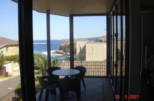
Photo 6: Views from the first floor east-facing balcony of
5 Tower Street looking south over the front section of the subject site.
Approximate height and
extent of the roof of the initial proposal
|
|

Front building line and
height of the roof gutter of the amended proposal
|
|
Previous approved front
building line and building height
|
|


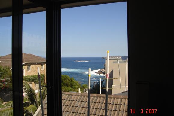
Photo 7: Views from the living area at the first floor
level of 5 Tower Street looking over part of the subject site at standing
position.
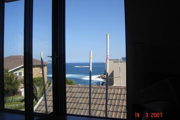
Photo 8: Views from the living area at the first floor
level of 5 Tower Street looking over subject site at sitting position.
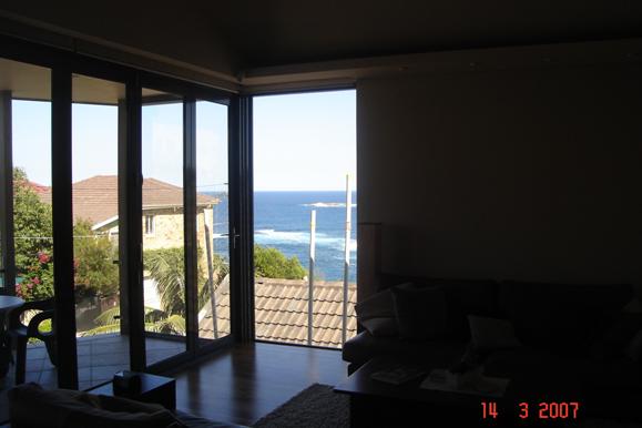
Photo 9: Views from the kitchen area at the first floor
level of 5 Tower Street looking over subject site at standing position.
Performance Requirement P6 under section 4.3 Height, Form
and Materials of the Development Control Plan for Dwelling Houses and Attached
Dual Occupancies requires that “buildings are designed to allow a sharing of
views”.
The concept of ‘view sharing’ was further defined in the
Land and Environment Court by Senior Commissioner Roseth in Tenacity v
Warringah Council (2004) proceedings. The Senior Commissioner’s discussion
of the notion of view sharing is provided below as background:
“The notion of view sharing is
invoked when a property enjoys existing views and a proposed development would
share that view by taking some of it away for its own enjoyment. (Taking it all
away cannot be called view sharing, although it may, in some circumstances, be
quite reasonable.) To decide whether or not view sharing is reasonable, I have
adopted a four-step assessment.
(1) “The
first step is the assessment of views to be affected. Water views are valued
more highly than land views. Iconic views (e.g. of the Opera House, the Harbour
Bridge or North Head) are valued more highly than views without icons. Whole
views are valued more highly than partial views, e.g. a water view in which the
interface between land and water is visible is more valuable than one in which
it is obscured.
Views available to 5 Tower Street are two-fold. Firstly,
views are available to the southeast from the front east-facing balcony (shown
in photo 6 above) to the ocean, Gordon Bay and Wedding Cake Island. Views to
the south and southwest from the front east-facing balcony are largely obscured
by 11 Tower Street. Secondly, views are available from the side boundary south
facing living room window. Views from the living room window are mainly to the
southeast and include the ocean, wedding cake island and part of the Gordons
Bay as well as 11 Tower Street (depending on where you stand within the living
room as shown in photos 7, 8 & 9 above). The water views and Wedding Cake
Island views are considered to be valuable views.
(2) The
second step is to consider from what part of the property the views are
obtained. For example the protection of views across side boundaries is more
difficult than the protection of views from front and rear boundaries. In
addition, whether the view is enjoyed from a standing or sitting position may
also be relevant. Sitting views are more difficult to protect than standing
views. The expectation to retain side views and sitting views is often
unrealistic.
The views which will be partially affected by the amended
proposal are views from various positions within the living room and kitchen
looking out through a window on the southern side of 5 Tower Street near front
balcony. There is no view loss to the first floor front balcony of 5 Tower
Street.
It should be noted that the amount of views available from
the affected window is dependant on where you stand in the living room/kitchen.
In general, the views are only available from the front section of the living
room towards the front balcony, as one moves further into the living room away
from the front balcony, the extent of views obtained are reduced, due to the
location of the window, views and line of sight. In the amended proposal, part
of the views from the side window will be blocked by the front section of the
proposed first floor additions (shown in photos 7, 8 & 9 above) but a reasonable
level of outlook including the view of Wedding Cake Island can still be
attained through the window and the views are available from both standing and
sitting position as the window is full height.
Given that the primary views from the front balcony of 5
Tower Street are being retained and the line of sight to obtain views from the
side living room window is entirely over the subject site at 7 Tower Street, it
would be reasonable to expect a degree of view loss from the affected window.
Further, as noted by Senior Commissioner Roseth in Tenacity v Warringah
Proceedings, “the expectation to retain side views and sitting views is
often unrealistic”.
(3) The
third step is to assess the extent of the impact. This should be done for the
whole of the property, not just for the view that is affected. The impact on
views from living areas is more significant than from bedrooms or service areas
(though views from kitchens are highly valued because people spend so much time
in them). The impact may be assessed quantitatively, but in many cases this can
be meaningless. For example, it is unhelpful to say that the view loss is 20%
if it includes one of the sails of the Opera House. It is usually more useful
to assess the view loss qualitatively as negligible, minor, moderate, severe or
devastating.
As noted previously, the amended proposal will only affect
the views from the side living room window and the primary views from the front
balcony of 5 Tower Street will be retained. It is considered that the extent of
the impact from the side living room window is minor as the views to Wedding
Cake Island and ocean can still be attained from the window depending on where
you stand in the living room/kitchen.
(4) The
fourth step is to assess the reasonableness of the proposal that is causing the
impact. A development that complies with all planning controls would be
considered more reasonable than one that breaches them. Where an impact on
views arises as a result of non-compliance with one or more planning controls,
even a moderate impact may be considered unreasonable. With a complying
proposal, the question should be asked whether a more skilful design could
provide the applicant with the same development potential and amenity and
reduce the impact on the views of neighbours. If the answer to that question is
no, then the view impact of a complying development would probably be
considered acceptable and the view sharing reasonable.
The proposed development generally complies with the
relevant preferred solutions of the DCP except for the setback from the side
boundary at the first floor level. However, the issue of view loss is not
directly associated with side setback, rather it is the front setback. A
development with a fully compliant side setback at first floor level (i.e. 1.5m
from side boundary) could easily be subject to the same problem. The issue of
view loss is therefore tied more closely in this instance with setback from
front boundary. The performance requirement of the DCP requires the dwelling to
maintain a consistent front building setback of adjoining development or the
dominant setback along the street. To this end, the proposal has shown full
compliance with this requirement.
It should be also noted that the proposal incorporates a
splay at north-eastern corner of the first floor additions and further
amendments were made to delete the pitched roof over the front section of the
first floor addition and an overhang to the front balcony to further minimise
the potential view loss from 5 Tower Street. Whilst it is acknowledged that the
proposal has been revised to minimise view loss from No. 5, it is considered
that the provision of an overhang to the front balcony will obscure the views
and its deletion would improve the views to the ocean and Wedding Cake Island
from most of the living room of No. 5 in either standing or sitting position.
It is considered that the suggestion made by the objectors
to pull the front wall of the proposed first floor back by 600mm to maintain
the consistency with the previous approved development is unreasonable as this
will allow full retention of the views from the side window of No. 5 Tower
Street whereas the views from the proposed rumpus room at the first floor level
of No. 7 Tower Street will be significantly reduced unless substantial
alterations are made to the proposal at 9 Tower Street. The quantity and
quality existent of the view available from the front living area of Nos. 5 and
7 Tower Street would be similar and therefore equitable if the front setback of
the proposed addition of No. 7 Tower Street is maintained as per the current
scheme. Whilst it is acknowledged that the existing views from No. 5 will be
partially affected by the amended proposal, it is considered that the degree of
the impact is reasonable and any further setback from the front boundary would
conflict with the concept of view sharing as defined by Senior Commissioner
Roseth in Tenacity v Warringah Council (2004) proceedings.
For these reasons, it is considered that the proposed
first floor setback should be supported subject to conditions requiring the
deletion of the proposed overhang over the front balcony and ensuring the view
is not further blocked by other structures such as privacy screens.
10. RELATIONSHIP TO CITY PLAN
The relationship with the City Plan is as follows:
Outcome
4: Excellence in urban design.
Direction 4a: Improved design and
sustainability across all development.
11. FINANCIAL IMPACT STATEMENT
There is
no direct financial impact for this matter.
12. CONCLUSION
The proposed development is generally consistent with the
aims, objectives and performance requirements of the DCP for Dwelling Houses
and Attached Dual Occupancies. The proposed development is consistent with the
bulk and scale of adjacent and surrounding buildings and does not result in
adverse amenity impacts to neighbours by way of privacy, overshadowing or
unreasonable view loss. The proposal is recommended for approval subject to
conditions.
RECOMMENDATION:
A. THAT
Council as the responsible authority grant its development consent under
Section 80 and 80A of the Environmental Planning and Assessment Act 1979 (as
amended) to Development Application No. 838/2006 to carry out alterations and
new first floor additions to the existing single storey semi-detached dwelling
house including new first floor balconies, new front hardstand car space and
associated landscaping at 7 Tower Street, Coogee subject to the following
conditions:
1. The
development must be implemented substantially in accordance with the amended
plans numbered 1b and 2b, dated 2 July 2007 and received by Council on 2 July
2007, the application form and on any supporting information received with the
application, except as may be amended by the following conditions and as may be
shown in red on the attached plans:
The following conditions are
applied to satisfy the provisions of section 79C of the Environmental Planning
and Assessment Act 1979 and to maintain reasonable levels of environmental
amenity:
2. The
first floor addition to the subject premises must be constructed at the same
time as the adjoining dwelling at 9 Tower Street to the satisfaction of
Council.
3. A
Construction Certificate for DA consent 838/2006 must not be issued by Council
or an the Certifying Authority unless that Construction Certificate also
incorporates DA consent 837/2006.
Reason:
Council is of the opinion that
approval of both DA 838/2006 and DA 837/2006 is warranted only in circumstances
where both semi detached dwellings, known as Nos 7 & 9 Tower Street, Coogee
are acted upon concurrently. The condition is imposed to prevent the owner of
either property engaging a private certifier to issue an individual
construction certificate for their property. Failure to comply with this
condition would amount to an offence pursuant to the Environmental Planning and
Assessment Act. In the absence of both consents being acted upon concurrently a
streetscape issue may arise.
4. An
Occupation Certificate must not be issued for the first floor addition to the
subject development prior to the adjoining dwelling at 9 Tower Street
(DA/837/2006) being constructed at least up to “lock up” stage (completion of
all structural work, internal and external wall frame, roofing, guttering and
drainage and external walls/cladding and finishes) to the satisfaction of
Council.
5. The
colours, materials and finishes of the external surfaces to the building are to
be compatible with the existing and adjacent development to maintain the
integrity and amenity of the building and the streetscape.
Details of the proposed colours,
materials and textures (i.e. a schedule and brochure/s or sample board) are to
be submitted to and approved by Council’s Director of Planning & Community
Development, in accordance with section 80A (2) of the Environmental
Planning and Assessment Act 1979 prior to a construction certificate
being issued.
6. At no time
shall any privacy screening devices be placed or erected on the northern side
of the first floor balcony. The glazing to the first floor balustrade shall be
clear/transparent glass.
7. The
proposed sun louvres to the first floor level front balcony at the front
elevation shall be deleted.
8. A privacy
screen having a height of 1.8m, measured from the finished balcony level, is to
be provided to the northern side of the rear first floor balcony to minimise
overlooking into the rear yard of 5 Tower Street. Details of compliance are to
be provided in the construction certificate plans.
9. The
proposed roller shutter door and its associated structure on the front boundary
are to be deleted and the fence on the street alignment is to be a maximum
height of 1.8m at any point, to maintain reasonable levels of amenity to the
streetscape.
10. Metal roof
sheeting is to be painted or colour bonded to minimise reflection and to be
sympathetic and compatible with the building and surrounding environment.
11. There must
be no encroachment of the structure/s onto any adjoining premises or onto
Council’s road reserve, footway or public place, unless permission has been
obtained from the owner/s of the adjoining land accordingly.
12. Any gate
openings shall be constructed so that the gates, when hung, will be fitted in
such a manner that they will not open over the footway or public place.
13. Street
numbering must be provided to the premises in a prominent position, to the
satisfaction of Council.
14. The
finished ground levels external to the building are to be consistent with the
development consent and are not to be raised (other than for the provision of
paving or the like on the ground) without the written consent of Council.
The following conditions are imposed to promote
ecologically sustainable development and energy efficiency.
15. The
consumption of water within the building shall be minimised by the use of
triple A rated water efficient plumbing fixtures (taps and shower roses) and
water efficient dual flush toilets. Details of compliance are to be noted in
the construction certificate plans or specifications.
16. External
timber or metal framed and brick veneer walls and roofs are to be provided with
insulation (i.e. bulk insulation and a reflective building membrane/reflective
sarking/foil insulation), having a minimum total thermal resistance R–value of
3.0 in roofs and 1.5 in external walls. The insulation and reflective building
membrane is to be installed in accordance with the relevant requirements of the
Building Code of Australia and the manufacturers details.
Details of compliance with the
requirements for insulation are to be included in the construction
certificate application.
17. Hot water
service pipes are to be provided with insulation and must also satisfy any
relevant requirements of Building Code of Australia and AS 3500.
The following group of conditions have been applied to
ensure that adequate drainage is provided from the premises and to maintain
adequate levels of health and amenity in the locality:
18. Surface
water/stormwater must be drained and discharged to the street gutter to the
satisfaction of the certifying authority and details of the proposed stormwater
drainage system are to be included in the construction certificate details for
the development.
Details of
any works proposed to be carried out in or on a public road/footway are to be
submitted to and approved by Council prior to commencement of works.
19. External
paths and ground surfaces are to be graded and drained away from the building
and adjoining premises in such a manner so as not to result in the entry of
water into a building, or cause a nuisance or damage to the adjoining premises.
The following conditions are applied to ensure that the
development satisfies the provisions of the Environmental Planning and
Assessment Act 1979 and Regulations:
20. The
requirements and provisions of the Environmental Planning & Assessment Act
1979 and Environmental Planning & Assessment Regulation 2000, must be fully
complied with at all times.
Failure to comply with these legislative requirements is
an offence and may result in the commencement of legal proceedings, issuing of
`on-the-spot` penalty infringements or service of a notice and order by
Council.
21. All new
building work must be carried out in accordance with the provisions of the Building
Code of Australia (BCA), in accordance with Clause 98 of the Environmental
Planning and Assessment Regulation 2000.
22. Prior
to the commencement of any building works, a construction certificate must
be obtained from the Council or an accredited certifier, in accordance with the
provisions of the Environmental Planning & Assessment Act 1979 and
Environmental Planning & Assessment Regulation 2000.
23. Prior to
the commencement of any building works, the person having the benefit of
the development consent must: -
i) appoint a Principal
Certifying Authority for the building work; and
ii) appoint a principal
contractor for the building work, or in relation to residential building
work, obtain an owner-builder permit in accordance with the requirements
of the Home Building Act 1989, and notify the Principal Certifying Authority
and Council accordingly in writing; and
iii) unless the
person having the benefit of the consent is the principal contractor
(i.e. owner-builder), notify the principal contractor of the
required critical stage inspections and other inspections to be carried
out, as specified by the Principal Certifying Authority; and
iv) give at
least two days notice to the Council, in writing, of the persons intention to
commence building works.
In
relation to residential building work, the principal contractor must be the
holder of a contractor licence, in accordance with the provisions of the Home
Building Act 1989.
24. The
building works must be inspected by the Principal Certifying Authority
(or another certifying authority if the Principal Certifying
Authority agrees), in accordance with sections 109 E (3) of the
Environmental Planning & Assessment Act 1979 and clause 162A of the
Environmental Planning & Assessment Regulation 2000, to monitor compliance
with the relevant standards of construction, Council’s development consent and
the construction certificate.
The Principal Certifying
Authority must specify the relevant stages of construction to be inspected
in accordance with section 81A (2) (b1) (ii) of the Environmental Planning
& Assessment Regulation 2000 and a satisfactory inspection must be carried
out, to the satisfaction of the Principal Certifying Authority, prior to
proceeding to the subsequent stages of construction or finalisation of the
works (as applicable).
Documentary evidence of the
building inspections carried out and details of compliance with Council’s
consent is to be maintained by the Principal Certifying Authority.
Details of critical stage inspections carried out and copies of
certification relied upon must also be forwarded to Council with the occupation
certificate.
The principal contractor or
owner-builder (as applicable) must ensure that the required critical
stage and other inspections, as specified in the Principal Certifying
Authority’s “Notice of Critical Stage Inspections”, are carried out to the
satisfaction of the Principal Certifying Authority and at least 48 hours
notice (excluding weekends and public holidays) is to be given to the Principal
Certifying Authority, to carry out the required inspection, before carrying
out any further works.
25. A sign must
be erected and maintained in a prominent position on the site, which contains
the following details:
·
name, address,
contractor licence number and telephone number of the principal contractor,
including a telephone number at which the person may be contacted outside
working hours, or owner-builder permit details (as applicable);
·
name, address
and telephone number of the Principal Certifying Authority; and
·
a statement
stating that “unauthorised entry to the work site is prohibited”.
26. An
Occupation Certificate must be obtained from the Principal Certifying
Authority prior to any occupation of the building work encompassed in
this development consent (including alterations and additions to existing
buildings), in accordance with the relevant provisions of the Environmental
Planning & Assessment Act 1979.
An
Occupation Certificate must not be issued for the development if the
development is inconsistent with the development consent. The requirements of
the Environmental Planning & Assessment Act 1979 and conditions of
development consent must be satisfied prior to the issuing of an occupation
certificate.
27. Prior
to the issuing of an interim or final occupation certificate, a statement
is required to be obtained from the Principal Certifying Authority, which
confirms that the development is not inconsistent with the development consent
and the relevant conditions of development consent have been satisfied.
Details of critical stage
inspections carried out by the principal certifying authority together with any
other certification relied upon and must also be provided to Council with the
occupation certificate.
28. In
accordance with clause 98 of the Environmental Planning and Assessment
Regulation 2000, it is a prescribed condition, that in the case of residential
building work, a contract of insurance must be obtained and in force, in
accordance with the provisions of the Home Building Act 1989.
Where the
work is to be done by a licensed contractor, excavation or building work must
not be carried out unless the Principal Certifying Authority (PCA): -
·
has been
informed in writing of the licensee’s name and contractor number; and
·
is satisfied
that the licensee has complied with the insurance requirements of Part 6 of the
Home Building Act 1989, or
Where the
work to be done by any other person (i.e. an owner-builder), excavation
or building work must not be carried out unless the Principal Certifying
Authority: -
·
has been
informed of the person’s name and owner-builder permit number; or
·
has been given
a declaration, signed by the owner of the land that states that the market cost
of the labour and materials involved in the work does not exceed $5,000.
Details of the principal building
contractor and compliance with the provisions of the Home Building Act 1989
(i.e. Details of the principal licensed building contractor and a copy of the
Certificate of Insurance) are to be submitted to Council prior to the
commencement of works, with the notice of appointment of the PCA / notice
of intention to commence building work.
29. The
required Long Service Levy payment, under the Building and Construction
Industry Long Service Payments Act 1986, is to be forwarded to the Long Service
Levy Corporation or the Council, prior to the issuing of a Construction
Certificate, in accordance with Section 109F of the Environmental Planning
& Assessment Act 1979.
At the
time of this development consent, Long Service Levy payment is applicable on
building work having a value of $25,000 or more, at the rate of 0.35% of the cost of the works.
30. Smoke alarms are required
to be installed in each Class 1 building or residential dwelling in accordance
with the relevant provisions of Part 3.7.2 of the B.C.A. – Housing Provisions.
Smoke alarms must comply with AS3786 – Smoke alarms and be
connected to the consumer mains electric power supply and provided with a
battery back-up.
The smoke alarms are to be installed in suitable locations
on or near the ceiling, in any storey containing bedrooms; located between each
part of the dwelling containing the bedrooms and the remainder of the dwelling,
or where bedrooms are served by a hallway, the smoke alarms are to be located
in that hallway; and smoke alarms are to be installed in any other storey not
containing bedrooms, to the satisfaction of the certifying authority.
Smoke alarms are not to be located in ‘dead-air-spaces’,
in the corner junction of walls and ceilings between exposed rafters/joists or
at the apex of raked ceilings, as detailed in Part 3.7.2 of the Building Code
of Australia – Housing Provisions.
Details of compliance with the provisions of the Building
Code of Australia must be included in the plans/specification for the construction
certificate.
The following conditions are applied to ensure that the
development satisfies relevant standards of construction, and to maintain
adequate levels of health, safety and amenity during construction:
31. The
demolition, removal, storage, handling and disposal of building products and
materials must be carried out in accordance with the relevant requirements of
WorkCover NSW, the NSW Department of Environment & Conservation (formerly
the Environment Protection Authority) and Randwick City Council policies and
conditions, including:
· Occupational Health and Safety Act 2000
· Occupational Health and Safety (Hazardous
Substances) Regulation 2001
· Occupational Health and Safety (Asbestos
Removal Work) Regulation 2001
· WorkCover NSW Code of Practice for the Safe
Removal of Asbestos
·
Australian
Standard 2601 (2001) – Demolition of Structures
·
The Protection
of the Environment Operations Act 1997 and Protection of the Environment
Operations (Waste) Regulation 1996.
·
Relevant Department of Environment &
Conservation (DEC) / Environment Protection Authority (EPA) and WorkCover NSW
Guidelines.
·
Randwick City
Council Asbestos Policy (adopted 13 September 2005)
A copy of Council’s Asbestos Policy is available on Council’s web
site at www.randwick.nsw.gov.au in the Building & Development section or a
copy can be obtained from Council’s Customer Service Centre.
32. A copy of
the construction certificate, the approved plans & specifications and
development consent conditions must be kept on the site at all times and be
made available to the Council officers and all building contractors for
assessment.
33. All
excavations and backfilling associated with the erection or demolition of a
building must be executed safely in accordance with appropriate professional
standards and excavations are to be properly guarded and supported to prevent
them from being dangerous to life, property or buildings.
Retaining
walls, shoring or piling must be provided to support land which is excavated in
association with the erection or demolition of a building, to prevent the
movement of soil and to support the adjacent land and buildings, if the soil
conditions require it. Adequate provisions are also to be made for drainage.
Retaining
walls, shoring, or piling must be designed and installed in accordance with
appropriate professional standards and the relevant requirements of the
Building Code of Australia and Australian Standards. Details of proposed
retaining walls, shoring or piling are to be submitted to and approved by the
Principal Certifying Authority for the development prior to commencing such
excavations or works.
34. Except with the written
approval of Council’s Manager of Health, Building & Regulatory Services,
all building, demolition and associated site works (including site deliveries)
must only be carried out between the hours of 7.00am to 5.00pm on Monday to
Friday inclusive and between 8.00am to 5.00pm on Saturdays and all building
activities are strictly prohibited on Sundays and Public Holidays.
In addition, the use of any rock
excavation machinery or any mechanical pile drivers or the like, is restricted
to the hours of 8.00am to 5.00pm (maximum) on Monday to Friday only, to
minimise the noise levels during construction and loss of amenity to nearby
residents.
35. Noise and vibration
emissions during the construction of the building and associated site works
must not result in damage to nearby premises or result in an unreasonable loss
of amenity to nearby residents and the relevant provisions of the Protection
of the Environment Operations Act 1997 must be satisfied at all times.
36. Public safety and
convenience must be maintained at all times during demolition, excavation and
construction works.
The roadway, footpath and nature strip must be maintained
in a good, safe condition and free from any obstructions, materials, soils or
debris at all times. Any damage caused to the road, footway or nature strip
must be repaired immediately, to the satisfaction of Council.
A Road Opening Permit must be obtained from the Council
and other relevant Authorities prior to excavating or opening-up the road or
footway for services or the like.
37. Building materials, sand,
soil, waste materials or construction equipment must not be placed upon the
footpath, roadway or nature strip at any time and the footpath, nature strip
and road must be maintained in a clean condition and free from any
obstructions, soil and debris at all times.
Bulk bins/waste containers must not be located upon the
footpath, roadway or nature strip at any time without the prior written
approval of the Council, unless the waste container is located upon the road in
accordance with the Roads & Traffic Authority Guidelines and Requirements,
and the container is exempt from an approval under Development Control Plan for
Exempt & Complying Development and Council’s Local Approvals Policy.
Applications to place a waste container in a public place can be made to
Council’s Building Services section.
38. During construction
stages, sediment laden stormwater run-off shall be controlled using the
sediment control measures outlined in the manual for Managing Urban Stormwater
– Soils and Construction, published by the NSW Department of Housing
Stockpiles of soil, sand, aggregate or other materials
must not be located on any footpath, roadway, nature strip, drainage line or
any public place and the stockpiles must be protected with adequate sediment
control measures.
Building operations such as brick cutting, washing tools
or equipment and mixing mortar are not permitted on public footpaths, roadways,
nature strips, in any public place or any location which may lead to the
discharge of materials into the stormwater drainage system.
A warning sign for soil and water management must be
displayed in a prominent position on the building site, visible to both the
public and site workers. The sign must be displayed throughout the
construction period. Copies of a suitable warning sign are available at
Council’s Customer Service Centre for a nominal fee.
39. Public safety must be
maintained at all times and public access to the site and building works,
materials and equipment on the site is to be restricted, when work is not in
progress or the site is unoccupied.
A temporary safety fence is to be provided to protect the
public, located to the perimeter of the site (unless the site is separated from
the adjoining land by an existing structurally adequate fence, having a minimum
height of 1.5 metres). Temporary fences are to have a minimum height of 1.8
metres and be constructed of cyclone wire fencing, with geotextile fabric attached
to the inside of the fence to provide dust control, or other material approved
by Council.
Temporary site fences are to be structurally adequate,
safe and be constructed in a professional manner and the use of poor quality
materials or steel reinforcement mesh as fencing is not permissible.
The public safety provisions and temporary fences must be
in place prior to the commencement of any demolition, excavation or building
works and be maintained throughout construction.
If it is proposed to locate any site fencing, hoardings or
amenities upon a footpath or public place, the written consent from Council’s
Building Services section must be obtained beforehand and detailed plans are to
be submitted to Council for consideration, together with payment of the weekly
charge in accordance with Council’s adopted fees and charges.
40. A local approval
application must be submitted to and be approved by Council's Building Services
section prior to commencing any of the following activities on a footpath,
road, nature strip or in any public place:-
·
Install or
erect any site fencing, hoardings or site structures
·
Operate a
crane or hoist goods or materials over a footpath or road
·
Placement of a
waste skip (grater than 3m in length) or any container or other article.
The following group of conditions have been applied to
ensure the structural adequacy and integrity of the proposed building and
adjacent premises:
41. A
Certificate of Adequacy supplied by a professional engineer shall be
submitted to the certifying authority (and the Council, if the Council is
not the certifying authority) prior to a construction certificate being
issued for the development, certifying the structural adequacy of the
existing structure to support the additional storey.
The following conditions have been applied to ensure that
adequate security provisions are made for vehicular access, parking and public
infrastructure:
42. A Road Opening Permit must
be obtained from Council's City Services Department prior to opening-up or
carrying out any proposed works within the road, footpath, nature strip or
other public place and all works including repairs are to be carried out to
Council's satisfaction.
Civil Works Conditions
The following conditions are applied to provide adequate
provisions for access, transport and infrastructure:
43. Prior
to the issue of an occupation certificate, the applicant must meet the full
cost for Council or a Council approved contractor to:
a. Construct
concrete vehicular crossing and layback at kerb opposite the vehicular entrance
to the site.
44. The
applicant must meet the full cost for Council or a Council approved contractor
to repair/replace any damaged sections of Council's roadway, footpath, kerb
& gutter, nature strip etc which are due to building works being carried
out at the above site. This includes the removal of cement slurry from
Council's footpath and roadway.
45. The
applicant shall note that all external work, carried out on Council property,
shall be in accordance with Council's Policy for "Vehicular Access and
Road and Drainage Works". An application for the cost of the Council civil
works is to be submitted to Council at the completion of the internal building
works. An application fee shall be payable to Council for the quotation of the
required works. The applicant may elect to use his contractor for the required
works, subject to Council approval, however a design and supervision fee based
on the lowest quotation from Council's nominated contractor will be required to
be paid prior to the commencement of any works.
Alignment Level Conditions
The following conditions are applied to provide adequate
provision for future civil works in the road reserve:
46. The
Council’s Development Engineer has inspected the above site and have determined
that the design alignment level (concrete/paved/tiled level) at the property
boundary for driveway and pathway entrances shall be as follows:
Driveway Entrance –
match the existing Council kerb level at both the southern & northern edge
openings of the driveway.
Pedestrian Entrance –
match the existing Council footpath level.
47. The
design alignment levels (concrete/paved/tiled level) issued by Council and
their relationship to the kerb/footpath must be indicated on the building plans
for the construction certificate. The design alignment level at the street
boundary, as issued by the Council, must be strictly adhered to.
48. The
above alignment levels and the site inspection by Council’s Development
Engineer have been issued at a prescribed fee of $121.00 (inclusive of GST).
This amount is to be paid prior to a construction certificate being issued for
the development.
Drainage
Conditions
The following conditions are applied to provide adequate
provisions for drainage and associated infrastructure:
49. Detailed
drainage plans shall be submitted to and approved by the certifying authority
prior to the issue of a construction certificate. The drainage plans shall
demonstrate compliance with the conditions of this development approval.
50. Stormwater
runoff from the site shall be discharged either:
a) To
the kerb and gutter along the site frontage by gravity (without the use of a
charged system); OR
b) Through
a private drainage easement(s) to Council’s kerb and gutter (or underground
drainage system); OR
c) To
a suitably sized infiltration area. As a guide the infiltration area shall be
sized based on a minimum requirement of 1 m2 of infiltration area (together
with 1 m3 of storage volume) for every 20 m2 of roof/impervious area on the
site.
Prior to the use of infiltration
in rear draining lots (where there is no formal overland escape route to
Council’s kerb and gutter/street drainage system), a geotechnical
investigation will be required to determine whether the ground is suitable for
infiltration. Should rock and/or a water table be encountered within two metres
of the proposed base of the infiltration pit, or the ground conditions comprise
low permeability soils such as clay, infiltration may not be appropriate.
NOTE: Should the applicant be unable
to obtain a private drainage easement over properties to the rear of the
development site (to facilitate stormwater discharge in accordance with option
b)); and ground conditions preclude the use of infiltration (Option c),
consideration may be given to the use of a charged system or a pump out system
to drain that portion of the site that cannot be drained by gravity to the kerb
and gutter at the front of the property.
51. Should
a charged system be required to drain any portion of the site, the charged
system must be designed with suitable clear-outs/inspection points at pipe
bends and junctions.
52. Should
a pump system be required to drain any portion of the site the system must be
designed with a minimum of two pumps being installed, connected in parallel
(with each pump capable of discharging at the required discharge rate) and
connected to a control board so that each pump will operate alternatively. The
pump wet well shall be sized for the 1 in 100 year, 2 hour storm assuming both
pumps are not working.
The pump system must also be
designed and installed strictly in accordance with Randwick City Council's
Stormwater Code.
53. All
pump out water must pass through a stilling pit prior to being discharged by
gravity to the kerb and gutter.
Service
Authority Conditions
The following conditions are
applied to provide adequate consideration for service authority assets:
54. A
public utility impact assessment must be carried out on all public utility
services on the site, roadway, nature strip, footpath, public reserve or any
public areas associated with and/or adjacent to the development/building works
and include relevant information from public utility authorities and
exploratory trenching or pot-holing, if necessary, to determine the position
and level of service.
55. The
applicant must meet the full cost for telecommunication companies, gas
providers, Energy Australia and Sydney Water to adjust/repair/relocate their
services as required. The applicant must make the necessary arrangements with
the service authority.
Landscape
Conditions
The following conditions are applied to provide adequate
provisions for landscaping and to maintain reasonable levels of environmental
amenity:
Tree Management
56. Approval is granted
for the removal of the Kentia Palm located in the front yard of the site.
Advisory Conditions
A1 The applicant is advised that the
Construction Certificate plans and specification must comply with the
provisions of the Building Code of Australia (BCA) and the construction certificate
must not be inconsistent with the development consent.
In this regard, the development consent plans do not show
compliance with the deemed-to-satisfy provisions of the BCA.
Details of compliance with the relevant provisions of the
Building Code of Australia and conditions of development consent are to be
provided in the plans and specifications for the construction certificate.
You are advised to ensure that the
development is not inconsistent with Council's consent and if necessary consult
with Council’s Building Certification Services or your accredited certifier
prior to submitting your construction certificate application to enable these
matters to be addressed accordingly.
A2 The
applicant is to advise Council in writing and/or photographs of any signs of
existing damage to the Council roadway, footway, or verge prior to the
commencement of any building/demolition works.
ATTACHMENT/S:
Nil
|
………………………………
|
………………………………
|
|
SIMA
TRUUVERT
|
FRANK
KO
|
|
DIRECTOR,
CITY PLANNING
|
DEVELOPMENT
ASSESSMENT OFFICER
|
Director, City Planning Report
66/2007
REPORT BY: DIRECTOR,
CITY PLANNING
INTRODUCTION:
At the Health Building and Planning Committee Meeting held
10 April 2007 it was resolved:
RESOLUTION: (Notley-Smith/Matson) – That:
A. Council
allow new on-site detention tanks to be utilised for on-site storage and re-use
provided that:
1. The
required on-site detention volume is provided/maintained above the constant
outlet and the required retention volume is provided below the outlet;
2. A suitably
qualified expert confirms that the quality of water proposed for re-use is
suitable for the intended purpose;
3. Suitable
provisions are made to prevent mosquito infestation in the tank without
compromising the inlet capacity of the tank; and
B. A report
be brought back to Council addressing the issue of using surplus rainwater for
other purposes, such report to include some guidelines on the design of new
tanks to allow for retention of water for landscaping purposes
BACKGROUND:
State Environmental Planning Policy (Building
Sustainability Index: BASIX) (2004) was introduced by the NSW Government to
ensure homes are designed to use less potable water and be responsible for
fewer greenhouse gas emissions by setting energy and water reduction targets
for house and units.
As detailed in the report presented to Council on the 10 April 2007, Council is unable to require
applicants to provide water conservation initiatives beyond those required by
BASIX, however, applicants may choose to implement additional measures.
One of the ways to reduce potable water consumption is to
install stormwater retention systems (rainwater tanks). Many developments
covered by BASIX nominate to provide a rainwater tank to achieve their water
reduction targets.
In addition to reducing potable water consumption, Council
is also concerned with mitigating urban flooding and managing stormwater flows.
Council’s Private Stormwater Code addresses this matter and requires most dual
occupancy, multi-unit, commercial and industrial developments to provide
on-site detention systems to reduce peak stormwater flows.
Guidelines for the design of combined on-site detention
and retention systems
When designing new on-site detention systems, it is
possible to combine the on-site detention system and on-site retention systems
by simply constructing a larger tank with the required detention volume above
the outlet and the required retention volume below the outlet. Figure 1 below
shows diagrammatically how such a tank could be constructed.
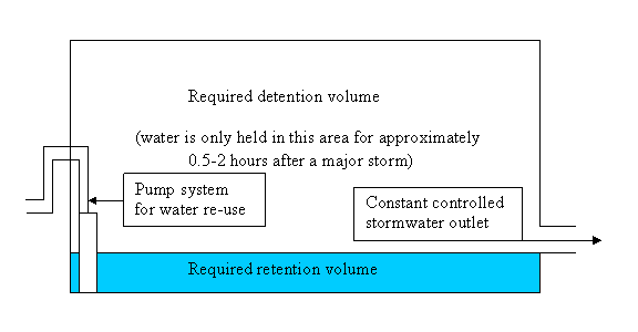

Figure 1: schematic of combined on-site detention and
retention system
Combining the on-site detention system with the rainwater
tank as detailed above will not reduce the total volume of storage required and
results in numerous issues (discussed in the previous report presented to
Council on the 10 April 2007) that must be addressed in order for the system to
function properly.
In relation to existing on-site detention tanks, it is
noted that many tanks have open bases to allow infiltration into the ground.
These tanks cannot readily be modified to allow for retention as the open bases
will not allow for water to be held in the tank for extended periods of time.
Any attempt to convert these tanks to a combined detention and retention system
would firstly involve sealing/waterproofing the base of the tank, which would
in turn reduce the effectiveness of the detention system. Infiltration is the
preferred method of stormwater management as it recharges the ground water
system and reduces the amount of water being discharged into the street
drainage system. Any proposal to reduce infiltration is not encouraged.
Existing on-site detention tanks with sealed bases may be
modified to allow for combined detention and retention provided that an
adequate detention volume is maintained to manage stormwater flows. In most
cases detention tanks have not been designed with surplus storage capacity,
which means that the provision of extra storage volume would generally be
required to facilitate the conversion.
Assuming that the additional storage capacity is
available, it is not necessarily possible to simply raise the height of the
outlet so the area below becomes available for retention. Raising the height of
the outlet changes the hydraulic design of the system and may compromise the
functioning of the on-site detention system.
Any proposals to convert existing detention systems to
combined detention/retention systems would need to be supported by calculations
from a suitably qualified hydraulic engineer to demonstrate to Council that the
modified system would still meet the required detention requirements.
Guidelines for re-using stormwater runoff for landscaping
purposes
Given that on-site detention systems accept runoff from
the entire site (not just roofs), the quality of water in on-site detention
systems is generally much lower that the quality of water in rainwater tanks.
The Department of Environment and Conservation NSW have published a document
titled ‘Managing Urban Stormwater – Harvesting and Reuse’ which considers how
stormwater may be harvested, treated and re-used. The document makes a clear
distinction between rainwater (which is the runoff from roofs) and stormwater
(which includes runoff from all surfaces and is collected from a drain or
creek). Whilst the report does not specifically reference stormwater collected
in a detention tank, the principals are the same in that runoff from a drain or
creek includes runoff from all surfaces.
The subject document notes that stormwater (as opposed to
rainwater) must be treated to reduce pathogen and pollution levels prior to
re-use. Consequently, in the event of rainwater and general stormwater runoff
being combined in a single tank, it would be necessary to treat all the water
to reduce pathogen and pollution levels prior to re-use. When the water is
being reused for irrigation, consideration must also be given to the nutrient
levels.
The table below is taken from the Department of
Environment and Conservation NSW publication titled ‘Managing Urban Stormwater
– Harvesting and Reuse’ (2006) and provide quidelines for the stormwater
quality criteria that should be complied with for different re-use
applications:
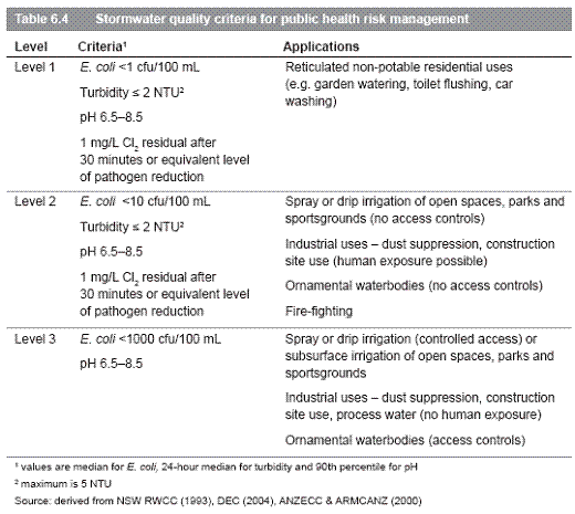
Guidelines for re-using rainwater for landscaping purposes
Rainwater tanks are typically provided with first flush
systems to ensure that the water entering the tank is as clean as possible.
This water does not generally require any further treatment before is may be
used on site for irrigation.
Council’s Strategic Planning Department are currently
preparing a fact sheet that will provide guidelines for the design and
installation of rainwater tanks.
RELATIONSHIP TO CITY PLAN:
The
relationship with the City Plan is as follows:
Outcome 10: A Healthy Environment
Direction 10f: A total water cycle management
approach including water conservation, reuse and water quality improvements is
adopted.
Key Action: Council to increase water saving
initiatives across our buildings and all areas of operation.
Outcome 10: A Healthy Environment
Direction 10b: Environmental risks and impacts
are strategically managed
Key Action: Develop and implement policies,
programmes and strategies to manage environmental risks and impacts.
FINANCIAL
IMPACT STATEMENT:
There is
no direct financial impact for this matter.
CONCLUSION:
When new on-site detention systems are constructed it is
possible to provide a stormwater retention area at the base of the detention
tank. However, combining the two storage tanks may compromise the quality of
water available for re-use, and will not provide any appreciable performance
benefits.
Existing on-site detention systems cannot be used for
on-site retention by blocking off the outlets without compromising the function
of the on-site detention system. However it may be possible to modify the
system by increasing the storage capacity to allow for a combined onsite detention/retention
system. Any proposals to convert an existing detention system to combined
detention/retention system would need to be supported by calculations from a
suitably qualified hydraulic engineer to demonstrate to Council that the
modified system will still meet the required detention requirements.
Whilst rainwater (runoff from roofs only) may generally be
used for irrigation purposes without treatment, stormwater runoff (runoff from
all surfaces) should be suitably treated to reduce pathogen and pollution
levels prior to re-use. Consequently, water collected in a combined
detention/retention system would need to be treated reduce pathogen and
pollution levels prior to reuse.
Combining the on-site detention and retention systems in
one tank is possible, however, it requires detailed engineering design, may
compromise the quality of water available for re-use, and will not generally
provide any appreciable performance benefits. Notwithstanding this, it is
recommended that Council does not prohibit residents from exploring the option
of having combined onsite detention and retention systems.
RECOMMENDATION:
That:
A. Part A of
the previous recommendation (from the Health Building and Planning Committee
Meeting held 10 April 2007) be amended to allow for existing on-site detention
systems to be modified to allow for combined detention/retention systems as
detailed below:
A. Council
allow on-site detention tanks to be utilised for on-site storage and re-use
provided that:
1. The
required on-site detention volume in new detention tanks is provided above the
constant outlet and the required retention volume is provided below the outlet;
2. If
existing detention tanks are modified to allow a portion of the tank to used
for retention, it is demonstrated by a suitably qualified Hydraulic Engineer
that the on-site detention requirements are still being satisfied
3. A
suitably qualified expert confirms that the quality of water proposed for
re-use is suitable for the intended purpose; and
4. Suitable
provisions are made to prevent mosquito infestation in the tank without
compromising the inlet capacity of the tank;
And
B. This report
be accepted in response to Part B of the previous recommendation.
ATTACHMENT/S:
Nil
Director,
City Planning Report 67/2007
REPORT BY: DIRECTOR,
CITY PLANNING
At the Ordinary Council Meeting on 24 October 2006, based
on a Notice of Motion (Cr Matson/Cr Woodsmith), Council resolved to initiate
steps towards a new development control plan to incorporate controls for
telecommunications and radiocommunication facilities in Randwick City. A
report was then considered by Council at 12 December 2006 meeting outlining the
prepared scope of a DCP and gaining formal resolution to proceed. A further
report at Council’s 12 June 2007 HPB meeting considered a draft Development
Control Plan - Telecommunication and Radiocommunication Facilities and
recommended its public exhibition.
The draft Development Control Plan was exhibited between 4
July and 8 August 2007 and there were no submissions received. This report
outlines the public exhibition process and recommends only minor changes which
provide clarification in relation to the information required to be provided by
applicants.
BACKGROUND:
There are two types of telecommunication facilities
identified under Commonwealth legislation (Telecommunications Act 1997 and the
Telecommunications (Low Impact Facility) Determination 1997):
· Low impact telecommunication
facilities
· Not low impact
telecommunication facilities.
The definition of low impact telecommunication facilities
is included in the Commonwealth of Australia Telecommunications (Low-impact
Facilities) Determination 1997 (as amended), a copy of which is included in
Appendix 1 of the draft DCP (Attachment 1). Most telecommunication and
radiocommunication developments proposed in Randwick City are ‘low impact
telecommunication facilities’. Under Commonwealth legislation registered
telecommunication carriers do not need to obtain Council consent to install a
low impact telecommunication facility provided that they meet certain criteria
and notify Council and the community in accordance with the Act and
Determination.
The DCP Telecommunication and Radiocommunication thus
cannot apply to ‘low impact facilities’ as a development application is not
required. Whilst not applying to “low impact facilities”, the DCP may
nevertheless assist telecommunications carriers also in their siting, design
and installation of “low impact” facilities and consultation requirements.
The DCP provides controls and guidelines for the siting,
design and installation of telecommunication and radiocommunication facilities
that require development consent from Council (“not low impact facilities”).
The draft DCP has been prepared based on NSW State
Government guidelines and a review of DCPs from other local government areas.
Research into Commonwealth Legislation and telecommunication and
radiocommunication industry codes of practice was also undertaken. The
previous report to Council (12 June 2007) provided details on the contents of
the draft DCP.
PUBLIC
EXHIBITION
The draft Development Control Plan was placed on public
exhibition from Wednesday 4 July to Wednesday 8 August, 2007. The exhibition
was advertised in the Southern Courier and on Council’s website. A copy and
brief explanation of the draft Development Control Plan was on display at
Council’s Customer Service Centre and at the Bowen Library during the public
exhibition period. The main telecommunication carriers who operate in Randwick
City were also notified by letter of the public exhibition.
There were no submissions received during the public
exhibition period. The following changes to the draft DCP (Attachment 1) have been
made to reflect comments received by Council staff for clarifying sections of
the draft DCP:
- Included in Section 6.6 (Facility health controls) in
relation to providing sufficient Electro Magnetic Radiation (EMR)
requirement to “Provide an EMR assessment in accordance with the ARPANSA
prediction methodology and report format as described in the ACIF Code”;
and
- Appendix 3 – Compliance checklist for Low Impact
Facilities: amended for the heading for clarity, to read “Information
Requirements for Low Impact Facilities and Not Low Impact Facilities and
by replacing ‘making an application’ with ‘information requirements’ and
replacing the word ‘application’ with ‘proposal’.
- Minor
wording changes for consistency within the draft documents (changes shown
underlined draft final DCP (Attachment 1).
RELATIONSHIP TO CITY PLAN:
The relationship with the City
Plan is as follows:
Outcome 4: New and existing
development is managed by a robust framework.
Direction 4b: Develop
and implement effective processes and strategies to manage the impact of new
and existing development.
FINANCIAL IMPACT
STATEMENT:
Council agreed to the allocation of $12,000 to prepare,
exhibit and finalise the draft DCP at its 12 December 2006 meeting, being
sourced from the Strategic Planning budget.
CONCLUSION:
The draft DCP Telecommunication and Radiocommunication was
prepared based on State Government guidelines and a review of other local
government controls and Commonwealth Legislation, guidelines and codes of
practice and was placed on public exhibition in accordance with the
Environmental Planning and Assessment Regulation. No submissions were received
on the draft DCP however a number of minor wording changes were made based on
comments by Council officers. It is recommended that the draft DCP be adopted
by Council.
RECOMMENDATION:
That Council:
a) Adopt the
Draft Final Development Control Plan – Telecommunication and Radiocommunication
Facilities in accordance with the requirements of the Environmental Planning
and Assessment Act, 1979 and Regulation, 2000; and
b) Agree that
the Director, City Planning may make minor modifications to the draft
Development Control Plan to rectify numerical, typographical, interpretive and
formatting errors if required, in the completion and printing of the Draft
Final Development Control Plan – Telecommunication and Radiocommunication
Facilities.
ATTACHMENT/S:
Draft Development Control Plan - Telecommunication and
Radiocommunication Facilities

TELECOMMUNICATIONS AND
RADIOCOMMUNICATIONS
DEVELOPMENT CONTROL PLAN
Adopted:
Effective:
Cost:
Draft Final August 2007
Table of Contents
1 Introduction
1.1 Introduction
1.2 Citation
1.3 Area to which this plan applies
1.4 Commencement
1.5 To what facilities does this plan apply?
1.6 What is the purpose of this plan?
1.7 Definitions
2 Objectives
2.1 Social
2.2 Environmental
2.3 Economic
3 How does this plan relate to other plans/legislation?
3.1 Commonwealth legislation
3.1.1 Telecommunications Act 1997
3.1.2 Radiocommunications Act 1992
3.1.3 Telecommunications Code of Practice 1997
3.1.4 Telecommunications (Low-impact Facilities) Determination 1997
3.1.5 Code for the Deployment of Mobile Phone Infrastructure C564:2004 (ACIF, 2004)
3.2 NSW State Government
3.2.1 Environmental Planning and Assessment Act 1979
3.2.2 Local Government Act 1993 (as amended)
3.2.3 Department of Planning (former Planning NSW) Draft Telecommunications Guidelines
3.3 NSW Local Government
3.3.1 Council's planning instruments, codes, policies and statutory requirements
4 Does your proposal need Council consent?
5 Making an application
5.1 Lodgement Requirements
5.2 Site and Locality Analysis
5.3 Statement of Environmental Effects
5.4 Public Notification / Consultation
6 Design Controls
6.1 Visual amenity
6.2 Co-location
6.3 Location
6.4 Heritage and Environment
6.5 Facility physical design controls
6.6 Facility health controls
7 Conditions of DA Consent
Appendix 1 Low impact Determination Commonwealth of Australia Telecommunications (Low-impact Facilities) Determination 1997 (as amended)
Appendix 2 ACIF Industry Code Deployment of Mobile Phone Infrastructure C564:2004
Appendix 3 Information Checklist for “Low Impact Facilities” and “Not Low Impact Facilities”
1 Introduction
1.1 Introduction
This DCP applies to telecommunications and radiocommunications infrastructure (including broadcasting infrastructure covered under the Telecommunications Act 1997 and the Radiocommunications Act 1992). There are two categories of facilities:
“low impact facilities”
“not low impact facilities”.
Council does not have regulatory control over “low
impact facilities”. These are facilities described in the Commonwealth
Government’s Telecommunications (Low Impact Facilities) Determination 1997 (LIF
Determination - see Appendix 1) which exempts low impact facilities from State
and Territory planning and environmental laws. These facilities must comply
with the Telecommunications Code of Practice 1997 which is administered by the
Australian Communications and Media Authority.
In addition to State and Federal regulations there is a
registered industry code established by the Australian Communications Industry
Forum (ACIF) called Deployment of Mobile Phone Infrastructure C564:2004 (the
"ACIF Code"). The Code supplements the requirements already imposed
on carriers under the existing legislative scheme by requiring them to consult
with the local community and to adopt a precautionary approach in planning,
installing and operating telecommunications infrastructure.
Council is the consent authority for facilities that require development consent under the Environmental Planning and Assessment Act 1979 (those that are not listed as “low impact facilities”). These facilities are referred to as “not low impact facilities”.
This DCP provides:
controls and guidelines for the siting, design and installation of telecommunications and radiocommunications facilities that require development consent from Council (“not low impact facilities”), and
information to assist the community to understand the planning and legislative requirements for telecommunication facilities.
While the DCP does not apply to low impact facilities, it may nevertheless assist as guidelines for telecommunications carriers for the siting, design and installation of “low impact” facilities.
1.2 Citation
This Development Control Plan (DCP) is called the Telecommunications and Radiocommunications Development Control Plan 2007.
1.3 Area to which this plan applies
This DCP applies to all land within Randwick City Local Government Area.
1.4 Commencement
This DCP was approved by Randwick City Council on ______________. The DCP commenced on ___________
1.5 To what facilities does this plan apply?
This plan applies to any fixed transmitter, its supporting infrastructure and ancillary development which are termed “Not Low Impact Facilities” under the following legislation:
Telecommunications Act 1997; and
Radiocommunications Act 1992.
The DCP does not apply to ‘low impact facilities’, including temporary emergency services which are identified in the Telecommunications (Low-impact Facilities) Determination 1997 [LIF Determination] (refer Appendix 1 of this DCP).
1.6 What is the purpose of this plan?
The purpose of this plan is:
to provide a consistent and integrated planning framework that addresses the local community’s interests in the effective, efficient and suitable provision of telecommunications and radiocommunications infrastructure so that it achieves environmental, economic and social sustainability in the short, medium and long term;
to provide a consistency of approach which assists carriers, the local community and Council;
to balance the needs of different stakeholders, including the local community, industry, Council, State and Federal Government, and
to provide guidance to carriers about Council’s planning, design and consultation requirements.
1.7 Definitions
The terms, used in this document, have the following meanings. The definitions included here are for the purpose of clarification only and do not supplant the definitions in legislation.
Co-located facilities one or more facilities on or within an original facility or a public utility structure
Co-siting: the siting of a number of telecommunication facilities, often owned by different carriers, in one location
Communications facility means a building, structure, work or place used primarily for transmitting or receiving signals for the purpose of communication, and includes radio masts, towers, satellite dishes, cables and the like, but does not include any reception device attached to a dwelling for domestic purposes.
Cumulative impact the impact of radiation from various sources or over time
Electromagnetic radiation (EMR) the radiation in the microwave and radiofrequency band of the electromagnetic spectrum
Low-impact telecommunication facility (LIF) means a low-impact facility within the meaning of the Telecommunications (Low-impact Facilities) Determination 1997 of the Commonwealth made under the Telecommunications Act 1997 of the Commonwealth.
(note: these facilities are exempt from State and Council planning under the Telecommunications (Low-Impact Facilities) Determination 1997 – refer Appendix 1)
Public utility undertaking means any undertaking carried on by, or by authority of, any public authority, or in pursuance of any Commonwealth or State Act, for the purpose of:
(a) railway, road or air transport, or
(b) the provision of sewerage or drainage services, or
(c) the supply of water, hydraulic power, electricity or gas, or
(d) low-impact telecommunication facilities.
Radiocommunications facility a base station or radiocommunications link, satellite-based facility or radiocommunications transmitter
Telecommunications facility any part of the infrastructure of a Telecommunications Network. It includes any telecommunications line, equipment, apparatus, telecommunications tower, mast, antenna, tunnel, duct, hole, pit, pole or other structure or thing used, or for use in connection with a Telecommunications Network.
Telecommunications Network a system, or series of systems, that carries, or is capable of carrying, communications by means of guided and/or unguided electromagnetic radiation
2 Objectives
The objectives of this plan are to ensure the effective, efficient and suitable provision of telecommunications and radiocommunications infrastructure so that it achieves social, environmental and economic sustainability, specifically:
2.1 Social
The social objectives of this plan are to:
apply a precautionary approach to the deployment of telecommunications and radio-communications infrastructure;
minimise EMR exposure to the public;
avoid community sensitive locations;
ensure that the general public and local communities have access to telecommunications technology;
achieve equity for the various stakeholders by endeavouring to balance their various needs;
enable the community to adequately identify infrastructure and the agencies responsible for them;
outline the planning process to ensure that the community is adequately informed and empowered to participate in the planning/decision-making process.
2.2 Environmental
The environmental objectives of this plan are to:
help implement principles of quality urban design in respect to telecommunications and radiocommunications infrastructure;
ensure infrastructure is visually compatible with surrounding character and locality/visual context with particular regard to heritage buildings/areas and cultural icons;
minimise adverse impacts on the natural environment;
assess whether the proposed infrastructure is consistent with the amenity of the area;
ensure sites are restored after discontinuation or removal of infrastructure.
2.3 Economic
The economic objectives of this plan are to:
identify the type of land use areas suitable for this type of infrastructure in a local government area;
accommodate the planning requirements of new technology;
assess whether the proposed infrastructure is consistent with permitted development in adjacent areas;
ensure reasonable access to telecommunications technology;
provide certainty for stakeholders and a consistent approach to the implementation/assessment of telecommunications infrastructure.
3 How does this plan relate to other plans/legislation?
3.1 Commonwealth legislation
3.1.1 Telecommunications Act 1997
The Telecommunications Act 1997 establishes a regime for Carriers’ rights and responsibilities when inspecting, maintaining or installing both ‘low-impact’ and ‘not low impact’ telecommunications facilities.
3.1.2 Radiocommunications Act 1992
The Radiocommunications Act 1992 regulates radiocommunications transmitters. It provides for the licensing of radiocommunications equipment and applies mandatory standards to its use.
3.1.3 Telecommunications Code of Practice 1997
The Telecommunications Code of Practice 1997 establishes obligations on carriers in land-access situations such as when inspecting land, installing low impact telecommunication facilities and maintaining such facilities. It also requires carriers to comply with recognised industry codes and standards.
3.1.4 Telecommunications (Low-impact Facilities) Determination 1997
The Telecommunications (Low-impact) Facilities Determination 1997 exempts telecommunications infrastructure classified as “low impact” from compliance with State and Local Government regulations. This classification relates primarily to visual appearance and size, rather than emissions.
3.1.5 Code for the Deployment of Mobile Phone Infrastructure (ACIF C564:2004)
This Code (Appendix 2) derives its authority from the
Telecommunications Act 1997 and applies only to telecommunications carriers and
their infrastructure. It does not apply to other broadcasters, councils or
other agencies. It requires carriers to apply a precautionary approach to site
selection and the design and operation of infrastructure; to consult with
councils and communities regarding siting; to provide information to the public
and to implement a complaints handling procedure. It applies to both low impact
and not-low-impact facilities.
3.2 New South Wales State Government
3.2.1 Environmental Planning and Assessment Act 1979
To meet Council's obligations to achieve environmental, economic and social sustainability, this DCP has been prepared in accordance with Section 74C of the Environmental Planning and Assessment Act, 1979 and the Environmental Planning and Assessment Regulation 2000.
3.2.2 Local Government Act 1993 (as amended)
This DCP assists Council to fulfil its obligations under the Local Government Act 1993 by having regard to the principles of ecologically sustainable development, including application of the precautionary principle.
3.2.3 Department of Planning (former Planning NSW) Draft Telecommunications Guidelines
Planning NSW introduced guidelines for councils in respect to preparing any DCP or providing guidance on telecommunications infrastructure. The purpose of these guidelines is to provide advice on appropriate and consistent planning controls for telecommunications facilities across the State. The guidelines also seek to promote an approach that provides for better information and communication.
3.3 NSW Local Government
3.3.1 Council's planning instruments, codes, policies and statutory requirements
The Randwick City Plan sets the direction for Randwick City over the next 20 years; the key elements of the City Plan will be reflected in all Council’s planning (including this DCP), infrastructure, management and budget documents.
The Randwick Local Environmental Plan 1998 includes definitions for ‘communication facility’, ‘low-impact telecommunication facility’ and ‘public utility undertaking’. Under the Randwick LEP 1998, public utility undertakings (which include low-impact telecommunication facilities) do not require consent in all zones other than Zone No 8 (National Parks Zone). Communication facilities are permissible with consent in all residential, business, industrial, Port Botany, special uses and open space zones. In Zone 7 (Environmental Protection) and Zone 8 (National Parks) consent is required and development must either be consistent with an approved plan of management or the National Parks and Wildlife Act, 1974.
This DCP is consistent with the aims and objectives of the City’s relevant planning instruments.
4 Does your proposal need Council consent?
By law, new infrastructure requires Council consent unless it is exempted by other legislation such as the Low Impact Facilities Determination (LIF Determination) or is classified as exempt or complying development in Randwick Local Environmental Plan 1998.
Low Impact Facilities - Consultation
Development consent is not required for low-impact facilities. However, as part of a carrier’s consultation obligations, a written submission to Council must demonstrate the proposal’s compliance with the relevant sections of the ACIF Code. The carrier, while not required, may also supply the information listed in the information checklist at Appendix 3. The carrier may also consider the Design Controls contained in Section 6 of this DCP and information regarding facility design contained in Low Impact Facilities for Better Visual Outcomes prepared by the Mobile Carriers Forum that can be accessed through http://www.mcf.amta.org.au.
For facilities covered by the LIF Determination, the carrier must consult with the potentially affected community, irrespective of Council boundaries, as required by the ACIF Code. The carrier is to consult with Council about a consultation strategy. Consultation must be commensurate with the anticipated impact of the facility. The applicant must make reasonable endeavours to conduct consultation in such a way that local communities are informed about the proposal and able to comment on it.
For each proposed facility, a sign must be erected notifying the intention of the carrier to erect infrastructure on site and providing the name and contact details of the carrier, consistent with the ACIF code.
For each completed facility, a permanent and legible weatherproof sign must be publicly visible in the immediate proximity of the facility and visible to the general public, to identify the name and contact details of the operator or site manager, consistent with the ACIF Code.
The applicant must provide Council with the results of its community consultation undertaken for facilities covered by the LIF Determination.
5 Making an application
5.1 Lodgement Requirements
The applicant is to provide information about the existing infrastructure of that carrier in the area to assist with Council’s consideration of this application.
The applicant is to provide Council with:
its rationale for deciding that the proposal is a not-low-impact facility;
an EMR assessment in accordance with the ARPANSA prediction methodology and report format as described in the ACIF Code;
a 360o prediction map of exposure levels at 1.5m above publicly accessible surfaces within 300 m and listed as a likely community sensitive location at 5.1(c) in the ACIF Code, or for other sites upon request;
the information listed in the checklist (see Appendix 3);
photo montage/s of the proposed facility in context of the location;
the results of any community consultation process;
statement of environmental effects; and
site and locality analysis.
Upon request, the applicant is to provide extra documentation such as a heritage impact statement, should the site be identified adjacent to a heritage item or within a heritage conservation area.
Telecommunication facility (ie mobile) providers must provide compliance evidence that indicates that exposure details contained in the application are true and accurate, consistent with the ACIF Code. Other radiocommunication infrastructure providers must provide an EMR compliance certificate as to exposure details in the application.
5.2 Site and Locality Analysis
A site and locality analysis establishes the development
context by showing graphically the constraints and opportunities of the
proposed site in relation to existing land uses and existing buildings in the
immediate surroundings and the environment
generally. It should influence the suitability of the proposed location and the design.
A site and locality analysis plan is to be submitted with all applications and should indicate in relation to the proposed site for a radius of 300 metres:
existing vegetation;
site boundaries and dimensions;
topography;
location of existing buildings;
views to and from the proposed site; and
location of any sensitive land use within the adjacent area such as schools, child care centres, parks and recreational areas/reserves.
The site and locality analysis must be to scale.
A written statement explaining how the design of the facility has responded to the site analysis is also required to be submitted with all applications.
5.3 Statement of Environmental Effects
A written statement is to be prepared and must explain how the proposed radiocommunications or telecommunications facility has responded to the site analysis and the objectives of the Randwick LEP 1998 and this DCP.
This statement is to demonstrate how the precautionary principle has been applied in the siting, design and operation of the proposed facility as identified in the ACIF Codes (refer Appendix 2).
5.4 Public notification/consultation
Development applications are to comply with Council’s DCP on public notification.
Details of consultation requirements for ‘low impact facilities’ are contained in Section 4 above.
6 Design Controls
The application is required to consider the following design controls:
6.1 Visual amenity
i) Antennas and supporting infrastructure should be designed to minimise or reduce the visual and cumulative visual impact from the public domain and adjacent areas.
ii) Within the local context, the infrastructure design must take account of:
colour;
texture;
form;
bulk; and
scale.
iii) Infrastructure must:
be well-designed;
be integrated with the existing building structure unless otherwise justified in writing to Council;
have concealed cables where practical and appropriate;
be unobtrusive where possible; and
be consistent with the character of the surrounding area.
iv) Minimise the visual impact of a telecommunications or radiocommunication facility by any one or more of the following:
by integrating the facility with the design and appearance of any building or structure on or within which it is located;
by screening any equipment associated with the facility so as to reduce its visibility;
by avoiding the obstruction of views of significant vistas, significant landmarks or items of environmental heritage;
by ensuring that the facility as installed is in keeping with the streetscape;
by ensuring that the colour and finish of the facility are in keeping with the locality; and
by ensuring that the scale of the facility is in keeping with the locality, bearing in mind that the scale may be affected by the intended coverage of the facility.
v) Infrastructure must be removed when no longer being used. The site must be restored following construction of the infrastructure.
6.2 Co-location
Co-location is the practice of locating a number of different telecommunication facilities, often owned by different carriers, on one facility or structure. Co-location may not always be a desirable option where:
cumulative emissions are a consideration;
it may be visually unacceptable;
there are physical and technical limits to the amount of infrastructure that structures are able to support; or
the required coverage cannot be achieved from the location.
i) Co-locate facilities (where possible) or demonstrate why the co-location with other facilities in the vicinity is not viable;
ii) Demonstrate a precautionary approach and effective measures to minimise any negative impacts of co-location.
6.3 Location
i) Demonstrate that, in selecting a site, that the applicant has adopted a precautionary approach in regards to minimising EMR exposures consistent with Section 5.1 of the ACIF Code. Preferred land uses (as determined by this Council) include:
industrial areas;
special uses where co-location arises, such as university, hospital and port uses, and
commercial centres.
ii) Demonstrate particular consideration of likely sensitive land uses. Sensitive land uses may include areas:
where occupants are located for long periods of time (e.g. residences); and
that are frequented by children (eg schools, child care centres).
6.4 Heritage and Environment
Infrastructure proposed for areas of environmental significance (as defined in LIF Determination) require development consent under the LIF Determination and Council's LEP. The applicant must:
Note: The Randwick LEP 1998 (clause 43) requires a report on the heritage impact for development relating to a heritage item or within a heritage conservation area.
|
|
i) Demonstrate how the proposed facility avoids or minimises the visual impact on the heritage significance of heritage items and conservation areas;
ii) Provide a heritage impact report/statement if the proposal involves a heritage item or is located within a heritage conservation area, and
iii) Demonstrate how the proposed facility avoids or minimises the physical impact on any endemic flora and fauna.
6.5 Facility physical design controls
i) Infrastructure must be of high quality design and construction. Proposals should consider the range of available alternate infrastructure including new technologies, to minimise unnecessary or incidental EMR emissions and exposures, as required under the ACIF Code.
ii) The plan for the facility must include measures to restrict public access to the antenna(s). Approaches to the antenna(s) must contain appropriate signs warning of EMR and providing contact details for the facility(ies) owner/manager.
iii) Where relevant, proposals must comply with the BCA for purposes of construction and the relevant exposure levels as directed by the Australian Communications Authority (ACA). Provide Council with certification about the standards with which the facility will comply.
iv) Proposals should also consider:
minimising transmitter power to that required to achieve coverage requirements
choosing or designing antennae which minimise emissions in directions not required for coverage
selecting the option that results in the lowest exposures (if alternative sites are available or if there are different options for mounting antennae on a single site).
6.6 Facility health controls
i) Provide an EMR assessment in accordance with the ARPANSA prediction methodology and report format as described in the ACIF Code including details of compliance with the Code.
ii) Demonstrate the precautions taken to minimise EMR exposures to the public.
iii) Provide a mapped analysis of cumulative EMR effect of the proposal (as per Section 5.0 - Making an Application).
7 Conditions of DA Consent
The applicant is advised that the consent may be subject to a number of conditions, including but not restricted to the following:
the colour of the telecommunications facility shall compliment its surrounds in order to reduce the structure’s visibility;
infrastructure must be well maintained and upgraded;
the applicant is responsible for the maintenance and upgrading of infrastructure;
the applicant, should any emissions other than electromagnetic radiation arise from the installation and operation of the infrastructure, Council and the DECC are to notified and a preferred strategy of amelioration recommended;
infrastructure must be removed when it is no longer in use, including any associated structures such as screening; and
each facility is to provide a permanent and legible weatherproof sign which must be publicly visible in the immediate proximity of the facility and is to identify the name and contact details of the operator or site manager.
Appendix 1
Low impact Determination Commonwealth of Australia Telecommunications (Low-impact Facilities) Determination 1997 (as amended)

Telecommunications (Low-impact Facilities) Determination
1997
as amended
made
under subclause 6(3) of Schedule 3 of the
This
compilation was prepared on 14 July 2004
taking into account amendments up to Telecommunications (Low-impact
Facilities) Determination 1997 (Amendment No. 1 of 1999)
Prepared
by the Office of Legislative Drafting,
Attorney-General’s Department, Canberra
Contents
Part
1 Preliminary
1.1 Citation [see Note 1] 27
1.2 Commencement 27
1.3 Definitions 27
1.4 Principal designated use 30
Part
2 Areas
2.1 Commercial area 32
2.2 Industrial area 32
2.3 Residential area 32
2.4 Rural area 32
2.5 Area of environmental significance 32
Part
3 Low-impact facilities
3.1 Facilities 34
Schedule Facilities and areas 35
Part 1 Radio facilities 35
Part 2 Underground housing 37
Part 3 Above ground housing 37
Part 4 Underground cable facilities 39
Part 5 Public payphones 40
Part 6 Emergency facilities 40
Part 7 Co-located facilities 41
Notes 42
Part 1 Preliminary
1.1 Citation [see
Note 1]
This
determination may be cited as the Telecommunications (Low‑impact
Facilities) Determination 1997.
1.2 Commencement
This
determination commences on 1 July 1997.
|
Background
to determination
Part
1 of Schedule 3 to the Telecommunications Act 1997 authorises a
carrier to enter on land and install a facility if the facility is a
low-impact facility.
Under
subclause 6 (3) of Part 1, the Minister may, by written instrument,
determine that a specified facility is a low-impact facility.
Under
subclauses 6 (4), (5) and (7), certain facilities cannot be low‑impact
facilities:
designated overhead
lines
a tower that is not
attached to a building
a tower attached to a
building and more than 5 metres high
an extension to a
tower that has previously been extended
an extension to a
tower, if the extension is more than 5 metres high.
A
facility cannot be a low-impact facility unless it is specified in this
determination. Therefore, overhead cabling and new mobile telecommunications
towers are not low-impact facilities.
Also,
a facility will be a low-impact facility only if it is installed in
particular areas identified in this determination. The areas have an order of
importance, based on zoning under State or Territory laws, so that any area
only has its “highest” possible zoning. The order of priority is:
area of environmental
significance
residential areas
commercial areas
industrial areas
rural areas.
One
effect of this determination is that a facility in an area of environmental
significance cannot be a low-impact facility.
Rules
for the installation and maintenance of a low-impact facility can be found in
Schedule 3 to the Telecommunications Act and the Telecommunications Code of
Practice 1997.
|
|
Simplified
outline of determination
The
determination has 3 Parts.
Part
2 identifies areas in which a facility may be installed, by reference to
zoning arrangements under State and Territory planning laws.
Part
3 and the Schedule identify the low-impact facilities.
Definitions
for words and expressions used in this determination are to be found in section
1.3.
|
1.3 Definitions
In
this determination:
Aboriginal person has the same meaning as in Schedule 3 to the Act.
Act means the Telecommunications Act 1997.
area of environmental significance has the meaning given by section
2.5.
co-located facilities means one or more facilities installed on or
within:
(a) an original facility; or
(b) a public utility structure.
commercial area has the meaning given by section 2.1.
emergency, for the installation of a facility, means circumstances
in which the facility must be installed without delay to protect:
(a) the
integrity of a telecommunications network or a facility; or
(b) the
health or safety of persons; or
(c) the
environment; or
(d) property;
or
(e) the
maintenance of an adequate level of service.
emergency services organisation has the same meaning as in
subsection 265 (11) of the Act.
Note At the commencement of this
determination, the emergency service organisations were:
a police force or service
a fire service
an ambulance service
a service specified in the
numbering plan (see Act, s 455) as an emergency services organisation
a service for despatching the force or service.
in-building subscriber connection equipment means a facility
installed within a building with the aim of managing and maintaining the supply
of carriage services to a customer of a carrier.
industrial area has the meaning given by section 2.2.
installation, for a facility, has the same meaning as in
Part 1 of Schedule 3 to the Act.
Note Installation includes:
construction of the facility
attachment of the facility to a building or other
structure
any activity ancillary to installation.
listed international agreement has the same meaning as in
Schedule 3 to the Act.
Note Listed international agreements are
agreements specified in the regulations.
Nature Conservation Director means the Director of National
Parks and Wildlife under the National Parks and Wildlife Conservation Act
1975.
original facility means the original structure that is currently
used, or intended to be used, for connection to a telecommunications network
where the original structure was:
(a) in
place on the date on which the Telecommunications (Low-impact Facilities)
Determination 1997 (Amendment No. 1 of 1999) took effect; or
(b) installed
after that date by means other than in accordance with Part 7 of the Schedule.
planning law, for an area, means a law of the State or Territory where
the area is located dealing with land use, planning or zoning.
principal designated use, for an area, has the meaning
given by section 1.4.
public utility has the same meaning as in Schedule 3 to the Act.
public utility structure means a structure used, or for
use, by a public utility, for the provision to the public of:
(a) reticulated products or services, such
as electricity, gas, water, sewerage or drainage; or
(b) carriage services (other than carriage
services supplied by a carriage service provider); or
(c) transport services; or
(d) a product or service of a kind that is
similar to a product or service covered by paragraph (a), (b) or (c).
relevant local government authority, for land in a State or
Territory, means an authority of the State or Territory responsible for the
local government of the area where the land is located.
residential area has the meaning given by section 2.3.
rural area has the meaning given by section 2.4.
significant environmental disturbance means significant interference
with the relationship between a species or community and its immediate
environment or habitat and includes, for example, significant interference with
identified flora and fauna, ecological communities, geological features,
wilderness values or scientific values within an area.
subscriber connection means an installation for the sole purpose of
connecting premises to a telecommunications network.
Torres Strait Islander has the same meaning as in
Schedule 3 to the Act.
tower means a tower, pole or mast.
Note A number of
other words and expressions used in this determination are defined in the Telecommunications
Act 1997 (see s 7), including ‘carrier’ and ‘facility’.
volume means the apparent volume of materials that constitute:
(a) co-located facilities; or
(b) an original facility; or
(c) a public utility structure;
where the materials are visible from a point outside the
co-located facilities, original facility or public utility structure.
1.4 Principal
designated use
(1) If
an area is described, under a planning law, as having a sole or principal use,
the use is the principal designated use of the area.
(2) If
an area is described, under a planning law, as having 2 or more uses, in terms
that show that 1 of the uses is the predominant, preferred or most likely use,
the use is the principal designated use of the area.
(3) If
an area is described, under a planning law, as having 2 or more principal uses,
without any indication of the predominant, preferred or most likely use, the principal
designated use of the area is determined on the following basis:
(a) if
the uses include residential purposes, the principal designated use is for
residential purposes;
(b) if
the uses include commercial purposes, but not residential purposes, the
principal designated use is for commercial purposes;
(c) if
the uses include industrial purposes, but neither residential nor commercial
purposes, the principal designated use is for industrial purposes.
(4) If
a carrier proposes to engage in a low-impact facility activity in an area under
Chapter 4 of the Telecommunications Code of Practice 1997, the principal
designated use of the area is to be determined by reference to the time when
the carrier proposes to issue the first notice to the owner or occupier of land
in the area under Part 5 of that Chapter.
Note Areas of environmental significance are
identified in accordance with section 2.5, not by reference to planning laws.
The effect of this determination is that an area may be an
area of environmental significance, and also a residential, commercial,
industrial or rural area identified by
reference to planning laws. However, the area’s status as an area of
environmental significance is more important for the identification of
low-impact facilities.
Part
2 Areas
2.1 Commercial
area
An
area is a commercial area if its principal designated use is for commercial purposes.
Note The use of an area is to be assessed at
the time mentioned in subsection 1.4 (4).
2.2 Industrial
area
An
area is an industrial area if its principal designated use is for industrial
purposes.
Note The use of an area is to be assessed at
the time mentioned in subsection 1.4 (4).
2.3 Residential
area
(1) An
area is a residential area if its principal designated use is for residential
purposes.
(2) A
part of a built-up area is a residential area if it cannot otherwise be
described as a commercial, industrial or rural area.
Note The use of an area is to be assessed at
the time mentioned in subsection 1.4 (4).
2.4 Rural area
(1) An
area is a rural area if its principal designated use is for rural purposes.
(2) An
area that is not part of a built-up area is a rural area if it cannot otherwise
be described as a commercial, industrial or residential area.
Note The use of an area is to be assessed at
the time mentioned in subsection 1.4 (4).
2.5 Area of
environmental significance
(1) An
area is an area of environmental significance if it is identified property for
section 3A of the World Heritage Properties Conservation Act 1983.
(2) An
area is an area of environmental significance if it is an identified property
(within the meaning of section 3A of the World Heritage Properties
Conservation Act 1983).
(3) An
area is an area of environmental significance if it is a place that Australia
is required to protect by the terms of a listed international agreement.
(4) An
area is an area of environmental significance if, under a law of the
Commonwealth, a State or a Territory:
(a) it
is designated as a reserve for nature conservation purposes; and
(b)
the principal purpose of the designated reserve is for nature conservation.
(5) An
area is an area of environmental significance if it is an area that, under a
law of the Commonwealth, or a State or Territory, is protected from significant
environmental disturbance.
(6) An
area is an area of environmental significance if it is entered in the Register
of the National Estate or the Interim List for that Register.
(7) An
area is an area of environmental significance if, under a law of the
Commonwealth, a State or a Territory, it consists of a place, building or thing
that is entered in a register relating to heritage conservation.
(8) An
area is an area of environmental significance if, under a law of the
Commonwealth, a State or a Territory, it is:
(a) entered
in a register; or
(b) otherwise
identified;
as
being of significance to Aboriginal persons or Torres Strait Islanders, in
accordance with their traditions.
Part 3 Low-impact facilities
3.1 Facilities
(1) A
facility described in column 2 of an item in the Schedule is a low‑impact
facility only if it is installed, or to be installed, in an area mentioned in
column 3 of the item.
(2) However,
the facility is not a low‑impact facility if the area is also an area of
environmental significance.
(3) For
subsection (1), trivial variations for a facility mentioned in column 2 are to
be disregarded.
(4) A
facility that is ancillary to a facility covered by subsection (1) is also a
low-impact facility only if it is installed, or to be installed, solely to
ensure the protection or safety of:
(a) the
low-impact facility; or
(b) persons
or property in close proximity to the low-impact facility.
Schedule Facilities and areas
(section 3.1)
Part 1 Radio facilities
|
Column 1
Item no.
|
Column 2
Facility
|
Column 3
Areas
|
|
1
|
Subscriber connection deployed by radio or satellite terminal
antenna or dish:
(a) not more than
1.2 metres in diameter; and
(b) either:
(i) colour-matched
to its background; or
(ii) in
a colour agreed in writing between the carrier and the relevant local
authority
|
Residential
Commercial
Industrial
Rural
|
|
1A
|
Subscriber connection deployed by radio or satellite terminal
antenna or dish:
(a) not more than
1.8 metres in diameter; and
(b) either:
(i) colour-matched
to its background; or
(ii) in
a colour agreed in writing between the carrier and the relevant local
government authority
|
Industrial
Rural
|
|
2
|
Panel, yagi or other like antenna:
(a) flush mounted to
an existing structure; and
(b) either:
(i) colour-matched
to its background; or
(ii) in
a colour agreed in writing between the carrier and the relevant local
authority
|
Residential
Commercial
Industrial
Rural
|
|
3
|
Panel, yagi or other like antenna:
(a) not more than
2.8 metres long; and
(b) if the antenna
is attached to a structure — protruding from the structure by not more
than 3 metres; and
(c) either:
(i) colour-matched
to its background; or
(ii) in
a colour agreed in writing between the carrier and the relevant local
authority
|
Residential
Commercial
Industrial
Rural
|
|
4
|
An omnidirectional antenna or an array of omnidirectional antennas:
(a) not more than
4.5 metres long; and
(b) not more than 5
metres apart; and
(c) if the array is
attached to a structure — protruding from the structure by not more than
2 metres
|
Industrial
Rural
|
|
5
|
Radiocommunications dish:
(a) not more than
1.2 metres in diameter; and
(b) either:
(i) colour-matched
to its background; or
(ii) in
a colour agreed in writing between the carrier and the relevant local
government authority; and
(c) if attached to a
supporting structure, the total protrusion from the structure is not more
than 2 metres
|
Residential
Commercial
Industrial
Rural
|
|
5A
|
Radiocommunications dish:
(a) not more than
1.8 metres in diameter; and
(b) either:
(i) colour-matched
to its background; or
(ii) in
a colour agreed in writing between the carrier and the relevant local
government authority
|
Industrial
Rural
|
|
6
|
Microcell installation with:
(a) a cabinet not
more than 1 cubic metre in volume; and
(b) a separate
antenna not more than 1 metre long
|
Residential
Commercial
Industrial
Rural
|
|
7
|
In-building coverage installation:
(a) to improve
cellular coverage to mobile phone users operating inside a building; and
(b) wholly contained
and concealed in a building
|
Residential
Commercial
Industrial
Rural
|
|
8
|
Equipment installed inside a
structure, including an antenna concealed in an existing structure
|
Commercial
Industrial
Rural
|
|
9
|
An extension to a tower if:
(a) the height of
the extension does not exceed 5 metres; and
(b) there have been
no previous extensions to the tower
|
Industrial
Rural
|
Part 2 Underground housing
|
Column 1
Item no.
|
Column 2
Facility
|
Column 3
Areas
|
|
1
|
Pit with surface area of not more than 2 square metres
|
Residential
Commercial
Industrial
Rural
|
|
2
|
Manhole with surface area of not
more than 2 square metres
|
Residential
Commercial
Industrial
Rural
|
|
3
|
Underground equipment shelter or housing with surface area of not
more than 2 square metres
|
Residential
Commercial
Industrial
Rural
|
Part 3 Above ground housing
|
Column 1
Item no.
|
Column 2
Facility
|
Column 3
Areas
|
|
1
|
Pillar:
(a) not
more than 2 metres high; and
(b) with
a base area of not more than 2 square metres
|
Residential
Commercial
Industrial
Rural
|
|
2
|
Roadside cabinet:
(a) not
more than 2 metres high; and
(b) with
a base area of not more than 2 square metres
|
Residential
Commercial
Industrial
Rural
|
|
3
|
Pedestal:
(a) not more than 2
metres high; and
(b) with a base area
of not more than 2 square metres
|
Residential
Commercial
Industrial
Rural
|
|
4
|
equipment shelter:
(a) not more than
2.5 metres high; and
(b) with a base area
of not more than 5 square metres; and
(c) either:
(i) colour-matched
to its background; or
(ii) in
a colour agreed in writing between the carrier and the relevant local
authority
|
Residential
Commercial
Industrial
Rural
|
|
5
|
equipment shelter:
(a) used solely to
house equipment used to assist in providing a service by means of a facility
mentioned in Part 1; and
(b) not more than 3
metres high; and
(c) with a base area
of not more than 7.5 square metres; and
(d) either:
(i) colour-matched
to its background; or
(ii) in
a colour agreed in writing between the carrier and the relevant local
authority
|
Residential
Commercial
Industrial
Rural
|
|
6
|
In-building subscriber
connection equipment
|
Residential
Commercial
Industrial
Rural
|
|
7
|
Solar panel with a base area of
not more than 7.5 square metres
|
Rural
|
Part
4 Underground cable facilities
|
Column 1
Item no.
|
Column 2
Facility
|
Column 3
Areas
|
|
1
|
Underground conduit or cable deployed by:
(a) narrow trench
not more than:
(i) 450
millimetres wide; or
(ii) 650
millimetres wide if intended to be used by more than one carrier; or
(b) direct burial;
or
(c) bore or
directional drill hole at least 600 millimetres below the surface;
where:
(d) access to
business premises is not restricted between the hours of 8 am and 6 pm,
Monday to Friday, or such other hours agreed to by the relevant local government
authority; and
(e) in relation to
residential areas, not more than 100 metres of excavation is left open at any
time and vehicle access to each property is not lost for more than 8 hours in
total
|
Residential
Commercial
Industrial
Rural
|
|
2
|
Conduit or cabling to be laid in:
(a) an existing
trench; or
(b) a trench created
by a developer, relevant local government authority, public utility or
carrier.
|
Residential
Commercial
Industrial
Rural
|
|
3
|
Cable location marking post or sign
|
Residential
Commercial
Industrial
Rural
|
Part
5 Public payphones
|
Column 1
Item no.
|
Column 2
Facility
|
Column 3
Areas
|
|
1
|
Public payphone cabinet or booth:
(a) used solely for
carriage and content services; and
(b) not designed for
other uses (for example, as a vending machine); and
(c) not fitted with
devices or facilities for other uses; and
(d) not used to
display commercial advertising other than advertising related to the supply
of standard telephone services
|
Residential
Commercial
Industrial
Rural
|
|
2
|
Public payphone instrument:
(a) used solely for
carriage and content services; and
(b) not designed for
other uses (for example, as a vending machine); and
(c) not fitted with
devices or facilities for other uses; and
(d) not used to
display commercial advertising other than advertising related to the supply
of standard telephone services or displayed as part of the supply of a
content service
|
Residential
Commercial
Industrial
Rural
|
Part 6 Emergency facilities
|
Column 1
Item no.
|
Column 2
Facility
|
Column 3
Areas
|
|
1
|
A temporary facility installed:
(a) in an emergency;
and
(b) to provide
assistance to an emergency services organisation
|
Residential
Commercial
Industrial
Rural
|
Part
7 Co-located facilities
|
Column 1
Item no.
|
Column 2
Facility
|
Column 3
Areas
|
|
1
|
Facility mentioned in:
(a) Part 1, 5 or 6;
or
(b) item 3 of Part
4;
installed on or
within:
(c) an original
facility; or
(d) a public utility
structure
|
Industrial
Rural
|
|
2
|
Facility mentioned in:
(a) Part 1, 5 or 6;
or
(b) item 3 of Part
4;
installed on or
within:
(c) an original facility;
or
(d) a public utility
structure;
where:
(e) the total volume
of the co-located facilities is no more than 25 per cent greater than the
volume of the original facility or the original infrastructure; and
(f) the levels of
noise that are likely to result from the operation of the co-located
facilities are less than or equal to the levels of noise that resulted from
the operation of the original facility or the public utility structure
|
Residential
Commercial
|
Notes to the Telecommunications
(Low-impact Facilities) Determination 1997
Note
1
The
Telecommunications (Low-impact Facilities) Determination 1997 (in force
under subclause 6 (3) of the Telecommunications Act 1997) as shown in
this compilation is amended as indicated in the Tables below.
Table of Instruments
|
Title
|
Date of notification
in Gazette
|
Date of
commencement
|
Application, saving or
transitional provisions
|
|
Telecommunications
(Low-impact Facilities)
Determination 1997
|
30 June 1997
(see Gazette 1997, No. S250)
|
1 July 1997
|
|
|
Telecommunications
(Low-impact Facilities) Determination 1997 (Amendment No. 1 of 1999)
|
17 Aug 1999
(see Gazette 1999, No. S377)
|
17 Aug 1999
|
—
|
Table of Amendments
|
ad. = added or inserted am. = amended rep. =
repealed rs. = repealed and substituted
|
|
Provision affected
|
How affected
|
|
Part 1
|
|
|
S. 1.3.....................
|
am. 1999 No. 1
|
|
Part 2
|
|
|
S. 2.5.....................
|
am. 1999 No. 1
|
|
Part 3
|
|
|
S. 3.1.....................
|
am. 1999 No. 1
|
|
Schedule
|
|
|
Part 1
|
|
|
Part 1.....................
|
am. 1999 No. 1
|
|
Part 3
|
|
|
Part 3.....................
|
am. 1999 No. 1
|
|
Part 4
|
|
|
Part 4.....................
|
am. 1999 No. 1
|
|
Part 5
|
|
|
Part 5.....................
|
am. 1999 No. 1
|
|
Part 7
|
|
|
Part 7.....................
|
am. 1999 No. 1
|
Appendix 2
ACIF Industry Code for
Deployment of Mobile Phone Infrastructure C564:2004
The Code specifies the
best contemporary practices in the areas of design, installation and operation
of radiocommunications infrastructure. The Code requires the application of a
precautionary approach to the deployment of radiocommunications infrastructure
and contains obligations on carriers to consult.
The Code replaces ACIF
C564:2002 Deployment of Radiocommunications Infrastructure Industry
Code.
An abstract and copy of the Code can be downloaded from the Australian Communications Industry Forum website:
http://www.acif.org.au/documents/codes/C564
Appendix 3
Information Checklist for “Low Impact Facilities and “Not Low Impact Facilities”
Information Requirements |
Required Yes/No |
Supplied Yes/No |
Has the proponent provided council with its information on infrastructure in this council’s jurisdiction? |
|
|
Is the proposal low impact? |
|
|
Is the proposal not low impact? |
|
|
Has adequate justification been provided for this decision proposed location? |
|
|
Has the proponent provided a 360o map of predicted exposure levels at 1.5m above publicly accessible surfaces within 300m and listed as a likely community sensitive location at 5.1(c) in the ACIF Code? |
|
|
Has the proponent provided cross sectional diagrams? |
|
|
Has the proponent provided a photo montage of the facility in context of the location? |
|
|
Has the proponent provided a community consultation proposal where required under the ACIF Code? |
|
|
Has the proponent provided a heritage report/impact statement in accordance with Council's LEP (if required)? |
|
|
Has the proponent provided professional certification that exposure details contained in the application are true and accurate? |
|
|
Location |
|
|
Has the proponent demonstrated that, in selecting a site, it has adopted a precautionary approach in regards to minimising Electromagnetic Radiation exposures? |
|
|
Is the facility in a preferred land use area? |
|
|
If the facility is in a sensitive area has it considered Australian Communications Industry Forum 5.1.4? |
|
|
Site analysis |
Yes/No |
Yes/No |
Is the proposed site within 300m of a school, adjacent to a playground, child care centre or on a listed heritage item? |
|
|
Has the proponent submitted a scaled site and adjacent locality analysis plan showing: |
|
|
existing vegetation; |
|
|
site boundaries and dimensions |
|
|
topography |
|
|
location of existing buildings; |
|
|
views to and from the proposed site; |
|
|
location of sensitive land uses? |
|
|
Public consultation |
Yes/No |
Yes/No |
Has the proponent consulted with affected adjoining councils (where relevant)? |
|
|
Has the proponent consulted with council about how best to conduct community consultation? |
|
|
Does the proposal provide for visible permanent signage on site? |
|
|
Has the proponent advised relevant community groups? |
|
|
Has the proponent placed an advertisement in the local paper (if appropriate)? |
|
|
Has the proponent conducted a public meeting (if appropriate)? |
|
|
Has the proponent provided council with the results of its community consultation process? (if appropriate) |
|
|
Has the proponent adequately considered the issue of non-English speaking communities? |
|
|
Has the proponent erected a sign on site notifying of its intention to construct that provides its contact details for facilities covered by the LIF Determination? |
|
|
Design controls / Council’s requirements |
|
|
1. Visual amenity |
|
|
Has the facility been designed so as to minimise visual impact from the public domain? |
|
|
Does the design minimise or reduce the cumulative visual impact from the public domain? |
|
|
Does the design take account of |
|
|
colour; |
|
|
texture; |
|
|
form; |
|
|
bulk and scale? |
|
|
Is the facility?: |
|
|
well designed; |
|
|
integrated with existing building structure; |
|
|
incorporating concealed cables; |
|
|
integrating the shelters with building structure; |
|
|
unobtrusive; |
|
|
consistent with character of the surrounding area? |
|
|
Does the plan include removal of the infrastructure when it is redundant? |
|
|
Does the plan include restoration of the site following construction of the infrastructure? |
|
|
2. Co-location |
|
|
Does the plan require co-location? If so, |
|
|
does it result in an unacceptable visual impact? |
|
|
does it minimise cumulative emissions for neighbouring residents or |
|
|
other sensitive land uses? |
|
|
3. Environment and heritage |
|
|
Is the infrastructure in a heritage area/on a heritage building/in the vicinity of heritage items requiring development consent? |
|
|
Have measures been implemented to reduce visual impact on the heritage item or conservation area? |
|
|
Has the proponent provided a heritage impact report/ statement? |
|
|
Has the proponent considered minimising physical impact on flora & fauna? |
|
|
4. Facility physical design controls |
|
|
Has the carrier demonstrated that the infrastructure is of high quality design and construction? |
|
|
Does the plan include measures to restrict public access to the antenna(s)? |
|
|
Does the facility comply with the Building Code of Australia (not relevant for facilities covered by the LIF Determination) and other relevant Australian standards? |
|
|
5. Facility health controls |
|
|
Has the proponent demonstrated the measures it has taken to minimise Electromagnetic Radiation exposures in the adjacent area? |
|
|
Has the proponent provided a statement that the proposed facility complies with the relevant Australian exposure standard? |
|
|
Are any emissions other than electromagnetic expected? |
|
|
Director,
City Planning Report 68/2007
REPORT BY: DIRECTOR,
CITY PLANNING
EXECUTIVE
SUMMARY:
Council,
at its Health, Building and Planning meeting of 12 June 2007, endorsed a new
Section 94A (s94A) Development Contributions Plan, to commence from 2 July
2007. The Council report noted that a Planning Agreements Policy would also be
prepared to supplement this Plan.
The 2006 changes to the Environmental Planning and
Assessment Act 1979 (the Act) and Regulation provided for planning agreements
to be used as an alternative to s94 (nexus based developer contributions) or
S94A (contribution via a percentage levy) contributions.
Council’s new s94A Plan provides a clear, efficient and
equitable means of levying development contributions as a percentage of
development costs. This Plan, in line with the State government’s guidelines,
notes that Council may consider voluntary planning agreements as an alternative
to a s94A levy. The draft Planning Agreements Policy has now been prepared to
provide the objectives, principles and procedures for preparing agreements. The
draft Policy is now submitted for Council’s endorsement.
ISSUES:
Voluntary planning agreements may be used as an
alternative to collecting s94 or s94A contributions. These planning agreements
may be particularly useful for large scale developments that are likely to be
developed in stages and in situations where the developer has a key interest in
delivering public infrastructure.
The Act now established a statutory framework for planning
agreements. A planning agreement is a contractual agreement between the
planning authority and the developer, for a public purpose. A public purpose
may include the provision of (or the recoupment of the cost of providing)
public amenities and services, affordable housing, transport and other
infrastructure, the funding of recurrent expenditure, the monitoring of the
impacts of development and the conservation or enhancement of the natural
environment.
Under a planning agreement, a developer may dedicate land
free of cost, pay a monetary contribution, or provide any other material public
benefit, or any combination of these. Planning agreements can be entered into
at either the rezoning or development application stage. A planning agreement
must be publicly exhibited for 28 days before it is entered into. A planning
agreement may also be registered by the Registrar-General in
relation to the land to which it applies and thereby bind
successors in title to the land. Once entered into, a planning agreement
becomes a statutory obligation.
A
Planning Agreements Policy has now been prepared in line with the Department of
Planning’s guidelines in order to provide applicants and the community with a
clear understanding of the process and guidance for the use of planning
agreements.
RELATIONSHIP
TO CITY PLAN:
The relationship with the City Plan is as follows:
Outcome
2: A Vibrant and diverse Community.
Direction 2b: Enrich our range of community services that
meet our community’s needs
Direction 2d: New and
upgrades community facilities that are multi purpose and in accessible
locations.
Outcome
6: A Liveable City.
Direction 6b: Our
public assets are planned managed and funded to meet the community expectations
and defined levels of service.
FINANCIAL IMPACT STATEMENT:
Preparation of the s94A Plan, which includes the Planning
Agreement Policy, has been largely in house, based on 3 days per weeks for a
s94 planner over 12 months and approximately $25,000 for an expert peer review,
charged from the s94 budget.
CONCLUSION:
The Planning Agreement Policy will provide a clear
understanding to the community and developers as to the use and process for
planning agreements, and will assist applicants and the Council to utilise
planning agreements for greater flexibility in the receipt of development
contributions, where this would provide the preferred outcome in terms of
public amenities and services provision.
RECOMMENDATION:
That:
a) Council
approve the Planning Agreements Policy for finalisation; and
b) Council
agree that the Director, City Planning, may make minor modifications to any
numerical, typographical, interpretation and formatting errors, if required, in
the finalisation and printing of the policy.
ATTACHMENT/S:
Draft Planning Agreements Policy


Planning Agreements Policy
DRAFT
Folder
No: F2006/00093
OBJECTIVE
This Policy establishes a framework to guide the
preparation of planning agreements in a manner that is efficient, fair,
transparent and accountable.
POLICY STATEMENT
Planning agreements are one of a number of alternative
mechanisms under Council’s S94A Development Contributions Plan 2007 for
developers to contribute to the public facilities needs arising in Randwick City.
Council has adopted this policy in order to provide
developers and the community with an understanding of the objectives,
principles and procedures applying to the preparation of planning agreements.
Minute No:
…….. Meeting Date: 11 September 2007
Introduction
1.1
This Policy
sets out Randwick City Council’s policy, principles and procedures relating to
planning agreements under the Environmental Planning and Assessment Act 1979
(the Act).
Planning agreements form one part
of Council’s development contributions system. Randwick City Council’s
development contributions system aims to implement contribution schemes as
described under sections 93C and 94 of the Act to best manage the demands
arising from new development on public facilities provision within the City.
1.2
In this
Policy, the following terminology is used:
Act means the Environmental Planning
and Assessment Act 1979,
development application has the same
meaning as in the Act,
development contribution means the kind of provision made
by a developer under a planning agreement, being a monetary contribution, the
dedication of land free of cost to Council or the provision of a material
public benefit,
instrument change means a change to an environmental
planning instrument to enable a development application to be made to carry out
development, subject of a planning agreement,
planning benefit means a development contribution
that confers a net public benefit, that is, a benefit that exceeds the benefit
derived from measures that would address the impacts of particular development
on surrounding land or to the wider community,
planning obligation means an obligation imposed by a
planning agreement on a development requiring the developer to make a development
contribution,
public benefit is the benefit enjoyed by the
public as a consequence of a development contribution,
public facilities means public infrastructure,
facilities, amenities and services,
public means a section of the public,
Regulation means the Environmental
Planning and Assessment Regulation 2000,
surplus value, means the value of the developer’s
provision under a planning agreement less the sum of the value of public works
required to be carried out by the developer under a condition imposed under
s80A (1) of the act and the value of development contributions that are or
could have been required to be made under s94 or s94A of the Act in respect of
the development to which the agreement applies.
1.3
The purposes
of this Policy are:
(a)
to establish a
framework governing the use of planning agreements by the Council
(b)
to ensure that
the framework so established is efficient, fair, transparent and accountable
(c)
to enhance
planning flexibility in Randwick City through the use of planning agreements
(d)
to enhance the
range and extent of development contributions made by development towards
public facilities in the City
(e)
to set out the
Council’s specific objectives and procedures relating to the use of planning
agreements within the City.
1.4
The Council’s
planning agreement framework is based on:
(a)
the provisions
of Subdivision 2 of Division 6 of Part 4 of the Act
(b)
the provisions
of Division 1A of Part 4 of the Regulation, and
(c)
this Policy.
1.5
This Policy is
not legally binding. However, it is intended that the Council and all persons
dealing with the Council, in relation to planning agreements, will follow this
Policy to the fullest extent possible.
1.6
It is intended
that this Policy will be periodically updated. The updates may cover additional
matters to those covered in this Policy or provide more detailed information or
guidance on specific matters covered in this Policy.
2. Policy on the use of Planning Agreements
Strategic Objectives
2.1
The Council’s
strategic objectives for the use of planning agreements are:
(a)
To advance
Council’s adopted vision for our City in accordance with The Randwick City
Plan
(b)
to provide an
enhanced and more flexible development contributions system for the Council
(c)
more
particularly, to supplement or replace, as appropriate, the application of s94
and s94A of the Act on development
(d)
to give all
stakeholders in development, greater involvement in determining the type,
standard and location of public facilities and other public benefits
(e)
to facilitate
public participation to gain an understanding of community preferences for the
provision of public benefits
(f)
to adopt
innovative approaches to the provision of infrastructure
(g)
to fund new or
upgrade existing infrastructure to appropriate levels that reflect and balance
of environmental standards, community expectations and funding priorities, and
(h)
to provide
certainty for the community, developers and Council in respect to
infrastructure and development outcomes.
Principles
2.2
The Council’s
use of planning agreements will be guided by these principles:
(a)
planning
decisions may not be bought or sold through planning agreements
(b)
development
that is unacceptable on planning grounds will not be permitted because of
planning benefits offered by developers that do not make the development
acceptable in planning terms
(c)
the Council
will not allow planning agreements to improperly fetter the exercise of its
functions under the Act, Regulation or any other Act or law
(d)
the Council
will ensure that all parties involved in the Planning Agreement process are
dealt with fairly
(e)
the Council
will not allow the interests of individuals or interest groups to outweigh the
public interest when considering a proposed planning agreement
(f)
the Council
will not improperly rely on its statutory position in order to extract
unreasonable public benefits under planning agreements
(g)
if the Council
has a commercial stake in a development the subject of an agreement, it will
take appropriate steps to ensure that it avoids a conflict of interest between
its role as a planning authority and its interest in the development.
Circumstances in which Council will consider negotiating a
planning agreement
2.3
The Council,
at its complete discretion, may negotiate a planning agreement with a developer
in connection with any application by the developer for an instrument change or
for development consent relating to any land in the Council’s area.
Specific purposes of planning agreements
2.4
The Council may consider
negotiating a planning agreement to:
(a) compensate for the loss of, or
damage to, a public amenity, service, resource or asset caused by the
development through its replacement, substitution, repair or regeneration
(b) meet the demands created by the
development for new public infrastructure, amenities and services
(c) address a deficiency in the
existing provision of public facilities in the Council area
(d) achieve recurrent funding in
respect of public facilities
(e) prescribe inclusions in the
development that meet specific planning objectives of the Council
(f)
monitor the
implementation of development
(g) provide affordable housing
(h) secure planning benefits for the
public.
Acceptability test to be applied to all planning
agreements
2.5
The Council will apply the
following test in order to assess the desirability of a proposed planning agreement:
(a) is the proposed planning agreement
directed towards a proper or legitimate planning purpose having regard to its
statutory planning controls and other adopted planning policies and the
circumstances of the case?
(b) does the proposed planning agreement
provide for a reasonable means of achieving the relevant purpose?
(c) will the planning agreement
produce outcomes that meet the general values and expectations of the community
and protect the overall public interest?
(d) does the proposed planning agreement
promote the Council’s strategic objectives in relation to the use of planning
agreements?
(e) does the proposed planning
agreement conform to the principles governing the Council’s use of planning
agreements?
(f)
are there any
relevant circumstances that may operate to preclude the Council from entering
into the proposed planning agreement?
Consideration of planning agreements in relation to
instrument changes and development applications
2.6
When exercising its functions
under the Act in relation to an application by a developer for an instrument
change or a development consent to which a proposed planning agreement relates,
the Council will consider to the fullest extent permitted by law:
(a) whether the proposed planning
agreement is relevant to the application and hence may be considered in
connection with the application, and
(b) if so, the proper planning weight
to be given to the proposed planning agreement.
Application of s94 and s94A to development to which a
planning agreement relates
2.7
The Council has no general
policy on whether a planning agreement should exclude the application of s94 or
s94A of the Act to development to which the agreement relates. This is a matter
for negotiation between the Council and a developer having regard to the
particular circumstances of the case.
Relationship between planning agreements and SEPP 1
2.8
The benefits proposed by the
developer under an agreement should not be used to justify a dispensation with
applicable development standards under State Environmental Planning Policy
No.1 – Development Standards in relation to development.
Form of development contributions under a planning
agreement
2.9
The form of a development
contribution to be made under a proposed planning agreement will be determined
by the particulars of the instrument change or development application to which
the proposed planning agreement relates.
For example, whether the contribution shall be cash, provided as
material public benefit, land dedication or a combination of the above.
Standard charges
2.10
Wherever possible, the Council
will seek to standardise development contributions sought under planning
agreements in order to streamline negotiations and provide fairness,
predictability and certainty for developers. This, however, does not prevent
public benefits being negotiated on a case by case basis.
Recurrent
charges
2.11
The Council may request
developers, through a planning agreement, to make development contributions
towards the recurrent costs of public facilities. Where the public facility
primarily serves the development to which the planning agreement relates or
neighbouring development, the arrangement for recurrent funding may be sought
in perpetuity. However, where the public facility or public benefit is intended
to serve the wider community, the planning agreement will only require the
developer to make contributions towards the recurrent costs of the facility
until a public revenue stream is established to support the on-going costs of
the facility.
Pooling of
development contributions
2.12
Where a proposed planning
agreement provides for a monetary contribution by the developer, the Council
may seek to include a provision permitting money paid under the agreement to be
pooled with money paid under other planning agreements and applied
progressively for the different purposes under those agreements, subject to the
specific requirements of the relevant agreements. Pooling may be appropriate to allow public
benefits, particularly essential infrastructure, to be provided in a fair, more
efficient and equitable way.
Methodology for valuing public benefits under a planning
agreement
2.13
Unless otherwise agreed in a
particular case, where the benefit under a planning agreement is the provision
of land for a public purpose, the value of the benefit will be determined by an
independent valuer of at least 10 years’ experience in valuing land in New
South Wales (and who is acceptable to the Council), on the basis of a scope of
work which is prepared by the Council. All costs of the independent valuer in
carrying out such a valuation will be borne by the developer.
2.14
Unless otherwise agreed in a
particular case, where the benefit under a planning agreement is the carrying
out of works for a public purpose, the value of the benefit will be determined
by an independent quantity surveyor of at least 10 years’ experience (and who
is acceptable to Council), on the basis of the estimated value of the completed
works determined using the method that would be ordinarily adopted by a
quantity surveyor. The scope of work for this independent quantity surveyor
will be prepared by Council. All costs of the independent quantity surveyor in
carrying out this work will be borne by the developer.
2.15
Where the benefit under a
planning agreement is the provision of a material public benefit, the Council
and the developer will negotiate the manner in which the benefit is to be
valued for the purposes of the agreement.
Credits and refunds
2.16
The Council generally will not
agree to a planning agreement providing for the surplus value under a planning
agreement to be refunded to the developer or offset against development
contributions required to be made by the developer in respect of other
development in the City.
Time when developer’s obligations
arise under a planning agreement
2.17
The Council will generally
require a planning agreement to provide that the developer’s obligations under
the agreement take effect when the first development consent operates in
respect of development that is the subject of the agreement.
Implementation agreements
2.18
In appropriate cases, the
Council may require a planning agreement to provide that before the development
the subject of the agreement is commenced, the Parties are to enter into an implementation
agreement that provides for matters such as:
(a)
the times at
which and, if relevant, the period during which, the developer is to make
provision under the planning agreement
(b)
the design,
technical specification and standard of any work required by the planning
agreement to be undertaken by the developer
(c)
the manner in
which a work is to be handed over to the Council
(d)
the manner in
which a material public benefit is to be made available for its public purpose
in accordance with the planning agreement
(e)
the management
or maintenance of land or works following hand-over to the Council.
Monitoring and review of a planning agreement
2.19
The Council will continuously
monitor the performance of the developer’s obligations under a planning
agreement. This may include the Council requiring the developer (at its costs)
to report periodically to Council on its compliance with obligations under the
planning agreement.
2.20
The Council may require a
planning agreement to contain a provision establishing a mechanism under which
the planning agreement is periodically reviewed with the involvement of all
parties.
2.21
The Council will require a
planning agreement to contain a provision requiring the parties to use their
best endeavours to agree on any modification to the agreement having regard to
the outcomes of the review.
Modification or discharge of the developer’s obligations
under a planning agreement
2.22
The Council will generally only
agree to a provision in a planning agreement permitting the developer’s
obligations under the agreement to be modified or discharged where the
modification or discharge is linked to the following circumstances:
(a)
the
developer’s obligations have been fully carried in accordance with the
agreement
(b)
the developer
has assigned the developer’s interest under the agreement in accordance with
its terms and the assignee has become bound to the Council to perform the
developer’s obligations under the agreement
(c)
the
development consent to which the agreement relates has lapsed
(d)
the
performance of the planning agreement has been frustrated by an event beyond
the control of the parties
(e)
the Council
and the developer otherwise agree to the modification or discharge of the
agreement.
2.23
Such a provision will require
the modification or revocation of the planning agreement in accordance with the
Act and Regulation.
Assignment and dealings by the developer
2.24
The Council will require every
planning agreement to provide that the developer may not assign its rights or
obligations under the agreement nor have any dealing in relation to the land
the subject of the agreement unless, in addition to any other requirements of
the agreement:
(a) the Council has given its consent
to the assignment or dealing
(b) the developer has, at no cost to
the Council, first procured the execution by the person with whom it is dealing
of all necessary documents in favour of the Council by which that person agrees
to be bound by the agreement as if they were a party to the original agreement;
and
(c) the developer is not in breach of
the agreement.
Provision of security under a planning agreement
2.25
The Council generally will
require a planning agreement to make provision for security by the developer of
the developer’s obligations under the agreement.
2.26
Unless otherwise agreed by the
parties in a particular case, the form of security will usually but not
necessarily be an unconditional bank guarantee from an Australian Bank in
favour of the Council to the full value of the developer’s provision under the
agreement and on terms otherwise acceptable to the Council.
Preparation of the planning agreement
2.27
The Council and the developer
will, in each case, decide who will prepare the planning agreement relating to
a particular application for an instrument change or development application.
2.28
The Council will generally
require the planning agreement to be in or to the effect of the standard-form
planning agreement.
Council’s costs of negotiating, entering into, monitoring
and enforcing a planning agreement
2.29
The Council may require a
planning agreement to make provision for payment by the developer of part or
all of the Councils’ costs of and incidental to:
(a) negotiating, preparing and
entering into the agreement
(b) enforcing the agreement
2.30
The amount to be paid by the
developer will be determined by negotiation in each case.
2.31
In particular cases, the
Council may require the planning agreement to make provision for a development
contribution by the developer towards the on-going administration of the
agreement.
Notations on Certificates under s149 of the Act
2.32
The Council will generally
require a planning agreement to contain an acknowledgement by the developer
that the Council may, in its absolute discretion, make a notation under s149(5)
of the Act about a planning agreement on any certificate issued under s149 of
the Act relating to the land the subject of the agreement or any other land.
Registration of planning agreements
2.33
The Council may require a
planning agreement to contain a
provision requiring the developer to agree to registration of the agreement
pursuant to s93H of the Act if the requirements of that section are satisfied.
2.34
In the event of the sale or
transfer of the land to which a planning agreement applies, the consent of the
Council will be required to any assignment of the planning agreement
notwithstanding its registration under s93H of the Act, having regard to the
ability of the transferee to perform the terms and conditions of the planning
agreement including the provision of any security, bank guarantee or bond which
may be required by the agreement.
Dispute resolution
2.35
The Council will generally
require a planning agreement to provide for mediation of disputes between the
parties to the agreement, at their own costs, before the parties may exercise
any other legal rights in relation to the dispute. Unless the parties agree
otherwise, the planning agreement will provide that such mediation will be
conducted pursuant to the Mediation Rules publishes by the Law Society of New
South Wales current at the time the agreement is entered.
Hand-Over of Works
2.36
The Council will generally not
accept the hand-over of a public work carries out under a planning agreement
unless the developer furnishes to the Council a certificate to the effect that
the work has been carried out and completed in accordance with the agreement
and any applicable development consents (which certificate may, at the
Council’s discretion, be a final occupation certificate, compliance certificate
or a subdivision certificate) and, following the issue of such a certificate to
the Council, the work is also certified as complete by a Council building
surveyor or engineer.
2.37
The Council will also require
the agreement to provide for a defects liability period during which any
defects must be rectified at the developer’s expense.
Management of land or works after hand-over
2.38
If a planning agreement provides
for the developer, at the developers cost, to manage or maintain land that has
been dedicated to the Council or works that have been handed-over to the
Council, the Council may require the parties to enter into a separate
implementation agreement in that regard (see 2.18).
2.39
The failure of the parties to
reach agreement in relation to management and maintenance of the land or works
may be dealt with under the dispute resolution provisions of the planning
agreement.
Public use of privately-owned facilities
2.40
If a planning agreement
provides for the developer to make a privately-owned facility available for
public use, the Council may require the parties to enter into a separate
implementation agreement in that regard (see 2.18).
2.41
The failure of the parties to
reach agreement in relation to management and maintenance of the land or works
may be dealt with under the dispute resolution provisions of the planning
agreement.
3. Procedures
Relating to the Use of Planning Agreements
Council’s negotiation process
3.1
The Council’s negotiation
process for planning agreements aims to be efficient, predictable, transparent
and accountable.
3.2
The process is based on
principles of fairness, co-operation, full disclosure, early warning, and
agreed working practices and timetables.
When should a planning agreement be negotiated?
3.3
The Council is required to
ensure that a planning agreement is publicly notified as part of and in the
same manner as the application for the instrument change or the development
application to which it relates.
3.4
The planning agreement must
therefore be negotiated and documented before it is publicly notified as
required by the Act and Regulation.
3.5
The Council prefers that a
planning agreement is negotiated before lodgement of the relevant application
and that it accompanies the application on lodgement.
Who will negotiate a planning agreement on behalf of the
Council?
3.6
A Council Officer or officers
with appropriate delegated authority will negotiate a planning agreement on
behalf of the Council. No planning agreement shall become binding until it is
approved and accepted by a resolution of Council.
3.7
The Councillors will not be
involved in the face to face negotiation of the agreement.
Separation of Council’s commercial and
planning assessment roles
3.8
If the Council has
a commercial interest in the subject matter of a planning agreement as a
landowner, developer or financier, the Council will ensure that the person who
assesses the application to which a planning agreement relates is not the same
person or a subordinate of the person who negotiated the terms of the planning
agreement on behalf of the Council in it’s capacity as landowner, developer or
financier.
Role of the governing body of the
Council in relation to development applications to which planning agreements
relate
3.9
The governing body
of the Council will, in all cases, determine development applications to which
planning agreements relate.
Involvement of independent third parties in the
negotiation process
3.10
The Council may encourage the appointment of an independent person (the costs of
the independent person will be borne by the developer) to facilitate or
otherwise participate in the negotiations or aspects of it, particularly where:
(a) an
independent assessment of a proposed instrument change or development
application is necessary or desirable,
(b)
factual
information requires validation in the course of negotiations,
(c) sensitive
financial or other confidential information must be verified or established in
the course of negotiations,
(d) facilitation
of complex negotiations are required in relation to large projects or where
numerous parties or stakeholders are involved,
(e) dispute
resolution is required under a planning agreement.
Key steps in the negotiation process
3.11
The negotiation of a planning
agreement will generally involve the following key steps:
(a)
before
lodgement of the relevant application by the developer, the parties will decide
whether to negotiate a planning agreement
(b)
the parties
will then appoint persons to represent them in the negotiations, generally
involving a minimum of 2 and maximum of 3 persons per party
(c)
the parties
may appoint an additional person to attend and take minutes of all negotiations
(d)
the parties
will also decide whether to appoint an independent person to facilitate or
otherwise participate in the negotiations or aspects of it
(e)
the parties
will also agree on a timetable for negotiations and the protocols and work
practices governing their negotiations
(f)
the parties
will then identify the key issues for negotiation and undertake the
negotiations
(g)
if agreement
is reached, the agreed party (Council or developer) will prepare the proposed
planning agreement and provide a copy to the other party
(h)
the parties
will undertake further negotiation on the specific terms of the proposed
planning agreement
(i)
once agreement
is reached on the terms of the proposed planning agreement, the developer will
be required to execute the agreement.
(j)
the developer
may then make the relevant application to the Council accompanied by a copy of
the proposed agreement
(k)
the parties
may be required to undertake further negotiations and, hence, a number of the
above steps as a result of the public notification and inspection of the
planning agreement or its formal consideration by the Council in connection
with the relevant application.
Public notification of planning agreements
3.12
A planning agreement must be
publicly notified and be available for public inspection for a minimum period
of 28 days as prescribed by the Act and Regulation.
3.13
The Council is required to
ensure that a planning agreement is publicly notified as part of and in the
same manner as with the application for the instrument change or the
development application to which it relates.
3.14
Where the application, to which
a planning agreement relates, is required by the Act or Regulation to be
publicly notified and available for public inspection for a period exceeding 28
days, the Council will publicly notify the planning agreement and make it
available for public inspection for that longer period.
3.15
Where the application to which
a planning agreement relates is permitted by the Act or Regulation to be
publicly notified and available for public inspection for a period of less than
28 days, the Council will publicly notify the application and make it available
for public inspection for a minimum period of 28 days.
3.16
The Council will publicly
re-notify and make available for public inspection a proposed planning
agreement and the application to which it relates if, in the Council’s opinion,
a material change is made to the terms of the agreement or the application
after it has been previously publicly notified and inspected. Such a change may
arise as a consequence of public submissions made, or the formal consideration
by the Council, or for any other reason.
When is a planning agreement required to be entered into?
3.17
A planning agreement is entered
into when it is signed by all of the parties.
3.18
A planning agreement can be
entered into at any time after the agreement is publicly notified in accordance
with the Act and Regulation.
3.19
The Council will usually
require a planning agreement to be entered into prior to the issue of the
determination to the development to which the agreement relates under s.80 of
the Act.
3.20
The Council will usually
require a planning agreement to be entered into prior to the gazettal of any
instrument change.
Planning Agreement Register
3.21
The Council is required to keep
a register of planning agreements applying to land within the Council’s area,
whether or not the Council is a party to a planning agreement. The Council is
required to record in the register the date an agreement was entered into and a
short description of the agreement (including any amendment).
3.22
The Council will make the following
available for public inspection (free of charge) during ordinary office hours:
(a) the planning agreement register
(b) copies of all planning agreements
(including amendments) that apply to the area of the Council
(c) copies of the explanatory notes
relating to those agreements.
3.23
The Council will also make its
planning agreement register available to the public on its website.
Director,
City Planning Report 69/2007
REPORT BY: DIRECTOR,
CITY PLANNING
INTRODUCTION:
The purpose of this report is to provide a progress update
on the imminent transfer of dwellings within the Prince Henry development site
to Council’s affordable housing rental portfolio.
As part of the development process of the Prince Henry
hospital site, a Deed of Agreement was ratified to formalise negotiated
requirements between Landcom and Randwick Council. One of these requirements
was the construction and transfer of eight (8) dwellings to Council for
affordable housing purposes. Half of these dwellings are to be located on land
sold to Stockland. Landcom has passed on to Stockland this legal obligation to
provide affordable housing in accordance with the terms of the Deed of
Agreement. As a result, Stockland’s obligation is to provide 4 dwellings on
the site north of Pine Avenue in the following configuration:
·
1 x one
bedroom unit
·
2 x two
bedroom unit
·
1 x three
bedroom unit.
ISSUES:
In August 2007, a representative of Stockland met with
council staff to confirm and nominate off the plan, the four dwellings to be
transferred to Council for affordable housing purposes. Stockland has advised
that the first affordable dwelling unit is expected to be transferred to
Council in December 2007. The construction of the second unit is expected to
be completed in July 2008. The two remaining nominated affordable housing
units will not be transferred until mid 2009.
To prepare for the transfer of affordable housing units to
Council’s affordable rental housing program, an assessment of the anticipated
costs associated with managing these units was undertaken by Council staff.
To inform the evaluation, actual tenancy and property
management costs from Council’s affordable housing rental operations were used,
together with the projected rental income, and quarterly strata and community
levies supplied by Stockland.
The evaluation confirmed that the cost of maintaining one
and two bedroom affordable housing units is financially feasible in that a
modest net surplus income will be returned to Council’s affordable housing
rental program. Surplus funds will be accumulated to cover future asset
management contingencies.
However, the same cannot be said for three bedroom units.
Quarterly levies are expected to be higher than levies for one and two bedroom
units. This is because levies are based on the monetary value of the dwelling
units. By way of comparison, the cheapest one bedroom unit attracts a total
levy of approximately $5,300 per year. The maintenance levy for a three
bedroom unit is expected to be higher than $6,000 per year, which will present
a financial risk to Council’s cost neutral affordable rental housing program.
In the light of the above information, the issue of
substituting the required one and three bedroom for two x 2 bedroom affordable
units was raised with Stockland’s representative. Council officers were
advised that Stockland is happy to make the substitution.
RELATIONSHIP TO CITY PLAN:
The relationship with the City
Plan is as follows:
Outcome 6: A liveable City
Directions 6a: Our
public assets are planned, managed and funded to meet the community
expectations and defined levels of service.
Direction 6e: Housing diversity,
accessibility and adaptability to support our diverse
community.
FINANCIAL IMPACT STATEMENT:
There is no direct financial impact for this matter.
CONCLUSION:
The inclusion of a three bedroom dwelling on the subject
site as part of Council’s pool of affordable rental housing stock is not
considered to be a viable proposition. The annual levies are higher because the
contribution rate is based on the value of the dwelling unit. Generally, three
bedroom units have higher property values than one or two bedroom units within
the Prince Henry site.
With the estimated higher annual levies, there is the
added risk that its rental income will not be sufficiently robust to withstand
vacancy periods. This situation could easily arise if there is a lack of
demand from eligible tenants seeking larger size units under the terms of
Council’s program. According to the 2006 Census, 26% of our population live
alone, and the average size of household is expected to shrink as the
population continues to age. Demand for one and two bedroom units is typically
higher than for three bedroom units. The affordable rental housing units owned
by other organisations in
the inner and middle ring LGAs are largely one and two bedroom units.
The
proposal to exchange a three bedroom unit for two x 2 bedroom units will
provide a greater social benefit, while demonstrating its commitment of
encouraging social mix in residential neighbourhoods.
RECOMMENDATION:
That
Council receive and note the report and the proposed changes of the dwelling
mix to four x 2 bedroom units.
ATTACHMENT/S:
Nil